Eagle Pass, Texas
| Eagle Pass, Texas | |
|---|---|
| City | |
 | |
|
Nickname(s): El Aguilón El Paso del Aguila | |
 Location of Eagle Pass, Texas | |
 Eagle Pass, Texas Location of Eagle Pass in Texas | |
| Coordinates: 28°42′38″N 100°29′22″W / 28.71056°N 100.48944°WCoordinates: 28°42′38″N 100°29′22″W / 28.71056°N 100.48944°W | |
| Country |
|
| State |
|
| County | Maverick |
| Government | |
| • Type | Council-Manager |
| • City Council |
Mayor Ramsey E. Cantu Yolanda Ramon Luis Sifutentes |
| • City Manager | Roberto Gonzalez |
| Area | |
| • Total | 9.58 sq mi (24.812 km2) |
| • Land | 9.58 sq mi (24.812 km2) |
| • Water | 0.0 sq mi (0.1 km2) |
| Elevation | 732 ft (223 m) |
| Population (2010) | |
| • Total | 26,255 |
| • Density | 2,740.2/sq mi (1,058.1/km2) |
| Time zone | Central (CST) (UTC-6) |
| • Summer (DST) | CDT (UTC-5) |
| ZIP codes | 78852-78853 |
| Area code(s) | 830 |
| FIPS code | 48-21892[1] |
| GNIS feature ID | 1356538[2] |
| Website |
www |
Eagle Pass is a city in and the county seat of Maverick County in the US state of Texas. The population was 26,255 as of the 2010 census (2013 estimate 27,708.)[3]
Eagle Pass borders the city of Piedras Negras, Coahuila, Mexico, which is to the southwest and across the Rio Grande. The Eagle Pass-Piedras Negras Metropolitan Area (EG-PN) is one of six binational metropolitan areas along the United States-Mexican border. As of January 2008, according to the US census, the Eagle Pass Metropolitan Area's population was 48,401 people, and the Piedras Negras Metropolitan Area's population was 169,771.
History
Eagle Pass was the first American settlement on the Rio Grande. Originally known as Camp Eagle Pass, it served as a temporary outpost for the Texas militia, which had been ordered to stop illegal trade with Mexico during the Mexican-American War.[4] Eagle pass is so named because the contour of the hills through which the Rio Grande flows bore a fancied resemblance to the outstretched wings of an eagle.[5]
General William Leslie Cazneau (1807–1876) founded the Eagle Pass townsite in the 1840s.[6]
In 1850, Rick Pawless opened a trading post called Eagle Pass. In 1871, Maverick County was established, and Eagle Pass was named the county seat. During the remainder of the 19th century, schools and churches opened, the mercantile and ranching industries grew, and a railway was built.
The United States Army established the presumably permanent Fort Duncan on March 27, 1849, a few miles upstream from Camp Eagle Pass. Captain Sidney Burbank supervised the construction of Fort Duncan, which was named after Colonel James Duncan, who had fought in the Mexican War. After the Mexican-American War, trade flourished under the protection of the fort. The fort was near the trail of westward immigration to California. It also served as an outpost against hostile Apache. It was abandoned and reopened several times. In March 1860, it served as the base of operations against the border assaults arranged by Juan N. Cortina.[7]
Fort Duncan was held by the Confederacy during the American Civil War. On July 4, 1865, General Joseph O. Shelby, en route to offer his troops' service to Maximilian in Mexico, stopped at Fort Duncan and buried in the Rio Grande the last Confederate flag to have flown over his men.[4] After several decades of deactivation, Fort Duncan was activated as a training camp during World War I. In 1938, the City of Eagle Pass acquired the fort and still operates a museum and a children's library at the site.[7]
The rancher and gunfighter King Fisher lived in Eagle Pass until his ambush and murder in San Antonio in 1884.
During World War I Camp Eagle Pass was established as a post of the U.S. Army. The 3rd Infantry Regiment was assigned there and patrolled the Mexican Border.
Lawsuit
The City of Eagle Pass was sued by the US government to gain access to the land and construct a fence on the United States-Mexico border.[8]
Public corruption scandals
Eagle Pass and Maverick County have been the subject of several state and federal criminal investigations which have gained state and national media attention.
Maverick County corruption scandal
An ongoing public corruption, bid-rigging, and kickback investigation by the FBI and Texas Department of Public Safety has resulted in the arrest and improsionment of all four Maverick County Commissioners, one Justice of the Peace, and multiple local government employees and businessmen since October 2012, making it the largest public criminal probe in Eagle Pass and Maverick County history.[9] On February 20, 2015, a federal grand jury in Del Rio, Texas, indicted a County Commissioner and a former County Justice of the Peace in connection to an alleged bribery, kickback and bid-rigging scheme, all related to the ongoing public corruption investigation.[10] On February 23, 2015, former Maverick County Commissioner Rodolfo Heredia was sentenced to 10 years in federal prison followed by three years of supervised release and ordered to perform 1,200 hours of community service after completing his prison term. He was also ordered to pay a maximum of $56,003.88 in restitution to Maverick County.[11]
City of Eagle Pass gasoline card theft and fraud
On August 8, 2012, a federal grand jury in the U.S. District Court in Del Rio, Texas, indicted five Eagle Pass residents, including a former Public Works Department employee in connection with an estimated $70,000 credit card fraud scheme. According to the indictment, during 2011, City of Eagle Pass employee Edgar Aguilar obtained five city of Eagle Pass-owned “Fuelman” credit cards designated for fuel purchases for Public Works department vehicles and distributed them to his accomplices to purchase fuel for their own vehicles and to purchase fuel for others at the city’s expense. In some instances, defendants charged individuals a reduced rate for fuel purchased using the city’s credit card and then pocketed the cash.[12] On November 29, 2012, Aguilar entered a guilty plea for the charges of theft and fraud and on May 15, 2013, was sentenced to 42 months in federal prison and ordered to pay $68,373.87 in restitution for his role in the fraudulent scheme.[13]
Economic development
The city and surrounding area is home to a variety of businesses in retail, import, food manufacturing, and freight forwarding/transportation. The Eagle Pass Industrial Park hosts a number of larger companies including the O.F. Mossberg & Sons firearms manufacturing plant, which employs around 450 persons.
Eagle Pass is a major entry point for the Los Zetas cartel's drug smuggling operations. Approximately 2,000 pounds of cocaine moves from Mexico to Eagle Pass each month.[14]
Climate
Eagle Pass has a hot semi-arid climate (Köppen: BSh), typical of South Texas. The average hottest month is August, and the highest recorded temperature was 115 °F (46.1 °C) in 1944. On average, the coolest month is January, while the lowest recorded temperature was 10 °F (−12.2 °C) in 1962. Most precipitation occurs in the spring though fall with a drier Winter. The maximum average precipitation occurs in September.
| Climate data for Eagle Pass, Texas | |||||||||||||
|---|---|---|---|---|---|---|---|---|---|---|---|---|---|
| Month | Jan | Feb | Mar | Apr | May | Jun | Jul | Aug | Sep | Oct | Nov | Dec | Year |
| Record high °F (°C) | 96 (36) |
101 (38) |
106 (41) |
108 (42) |
114 (46) |
115 (46) |
115 (46) |
112 (44) |
111 (44) |
106 (41) |
100 (38) |
94 (34) |
115 (46) |
| Average high °F (°C) | 65.0 (18.3) |
70.0 (21.1) |
78.0 (25.6) |
85.0 (29.4) |
91.0 (32.8) |
96.0 (35.6) |
98.0 (36.7) |
99.0 (37.2) |
93.0 (33.9) |
84.0 (28.9) |
74.0 (23.3) |
65.0 (18.3) |
83.1 (28.4) |
| Average low °F (°C) | 42.0 (5.6) |
45.0 (7.2) |
52.0 (11.1) |
60.0 (15.6) |
68.0 (20) |
73.0 (22.8) |
75.0 (23.9) |
75.0 (23.9) |
70.0 (21.1) |
61.0 (16.1) |
51.0 (10.6) |
42.0 (5.6) |
59.5 (15.3) |
| Record low °F (°C) | 10 (−12) |
10 (−12) |
20 (−7) |
32 (0) |
42 (6) |
47 (8) |
62 (17) |
60 (16) |
42 (6) |
27 (−3) |
19 (−7) |
12 (−11) |
10 (−12) |
| Average precipitation inches (mm) | 0.90 (22.9) |
1.00 (25.4) |
1.01 (25.7) |
1.88 (47.8) |
2.55 (64.8) |
2.73 (69.3) |
2.08 (52.8) |
1.46 (37.1) |
3.11 (79) |
2.07 (52.6) |
0.95 (24.1) |
0.78 (19.8) |
20.45 (519.4) |
| Source: TWC[15] | |||||||||||||
Geography
Eagle Pass is located at 28°42′38″N 100°29′22″W / 28.71056°N 100.48944°W (28.710622, -100.489331).[16]
According to the United States Census Bureau, the city has a total area of 7.4 mi2 (19.2 km2), of which, 7.4 mi2 (19.2 km2) of it is land and 0.04 mi2 (0.1 km2) of it (0.40%) is covered by water.
The area is served by U.S. Highways 277 and 57, and FM (farm road) 481 . Maverick County Memorial International Airport is a general aviation field, The nearest commercial air service is 50 miles away via the Del Rio International Airport in Del Rio, Texas, which will be served by Texas Sky Airlines in 2016.
Demographics
As of the census[1] of 2006, 24,847 people, 6,925 households, and 5,588 families resided in the city. The population density was 3,030.3 people per square mile (1,169.4/km²). There were 7,613 housing units at an average density of 1,029.3 per square mile (397.2/km²). The racial makeup of the city was 42.73% White, 0.27% African American, 0.39% Native American, 0.76% Asian, 22.71% from other races, and 3.13% from two or more races. Hispanics or Latinos of any race were 96.90% of the population.
Of the 6,925 households, 43.5% had children under the age of 18 living with them, 59.0% were married couples living together, 18.3% had a female householder with no husband present, and 19.3% were not families. About 17.7% of all households were made up of individuals, and 9.5% had someone living alone who was 65 years of age or older. The average household size was 3.22 and the average family size was 3.69.
In the city, the population was distributed as 32.7% under the age of 18, 8.6% from 18 to 24, 25.6% from 25 to 44, 19.9% from 45 to 64, and 13.1% who were 65 years of age or older. The median age was 32 years. For every 100 females, there were 88.5 males. For every 100 females age 18 and over, there were 81.8 males.
The median income for a household in the city was $23,623, and for a family was $27,140. Males had a median income of $26,350 versus $17,346 for females. The per capita income for the city was $11,414. About 26.0% of families and 29.0% of the population were below the poverty line, including 34.0% of those under age 18 and 39.1% of those age 65 or over.
The majority of the income is attributed to dependence of the community on employment in the public sector.
| Historical population | |||
|---|---|---|---|
| Census | Pop. | %± | |
| 1850 | 383 | — | |
| 1860 | 522 | 36.3% | |
| 1870 | 1,240 | 137.5% | |
| 1880 | 1,627 | 31.2% | |
| 1910 | 3,536 | — | |
| 1920 | 5,765 | 63.0% | |
| 1930 | 5,059 | −12.2% | |
| 1940 | 13,343 | 163.7% | |
| 1950 | 14,211 | 6.5% | |
| 1960 | 12,094 | −14.9% | |
| 1970 | 15,364 | 27.0% | |
| 1980 | 21,407 | 39.3% | |
| 1990 | 20,651 | −3.5% | |
| 2000 | 22,413 | 8.5% | |
| 2010 | 26,248 | 17.1% | |
| Est. 2015 | 28,765 | [17] | 9.6% |
| U.S. Decennial Census 2012 estimate | |||
Nearby cities/communities
- Carrizo Springs, Texas
- Ciudad Acuña, Coahuila
- Crystal City, Texas
- Del Rio, Texas
- El Indio, Texas
- Elm Creek, Texas
- La Pryor, Texas
- Laredo, Texas
- Nuevo Laredo, Tamaulipas
- Piedras Negras, Coahuila
- San Antonio, Texas
- Radar Base, Texas
- Rosita North, Texas
- Rosita South, Texas
- Uvalde, Texas
- Quemado, Texas
Transportation
Highways
Government
Federal representation
The United States Postal Service operates a post office in located at 455 S Bibb Ave Eagle Pass, TX.
The United States Border Patrol has two stations in Eagle Pass. The Eagle Pass North Station located at 2285 Del Rio Blvd and the Eagle Pass South Station at 4156 El Indio Hwy Eagle Pass, TX.
Eagle Pass is the headquarters of the Kickapoo Traditional Tribe of Texas, a federally recognized tribe of Kickapoo people.[18]
Area newspapers
- EaglePass.com News (EaglePass.com News)
- Eagle Pass Chronicles
- Eagle Pass Daily
- The News Gram
- Periódico Zócalo (Zócalo News)
Education
Eagle Pass is served by the Eagle Pass Independent School District. The district operates 15 elementary schools, two junior high schools, and two high schools, which compete in UIL academics and sports.
Private schools
- Our Lady of Refuge Catholic School
Elementary schools
- Armando Cerna Elementary School
- Benavides Heights Elementary School
- Dena Kelso Graves Elementary School
- Henry B Gonzalez Elementary School
- Liberty Elementary School
- Nellie Mae Glass Elementary School
- Perfecto Mancha Elementary School
- Pete Gallego Elementary School
- Ray H Darr Elementary School
- Robert E Lee Elementary School
- Rosita Valley Elementary School
- Rosita Valley Literacy Academy
- Sam Houston Elementary School
- San Luis Elementary School
- Seco Mines Elementary School
- Kirchner Elementary School
Middle schools
- Eagle Pass Junior High School
- Memorial Junior High School
High schools
- Eagle Pass High School
- C.C. Winn High School
The community is served by branches of four-year Sul Ross University in Alpine, in the form of Rio Grande College, and Southwest Texas Junior College, a two-year community college based in Uvalde.
Notable people
- Rian James (1899–1953), author and screenwriter
- Biz Mackey (1897–1965), catcher and manager in Negro league baseball
- Robert C. Mathis (1927-2016), retired Air Force four-star general, served as Vice Chief of Staff, U.S. Air Force
- Connie Douglas Reeves (1901–2003), rancher, National Cowgirl Museum and Hall of Fame
- Gus Sorola (born 1978), Co-founder of Rooster Teeth
- Louis Lane (1923–2016) Conductor of Cleveland and Atlanta symphonies.
HVDC-back-to-back station
In 2000, as part of the power exchange between Texas and Mexico, a HVDC facility equipped with IGBTs was built. This facility, built for Central Power and Light (now AEP Texas) by the ABB Group, operates at a bipolar voltage of 15.9 kV, and has a maximum transfer rate of 36 megawatts. The power station enables AEP to purchase electricity from Mexico's Comisión Federal de Electricidad, when needed.[19]
Tornado
On April 24, 2007, at 7:00 p.m. CST, a tornado tore through the outside of Eagle Pass and caused loss of life and property damage. The community was paralyzed for more than a week.[20]
Gallery
 Downtown Eagle Pass
 Eagle Pass City Hall at the foot of International Bridge
 The Rio Grande at Eagle Pass, Texas, with Mexico in the background
 Historic First United Methodist Church on Quarry Street
 Map of the city 1887
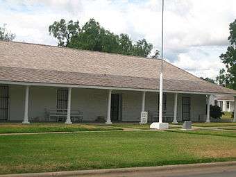 The restored Fort Duncan in Eagle Pass is located near the International Bridge.
 The International Bridge across the Rio Grande in Eagle Pass
 The Eagle Pass public library is located on Main Street east of the Maverick County Courthouse.
 Fort Duncan Medical Center in Eagle Pass is named after the former US Army outpost.
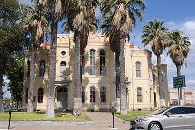 Historic Maverick County Courthouse
 Mall de las Aguilas on Bibb Street in Eagle Pass
See also
- Camino Real International Bridge
- Eagle Pass – Piedras Negras International Bridge
- Fort Duncan
- Union Pacific International Railroad Bridge
References
- 1 2 "American FactFinder". United States Census Bureau. Retrieved 2008-01-31.
- ↑ "US Board on Geographic Names". United States Geological Survey. 2007-10-25. Retrieved 2008-01-31.
- ↑ http://www.census.gov/
- 1 2 Texas Transportation Commission, Texas State Travel Guide, 2008, p. 232
- ↑ Gannett, Henry (1905). The Origin of Certain Place Names in the United States. Govt. Print. Off. p. 112.
- ↑ Handbook of Texas Online
- 1 2 Texas Historical Commission, historical marker at Fort Duncan, Eagle Pass, Texas, 1970
- ↑ Texas City Ordered to Turn Over Land to Feds for Border Fence Construction, January 16, 2008
- ↑ http://www.mysanantonio.com/news/local_news/article/Corruption-costly-for-Maverick-residents-4102816.php
- ↑ http://www.mysanantonio.com/news/local/article/Former-Maverick-County-justice-of-the-peace-6091885.php
- ↑ https://www.fbi.gov/sanantonio/press-releases/2015/former-maverick-county-commissioner-former-county-employee-and-three-contractors-sentenced-to-federal-prison-in-connection-with-a-bribery-kickback-and-bid-rigging-scheme
- ↑ https://www.fbi.gov/sanantonio/press-releases/2012/federal-grand-jury-indicts-five-in-connection-with-credit-card-fraud-scheme-involving-the-city-of-eagle-pass
- ↑ https://www.fbi.gov/sanantonio/press-releases/2013/former-eagle-pass-department-of-public-works-employee-sentenced-for-role-in-city-credit-card-fraud-scheme
- ↑ "Los Zetas Cartel Used Network of Ovens to Hide Mass Extermination in Mexico's Coahuila - Breitbart". Breitbart. 2016-02-08. Retrieved 2016-11-17.
- ↑ "Weather.com - Online Weather Data". The Weather Channel. Retrieved March 19, 2014.
- ↑ "US Gazetteer files: 2010, 2000, and 1990". United States Census Bureau. 2011-02-12. Retrieved 2011-04-23.
- ↑ "Annual Estimates of the Resident Population for Incorporated Places: April 1, 2010 to July 1, 2015". Retrieved July 2, 2016.
- ↑ "Tribal Directory." National Congress of American Indians. Retrieved 12 Sept 2013.
- ↑ a U.S./Mexico HVDC Light link
- ↑ "Tornado Kills 7 Near Eagle Pass On Mexican Border". CBS 11 TV. 2007-04-25. Retrieved 2009-03-21.
External links
| Wikimedia Commons has media related to Eagle Pass, Texas. |
- Official Eagle Pass, TX site
- Handbook of Texas Online article
- Eagle Pass Mayor Chad Foster explains why Eagle Pass is growing
- Maverick County Judge Pepe Aranda on the Growth of Eagle Pass
- A Day with the Kickapoo, and Indian tribe with a reservation near Eagle Pass
- Our Sister City of Piedras Negras, Mexico\
- Eagle Pass Daily News -- Local News and Information. In English and Spanish.
- Eagle Pass Review - Committed to Everything Eagle Pass
- Eagle Pass bilingual Shopping and News Destination.
Municipalities and communities of Maverick County, Texas, United States | ||
|---|---|---|
| City | 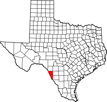 | |
| CDPs |
| |
