Benton, Missouri
| Benton, Missouri | |
|---|---|
| City | |
 Location of Benton, Missouri | |
| Coordinates: 37°5′49″N 89°33′44″W / 37.09694°N 89.56222°WCoordinates: 37°5′49″N 89°33′44″W / 37.09694°N 89.56222°W | |
| Country | United States |
| State | Missouri |
| County | Scott |
| Area[1] | |
| • Total | 0.53 sq mi (1.37 km2) |
| • Land | 0.53 sq mi (1.37 km2) |
| • Water | 0 sq mi (0 km2) |
| Elevation | 436 ft (133 m) |
| Population (2010)[2] | |
| • Total | 863 |
| • Estimate (2012[3]) | 867 |
| • Density | 1,628.3/sq mi (628.7/km2) |
| Time zone | Central (CST) (UTC-6) |
| • Summer (DST) | CDT (UTC-5) |
| ZIP code | 63736 |
| Area code(s) | 573 |
| FIPS code | 29-04798[4] |
| GNIS feature ID | 0713964[5] |
Benton is a city in Scott County, Missouri, United States. The population was 863 at the 2010 census. It is the county seat of Scott County.[6]
History
Benton was platted in 1822.[7] It was named for Thomas Hart Benton.[8]
Geography
Benton is located at 37°5′49″N 89°33′44″W / 37.09694°N 89.56222°W (37.097073, -89.562341).[9]
According to the United States Census Bureau, the city has a total area of 0.53 square miles (1.37 km2), all of it land.[1]
Demographics
| Historical population | |||
|---|---|---|---|
| Census | Pop. | %± | |
| 1880 | 109 | — | |
| 1890 | 202 | 85.3% | |
| 1900 | 234 | 15.8% | |
| 1910 | 320 | 36.8% | |
| 1920 | 312 | −2.5% | |
| 1930 | 345 | 10.6% | |
| 1940 | 408 | 18.3% | |
| 1950 | 546 | 33.8% | |
| 1960 | 554 | 1.5% | |
| 1970 | 640 | 15.5% | |
| 1980 | 674 | 5.3% | |
| 1990 | 575 | −14.7% | |
| 2000 | 732 | 27.3% | |
| 2010 | 863 | 17.9% | |
| Est. 2015 | 863 | [10] | 0.0% |
2010 census
As of the census[2] of 2010, there were 863 people, 311 households, and 214 families residing in the city. The population density was 1,628.3 inhabitants per square mile (628.7/km2). There were 339 housing units at an average density of 639.6 per square mile (247.0/km2). The racial makeup of the city was 94.21% White, 4.87% Black or African American, 0.23% from other races, and 0.70% from two or more races. Hispanic or Latino of any race were 1.51% of the population.
There were 311 households of which 35.0% had children under the age of 18 living with them, 54.0% were married couples living together, 10.9% had a female householder with no husband present, 3.9% had a male householder with no wife present, and 31.2% were non-families. 27.0% of all households were made up of individuals and 10.9% had someone living alone who was 65 years of age or older. The average household size was 2.45 and the average family size was 2.97.
The median age in the city was 35.5 years. 24.2% of residents were under the age of 18; 9.5% were between the ages of 18 and 24; 30.5% were from 25 to 44; 24.7% were from 45 to 64; and 11.1% were 65 years of age or older. The gender makeup of the city was 52.8% male and 47.2% female.
2000 census
As of the census[4] of 2000, there were 732 people, 287 households, and 191 families residing in the city. The population density was 1,770.0 people per square mile (689.3/km²). There were 301 housing units at an average density of 727.8 per square mile (283.5/km²). The racial makeup of the city was 97.54% White, 2.05% African American and 0.41% Native American. Hispanic or Latino of any race were 1.23% of the population.
There were 287 households out of which 32.8% had children under the age of 18 living with them, 53.3% were married couples living together, 9.1% had a female householder with no husband present, and 33.4% were non-families. 30.0% of all households were made up of individuals and 16.7% had someone living alone who was 65 years of age or older. The average household size was 2.40 and the average family size was 3.02.
In the city the population was spread out with 23.2% under the age of 18, 10.5% from 18 to 24, 29.8% from 25 to 44, 21.0% from 45 to 64, and 15.4% who were 65 years of age or older. The median age was 36 years. For every 100 females there were 92.6 males. For every 100 females age 18 and over, there were 95.1 males.
The median income for a household in the city was $33,365, and the median income for a family was $45,179. Males had a median income of $27,014 versus $20,662 for females. The per capita income for the city was $16,161. About 4.2% of families and 7.5% of the population were below the poverty line, including 8.9% of those under age 18 and 7.2% of those age 65 or over.
References
- 1 2 "US Gazetteer files 2010". United States Census Bureau. Archived from the original on 2012-07-14. Retrieved 2012-07-08.
- 1 2 "American FactFinder". United States Census Bureau. Retrieved 2012-07-08.
- ↑ "Population Estimates". United States Census Bureau. Archived from the original on 2013-06-17. Retrieved 2013-05-30.
- 1 2 "American FactFinder". United States Census Bureau. Archived from the original on 2013-09-11. Retrieved 2008-01-31.
- ↑ "US Board on Geographic Names". United States Geological Survey. 2007-10-25. Retrieved 2008-01-31.
- ↑ "Find a County". National Association of Counties. Archived from the original on 2011-05-31. Retrieved 2011-06-07.
- ↑ Earngey, Bill (1995). Missouri Roadsides: The Traveler's Companion. University of Missouri Press. p. 14.
- ↑ Eaton, David Wolfe (1918). How Missouri Counties, Towns and Streams Were Named. The State Historical Society of Missouri. p. 363.
- ↑ "US Gazetteer files: 2010, 2000, and 1990". United States Census Bureau. 2011-02-12. Retrieved 2011-04-23.
- ↑ "Annual Estimates of the Resident Population for Incorporated Places: April 1, 2010 to July 1, 2015". Retrieved July 2, 2016.
- ↑ "Census of Population and Housing". Census.gov. Archived from the original on May 11, 2015. Retrieved June 4, 2015.
Municipalities and communities of Scott County, Missouri, United States | ||
|---|---|---|
| Cities | 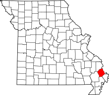 | |
| Villages | ||
| Townships |
| |
| Unincorporated communities | ||
| Footnotes | ‡This populated place also has portions in an adjacent county or counties | |