Butler, Missouri
| Butler, Missouri | |
|---|---|
| City | |
| Nickname(s): The Electric City[1] | |
 Location within Bates County and Missouri | |
| Coordinates: 38°15′31″N 94°20′6″W / 38.25861°N 94.33500°WCoordinates: 38°15′31″N 94°20′6″W / 38.25861°N 94.33500°W | |
| Country | United States |
| State | Missouri |
| County | Bates |
| Area[2] | |
| • Total | 4.08 sq mi (10.57 km2) |
| • Land | 4.07 sq mi (10.54 km2) |
| • Water | 0.01 sq mi (0.03 km2) |
| Elevation | 863 ft (263 m) |
| Population (2010)[3] | |
| • Total | 4,219 |
| • Estimate (2012[4]) | 4,157 |
| • Density | 1,000/sq mi (400/km2) |
| Time zone | Central (CST) (UTC-6) |
| • Summer (DST) | CDT (UTC-5) |
| ZIP code | 64730 |
| Area code(s) | 660 |
| FIPS code | 29-10054 [5] |
| GNIS feature ID | 0715118 [6] |
| Website | City Website |
Butler is a city in Bates County, Missouri, United States.[7] The population was 4,219 at the 2010 census. The county seat of Bates County,[8] the city is named for William Orlando Butler, a noted American military and political figure of the early and mid-19th century.[9] It is located approximately fifty miles south of Kansas City, Missouri on U.S. Route 71-Interstate 49.
History
When originally laid out in April 1852, Butler was a short distance from its later and current location, with John C. Kennett being recognized as the first settler to build a home.[9] The plat for Butler was filed in August, 1853 and consisted of five lots on fifty-five acres of donated land.[10] The first county seat for Bates County was Papinville.
After a large portion of the county was split off to form Vernon County in 1855, Papinville was no longer near the geographic center, and Butler was selected in 1856 as the county seat.[10] County officials shortly thereafter selected the contracting firm of Fitzpatrick & Hurt to construct a fifty-by-fifty foot brick courthouse at a cost of $5,000. This building served the county until being gutted by fire in 1861.[10] The year 1856 also saw the establishment of Butler's first general mercantile store was established in 1856, with several others following in the years prior to the Civil War's outbreak in 1861.
Civil War to present
During the Civil War western Missouri was engulfed in insurgent Confederate actions and raids by Union forces. Personal conflicts were also played out in the war's violence. Early in the conflict a major fire destroyed not only the Bates County courthouse but nearly all of the surrounding square of businesses and the town's first church.[9] The arson fire was the handiwork of a squad of volunteer Kansas cavalry acting on orders of Jayhawker Colonel James Montgomery. A company of pro-Confederate Missouri State Guard cavalry under Sidney D. Jackman arrived too late to stop the arson, but they pursued the Kansans back across the border, killing and wounding several.[9] During much of the spring and summer of 1862, the town was occupied by Union Colonel Fitz Henry Warren and elements of the 1st Regiment Iowa Volunteer Cavalry. Arriving in April, they stayed until mid-August when they left for Clinton, Missouri, followed closely by Confederate troops under Colonel Jackman and General Vard Cockrell. The opposing groups would finally meet a few days later at the Battle of Lone Jack in Jackson county.[9]

Two months later a Civil War milestone took place in Bates County at a site approximately eight miles southwest of Butler. This was the first combat against Confederates by African Americans fighting for the Union. During the Battle of Island Mound (aka "Battle of Fort Toothman") on October 28–29, 1862, the Union 1st Kansas Colored Volunteers—composed of former slaves who had escaped from Arkansas and Missouri—and a scouting element from the 5th Kansas Volunteer Cavalry engaged a numerically superior force of Confederate guerrillas and recent Missouri State Guard recruits led by Vard Cockrell and Bill Truman (a relative of future President Harry S. Truman). The Union forces crossed into Missouri on a mission to clear Confederate guerrillas from an area known as "Hog Island".[11] The Union troops commandeered and fortified the homestead of Confederate guerrilla Enoch John Toothman. The next day a detachment engaged with mounted Confederate cavalry, but stood their ground. The Confederates withdrew from the area on October 29. Eight Union men were killed and an estimated 30-40 Confederates.[11]
On August 25, 1863 Union Army General Thomas Ewing issued his controversial Order No. 11, requiring evacuation of all rural residents from the county.[10] Ostensibly it was a response to the raid on Lawrence, Kansas by Confederate guerrillas under William Quantrill and a means to cut off materiel support for further bushwhacker activity. Opponents believed it was a personal vendetta by Ewing, an abolitionist from Kansas who lost several friends in the raid. Order No. 11 called for the forced evacuation of the rural residents of Bates and three other border counties (Cass, Jackson, and Vernon) within 15 days of issuance.[10] All rural residents of the affected counties, regardless of their allegiance, were forced to leave their farms and homes.
Those who could prove their loyalty to the Union were allowed to remain in the counties but required to move to communities near Union military outposts. Those unwilling or unable to prove loyalty were ordered to move from the counties altogether or face imprisonment. Among the forced evacuees were Solomon and Hattie (Gregg) Young and their daughter Martha, the maternal grandparents and mother of future President Harry Truman. Butler was left a virtual ghost town. When residents returned later near war's end, the town and much of the county as a whole had been burned, looted, and otherwise destroyed by regular Union forces, pro-Union Jayhawkers, and Kansas "Red Legs".
Post-Bellum: A temporary structure for county business and court activities was constructed in late 1865 but proved inadequate. In 1869 a much larger two-story brick courthouse was constructed at a cost of $23,000.[10] While slowly continuing its recovery, Butler was finally incorporated as a village on June 19, 1872. Seven years later, on April 7, 1879 Butler was reincorporated as a fourth-class city, with William Page serving as the first mayor.[9] Numerous mills and grain elevators became part of the growing Butler business community through the 1870s, providing opportunities for surrounding farms to process wool and various grains.[9]
Butler gained electric power in 1881, being one of the first communities west of the Mississippi River to offer that convenience. Four large lights were mounted atop the Bates County courthouse, providing illumination for the downtown area. Butler became known as "The Electric City."[1][9] The 1869 courthouse survived until 1899 when it was found to be structurally unsound; it was closed and demolished.[10]
After passage of a bond issue, construction on the current Bates county courthouse began in 1901. The eighty-by-one hundred five foot Romanesque-style structure was built of "Carthage stone" from southern Missouri at a total project cost of $50,000 and was occupied in July, 1902.[10] By the early 20th century Butler's business listings included three banks, an opera house, four hotels, and a large number of general and specialty stores.[9]
In 2008 Bates county residents erected a statue and plaque honoring the 1st Kansas Colored Volunteers and the Battle of Island Mound on the grounds of the Bates County courthouse in Butler.[11] The State of Missouri purchased a 40-acre property including part of the former Toothman homestead and established the "Battle of Island Mound State Historic Site" in October 2012.[11]
The Bates County Courthouse and Palace Hotel are listed on the National Register of Historic Places.[12]
Geography
According to the United States Census Bureau, the city has a total area of 4.08 square miles (10.57 km2), of which, 4.07 square miles (10.54 km2) is land and 0.01 square miles (0.03 km2) is water.[2]
Demographics
| Historical population | |||
|---|---|---|---|
| Census | Pop. | %± | |
| 1870 | 1,064 | — | |
| 1880 | 2,162 | 103.2% | |
| 1890 | 2,812 | 30.1% | |
| 1900 | 3,158 | 12.3% | |
| 1910 | 2,894 | −8.4% | |
| 1920 | 2,702 | −6.6% | |
| 1930 | 2,706 | 0.1% | |
| 1940 | 2,958 | 9.3% | |
| 1950 | 3,333 | 12.7% | |
| 1960 | 3,791 | 13.7% | |
| 1970 | 3,984 | 5.1% | |
| 1980 | 4,107 | 3.1% | |
| 1990 | 4,099 | −0.2% | |
| 2000 | 4,209 | 2.7% | |
| 2010 | 4,219 | 0.2% | |
| Est. 2015 | 4,091 | [13] | −3.0% |
Butler is considered a part of the Kansas City metropolitan area.
2010 census
As of the census[3] of 2010, there were 4,219 people, 1,739 households, and 1,031 families residing in the city. The population density was 1,036.6 inhabitants per square mile (400.2/km2). There were 2,047 housing units at an average density of 502.9 per square mile (194.2/km2). The racial makeup of the city was 94.5% White, 2.7% African American, 0.5% Native American, 0.2% Asian, 0.5% from other races, and 1.7% from two or more races. Hispanic or Latino of any race were 2.3% of the population.
There were 1,739 households of which 29.7% had children under the age of 18 living with them, 42.8% were married couples living together, 12.2% had a female householder with no husband present, 4.3% had a male householder with no wife present, and 40.7% were non-families. 35.5% of all households were made up of individuals and 17.6% had someone living alone who was 65 years of age or older. The average household size was 2.30 and the average family size was 2.97.
The median age in the city was 39.3 years. 24.1% of residents were under the age of 18; 7.9% were between the ages of 18 and 24; 23.2% were from 25 to 44; 23.6% were from 45 to 64; and 20.9% were 65 years of age or older. The gender makeup of the city was 46.8% male and 53.2% female.
2000 census
As of the census[5] of 2000, there were 4,209 people, 1,723 households, and 1,047 families residing in the city. The population density was 1,089.5 people per square mile (421.0/km²). There were 1,914 housing units at an average density of 495.4 per square mile (191.5/km²). The racial makeup of the city was 95.65% White, 1.92% African American, 0.43% Native American, 0.38% Asian, 0.02% Pacific Islander, 0.55% from other races, and 1.05% from two or more races. Hispanic or Latino of any race were 0.97% of the population.
There were 1,723 households out of which 29.2% had children under the age of 18 living with them, 46.3% were married couples living together, 10.4% had a female householder with no husband present, and 39.2% were non-families. 35.2% of all households were made up of individuals and 21.1% had someone living alone who was 65 years of age or older. The average household size was 2.32 and the average family size was 2.97.
In the city the population was spread out with 25.0% under the age of 18, 8.8% from 18 to 24, 23.4% from 25 to 44, 19.1% from 45 to 64, and 23.7% who were 65 years of age or older. The median age was 39 years. For every 100 females there were 82.8 males. For every 100 females age 18 and over, there were 77.3 males.
The median income for a household in the city was $25,531, and the median income for a family was $31,596. Males had a median income of $27,917 versus $18,523 for females. The per capita income for the city was $15,237. About 15.4% of families and 19.4% of the population were below the poverty line, including 24.3% of those under age 18 and 18.3% of those age 65 or over.
In the media
- God, Guns & Automobiles, a reality television show that airs on History network features Butler resident Mark Muller and his automotive sales business, Max Motors.
Notable people
- Robert Heinlein, science fiction author who was born and lived in Butler, mentioned the town in his short story "Requiem" and the novel To Sail Beyond the Sunset, in which the main character mentions the town several times.
- Charles O'Rear, photographer and author. Best known for his photo Bliss.
- Randy Pike, Missouri state legislator, was born in Butler.
- Stan Wall, former Major League Baseball pitcher for the Los Angeles Dodgers.
- Warren Welliver, lawyer and jurist. Served ten years on the Supreme Court of Missouri.
References
- 1 2 "Official City webpage". City of Butler. 2013. Retrieved 12 July 2013.
- 1 2 "US Gazetteer files 2010". United States Census Bureau. Archived from the original on 2012-01-24. Retrieved 2012-07-08.
- 1 2 "American FactFinder". United States Census Bureau. Retrieved 2012-07-08.
- ↑ "Population Estimates". United States Census Bureau. Archived from the original on 2013-06-17. Retrieved 2013-05-30.
- 1 2 "American FactFinder". United States Census Bureau. Archived from the original on 2013-09-11. Retrieved 2008-01-31.
- ↑ "US Board on Geographic Names". United States Geological Survey. 2007-10-25. Retrieved 2008-01-31.
- ↑ "Geographic Names Information System". United States Geological Survey. Retrieved 2008-01-31.
- ↑ "Find a County". National Association of Counties. Archived from the original on 2011-05-31. Retrieved 2011-06-07.
- 1 2 3 4 5 6 7 8 9 Atkeson, W.O. (1918). "History of Butler Missouri". Historical Publishing Company via Ray's Place website. Retrieved 12 July 2013.
- 1 2 3 4 5 6 7 8 "Butler area history". Butler Chamber of Commerce via website. 2013. Archived from the original on 21 December 2012. Retrieved 12 July 2013.
- 1 2 3 4 "The Battle of Island Mound". Bates County government via website. 2013. Retrieved 14 July 2013.
- ↑ National Park Service (2010-07-09). "National Register Information System". National Register of Historic Places. National Park Service.
- ↑ "Annual Estimates of the Resident Population for Incorporated Places: April 1, 2010 to July 1, 2015". Retrieved July 2, 2016.
- ↑ "Census of Population and Housing". Census.gov. Archived from the original on May 11, 2015. Retrieved June 4, 2015.
External links
- City of Butler
- Historic maps of Butler in the Sanborn Maps of Missouri Collection at the University of Missouri
- Battle of Island Mound State Historic Site Missouri Department of Natural Resources
Municipalities and communities of Bates County, Missouri, United States | ||
|---|---|---|
| Cities | 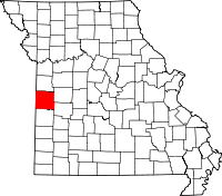 | |
| Villages | ||
| Townships | ||
| Unincorporated communities | ||
| Ghost towns | ||
| Footnotes | ‡This populated place also has portions in an adjacent county or counties | |