Greenfield, Missouri
| Greenfield, Missouri | |
|---|---|
| City | |
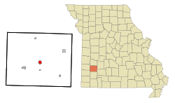 Location of Greenfield, Missouri | |
| Coordinates: 37°24′55″N 93°50′34″W / 37.41528°N 93.84278°WCoordinates: 37°24′55″N 93°50′34″W / 37.41528°N 93.84278°W | |
| Country | United States |
| State | Missouri |
| County | Dade |
| Area[1] | |
| • Total | 1.14 sq mi (2.95 km2) |
| • Land | 1.14 sq mi (2.95 km2) |
| • Water | 0 sq mi (0 km2) |
| Elevation | 1,096 ft (334 m) |
| Population (2010)[2] | |
| • Total | 1,371 |
| • Estimate (2012[3]) | 1,315 |
| • Density | 1,202.6/sq mi (464.3/km2) |
| Time zone | Central (CST) (UTC-6) |
| • Summer (DST) | CDT (UTC-5) |
| ZIP code | 65661 |
| Area code(s) | 417 |
| FIPS code | 29-29206[4] |
| GNIS feature ID | 0718821[5] |
Greenfield is a city in Dade County, Missouri. The population was 1,371 at the 2010 census. It is the county seat of Dade County.[6]
History
Greenfield was laid out in 1841, and named for the greenery of the original town site.[7] A post office called Greenfield has been in operation since 1850.[8]
The Greenfield square is lined with buildings built in the 1880s out of bricks made in the Greenfield Brickyard. The Opera House, which opened in 1888, is known as the "Jewel of the Square" and is still used for the summer productions of the Dade County Community Theater.
Geography
Greenfield is located at 37°24′55″N 93°50′34″W / 37.41528°N 93.84278°W (37.415340, -93.842781).[9] According to the United States Census Bureau, the city has a total area of 1.14 square miles (2.95 km2), all of it land.[1]
Demographics
| Historical population | |||
|---|---|---|---|
| Census | Pop. | %± | |
| 1860 | 228 | — | |
| 1870 | 364 | 59.6% | |
| 1880 | 712 | 95.6% | |
| 1890 | 998 | 40.2% | |
| 1900 | 1,406 | 40.9% | |
| 1910 | 1,434 | 2.0% | |
| 1920 | 1,440 | 0.4% | |
| 1930 | 1,304 | −9.4% | |
| 1940 | 1,353 | 3.8% | |
| 1950 | 1,213 | −10.3% | |
| 1960 | 1,172 | −3.4% | |
| 1970 | 1,172 | 0.0% | |
| 1980 | 1,394 | 18.9% | |
| 1990 | 1,416 | 1.6% | |
| 2000 | 1,358 | −4.1% | |
| 2010 | 1,371 | 1.0% | |
| Est. 2015 | 1,316 | [10] | −4.0% |
2010 census
As of the census[2] of 2010, there were 1,371 people, 600 households, and 336 families residing in the city. The population density was 1,202.6 inhabitants per square mile (464.3/km2). There were 709 housing units at an average density of 621.9 per square mile (240.1/km2). The racial makeup of the city was 95.6% White, 0.8% African American, 1.1% Native American, 0.1% Asian, 0.1% Pacific Islander, 0.4% from other races, and 2.0% from two or more races. Hispanic or Latino of any race were 2.4% of the population.
There were 600 households of which 27.5% had children under the age of 18 living with them, 39.7% were married couples living together, 12.3% had a female householder with no husband present, 4.0% had a male householder with no wife present, and 44.0% were non-families. 38.3% of all households were made up of individuals and 19% had someone living alone who was 65 years of age or older. The average household size was 2.19 and the average family size was 2.89.
The median age in the city was 43.5 years. 23.1% of residents were under the age of 18; 6.4% were between the ages of 18 and 24; 21.7% were from 25 to 44; 25% were from 45 to 64; and 23.9% were 65 years of age or older. The gender makeup of the city was 47.2% male and 52.8% female.
2000 census
As of the census[4] of 2000, there were 1,358 people, 623 households, and 368 families residing in the city. The population density was 1,235.0 people per square mile (476.7/km²). There were 731 housing units at an average density of 664.8 per square mile (256.6/km²). The racial makeup of the city was 95.88% White, 0.37% African American, 1.10% Native American, 0.07% Asian, 0.07% Pacific Islander, 0.37% from other races, and 2.14% from two or more races. Hispanic or Latino of any race were 1.18% of the population.
There were 623 households out of which 25.0% had children under the age of 18 living with them, 45.1% were married couples living together, 10.6% had a female householder with no husband present, and 40.8% were non-families. 37.7% of all households were made up of individuals and 23.3% had someone living alone who was 65 years of age or older. The average household size was 2.17 and the average family size was 2.82.
In the city the population was spread out with 23.7% under the age of 18, 7.4% from 18 to 24, 21.0% from 25 to 44, 23.4% from 45 to 64, and 24.5% who were 65 years of age or older. The median age was 43 years. For every 100 females there were 83.8 males. For every 100 females age 18 and over, there were 78.9 males.
The median income for a household in the city was $22,336, and the median income for a family was $28,594. Males had a median income of $27,955 versus $17,727 for females. The per capita income for the city was $14,051. About 12.3% of families and 18.6% of the population were below the poverty line, including 24.8% of those under age 18 and 15.6% of those age 65 or over.
References
- 1 2 "US Gazetteer files 2010". United States Census Bureau. Retrieved 2012-07-08.
- 1 2 "American FactFinder". United States Census Bureau. Retrieved 2012-07-08.
- ↑ "Population Estimates". United States Census Bureau. Retrieved 2013-05-30.
- 1 2 "American FactFinder". United States Census Bureau. Retrieved 2008-01-31.
- ↑ "US Board on Geographic Names". United States Geological Survey. 2007-10-25. Retrieved 2008-01-31.
- ↑ "Find a County". National Association of Counties. Retrieved 2011-06-07.
- ↑ "Dade County Place Names, 1928–1945 (archived)". The State Historical Society of Missouri. Retrieved 25 September 2016.
- ↑ "Post Offices". Jim Forte Postal History. Retrieved 25 September 2016.
- ↑ "US Gazetteer files: 2010, 2000, and 1990". United States Census Bureau. 2011-02-12. Retrieved 2011-04-23.
- ↑ "Annual Estimates of the Resident Population for Incorporated Places: April 1, 2010 to July 1, 2015". Retrieved July 2, 2016.
- ↑ "Census of Population and Housing". Census.gov. Retrieved June 4, 2015.
External links
- Chamber of Commerce
- Historic maps of Greenfield in the Sanborn Maps of Missouri Collection at the University of Missouri
Municipalities and communities of Dade County, Missouri, United States | ||
|---|---|---|
| Cities | 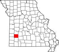 | |
| Villages | ||
| Townships | ||
| Unincorporated communities | ||
| Ghost towns | ||
| Footnotes | ‡This populated place also has portions in an adjacent county or counties | |