New London, Missouri
| New London, Missouri | |
|---|---|
| City | |
 Location of New London, Missouri | |
| Coordinates: 39°35′7″N 91°23′57″W / 39.58528°N 91.39917°WCoordinates: 39°35′7″N 91°23′57″W / 39.58528°N 91.39917°W | |
| Country | United States |
| State | Missouri |
| County | Ralls |
| Area[1] | |
| • Total | 0.69 sq mi (1.79 km2) |
| • Land | 0.69 sq mi (1.79 km2) |
| • Water | 0 sq mi (0 km2) |
| Elevation | 656 ft (200 m) |
| Population (2010)[2] | |
| • Total | 974 |
| • Estimate (2012[3]) | 981 |
| • Density | 1,411.6/sq mi (545.0/km2) |
| Time zone | Central (CST) (UTC-6) |
| • Summer (DST) | CDT (UTC-5) |
| ZIP code | 63459 |
| Area code(s) | 573 |
| FIPS code | 29-52058[4] |
| GNIS feature ID | 0723280[5] |
New London is a city in Ralls County, United States at the intersection of US Route 61 and Missouri Route 19. The population was 974 at the 2010 census. It is the county seat of Ralls County.[6]
New London is part of the Hannibal Micropolitan Statistical Area.
History
New London was platted in 1819.[7] It was named after the City of London, in England.[8]
Geography
New London is located at 39°35′7″N 91°23′57″W / 39.58528°N 91.39917°W (39.585206, -91.399143).[9] According to the United States Census Bureau, the city has a total area of 0.69 square miles (1.79 km2), all of it land.[1]
Demographics
| Historical population | |||
|---|---|---|---|
| Census | Pop. | %± | |
| 1860 | 268 | — | |
| 1870 | 410 | 53.0% | |
| 1880 | 502 | 22.4% | |
| 1890 | 683 | 36.1% | |
| 1900 | 881 | 29.0% | |
| 1910 | 942 | 6.9% | |
| 1920 | 911 | −3.3% | |
| 1930 | 900 | −1.2% | |
| 1940 | 1,005 | 11.7% | |
| 1950 | 858 | −14.6% | |
| 1960 | 875 | 2.0% | |
| 1970 | 967 | 10.5% | |
| 1980 | 1,161 | 20.1% | |
| 1990 | 988 | −14.9% | |
| 2000 | 1,001 | 1.3% | |
| 2010 | 974 | −2.7% | |
| Est. 2015 | 969 | [10] | −0.5% |
2010 census
As of the census[2] of 2010, there were 974 people, 417 households, and 265 families residing in the city. The population density was 1,411.6 inhabitants per square mile (545.0/km2). There were 467 housing units at an average density of 676.8 per square mile (261.3/km2). The racial makeup of the city was 91.5% White, 6.4% African American, 0.1% Native American, 0.2% Asian, and 1.8% from two or more races. Hispanic or Latino of any race were 0.8% of the population.
There were 417 households of which 30.5% had children under the age of 18 living with them, 46.0% were married couples living together, 13.7% had a female householder with no husband present, 3.8% had a male householder with no wife present, and 36.5% were non-families. 32.4% of all households were made up of individuals and 12.8% had someone living alone who was 65 years of age or older. The average household size was 2.34 and the average family size was 2.93.
The median age in the city was 39.6 years. 25.2% of residents were under the age of 18; 7.2% were between the ages of 18 and 24; 24.2% were from 25 to 44; 28.7% were from 45 to 64; and 14.9% were 65 years of age or older. The gender makeup of the city was 48.4% male and 51.6% female.
2000 census
As of the census[4] of 2000, there were 1,001 people, 411 households, and 286 families residing in the city. The population density was 1,424.1 people per square mile (552.1/km²). There were 466 housing units at an average density of 663.0 per square mile (257.0/km²). The racial makeup of the city was 92.31% White, 6.29% African American, 0.20% Native American, 0.10% Asian, 0.10% Pacific Islander, and 1.00% from two or more races. Hispanic or Latino of any race were 0.70% of the population.
There were 411 households out of which 34.3% had children under the age of 18 living with them, 52.6% were married couples living together, 13.4% had a female householder with no husband present, and 30.4% were non-families. 27.3% of all households were made up of individuals and 13.1% had someone living alone who was 65 years of age or older. The average household size was 2.44 and the average family size was 2.94.
In the city the population was spread out with 26.3% under the age of 18, 8.4% from 18 to 24, 23.9% from 25 to 44, 25.4% from 45 to 64, and 16.1% who were 65 years of age or older. The median age was 39 years. For every 100 females there were 91.8 males. For every 100 females age 18 and over, there were 87.3 males.
The median income for a household in the city was $28,875, and the median income for a family was $35,192. Males had a median income of $26,691 versus $18,194 for females. The per capita income for the city was $14,360. About 10.4% of families and 13.6% of the population were below the poverty line, including 21.5% of those under age 18 and 12.8% of those age 65 or over.
References
- 1 2 "US Gazetteer files 2010". United States Census Bureau. Retrieved 2012-07-08.
- 1 2 "American FactFinder". United States Census Bureau. Retrieved 2012-07-08.
- ↑ "Population Estimates". United States Census Bureau. Retrieved 2013-05-30.
- 1 2 "American FactFinder". United States Census Bureau. Retrieved 2008-01-31.
- ↑ "US Board on Geographic Names". United States Geological Survey. 2007-10-25. Retrieved 2008-01-31.
- ↑ "Find a County". National Association of Counties. Retrieved 2011-06-07.
- ↑ Eaton, David Wolfe (1917). How Missouri Counties, Towns and Streams Were Named. The State Historical Society of Missouri. p. 343.
- ↑ Ramsay, Robert L. (1952). Our Storehouse of Missouri Place Names. University of Missouri Press. p. 29.
- ↑ "US Gazetteer files: 2010, 2000, and 1990". United States Census Bureau. 2011-02-12. Retrieved 2011-04-23.
- ↑ "Annual Estimates of the Resident Population for Incorporated Places: April 1, 2010 to July 1, 2015". Retrieved July 2, 2016.
- ↑ "Census of Population and Housing". Census.gov. Retrieved June 4, 2015.
External links
- Historic maps of New London in the Sanborn Maps of Missouri Collection at the University of Missouri
Municipalities and communities of Ralls County, Missouri, United States | ||
|---|---|---|
| Cities | 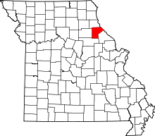 | |
| Village | ||
| Townships |
| |
| Unincorporated communities |
| |
| Ghost towns |
| |
| Footnotes | ‡This populated place also has portions in an adjacent county or counties | |