Oran, Missouri
| Oran, Missouri | |
|---|---|
| City | |
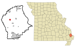 Location of Oran, Missouri | |
| Coordinates: 37°5′4″N 89°39′15″W / 37.08444°N 89.65417°WCoordinates: 37°5′4″N 89°39′15″W / 37.08444°N 89.65417°W | |
| Country | United States |
| State | Missouri |
| County | Scott |
| Area[1] | |
| • Total | 1.08 sq mi (2.80 km2) |
| • Land | 1.08 sq mi (2.80 km2) |
| • Water | 0 sq mi (0 km2) |
| Elevation | 338 ft (103 m) |
| Population (2010)[2] | |
| • Total | 1,294 |
| • Estimate (2012[3]) | 1,282 |
| • Density | 1,198.1/sq mi (462.6/km2) |
| Time zone | Central (CST) (UTC-6) |
| • Summer (DST) | CDT (UTC-5) |
| ZIP code | 63771 |
| Area code(s) | 573 |
| FIPS code | 29-54758[4] |
| GNIS feature ID | 0731629[5] |
Oran is a city in Scott County, Missouri, United States. The population was 1,294 at the 2010 census. It was surveyed under the name of Sylvania on July 9, 1869. It was renamed St. Cloud on February 14, 1870. It was renamed again as Oran on August 23, 1882, when a new plat of the town was filed.[6]
Geography
Oran is located at 37°5′4″N 89°39′15″W / 37.08444°N 89.65417°W (37.084520, -89.654121).[7]
According to the United States Census Bureau, the city has a total area of 1.08 square miles (2.80 km2), all of it land.[1]
Demographics
| Historical population | |||
|---|---|---|---|
| Census | Pop. | %± | |
| 1890 | 271 | — | |
| 1900 | 497 | 83.4% | |
| 1910 | 1,023 | 105.8% | |
| 1920 | 1,141 | 11.5% | |
| 1930 | 940 | −17.6% | |
| 1940 | 1,106 | 17.7% | |
| 1950 | 1,156 | 4.5% | |
| 1960 | 1,090 | −5.7% | |
| 1970 | 1,226 | 12.5% | |
| 1980 | 1,266 | 3.3% | |
| 1990 | 1,164 | −8.1% | |
| 2000 | 1,264 | 8.6% | |
| 2010 | 1,294 | 2.4% | |
| Est. 2015 | 1,277 | [8] | −1.3% |
2010 census
As of the census[2] of 2010, there were 1,294 people, 518 households, and 360 families residing in the city. The population density was 1,198.1 inhabitants per square mile (462.6/km2). There were 566 housing units at an average density of 524.1 per square mile (202.4/km2). The racial makeup of the city was 97.68% White, 1.55% African American, and 0.77% from two or more races. Hispanic or Latino of any race were 1.47% of the population.
There were 518 households of which 38.4% had children under the age of 18 living with them, 53.9% were married couples living together, 10.2% had a female householder with no husband present, 5.4% had a male householder with no wife present, and 30.5% were non-families. 27.8% of all households were made up of individuals and 14.7% had someone living alone who was 65 years of age or older. The average household size was 2.50 and the average family size was 3.03.
The median age in the city was 38.3 years. 27.1% of residents were under the age of 18; 7.8% were between the ages of 18 and 24; 25% were from 25 to 44; 24.1% were from 45 to 64; and 15.8% were 65 years of age or older. The gender makeup of the city was 49.8% male and 50.2% female.
2000 census
As of the census[4] of 2000, there were 1,264 people, 507 households, and 353 families residing in the city. The population density was 1,200.5 people per square mile (464.8/km²). There were 544 housing units at an average density of 516.7 per square mile (200.0/km²). The racial makeup of the city was 97.39% White, 0.40% African American, 0.40% Native American, 1.27% from other races, and 0.55% from two or more races. Hispanic or Latino of any race were 2.53% of the population.
There were 507 households out of which 35.1% had children under the age of 18 living with them, 55.4% were married couples living together, 11.0% had a female householder with no husband present, and 30.2% were non-families. 27.2% of all households were made up of individuals and 19.7% had someone living alone who was 65 years of age or older. The average household size was 2.49 and the average family size was 3.02.
In the city the population was spread out with 27.5% under the age of 18, 8.2% from 18 to 24, 26.9% from 25 to 44, 20.5% from 45 to 64, and 16.9% who were 65 years of age or older. The median age was 35 years. For every 100 females there were 91.5 males. For every 100 females age 18 and over, there were 81.9 males.
The median income for a household in the city was $28,750, and the median income for a family was $36,985. Males had a median income of $28,185 versus $17,500 for females. The per capita income for the city was $13,487. About 12.4% of families and 14.9% of the population were below the poverty line, including 20.4% of those under age 18 and 11.2% of those age 65 or over.
See also
References
- 1 2 "US Gazetteer files 2010". United States Census Bureau. Archived from the original on January 24, 2012. Retrieved 2012-07-08.
- 1 2 "American FactFinder". United States Census Bureau. Retrieved 2012-07-08.
- ↑ "Population Estimates". United States Census Bureau. Archived from the original on June 17, 2013. Retrieved 2013-05-30.
- 1 2 "American FactFinder". United States Census Bureau. Retrieved 2008-01-31.
- ↑ "US Board on Geographic Names". United States Geological Survey. 2007-10-25. Retrieved 2008-01-31.
- ↑ Edison Shrum (1984). The History of Scott County, Missouri. Sikeston, Missouri: Scott County Historical Society. pp. 259–260.
- ↑ "US Gazetteer files: 2010, 2000, and 1990". United States Census Bureau. 2011-02-12. Retrieved 2011-04-23.
- ↑ "Annual Estimates of the Resident Population for Incorporated Places: April 1, 2010 to July 1, 2015". Retrieved July 2, 2016.
- ↑ "Census of Population and Housing". Census.gov. Archived from the original on May 11, 2015. Retrieved June 4, 2015.
External links
- Oran R-III School District
- Historic maps of Oran in the Sanborn Maps of Missouri Collection at the University of Missouri
Municipalities and communities of Scott County, Missouri, United States | ||
|---|---|---|
| Cities | 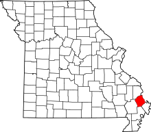 | |
| Villages | ||
| Townships |
| |
| Unincorporated communities | ||
| Footnotes | ‡This populated place also has portions in an adjacent county or counties | |