Ironton, Missouri
| Ironton, Missouri | |
|---|---|
| City | |
|
The Ironton Courthouse | |
| Nickname(s): Queen City of the Francois Mountains | |
 Location of Ironton, Missouri | |
| Coordinates: 37°36′2″N 90°37′54″W / 37.60056°N 90.63167°WCoordinates: 37°36′2″N 90°37′54″W / 37.60056°N 90.63167°W | |
| Country | United States |
| State | Missouri |
| County | Iron |
| Area[1] | |
| • Total | 1.39 sq mi (3.60 km2) |
| • Land | 1.34 sq mi (3.47 km2) |
| • Water | 0.05 sq mi (0.13 km2) |
| Elevation | 906 ft (276 m) |
| Population (2010)[2] | |
| • Total | 1,460 |
| • Estimate (2012[3]) | 1,426 |
| • Density | 1,089.6/sq mi (420.7/km2) |
| Time zone | Central (CST) (UTC-6) |
| • Summer (DST) | CDT (UTC-5) |
| ZIP code | 63650 |
| Area code(s) | 573 |
| FIPS code | 29-35468[4] |
| GNIS feature ID | 0750466[5] |

Ironton is a city in Iron County, Missouri, United States. The population was 1,460 at the 2010 census It is the county seat of Iron County,[6] and is 12 miles south of Belgrade, Missouri.
History
Ironton was designated county seat in 1857, soon after the formation of Iron County.[7] Like the county, Ironton was named from the deposits of iron ore found in the vicinity.[8] A post office called Ironton has been in operation since 1858.[9]
Geography
Ironton is located at 37°36′2″N 90°37′54″W / 37.60056°N 90.63167°W (37.600455, -90.631627).[10] According to the United States Census Bureau, the city has a total area of 1.39 square miles (3.60 km2), of which, 1.34 square miles (3.47 km2) is land and 0.05 square miles (0.13 km2) is water.[1]
Demographics
| Historical population | |||
|---|---|---|---|
| Census | Pop. | %± | |
| 1860 | 386 | — | |
| 1870 | 573 | 48.4% | |
| 1880 | 759 | 32.5% | |
| 1890 | 965 | 27.1% | |
| 1900 | 797 | −17.4% | |
| 1910 | 721 | −9.5% | |
| 1920 | 832 | 15.4% | |
| 1930 | 974 | 17.1% | |
| 1940 | 1,083 | 11.2% | |
| 1950 | 1,148 | 6.0% | |
| 1960 | 1,310 | 14.1% | |
| 1970 | 1,452 | 10.8% | |
| 1980 | 1,743 | 20.0% | |
| 1990 | 1,539 | −11.7% | |
| 2000 | 1,471 | −4.4% | |
| 2010 | 1,460 | −0.7% | |
| Est. 2015 | 1,392 | [11] | −4.7% |
2010 census
As of the census[2] of 2010, there were 1,460 people, 639 households, and 375 families residing in the city. The population density was 1,089.6 inhabitants per square mile (420.7/km2). There were 745 housing units at an average density of 556.0 per square mile (214.7/km2). The racial makeup of the city was 96.16% White, 1.71% Black or African American, 0.34% Native American, 0.07% Asian, 0.14% from other races, and 1.58% from two or more races. Hispanic or Latino of any race were 1.51% of the population.
There were 639 households of which 25.7% had children under the age of 18 living with them, 41.2% were married couples living together, 13.9% had a female householder with no husband present, 3.6% had a male householder with no wife present, and 41.3% were non-families. 37.4% of all households were made up of individuals and 16.1% had someone living alone who was 65 years of age or older. The average household size was 2.21 and the average family size was 2.88.
The median age in the city was 41.9 years. 20.1% of residents were under the age of 18; 9.8% were between the ages of 18 and 24; 23.1% were from 25 to 44; 26.6% were from 45 to 64; and 20.2% were 65 years of age or older. The gender makeup of the city was 47.2% male and 52.8% female.
2000 census
As of the census[4] of 2000, there were 1,471 people, 615 households, and 389 families residing in the city. The population density was 1,083.2 people per square mile (417.6/km²). There were 683 housing units at an average density of 502.9 per square mile (193.9/km²). The racial makeup of the city was 94.97% White, 3.06% African American, 0.41% Native American, 0.20% Asian, 0.20% from other races, and 1.16% from two or more races. Hispanic or Latino of any race were 0.61% of the population.
There were 615 households out of which 29.8% had children under the age of 18 living with them, 47.2% were married couples living together, 13.7% had a female householder with no husband present, and 36.7% were non-families. 31.9% of all households were made up of individuals and 17.2% had someone living alone who was 65 years of age or older. The average household size was 2.30 and the average family size was 2.88.
In the city, the population was spread out with 23.9% under the age of 18, 8.0% from 18 to 24, 24.9% from 25 to 44, 24.9% from 45 to 64, and 18.3% who were 65 years of age or older. The median age was 41 years. For every 100 females there were 86.9 males. For every 100 females age 18 and over, there were 83.3 males.
The median income for a household in the city was $23,808, and the median income for a family was $31,458. Males had a median income of $28,800 versus $18,162 for females. The per capita income for the city was $14,710. About 17.4% of families and 22.9% of the population were below the poverty line, including 31.1% of those under age 18 and 18.9% of those age 65 or over.
Education
Ironton students are served by the Arcadia Valley School District. Arcadia Valley High School is a small, rural school.
Notable people
- Chris Carr, former NBA basketball player
References
- 1 2 "US Gazetteer files 2010". United States Census Bureau. Retrieved 2012-07-08.
- 1 2 "American FactFinder". United States Census Bureau. Retrieved 2012-07-08.
- ↑ "Population Estimates". United States Census Bureau. Retrieved 2013-05-30.
- 1 2 "American FactFinder". United States Census Bureau. Retrieved 2008-01-31.
- ↑ "US Board on Geographic Names". United States Geological Survey. 2007-10-25. Retrieved 2008-01-31.
- ↑ "Find a County". National Association of Counties. Retrieved 2011-06-07.
- ↑ "Iron County Place Names, 1928–1945 (archived)". The State Historical Society of Missouri. Retrieved 12 October 2016.
- ↑ Eaton, David Wolfe (1916). How Missouri Counties, Towns and Streams Were Named. The State Historical Society of Missouri. p. 176.
- ↑ "Post Offices". Jim Forte Postal History. Retrieved 12 October 2016.
- ↑ "US Gazetteer files: 2010, 2000, and 1990". United States Census Bureau. 2011-02-12. Retrieved 2011-04-23.
- ↑ "Annual Estimates of the Resident Population for Incorporated Places: April 1, 2010 to July 1, 2015". Retrieved July 2, 2016.
- ↑ "Census of Population and Housing". Census.gov. Retrieved June 4, 2015.
External links
- Historic maps of Ironton in the Sanborn Maps of Missouri Collection at the University of Missouri
Municipalities and communities of Iron County, Missouri, United States | ||
|---|---|---|
| Cities | 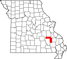 | |
| Village | ||
| Townships | ||
| Unincorporated communities | ||
| Ghost towns | ||
| Footnotes | ‡This populated place also has portions in an adjacent county or counties | |