Hermitage, Missouri
| Hermitage, Missouri | |
|---|---|
| City | |
 Location of Hermitage, Missouri | |
| Coordinates: 37°56′31″N 93°19′4″W / 37.94194°N 93.31778°WCoordinates: 37°56′31″N 93°19′4″W / 37.94194°N 93.31778°W | |
| Country | United States |
| State | Missouri |
| County | Hickory |
| Area[1] | |
| • Total | 1.25 sq mi (3.24 km2) |
| • Land | 1.25 sq mi (3.24 km2) |
| • Water | 0 sq mi (0 km2) |
| Elevation | 820 ft (250 m) |
| Population (2010)[2] | |
| • Total | 467 |
| • Estimate (2012[3]) | 462 |
| • Density | 373.6/sq mi (144.2/km2) |
| Time zone | Central (CST) (UTC-6) |
| • Summer (DST) | CDT (UTC-5) |
| ZIP code | 65668 |
| Area code(s) | 417 |
| FIPS code | 29-31780[4] |
| GNIS feature ID | 0719398[5] |
Hermitage is a city in Hickory County, Missouri, United States, on the Pomme de Terre River. The population was 467 at the 2010 census. It is the county seat of Hickory County.[6] The John Siddles Williams House on Museum Street in Hermitage, on the National Register of Historic Places since 1980, houses the Hickory County Historical Society Museum and Research Room.[7]
History
Hermitage was founded in 1846. It was named after The Hermitage,[8] the estate of the late president Andrew Jackson in Tennessee.[9] In 1847, it was designated seat of Hickory County, also named for Andrew Jackson whose nickname was "Old Hickory".[10][11]
Geography
Hermitage is located at 37°56′31″N 93°19′4″W / 37.94194°N 93.31778°W (37.941816, -93.317901).[12] According to the United States Census Bureau, the city has a total area of 1.25 square miles (3.24 km2), all of it land.[1]
Demographics
| Historical population | |||
|---|---|---|---|
| Census | Pop. | %± | |
| 1880 | 167 | — | |
| 1950 | 204 | — | |
| 1960 | 328 | 60.8% | |
| 1970 | 284 | −13.4% | |
| 1980 | 384 | 35.2% | |
| 1990 | 512 | 33.3% | |
| 2000 | 406 | −20.7% | |
| 2010 | 467 | 15.0% | |
| Est. 2015 | 458 | [13] | −1.9% |
2010 census
As of the census[2] of 2010, there were 467 people, 200 households, and 106 families residing in the city. The population density was 373.6 inhabitants per square mile (144.2/km2). There were 237 housing units at an average density of 189.6 per square mile (73.2/km2). The racial makeup of the city was 96.6% White, 0.4% African American, 0.4% Native American, 0.4% from other races, and 2.1% from two or more races. Hispanic or Latino of any race were 0.6% of the population.
There were 200 households of which 16.5% had children under the age of 18 living with them, 43.5% were married couples living together, 6.0% had a female householder with no husband present, 3.5% had a male householder with no wife present, and 47.0% were non-families. 40.0% of all households were made up of individuals and 22.5% had someone living alone who was 65 years of age or older. The average household size was 2.01 and the average family size was 2.65.
The median age in the city was 60.3 years. 12.8% of residents were under the age of 18; 4.7% were between the ages of 18 and 24; 15.9% were from 25 to 44; 25.5% were from 45 to 64; and 41.1% were 65 years of age or older. The gender makeup of the city was 46.0% male and 54.0% female.
2000 census
At the 2000 census,[4] there were 406 people, 174 households and 108 families residing in the city. The population density was 337.9 per square mile (130.6/km²). There were 208 housing units at an average density of 173.1 per square mile (66.9/km²). The racial makeup of the city was 93.60% White, 0.25% Native American, 1.23% from other races, and 4.93% from two or more races. Hispanic or Latino of any race were 1.23% of the population.
There were 174 households of which 26.4% had children under the age of 18 living with them, 50.0% were married couples living together, 7.5% had a female householder with no husband present, and 37.4% were non-families. 35.1% of all households were made up of individuals and 21.3% had someone living alone who was 65 years of age or older. The average household size was 2.29 and the average family size was 2.94.
Age distribution was 23.6% under the age of 18, 6.9% from 18 to 24, 22.7% from 25 to 44, 21.2% from 45 to 64, and 25.6% who were 65 years of age or older. The median age was 43 years. For every 100 females there were 98.0 males. For every 100 females age 18 and over, there were 86.7 males.
The median household income was $23,958, and the median family income was $29,583. Males had a median income of $20,417 versus $18,958 for females. The per capita income for the city was $12,944. About 13.2% of families and 18.6% of the population were below the poverty line, including 25.0% of those under age 18 and 15.2% of those age 65 or over.
References
- 1 2 "US Gazetteer files 2010". United States Census Bureau. Retrieved 2012-07-08.
- 1 2 "American FactFinder". United States Census Bureau. Retrieved 2012-07-08.
- ↑ "Population Estimates". United States Census Bureau. Retrieved 2013-05-30.
- 1 2 "American FactFinder". United States Census Bureau. Retrieved 2008-01-31.
- ↑ "US Board on Geographic Names". United States Geological Survey. 2007-10-25. Retrieved 2008-01-31.
- ↑ "Find a County". National Association of Counties. Retrieved 2011-06-07.
- ↑ Hickory County Historical Society, http://mogenweb.org/hickory/album/hchs.htm, last updated April 2011.
- ↑ Gannett, Henry (1905). The Origin of Certain Place Names in the United States. Govt. Print. Off. p. 155.
- ↑ "Hickory County Place Names, 1928–1945 (archived)". The State Historical Society of Missouri. Retrieved 6 October 2016.
- ↑ Eaton, David Wolfe (1916). How Missouri Counties, Towns and Streams Were Named. The State Historical Society of Missouri. p. 173.
- ↑ Simmons, George T.; Goggins, David (1991). Soil Survey of Hickory County, Missouri. The Service. p. 1.
- ↑ "US Gazetteer files: 2010, 2000, and 1990". United States Census Bureau. 2011-02-12. Retrieved 2011-04-23.
- ↑ "Annual Estimates of the Resident Population for Incorporated Places: April 1, 2010 to July 1, 2015". Retrieved July 2, 2016.
- ↑ "Census of Population and Housing". Census.gov. Retrieved June 4, 2015.
Municipalities and communities of Hickory County, Missouri, United States | ||
|---|---|---|
| Cities | 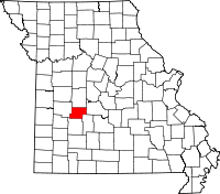 | |
| Village | ||
| Townships | ||
| Unincorporated communities | ||
| Footnotes | ‡This populated place also has portions in an adjacent county or counties | |