Platte City, Missouri
| Platte City, Missouri | |
|---|---|
| City | |
 Location of Platte City, Missouri | |
| Coordinates: 39°21′42″N 94°46′29″W / 39.36167°N 94.77472°WCoordinates: 39°21′42″N 94°46′29″W / 39.36167°N 94.77472°W | |
| Country | United States |
| State | Missouri |
| County | Platte |
| Government | |
| • Mayor | Frank Offutt |
| Area[1] | |
| • Total | 3.65 sq mi (9.45 km2) |
| • Land | 3.61 sq mi (9.35 km2) |
| • Water | 0.04 sq mi (0.10 km2) |
| Elevation | 820 ft (250 m) |
| Population (2010)[2] | |
| • Total | 4,691 |
| • Estimate (2012[3]) | 4,783 |
| • Density | 1,300/sq mi (500/km2) |
| Time zone | Central (CST) (UTC-6) |
| • Summer (DST) | CDT (UTC-5) |
| ZIP code | 64079 |
| Area code(s) | 816 |
| FIPS code | 29-58178 [4] |
| GNIS feature ID | 0730178 [5] |
Platte City is a city in Platte County, Missouri, along the Little Platte River. The population was 4,691 at the 2010 census. It is the county seat of Platte County.[6]
History

Platte City was founded by Zadock "Zed" Martin and was incorporated as a city in September 1843.
On December 16, 1861, Colonel W. James Morgan's Union Squad razed Platte City, including the courthouse.
The Platte County Fair held annually just outside Platte City began in 1863 and is the oldest continuously operating fair west of the Mississippi River.
On April 3, 1882, Jesse James planned a robbery of the Platte City bank, but it was never carried out due to his assassination by Robert Ford on the morning of the raid.[7]
On July 19, 1933 Bonnie & Clyde were ambushed by, and engaged in, a shootout with local authorities just south of Platte City at the Red Crown Tourist Court.
Geography
Platte City is located at 39°21′42″N 94°46′29″W / 39.36167°N 94.77472°W (39.361775, -94.774672).[8] According to the United States Census Bureau, the city has a total area of 3.65 square miles (9.45 km2), of which, 3.61 square miles (9.35 km2) is land and 0.04 square miles (0.10 km2) is water.[1]
Demographics
| Historical population | |||
|---|---|---|---|
| Census | Pop. | %± | |
| 1850 | 495 | — | |
| 1860 | 875 | 76.8% | |
| 1870 | 599 | −31.5% | |
| 1880 | 670 | 11.9% | |
| 1890 | 706 | 5.4% | |
| 1900 | 744 | 5.4% | |
| 1910 | 763 | 2.6% | |
| 1920 | 558 | −26.9% | |
| 1930 | 587 | 5.2% | |
| 1940 | 675 | 15.0% | |
| 1950 | 742 | 9.9% | |
| 1960 | 1,188 | 60.1% | |
| 1970 | 2,022 | 70.2% | |
| 1980 | 2,114 | 4.5% | |
| 1990 | 2,947 | 39.4% | |
| 2000 | 3,866 | 31.2% | |
| 2010 | 4,691 | 21.3% | |
| Est. 2015 | 4,833 | [9] | 3.0% |
2010 census
As of the census[2] of 2010, there were 4,691 people, 1,975 households, and 1,174 families residing in the city. The population density was 1,299.4 inhabitants per square mile (501.7/km2). There were 2,214 housing units at an average density of 613.3 per square mile (236.8/km2). The racial makeup of the city was 88.9% White, 4.6% African American, 0.5% Native American, 1.4% Asian, 0.2% Pacific Islander, 1.6% from other races, and 2.9% from two or more races. Hispanic or Latino of any race were 4.9% of the population.
There were 1,975 households of which 32.5% had children under the age of 18 living with them, 41.7% were married couples living together, 12.9% had a female householder with no husband present, 4.9% had a male householder with no wife present, and 40.6% were non-families. 34.9% of all households were made up of individuals and 9.3% had someone living alone who was 65 years of age or older. The average household size was 2.29 and the average family size was 2.97.
The median age in the city was 35.2 years. 24.2% of residents were under the age of 18; 9.3% were between the ages of 18 and 24; 31.3% were from 25 to 44; 23.6% were from 45 to 64; and 11.6% were 65 years of age or older. The gender makeup of the city was 50.4% male and 49.6% female.
2000 census
As of the census[4] of 2000, there were 3,866 people, 1,486 households, and 1,017 families residing in the city. The population density was 1,147.2 people per square mile (442.9/km²). There were 1,569 housing units at an average density of 465.6 per square mile (179.8/km²). The racial makeup of the city was 92.08% White, 3.34% African American, 0.49% Native American, 0.80% Asian, 1.16% from other races, and 2.12% from two or more races. Hispanic or Latino of any race were 2.79% of the population.
There were 1,486 households out of which 37.1% had children under the age of 18 living with them, 51.7% were married couples living together, 12.5% had a female householder with no husband present, and 31.5% were non-families. 25.7% of all households were made up of individuals and 6.7% had someone living alone who was 65 years of age or older. The average household size was 2.48 and the average family size was 2.99.
In the city the population was spread out with 27.1% under the age of 18, 8.8% from 18 to 24, 34.6% from 25 to 44, 19.3% from 45 to 64, and 10.1% who were 65 years of age or older. The median age was 33 years. For every 100 females there were 99.1 males. For every 100 females age 18 and over, there were 94.4 males.
The median income for a household in the city was $46,379, and the median income for a family was $52,548. Males had a median income of $36,563 versus $26,169 for females. The per capita income for the city was $20,288. About 4.8% of families and 6.2% of the population were below the poverty line, including 8.0% of those under age 18 and 9.2% of those age 65 or over.
Education
Transportation
- Interstate 29 at exit 18.
References
- 1 2 "US Gazetteer files 2010". United States Census Bureau. Retrieved 2012-07-08.
- 1 2 "American FactFinder". United States Census Bureau. Retrieved 2012-07-08.
- ↑ "Population Estimates". United States Census Bureau. Retrieved 2013-05-30.
- 1 2 "American FactFinder". United States Census Bureau. Retrieved 2008-01-31.
- ↑ "US Board on Geographic Names". United States Geological Survey. 2007-10-25. Retrieved 2008-01-31.
- ↑ "Find a County". National Association of Counties. Retrieved 2011-06-07.
- ↑ http://query.nytimes.com/gst/abstract.html?res=9B01E1DE173DE533A25757C0A9629C94639FD7CF
- ↑ "US Gazetteer files: 2010, 2000, and 1990". United States Census Bureau. 2011-02-12. Retrieved 2011-04-23.
- ↑ "Annual Estimates of the Resident Population for Incorporated Places: April 1, 2010 to July 1, 2015". Retrieved July 2, 2016.
- ↑ "Census of Population and Housing". Census.gov. Retrieved June 4, 2015.
External links
- Platte City
- Historic maps of Platte City in the Sanborn Maps of Missouri Collection at the University of Missouri
Municipalities and communities of Platte County, Missouri, United States | ||
|---|---|---|
| Cities | 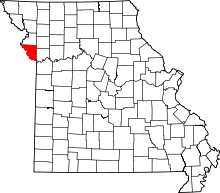 | |
| Villages | ||
| Townships |
| |
| Unincorporated communities |
| |
| Footnotes | ‡This populated place also has portions in an adjacent county or counties | |
Kansas City metropolitan area's cities and counties | ||
|---|---|---|
| Central city | 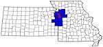 | |
| Largest cities (over 100,000 in 2000) | ||
| Medium-sized cities (10,000 to 100,000 in 2000) | ||
| Smaller Cities (between 5,000 and 9,900 in 2010) | ||
| Counties | ||