Vienna, Missouri
| Vienna, Missouri | |
|---|---|
| City | |
|
Maries County Courthouse in Vienna | |
 Location of Vienna, Missouri | |
| Coordinates: 38°11′12″N 91°56′53″W / 38.18667°N 91.94806°WCoordinates: 38°11′12″N 91°56′53″W / 38.18667°N 91.94806°W | |
| Country | United States |
| State | Missouri |
| County | Maries |
| Area[1] | |
| • Total | 1.06 sq mi (2.75 km2) |
| • Land | 1.06 sq mi (2.75 km2) |
| • Water | 0 sq mi (0 km2) |
| Elevation | 876 ft (267 m) |
| Population (2010)[2] | |
| • Total | 510 |
| • Estimate (2012[3]) | 600 |
| • Density | 575.5/sq mi (222.2/km2) |
| Time zone | Central (CST) (UTC-6) |
| • Summer (DST) | CDT (UTC-5) |
| ZIP code | 65582 |
| Area code(s) | 573 |
| FIPS code | 29-76102[4] |
| GNIS feature ID | 0728201[5] |

Vienna is a city in and the county seat of Maries County, Missouri, United States.[6] The population was 510 at the 2010 census.
History
Vienna became the county seat in 1855. It was named after Vienna, the capital of Austria.[7] According to folk etymology, the town was named after Vie Anna, the deceased daughter of a county judge.[8][9] A post office called Vienna has been in operation since 1856.[10]
Geography
Vienna is located at 38°11′12″N 91°56′53″W / 38.186630°N 91.948126°W.[11]
According to the United States Census Bureau, the city has a total area of 1.06 square miles (2.75 km2), all of it land.[1]
Demographics
| Historical population | |||
|---|---|---|---|
| Census | Pop. | %± | |
| 1930 | 348 | — | |
| 1940 | 433 | 24.4% | |
| 1950 | 471 | 8.8% | |
| 1960 | 536 | 13.8% | |
| 1970 | 505 | −5.8% | |
| 1980 | 514 | 1.8% | |
| 1990 | 611 | 18.9% | |
| 2000 | 628 | 2.8% | |
| 2010 | 610 | −2.9% | |
| Est. 2015 | 597 | [12] | −2.1% |
2010 census
As of the census[2] of 2010, there were 610 people, 264 households, and 134 families residing in the city. The population density was 575.5 inhabitants per square mile (222.2/km2). There were 341 housing units at an average density of 321.7 per square mile (124.2/km2). The racial makeup of the city was 98.4% White, 0.2% African American, 0.7% Native American, and 0.8% from two or more races. Hispanic or Latino of any race were 0.5% of the population.
There were 264 households of which 23.5% had children under the age of 18 living with them, 37.9% were married couples living together, 8.0% had a female householder with no husband present, 4.9% had a male householder with no wife present, and 49.2% were non-families. 47.0% of all households were made up of individuals and 31.1% had someone living alone who was 65 years of age or older. The average household size was 2.06 and the average family size was 2.88.
The median age in the city was 47.3 years. 20.8% of residents were under the age of 18; 7.7% were between the ages of 18 and 24; 18.9% were from 25 to 44; 23.9% were from 45 to 64; and 28.9% were 65 years of age or older. The gender makeup of the city was 47.5% male and 52.5% female.
2000 census
As of the census[4] of 2000, there were 628 people, 257 households, and 139 families residing in the city. The population density was 594.0 people per square mile (228.7/km²). There were 297 housing units at an average density of 280.9 per square mile (108.2/km²). The racial makeup of the city was 98.73% White, 0.48% Native American, 0.16% Asian, and 0.64% from two or more races.
There were 257 households out of which 24.1% had children under the age of 18 living with them, 38.5% were married couples living together, 9.7% had a female householder with no husband present, and 45.9% were non-families. 44.4% of all households were made up of individuals and 27.6% had someone living alone who was 65 years of age or older. The average household size was 2.11 and the average family size was 2.94.
In the city the population was spread out with 20.1% under the age of 18, 9.9% from 18 to 24, 21.8% from 25 to 44, 17.5% from 45 to 64, and 30.7% who were 65 years of age or older. The median age was 43 years. For every 100 females there were 79.4 males. For every 100 females age 18 and over, there were 72.5 males.
The median income for a household in the city was $23,456, and the median income for a family was $36,250. Males had a median income of $24,722 versus $20,000 for females. The per capita income for the city was $13,682. About 4.4% of families and 8.1% of the population were below the poverty line, including 2.2% of those under age 18 and 10.4% of those age 65 or over.
References
- 1 2 "US Gazetteer files 2010". United States Census Bureau. Retrieved 2012-07-08.
- 1 2 "American FactFinder". United States Census Bureau. Retrieved 2012-07-08.
- ↑ "Population Estimates". United States Census Bureau. Retrieved 2013-05-30.
- 1 2 "American FactFinder". United States Census Bureau. Retrieved 2008-01-31.
- ↑ "US Board on Geographic Names". United States Geological Survey. 2007-10-25. Retrieved 2008-01-31.
- ↑ "Find a County". National of Counties. Retrieved 2011-06-07.
- ↑ Eaton, David Wolfe (1916). How Missouri Counties, Towns and Streams Were Named. The State Historical Society of Missouri. p. 193.
- ↑ "Disappearing Missouri Names". The Kansas City Star. March 19, 1911. p. 15. Retrieved August 15, 2014 – via Newspapers.com.

- ↑ Earngey, Bill. 1995. Missouri Roadsides: The Traveler's Companion. Columbia, MO: University of Missouri Press, p. 265.
- ↑ "Post Offices". Jim Forte Postal History. Retrieved 2 November 2016.
- ↑ "US Gazetteer files: 2010, 2000, and 1990". United States Census Bureau. 2011-02-12. Retrieved 2011-04-23.
- ↑ "Annual Estimates of the Resident Population for Incorporated Places: April 1, 2010 to July 1, 2015". Retrieved July 2, 2016.
- ↑ "Census of Population and Housing". Census.gov. Retrieved June 4, 2015.
External links
- Historic maps of Vienna in the Sanborn Maps of Missouri Collection at the University of Missouri
Municipalities and communities of Maries County, Missouri, United States | ||
|---|---|---|
| Cities | 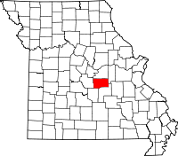 | |
| Village | ||
| Townships | ||
| Unincorporated communities | ||
| Ghost town | ||
| Footnotes | ‡This populated place also has portions in an adjacent county or counties | |