Warrenton, Missouri
| Warrenton, Missouri | |
|---|---|
| City | |
| Motto: A City For All Seasons | |
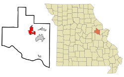 Location of Warrenton, Missouri | |
| Coordinates: 38°48′57″N 91°8′25″W / 38.81583°N 91.14028°WCoordinates: 38°48′57″N 91°8′25″W / 38.81583°N 91.14028°W | |
| Country | United States |
| State | Missouri |
| County | Warren |
| Government | |
| • Mayor | Eric Schleuter |
| • Chief of Police | Greg Houdyshell[1] |
| • City Clerk | Melody Rugh[2] |
| Area[3] | |
| • Total | 8.46 sq mi (21.91 km2) |
| • Land | 8.37 sq mi (21.68 km2) |
| • Water | 0.09 sq mi (0.23 km2) |
| Elevation | 828 ft (252 m) |
| Population (2010)[4] | |
| • Total | 7,880 |
| • Estimate (2012[5]) | 7,987 |
| • Density | 941.5/sq mi (363.5/km2) |
| Time zone | Central (CST) (UTC-6) |
| • Summer (DST) | CDT (UTC-5) |
| ZIP code | 63383 |
| Area code(s) | 636 |
| FIPS code | 29-77128[6] |
| GNIS feature ID | 0728363[7] |
| Website | The City of Warrenton, Missouri |
Warrenton is a city in Warren County, Missouri, United States. The population was 7,880 according to the 2010 Census. It is the county seat of Warren County.[8] Warrenton is located in the St. Louis Metropolitan Statistical Area. Warrenton's slogan is "A City for All Seasons."[9]
History
Warrenton was laid out in 1864. It was named from Warren County, which was named for General Joseph Warren, who was killed in action at the Battle of Bunker Hill in the American Revolutionary War.[10]
Geography
Warrenton is located at 38°48′57″N 91°8′25″W / 38.81583°N 91.14028°W (38.815951, -91.140164).[11] According to the United States Census Bureau, the city has a total area of 8.46 square miles (21.91 km2), of which, 8.37 square miles (21.68 km2) is land and 0.09 square miles (0.23 km2) is water.[3]
Demographics
| Historical population | |||
|---|---|---|---|
| Census | Pop. | %± | |
| 1860 | 480 | — | |
| 1870 | 588 | 22.5% | |
| 1880 | 299 | −49.1% | |
| 1890 | 664 | 122.1% | |
| 1900 | 770 | 16.0% | |
| 1910 | 795 | 3.2% | |
| 1920 | 800 | 0.6% | |
| 1930 | 1,250 | 56.3% | |
| 1940 | 1,254 | 0.3% | |
| 1950 | 1,584 | 26.3% | |
| 1960 | 1,869 | 18.0% | |
| 1970 | 2,057 | 10.1% | |
| 1980 | 3,219 | 56.5% | |
| 1990 | 3,564 | 10.7% | |
| 2000 | 5,281 | 48.2% | |
| 2010 | 7,880 | 49.2% | |
| Est. 2015 | 8,106 | [12] | 2.9% |
2010 census
As of the census[4] of 2010, there were 7,880 people, 2,927 households, and 1,969 families residing in the city. The population density was 941.5 inhabitants per square mile (363.5/km2). There were 3,196 housing units at an average density of 381.8 per square mile (147.4/km2). The racial makeup of the city was 93.9% White, 2.1% African American, 0.6% Native American, 0.7% Asian, 0.1% Pacific Islander, 0.9% from other races, and 1.8% from two or more races. Hispanic or Latino of any race were 3.7% of the population.
There were 2,927 households of which 39.6% had children under the age of 18 living with them, 47.0% were married couples living together, 15.1% had a female householder with no husband present, 5.2% had a male householder with no wife present, and 32.7% were non-families. 27.1% of all households were made up of individuals and 12.5% had someone living alone who was 65 years of age or older. The average household size was 2.61 and the average family size was 3.17.
The median age in the city was 32.4 years. 29.1% of residents were under the age of 18; 8.8% were between the ages of 18 and 24; 28.2% were from 25 to 44; 21.1% were from 45 to 64; and 12.8% were 65 years of age or older. The gender makeup of the city was 47.9% male and 52.1% female.
2000 census
As of the census[6] of 2000, there were 5,281 people, 1,985 households, and 1,363 families residing in the city. The population density was 720.6 people per square mile (278.2/km²). There were 2,110 housing units at an average density of 287.9 per square mile (111.1/km²). The racial makeup of the city was 95.64% White, 1.70% African American, 0.42% Native American, 0.38% Asian, 0.04% Pacific Islander, 0.57% from other races, and 1.25% from two or more races. Hispanic or Latino of any race were 1.29% of the population.
There were 1,985 households out of which 37.9% had children under the age of 18 living with them, 50.8% were married couples living together, 13.6% had a female householder with no husband present, and 31.3% were non-families. 26.5% of all households were made up of individuals and 10.9% had someone living alone who was 65 years of age or older. The average household size was 2.59 and the average family size was 3.14.
In the city the population was spread out with 30.0% under the age of 18, 9.4% from 18 to 24, 30.3% from 25 to 44, 16.8% from 45 to 64, and 13.6% who were 65 years of age or older. The median age was 32 years. For every 100 females there were 88.4 males. For every 100 females age 18 and over, there were 85.7 males.
The median income for a household in the city was $53.742, and the median income for a family was $68.740. Males had a median income of $36,809 versus $22,662 for females. The per capita income for the city was $16,431. About 8.0% of families and 10.6% of the population were below the poverty line, including 11.4% of those under age 18 and 15.1% of those age 65 or over.
Economy
Warrenton has direct access to both rail and interstate traffic via Interstate 70. Manufacturing consists of light industry, a copper foundry which is no longer run, and several quarries in the area. The town's primary sources of external revenue are service facilities for travellers. A notable company in Warrenton is Holland-Binkley.
Warren County R-III School District is the largest employer in Warren County.
Schools
Warrenton and the adjacent city of Truesdale, Missouri are home to the Warren County R-III School District, which is fully accredited in the state of Missouri. The district currently has five buildings: Warrenton High School, Daniel Boone Elementary, Warrior Ridge Elementary and Black Hawk Middle School. The Warren County R-III School District central office is also on the Black Hawk/Daniel Boone campus.
Warrenton is also home to Holy Rosary School, a small Catholic school serving children in Kindergarten through eighth grade.
The Central Wesleyan College was an important German-American institution from 1864 to 1941. After closing, one of the campus buildings burned on February 17, 1957 killing 72 persons in the Warrenton Nursing Home Fire.
Media
- KFAV, 99.9 mHz FM station featuring country music, sister station to KWRE
- KWRE, 730 kHz AM station featuring country music, sister station to KFAV
References and notes
- ↑ "The City of Warrenton, Missouri - Police Dept.". Retrieved 5 September 2013.
- ↑ "The City of Warrenton, Missouri - City Clerk". Retrieved 5 September 2013.
- 1 2 "US Gazetteer files 2010". United States Census Bureau. Retrieved 2012-07-08.
- 1 2 "American FactFinder". United States Census Bureau. Retrieved 2012-07-08.
- ↑ "Population Estimates". United States Census Bureau. Retrieved 2013-05-30.
- 1 2 "American FactFinder". United States Census Bureau. Retrieved 2008-01-31.
- ↑ "US Board on Geographic Names". United States Geological Survey. 2007-10-25. Retrieved 2008-01-31.
- ↑ "Find a County". National Association of Counties. Retrieved 2011-06-07.
- ↑ "City of Warrenton, Missouri Official Web Site". Retrieved 2006-11-26.
- ↑ Eaton, David Wolfe (1918). How Missouri Counties, Towns and Streams Were Named. The State Historical Society of Missouri. p. 369.
- ↑ "US Gazetteer files: 2010, 2000, and 1990". United States Census Bureau. 2011-02-12. Retrieved 2011-04-23.
- ↑ "Annual Estimates of the Resident Population for Incorporated Places: April 1, 2010 to July 1, 2015". Retrieved July 2, 2016.
- ↑ "Census of Population and Housing". Census.gov. Retrieved June 4, 2015.
External links
- The City of Warrenton, Missouri
- Historic maps of Warrenton in the Sanborn Maps of Missouri Collection at the University of Missouri
Municipalities and communities of Warren County, Missouri, United States | ||
|---|---|---|
| Cities |  | |
| Villages | ||
| Townships |
| |
| Unincorporated communities | ||
| Footnotes | ‡This populated place also has portions in an adjacent county or counties | |