Ulen, Indiana
| Ulen, Indiana | |
|---|---|
| Town | |
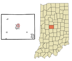 Location of Ulen in the state of Indiana | |
| Coordinates: 40°3′51″N 86°27′48″W / 40.06417°N 86.46333°WCoordinates: 40°3′51″N 86°27′48″W / 40.06417°N 86.46333°W | |
| Country | United States |
| State | Indiana |
| County | Boone |
| Township | Center |
| Area[1] | |
| • Total | 0.06 sq mi (0.16 km2) |
| • Land | 0.06 sq mi (0.16 km2) |
| • Water | 0 sq mi (0 km2) |
| Elevation | 942 ft (287 m) |
| Population (2010)[2] | |
| • Total | 117 |
| • Estimate (2012[3]) | 124 |
| • Density | 1,950.0/sq mi (752.9/km2) |
| Time zone | Eastern (EST) (UTC-5) |
| • Summer (DST) | EDT (UTC-4) |
| FIPS code | 18-77066[4] |
| GNIS feature ID | 0445034[5] |
Ulen is a town in Center Township, Boone County, Indiana, United States. The population was 117 at the 2010 census.
History
Ulen was incorporated as a town in 1929.[6] It was named for Henry Ulen, an industrialist.[7] The Ulen Historic District was listed on the National Register of Historic Places in 2015.[8]
Geography
Ulen is located at 40°3′51″N 86°27′48″W / 40.06417°N 86.46333°W (40.064213, -86.463431).[9]
According to the 2010 census, Ulen has a total area of 0.06 square miles (0.16 km2), all land.[1]
Demographics
| Historical population | |||
|---|---|---|---|
| Census | Pop. | %± | |
| 1930 | 74 | — | |
| 1940 | 99 | 33.8% | |
| 1950 | 83 | −16.2% | |
| 1960 | 130 | 56.6% | |
| 1970 | 138 | 6.2% | |
| 1980 | 193 | 39.9% | |
| 1990 | 50 | −74.1% | |
| 2000 | 123 | 146.0% | |
| 2010 | 117 | −4.9% | |
| Est. 2015 | 124 | [10] | 6.0% |
2010 census
As of the census[2] of 2010, there were 117 people, 49 households, and 40 families residing in the town. The population density was 1,950.0 inhabitants per square mile (752.9/km2). There were 54 housing units at an average density of 900.0 per square mile (347.5/km2). The racial makeup of the town was 100.0% White. Hispanic or Latino of any race were 0.9% of the population.
There were 49 households of which 24.5% had children under the age of 18 living with them, 75.5% were married couples living together, 6.1% had a female householder with no husband present, and 18.4% were non-families. 18.4% of all households were made up of individuals and 10.2% had someone living alone who was 65 years of age or older. The average household size was 2.39 and the average family size was 2.70.
The median age in the town was 51.8 years. 19.7% of residents were under the age of 18; 4.3% were between the ages of 18 and 24; 11.2% were from 25 to 44; 38.5% were from 45 to 64; and 26.5% were 65 years of age or older. The gender makeup of the town was 51.3% male and 48.7% female.
2000 census
As of the census[4] of 2000, there were 123 people, 48 households, and 39 families residing in the town. The population density was 1,946.9 people per square mile (791.5/km²). There were 53 housing units at an average density of 838.9 per square mile (341.1/km²). The racial makeup of the town was 100.00% White.
There were 48 households out of which 25.0% had children under the age of 18 living with them, 79.2% were married couples living together, 2.1% had a female householder with no husband present, and 16.7% were non-families. 14.6% of all households were made up of individuals and 6.3% had someone living alone who was 65 years of age or older. The average household size was 2.56 and the average family size was 2.85.
In the town the population was spread out with 22.8% under the age of 18, 5.7% from 18 to 24, 13.8% from 25 to 44, 31.7% from 45 to 64, and 26.0% who were 65 years of age or older. The median age was 50 years. For every 100 females there were 92.2 males. For every 100 females age 18 and over, there were 90.0 males.
The median income for a household in the town was $57,083, and the median income for a family was $56,667. Males had a median income of $0 versus $51,250 for females. The per capita income for the town was $41,557. None of the population and none of the families were below the poverty line.
References
- 1 2 "G001 - Geographic Identifiers - 2010 Census Summary File 1". United States Census Bureau. Retrieved 2015-07-25.
- 1 2 "American FactFinder". United States Census Bureau. Retrieved 2012-12-11.
- ↑ "Population Estimates". United States Census Bureau. Retrieved 2013-06-25.
- 1 2 "American FactFinder". United States Census Bureau. Retrieved 2008-01-31.
- ↑ "US Board on Geographic Names". United States Geological Survey. 2007-10-25. Retrieved 2008-01-31.
- ↑ Baker, Ronald L. (October 1995). From Needmore to Prosperity: Hoosier Place Names in Folklore and History. Indiana University Press. p. 329. ISBN 978-0-253-32866-3.
This community, incorporated in 1929...
- ↑ Bodenhamer, David J.; Barrows, Robert G. (22 November 1994). The Encyclopedia of Indianapolis. Indiana University Press. p. 340. ISBN 0-253-11249-4.
- ↑ "National Register of Historic Places Listings". Weekly List of Actions Taken on Properties: 9/14/15 through 9/18/15. National Park Service. 2015-09-25.
- ↑ "US Gazetteer files: 2010, 2000, and 1990". United States Census Bureau. 2011-02-12. Retrieved 2011-04-23.
- ↑ "Annual Estimates of the Resident Population for Incorporated Places: April 1, 2010 to July 1, 2015". Retrieved July 2, 2016.
- ↑ "Census of Population and Housing". Census.gov. Retrieved June 4, 2015.
Municipalities and communities of Boone County, Indiana, United States | ||
|---|---|---|
| City | ||
| Towns | ||
| Townships | ||
| Unincorporated communities |
| |
| Footnotes | ‡This populated place also has portions in an adjacent county or counties | |