Sugar Creek Township, Boone County, Indiana
| Sugar Creek Township | |
|---|---|
| Township | |
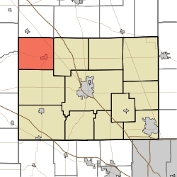 Location of Sugar Creek Township in Boone County | |
| Coordinates: 40°08′09″N 86°38′22″W / 40.13583°N 86.63944°WCoordinates: 40°08′09″N 86°38′22″W / 40.13583°N 86.63944°W | |
| Country | United States |
| State | Indiana |
| County | Boone |
| Government | |
| • Type | Indiana township |
| Area | |
| • Total | 33.59 sq mi (87.0 km2) |
| • Land | 33.57 sq mi (86.9 km2) |
| • Water | 0.03 sq mi (0.08 km2) |
| Elevation[1] | 814 ft (248 m) |
| Population (2010) | |
| • Total | 2,243 |
| • Density | 66.8/sq mi (25.8/km2) |
| FIPS code | 18-73844[2] |
| GNIS feature ID | 453880 |
Sugar Creek Township is one of twelve townships in Boone County, Indiana. As of the 2010 census, its population was 2,243 and it contained 919 housing units.[3]
Geography
According to the 2010 census, the township has a total area of 33.59 square miles (87.0 km2), of which 33.57 square miles (86.9 km2) (or 99.94%) is land and 0.03 square miles (0.078 km2) (or 0.09%) is water.[3] The township is named for the Sugar Creek.
Cities and towns
Adjacent townships
- Jefferson (south)
- Washington (east)
- Franklin Township, Montgomery County (southwest)
- Jackson Township, Clinton County (northeast)
- Perry Township, Clinton County (north)
Major highways
Cemeteries
The township contains seven cemeteries: Gipson, Sugar Plain, Old Cemetery, Walnut Grove, Green, Curry and Maple Lawn.
References
- ↑ "US Board on Geographic Names". United States Geological Survey. 2007-10-25. Retrieved 2008-01-31.
- ↑ "American FactFinder". United States Census Bureau. Retrieved 2008-01-31.
- 1 2 "Population, Housing Units, Area, and Density: 2010 - County -- County Subdivision and Place -- 2010 Census Summary File 1". United States Census. Retrieved 2013-05-10.
External links
Municipalities and communities of Boone County, Indiana, United States | ||
|---|---|---|
| City | ||
| Towns | ||
| Townships | ||
| Unincorporated communities |
| |
| Footnotes | ‡This populated place also has portions in an adjacent county or counties | |
This article is issued from Wikipedia - version of the 7/31/2014. The text is available under the Creative Commons Attribution/Share Alike but additional terms may apply for the media files.