Union Township, Boone County, Indiana
| Union Township | |
|---|---|
| Township | |
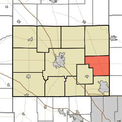 Location of Union Township in Boone County | |
| Coordinates: 40°01′56″N 86°17′31″W / 40.03222°N 86.29194°WCoordinates: 40°01′56″N 86°17′31″W / 40.03222°N 86.29194°W | |
| Country | United States |
| State | Indiana |
| County | Boone |
| Government | |
| • Type | Indiana township |
| Area | |
| • Total | 25.15 sq mi (65.1 km2) |
| • Land | 25.11 sq mi (65.0 km2) |
| • Water | 0.04 sq mi (0.1 km2) |
| Elevation[1] | 928 ft (283 m) |
| Population (2010) | |
| • Total | 2,357 |
| • Density | 93.9/sq mi (36.3/km2) |
| FIPS code | 18-77156[2] |
| GNIS feature ID | 453908 |
Union Township is one of twelve townships in Boone County, Indiana. As of the 2010 census, its population was 2,357 and it contained 864 housing units.[3]
History
The Simpson-Breedlove House was listed on the National Register of Historic Places in 2016.[4]
Geography
According to the 2010 census, the township has a total area of 25.15 square miles (65.1 km2), of which 25.11 square miles (65.0 km2) (or 99.84%) is land and 0.04 square miles (0.10 km2) (or 0.16%) is water.[3]
Unincorporated towns
Adjacent townships
- Center (west)
- Eagle (south)
- Marion (north)
- Worth (southwest)
- Clay Township, Hamilton County (southeast)
- Washington Township, Hamilton County (east)
Major highways
References
- ↑ "US Board on Geographic Names". United States Geological Survey. 2007-10-25. Retrieved 2008-01-31.
- ↑ "American FactFinder". United States Census Bureau. Archived from the original on September 11, 2013. Retrieved 2008-01-31.
- 1 2 "Population, Housing Units, Area, and Density: 2010 - County -- County Subdivision and Place -- 2010 Census Summary File 1". United States Census. Retrieved 2013-05-10.
- ↑ "National Register of Historic Places Listings". Weekly List of Actions Taken on Properties: 3/14/16 through 3/18/16. National Park Service. 2016-03-25.
External links
Municipalities and communities of Boone County, Indiana, United States | ||
|---|---|---|
| City | ||
| Towns | ||
| Townships | ||
| Unincorporated communities |
| |
| Footnotes | ‡This populated place also has portions in an adjacent county or counties | |
This article is issued from Wikipedia - version of the 9/10/2016. The text is available under the Creative Commons Attribution/Share Alike but additional terms may apply for the media files.