Orestes, Indiana
| Orestes, Indiana | |
|---|---|
| Town | |
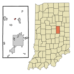 Location of Orestes in the state of Indiana | |
| Coordinates: 40°16′18″N 85°43′27″W / 40.27167°N 85.72417°WCoordinates: 40°16′18″N 85°43′27″W / 40.27167°N 85.72417°W | |
| Country | United States |
| State | Indiana |
| County | Madison |
| Township | Monroe |
| Area[1] | |
| • Total | 0.62 sq mi (1.61 km2) |
| • Land | 0.62 sq mi (1.61 km2) |
| • Water | 0 sq mi (0 km2) |
| Elevation | 873 ft (266 m) |
| Population (2010)[2] | |
| • Total | 414 |
| • Estimate (2012[3]) | 411 |
| • Density | 667.7/sq mi (257.8/km2) |
| Time zone | Eastern (EST) (UTC-5) |
| • Summer (DST) | EDT (UTC-4) |
| ZIP code | 46063 |
| Area code(s) | 765 |
| FIPS code | 18-56952[4] |
| GNIS feature ID | 0440695[5] |
Orestes is a town in Monroe Township, Madison County, Indiana, United States. It is part of the Anderson, Indiana Metropolitan Statistical Area. The population was 414 at the 2010 census.
History
Orestes was founded in 1876 when the railroad was extended to that point.[6] It may be named after Orestes in Greek mythology.[7] Orestes was incorporated as a town in 1894.[8]
Geography
Orestes is located at 40°16′18″N 85°43′27″W / 40.271710°N 85.724037°W.[9]
According to the 2010 census, Orestes has a total area of 0.62 square miles (1.61 km2), all land.[1]
Demographics
| Historical population | |||
|---|---|---|---|
| Census | Pop. | %± | |
| 1900 | 778 | — | |
| 1910 | 420 | −46.0% | |
| 1920 | 395 | −6.0% | |
| 1930 | 357 | −9.6% | |
| 1940 | 412 | 15.4% | |
| 1950 | 482 | 17.0% | |
| 1960 | 507 | 5.2% | |
| 1970 | 519 | 2.4% | |
| 1980 | 539 | 3.9% | |
| 1990 | 458 | −15.0% | |
| 2000 | 334 | −27.1% | |
| 2010 | 414 | 24.0% | |
| Est. 2015 | 411 | [10] | −0.7% |
2010 census
As of the census[2] of 2010, there were 414 people, 148 households, and 114 families residing in the town. The population density was 667.7 inhabitants per square mile (257.8/km2). There were 177 housing units at an average density of 285.5 per square mile (110.2/km2). The racial makeup of the town was 95.7% White, 0.2% African American, 0.5% Native American, 2.9% from other races, and 0.7% from two or more races. Hispanic or Latino of any race were 4.8% of the population.
There were 148 households of which 38.5% had children under the age of 18 living with them, 60.1% were married couples living together, 12.2% had a female householder with no husband present, 4.7% had a male householder with no wife present, and 23.0% were non-families. 18.9% of all households were made up of individuals and 10.8% had someone living alone who was 65 years of age or older. The average household size was 2.80 and the average family size was 3.11.
The median age in the town was 35.8 years. 24.6% of residents were under the age of 18; 11.8% were between the ages of 18 and 24; 24.6% were from 25 to 44; 25.6% were from 45 to 64; and 13.3% were 65 years of age or older. The gender makeup of the town was 51.4% male and 48.6% female.
2000 census
As of the census[4] of 2000, there were 334 people, 129 households, and 94 families residing in the town. The population density was 848.5 people per square mile (330.7/km²). There were 147 housing units at an average density of 373.5 per square mile (145.5/km²). The racial makeup of the town was 97.31% White, 0.30% African American, 0.30% Asian, 1.50% from other races, and 0.60% from two or more races. Hispanic or Latino of any race were 3.29% of the population.
There were 129 households out of which 31.8% had children under the age of 18 living with them, 54.3% were married couples living together, 7.0% had a female householder with no husband present, and 27.1% were non-families. 22.5% of all households were made up of individuals and 11.6% had someone living alone who was 65 years of age or older. The average household size was 2.59 and the average family size was 2.91.
In the town the population was spread out with 25.1% under the age of 18, 11.7% from 18 to 24, 29.9% from 25 to 44, 19.8% from 45 to 64, and 13.5% who were 65 years of age or older. The median age was 34 years. For every 100 females there were 111.4 males. For every 100 females age 18 and over, there were 103.3 males.
The median income for a household in the town was $39,219, and the median income for a family was $39,602. Males had a median income of $30,750 versus $21,250 for females. The per capita income for the town was $18,037. None of the families and 3.8% of the population were living below the poverty line, including no under eighteens and 11.8% of those over 64.
Business
References
- 1 2 "G001 - Geographic Identifiers - 2010 Census Summary File 1". United States Census Bureau. Retrieved 2015-07-17.
- 1 2 "American FactFinder". United States Census Bureau. Retrieved 2012-12-11.
- ↑ "Population Estimates". United States Census Bureau. Archived from the original on June 17, 2013. Retrieved 2013-06-25.
- 1 2 "American FactFinder". United States Census Bureau. Retrieved 2008-01-31.
- ↑ "US Board on Geographic Names". United States Geological Survey. 2007-10-25. Retrieved 2008-01-31.
- ↑ Forkner, John La Rue (1914). History of Madison County, Indiana: A Narrative Account of Its Historical Progress, Its People and Its Principal Interests, Volume 1. Lewis Publishing Company. p. 132.
- ↑ Baker, Ronald L. (October 1995). From Needmore to Prosperity: Hoosier Place Names in Folklore and History. Indiana University Press. p. 252. ISBN 978-0-253-32866-3.
...Orestes, son of Agamemnon...
- ↑ Forkner, John La Rue & Dyson, Byron H. (1897). Historical Sketches and Reminiscences of Madison County, Indiana. Wilson, Humprheys & Co. p. 844.
- ↑ "US Gazetteer files: 2010, 2000, and 1990". United States Census Bureau. 2011-02-12. Retrieved 2011-04-23.
- ↑ "Annual Estimates of the Resident Population for Incorporated Places: April 1, 2010 to July 1, 2015". Retrieved July 2, 2016.
- ↑ "Census of Population and Housing". Census.gov. Archived from the original on May 11, 2015. Retrieved June 4, 2015.
Municipalities and communities of Madison County, Indiana, United States | ||
|---|---|---|
| Cities | ||
| Towns | ||
| Townships | ||
| Unincorporated communities |
| |
| Footnotes | ‡This populated place also has portions in an adjacent county or counties | |