Soldier Creek Dam
| Soldier Creek Dam | |
|---|---|
 | |
| Location | Wasatch County, Utah, United States |
| Coordinates | 40°08′12″N 111°01′38″W / 40.13667°N 111.02722°WCoordinates: 40°08′12″N 111°01′38″W / 40.13667°N 111.02722°W |
| Construction began | 1970 |
| Opening date | 1974 |
| Owner(s) | U.S. Bureau of Reclamation |
| Dam and spillways | |
| Type of dam | Earthfill |
| Impounds | Strawberry River |
| Height | 272 ft (83 m)[1] |
| Length | 1,290 ft (390 m)[1] |
| Elevation at crest | 7,612 ft (2,320 m)[1] |
| Reservoir | |
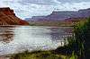
| Creates | Strawberry Reservoir |
| Total capacity | 1,127,610 acre·ft (1.39089 km3)[2] |
| Catchment area | 170 sq mi (440 km2)[2] |
| Surface area | 17,300 acres (7,000 ha)[2] |
Soldier Creek Dam is an earthen dam on the Strawberry River, located in Wasatch County, Utah in the United States. The dam forms Strawberry Reservoir, and is a principal feature of the Strawberry Valley Project, part of the Bonneville Unit of the Central Utah Project. The dam and reservoir were built and operated by the U.S. Bureau of Reclamation (USBR).[3]
Constructed between 1970 and 1974, the dam replaced the earlier Strawberry Dam, built slightly upstream of the current site from 1911–1913. The new dam increased the storage capacity of Strawberry Reservoir from 283,000 acre feet (0.349 km3) to more than 1,120,000 acre feet (1.38 km3).[4] The primary purpose of the dam is to store flows from the upper Strawberry River, as well as water diverted from eight tributaries of the Duchesne River, for diversion through the Strawberry Tunnel to supplement water supplies in the Utah Valley. Water from the Strawberry Tunnel eventually outlets into Six Water Canyon, the Diamond Fork River and finally the Spanish Fork River before flowing into Utah Lake.[3][5]
Soldier Creek Dam is a zoned earthfill embankment 272 feet (83 m) high and 1,290 feet (390 m) long, with a structural volume of 3,206,000 cubic yards (2,451,000 m3).[1] Water releases from the dam are controlled by outlet works with a bypass capacity of 2,830 cu ft/s (80 m3/s). The dam controls runoff from a drainage area of 170 square miles (440 km2).[6]
References
- 1 2 3 4 "Soldier Creek Dam Dimensions". Central Utah Project–Bonneville Unit. U.S. Bureau of Reclamation. 2009-04-08. Retrieved 2012-08-17.
- 1 2 3 "Soldier Creek Dam". National Performance of Dams Program. Stanford University. Retrieved 2012-08-17.
- 1 2 "Central Utah Project - Bonneville Unit". Central Utah Project. U.S. Bureau of Reclamation. 2009-05-27. Retrieved 2012-08-17.
- ↑ Eastman, Adam R. "Central Utah Project Bonneville Unit" (PDF). Historic Reclamation Projects Book. U.S. Bureau of Reclamation. Retrieved 2012-08-17.
- ↑ Stene, Eric A. "The Strawberry Valley Project". Spanish Fork River Drainage. Retrieved 2012-08-17.
- ↑ "Soldier Creek Dam Hydraulics & Hydrology". Central Utah Project–Bonneville Unit. U.S. Bureau of Reclamation. 2009-04-08. Retrieved 2012-08-17.
Colorado River system | |||||||||||||||
|---|---|---|---|---|---|---|---|---|---|---|---|---|---|---|---|
| Jurisdictions |
|     | |||||||||||||
| Canyons |
| ||||||||||||||
| Natural features |
| ||||||||||||||
| Tributaries | |||||||||||||||
| Engineering |
| ||||||||||||||
| Designated areas | |||||||||||||||
| Related topics | |||||||||||||||