Wasatch County, Utah
| Wasatch County, Utah | ||
|---|---|---|
| ||
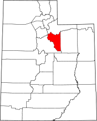 Location in the U.S. state of Utah | ||
 Utah's location in the U.S. | ||
| Founded | 1862 | |
| Named for | Native American word for mountain pass | |
| Seat | Heber City | |
| Largest city | Heber City | |
| Area | ||
| • Total | 1,206 sq mi (3,124 km2) | |
| • Land | 1,176 sq mi (3,046 km2) | |
| • Water | 30 sq mi (78 km2), 2.5% | |
| Population | ||
| • (2010) | 23,530 | |
| • Density | 20/sq mi (8/km²) | |
| Congressional district | 3rd | |
| Time zone | Mountain: UTC-7/-6 | |
| Website |
www | |

Wasatch County /ˈwɑːsætʃ/ is a county located in the U.S. state of Utah. As of the 2010 census, the population was 23,530.[1] Its county seat and largest city is Heber City.[2] The county was named for a Ute Indian word meaning mountain pass or low place in the high mountains.
Wasatch County is part of the Heber, UT Micropolitan Statistical Area as well as the Salt Lake City-Provo-Orem, UT Combined Statistical Area.
The county is governed by a seven-member county council with an appointed county manager.[3] As of 2016 County Council members are Danny Goode, Kendall Crittenden, Mike Kohler, Steve Farrell, Kipp Bangerter, Mike Petersen, and Greg McPhie.[4] Mike Davis serves as the appointed County Manager.
Geography
According to the U.S. Census Bureau, the county has a total area of 1,206 square miles (3,120 km2), of which 1,176 square miles (3,050 km2) is land and 30 square miles (78 km2) (2.5%) is water.[5]
Adjacent counties
- Salt Lake County (northwest)
- Summit County (north)
- Utah County (west)
- Duchesne County (east)
National protected areas
- Ashley National Forest (part)
- Uinta National Forest (part)
- Wasatch National Forest (part)
Demographics
| Historical population | |||
|---|---|---|---|
| Census | Pop. | %± | |
| 1870 | 1,244 | — | |
| 1880 | 2,927 | 135.3% | |
| 1890 | 3,595 | 22.8% | |
| 1900 | 4,786 | 33.1% | |
| 1910 | 8,920 | 86.4% | |
| 1920 | 4,625 | −48.2% | |
| 1930 | 5,636 | 21.9% | |
| 1940 | 5,754 | 2.1% | |
| 1950 | 5,574 | −3.1% | |
| 1960 | 5,308 | −4.8% | |
| 1970 | 5,863 | 10.5% | |
| 1980 | 8,523 | 45.4% | |
| 1990 | 10,089 | 18.4% | |
| 2000 | 15,215 | 50.8% | |
| 2010 | 23,530 | 54.7% | |
| Est. 2015 | 29,161 | [6] | 23.9% |
| U.S. Decennial Census[7] 1790–1960[8] 1900–1990[9] 1990–2000[10] 2010–2014[1] | |||
As of the census[11] of 2010, there were 23,530 people, 4,743 households, and 3,870 families residing in the county. The population density was 20 inhabitants per square mile (7.7/km2). There were 9,840 (2009) housing units at an average density of 8.4 per square mile (3.2/km2). The racial makeup of the county was 90.4% White, 0.3% Black or African American, 0.5% Native American, 0.8% Asian, 0.1% Pacific Islander, and 1.4% from two or more races. 13.5% of the population were Hispanic or Latino of any race.
There were 7,287 households out of which 43.1% had children under the age of 18 living with them, 68.70% were married couples living together, 7.4% had a female householder with no husband present, 3.8% had a male householder with no wife present, and 20.1% were non-families. 15.5% of all households were made up of individuals and 4.8% had someone living alone who was 65 years of age or older. The average household size was 3.18 and the average family size was 3.19.
In the county, the population was spread out with 36.3% under the age of 20, 5.2% from 20 to 24, 28.1% from 25 to 44, 21.9% from 45 to 64, and 8.6% who were 65 years of age or older. The median age was 31.6 years. For every 100 females there were 103.40 males. For every 100 females age 18 and over, there were 101.5 males.
As of the census[12] of 2000, the median income for a household in the county was $49,612, and the median income for a family was $52,102. Males had a median income of $37,399 versus $23,571 for females. The per capita income for the county was $19,869. About 4.20% of families and 5.20% of the population were below the poverty line, including 5.60% of those under age 18 and 4.00% of those age 65 or over.
Communities
- Charleston
- Daniel
- Heber City (county seat)
- Hideout
- Independence
- Midway
- Timber Lakes
- Wallsburg
See also
References
- 1 2 "State & County QuickFacts". United States Census Bureau. Retrieved December 30, 2013.
- ↑ "Find a County". National Association of Counties. Retrieved 2011-06-07.
- ↑ "Wasatch County Administrative Services". Retrieved 2011-10-17.
- ↑ "Wasatch County Government - County Council". www.wasatch.utah.gov. Retrieved 2016-05-23.
- ↑ "2010 Census Gazetteer Files". United States Census Bureau. August 22, 2012. Retrieved June 26, 2015.
- ↑ "County Totals Dataset: Population, Population Change and Estimated Components of Population Change: April 1, 2010 to July 1, 2015". Retrieved July 2, 2016.
- ↑ "U.S. Decennial Census". United States Census Bureau. Retrieved June 26, 2015.
- ↑ "Historical Census Browser". University of Virginia Library. Retrieved June 26, 2015.
- ↑ Forstall, Richard L., ed. (March 27, 1995). "Population of Counties by Decennial Census: 1900 to 1990". United States Census Bureau. Retrieved June 26, 2015.
- ↑ "Census 2000 PHC-T-4. Ranking Tables for Counties: 1990 and 2000" (PDF). United States Census Bureau. April 2, 2001. Retrieved June 26, 2015.
- ↑ "American FactFinder". United States Census Bureau. Retrieved 2011-05-14.
- ↑ "American FactFinder". United States Census Bureau. Retrieved 2008-01-31.
External links
 |
Salt Lake County | Summit County | | |
| |
Duchesne County | |||
| ||||
| | ||||
| Utah County |
Municipalities and communities of Wasatch County, Utah, United States | ||
|---|---|---|
| Cities | | |
| Towns | ||
| CDP | ||
| Indian reservation | ||
| Ghost towns | ||
| Footnotes | ‡This populated place also has portions in an adjacent county or counties | |
Coordinates: 40°20′N 111°10′W / 40.33°N 111.16°W