Pomeroy, Pennsylvania
| Pomeroy, Pennsylvania | |
|---|---|
| Census-designated place | |
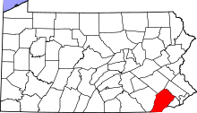
 Location in Chester County and the state of Pennsylvania. | |
| Coordinates: 39°57′51″N 75°53′11″W / 39.96417°N 75.88639°WCoordinates: 39°57′51″N 75°53′11″W / 39.96417°N 75.88639°W | |
| Country | United States |
| State | Pennsylvania |
| County | Chester |
| Township | Sadsbury |
| Area | |
| • Total | 0.33 sq mi (0.86 km2) |
| • Land | 0.33 sq mi (0.85 km2) |
| • Water | 0.004 sq mi (0.01 km2) |
| Elevation | 484 ft (148 m) |
| Population (2010) | |
| • Total | 401 |
| • Density | 1,200/sq mi (470/km2) |
| Time zone | Eastern (EST) (UTC-5) |
| • Summer (DST) | EDT (UTC-4) |
| ZIP code | 19367 |
| Area code(s) | 610 and 484 |
| FIPS code | 42-61968 |
Pomeroy | |||||||||||
|---|---|---|---|---|---|---|---|---|---|---|---|
| Former Pennsylvania Railroad station | |||||||||||
| Services | |||||||||||
|
None
| |||||||||||
Pomeroy is a census-designated place (CDP) in Sadsbury Township, Chester County, Pennsylvania, United States. The population was 401 at the 2010 census.[1]
It was once the northern terminus of the Pomeroy and Newark Railroad.
Geography
Pomeroy is located at 39°57′51″N 75°53′11″W / 39.96417°N 75.88639°W[2] in the southeast corner of Sadsbury Township. Pennsylvania Route 372 passes through the center of the village, connecting Coatesville 3 miles (5 km) to the east with Parkesburg 1 mile (1.6 km) to the west.
According to the United States Census Bureau, the CDP has a total area of 0.33 square miles (0.86 km2), of which 0.33 square miles (0.85 km2) is land and 0.004 square miles (0.01 km2), or 0.88%, is water.[3]
References
- ↑ "Profile of General Population and Housing Characteristics: 2010 Demographic Profile Data (DP-1): Sadsbury CDP, Pennsylvania". U.S. Census Bureau, American Factfinder. Retrieved August 21, 2012.
- ↑ US Geological Survey 7.5 minute topographic map series
- ↑ "Geographic Identifiers: 2010 Demographic Profile Data (G001): Pomeroy CDP, Pennsylvania". U.S. Census Bureau, American Factfinder. Retrieved August 21, 2012.
This article is issued from Wikipedia - version of the 7/11/2016. The text is available under the Creative Commons Attribution/Share Alike but additional terms may apply for the media files.