Milford Mills, Pennsylvania
| Milford Mills, Pennsylvania | |
| Village | |
 A portion of Milford Road abandoned following the construction of the Marsh Creek dam. | |
| Country | United States |
|---|---|
| State | Pennsylvania |
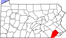
| County | Chester |
| Elevation | 272 ft (82.9 m) |
| Coordinates | 40°03′54″N 75°43′42″W / 40.06500°N 75.72833°WCoordinates: 40°03′54″N 75°43′42″W / 40.06500°N 75.72833°W |
| Population | 0 |
| Timezone | EST (UTC-5) |
| - summer (DST) | EDT (UTC-4) |
| ZIP code | 19335 |
| Area code | 610, 484 |
 Location of Milford Mills in Pennsylvania | |
 Location of Pennsylvania in the United States | |
Milford Mills was a village in the Marsh Creek Valley of Chester County, Pennsylvania that was inundated by the construction of the Marsh Creek Dam in 1972.
Milford Mills was one of several farming villages settled by Welsh, Scots-Irish and English in the first quarter of the 18th century in Upper Uwchlan Township. Like nearby Lyndell and Dorlan, Milford Mills grew during the 19th century as paper and textile manufacturing flourished. Bypassed by large-scale industry in the late 19th century, the region reverted to an agricultural economy until after World War II when the Pennsylvania Turnpike brought suburban development to northwestern Chester County.
From 1964-1972 the State of Pennsylvania acquired properties throughout the region for the Marsh Creek Dam project, relocating residents and finally razing the village entirely. Today the site lies beneath the 530-acre (2.1 km2) Marsh Creek Lake: part of a water management project operated by the Chester County Water Resources Authority and the State of Pennsylvania.
Abandoned roads and traces of houses, barns and other structures can be seen on the shores of the lake and in adjacent recreation areas in Marsh Creek State Park.
Gallery
 The Larkin Covered Bridge was once located in Milford Mills.
 Milford Mills is currently under Marsh Creek Lake.
 Marsh Creek Lake where Marsh Creek Valley and Milford Mills once stood
 Montrose School House on Covered Bridge Road, now under the water of Marsh Creek Lake
 Larkin's Covered Bridge at its original location on Covered Bridge Road
 Map of Milford Mills from an 1883 Atlas
References
- Quillman, Catherine C. The story of Milford Mills and the Marsh Creek Valley, Devon, PA: privately printed, 1989