East Marlborough Township, Chester County, Pennsylvania
| East Marlborough Township | |
| Township | |
 Unionville Historic District | |
| Country | United States |
|---|---|
| State | Pennsylvania |
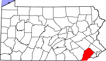
| County | Chester |
| Elevation | 358 ft (109.1 m) |
| Coordinates | 39°52′20″N 75°43′45″W / 39.87222°N 75.72917°WCoordinates: 39°52′20″N 75°43′45″W / 39.87222°N 75.72917°W |
| Area | 15.6 sq mi (40.4 km2) |
| - land | 15.6 sq mi (40 km2) |
| - water | 0.0 sq mi (0 km2), 0% |
| Population | 7,026 (2010) |
| Density | 450.4/sq mi (173.9/km2) |
| Timezone | EST (UTC-5) |
| - summer (DST) | EDT (UTC-4) |
| Area code | 610 |
 Location in Chester County and the state of Pennsylvania. | |
.svg.png) Location of Pennsylvania in the United Statess | |
| Website: http://www.eastmarlborough.org | |
East Marlborough Township is a township in Chester County, Pennsylvania, United States. The population was 7,026 at the 2010 census. East Marlborough and West Marlborough townships were carved out of the larger Marlborough Township in 1729. The township is home to a large number of Penn Oak trees, trees that were in existence when William Penn explored the area.
The well-known Longwood Gardens is located in East Marlborough Township.
History
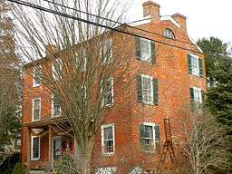
Cedarcroft, Green Valley Historic District, Longwood Gardens District, Marlborough Village Historic District, South Brook Farm, Unionville Village Historic District, and the Gideon Wickersham Farmstead are listed on the National Register of Historic Places.[1]
Geography
According to the United States Census Bureau, the township has a total area of 15.6 square miles (40 km2), all of it land.
Adjacent townships
- Newlin Township (north)
- Pocopson Township (northeast)
- Pennsbury Township (east)
- Kennett Township (south)
- New Garden Township (southwest)
- West Marlborough Township (west)
Demographics
At the 2010 census, the township was 89.2% non-Hispanic White, 1.4% Black or African American, 0.2% Native American, 3.6% Asian, 0.1% Native Hawaiian or other Pacific Islander, and 1.3% were two or more races. 4.6% of the population were of Hispanic or Latino ancestry .
As of the census[2] of 2000, there were 6,317 people, 2,131 households, and 1,734 families residing in the township. The population density was 404.5 people per square mile (156.1/km²). There were 2,188 housing units at an average density of 140.1/sq mi (54.1/km²). The racial makeup of the township was 94.40% White, 1.20% African American, 0.09% Native American, 2.33% Asian, 0.06% Pacific Islander, 0.79% from other races, and 1.12% from two or more races. Hispanic or Latino of any race were 3.96% of the population.
There were 2,131 households, out of which 43.8% had children under the age of 18 living with them, 73.9% were married couples living together, 5.6% had a female householder with no husband present, and 18.6% were non-families. 15.0% of all households were made up of individuals, and 3.8% had someone living alone who was 65 years of age or older. The average household size was 2.92 and the average family size was 3.28.
In the township the population was spread out, with 30.9% under the age of 18, 5.5% from 18 to 24, 27.4% from 25 to 44, 28.7% from 45 to 64, and 7.6% who were 65 years of age or older. The median age was 38 years. For every 100 females there were 100.5 males. For every 100 females age 18 and over, there were 97.6 males.
| Historical population | |||
|---|---|---|---|
| Census | Pop. | %± | |
| 1930 | 1,599 | — | |
| 1940 | 1,600 | 0.1% | |
| 1950 | 1,868 | 16.8% | |
| 1960 | 2,417 | 29.4% | |
| 1970 | 3,031 | 25.4% | |
| 1980 | 3,953 | 30.4% | |
| 1990 | 4,781 | 20.9% | |
| 2000 | 6,317 | 32.1% | |
| 2010 | 7,026 | 11.2% | |
| http://www.dvrpc.org/data/databull/rdb/db82/appedixa.xls. | |||
The median income for a household in the township was $95,812, and the median income for a family was $104,590. Males had a median income of $76,760 versus $42,260 for females. The per capita income for the township was $38,090. About 1.7% of families and 2.4% of the population were below the poverty line, including 3.7% of those under age 18 and 1.7% of those age 65 or over.
Education
East Marlborough Township is located partly in the Unionville-Chadds Ford School District and partly in the Kennett Consolidated School District.
References
- ↑ National Park Service (2010-07-09). "National Register Information System". National Register of Historic Places. National Park Service.
- ↑ "American FactFinder". United States Census Bureau. Retrieved 2008-01-31.