East Vincent Township, Chester County, Pennsylvania
| East Vincent Township | |
| Township | |
 | |
| Country | United States |
|---|---|
| State | Pennsylvania |
| County | Chester |
| Elevation | 390 ft (118.9 m) |
| Coordinates | 40°10′26″N 75°37′59″W / 40.17389°N 75.63306°WCoordinates: 40°10′26″N 75°37′59″W / 40.17389°N 75.63306°W |
| Area | 13.7 sq mi (35.5 km2) |
| - land | 13.5 sq mi (35 km2) |
| - water | 0.2 sq mi (1 km2), 1.46% |
| Population | 6,821 (2010) |
| Density | 497.9/sq mi (192.2/km2) |
| Timezone | EST (UTC-5) |
| - summer (DST) | EDT (UTC-4) |
| Area code | 610 |
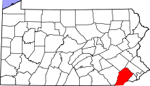
 Location in Chester County and the state of Pennsylvania. | |
.svg.png) Location of Pennsylvania in the United States | |
| Website: http://www.eastvincent.org | |
East Vincent Township is a township in Chester County, Pennsylvania, United States. The population was 6,821 at the 2010 census.[1]
Geography
According to the United States Census Bureau, the township has a total area of 13.7 square miles (35 km2), of which, 13.5 square miles (35 km2) of it is land and 0.2 square miles (0.52 km2) of it (1.10%) is water. The township is partially located in the Hopewell Big Woods.
History
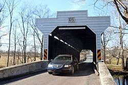
The Kennedy Bridge, Parker's Ford, and Vincent Forge Mansion are listed on the National Register of Historic Places.[2]
Demographics
At the 2010 census, the township was 89.3% non-Hispanic White, 4.9% Black or African American, 0.2% Native American, 2.2% Asian, 0.1% Native Hawaiian or other Pacific Islander, and 1.5% were two or more races. 2.1% of the population were of Hispanic or Latino ancestry .
As of the census[3] of 2000, there were 5,493 people, 1,888 households, and 1,466 families residing in the township. The population density was 405.9 people per square mile (156.8/km²). There were 1,960 housing units at an average density of 144.8/sq mi (55.9/km²). The racial makeup of the township was 92.59% White, 4.72% African American, 0.09% Native American, 0.93% Asian, 0.04% Pacific Islander, 0.40% from other races, and 1.24% from two or more races. Hispanic or Latino of any race were 1.11% of the population.
There were 1,888 households, out of which 42.3% had children under the age of 18 living with them, 63.9% were married couples living together, 10.5% had a female householder with no husband present, and 22.3% were non-families. 19.3% of all households were made up of individuals, and 9.3% had someone living alone who was 65 years of age or older. The average household size was 2.75 and the average family size was 3.16.
In the township the population was spread out, with 28.8% under the age of 18, 4.9% from 18 to 24, 29.2% from 25 to 44, 22.7% from 45 to 64, and 14.5% who were 65 years of age or older. The median age was 38 years. For every 100 females there were 105.0 males. For every 100 females age 18 and over, there were 102.9 males.
| Historical population | |||
|---|---|---|---|
| Census | Pop. | %± | |
| 1930 | 2,664 | — | |
| 1940 | 3,614 | 35.7% | |
| 1950 | 4,576 | 26.6% | |
| 1960 | 5,453 | 19.2% | |
| 1970 | 5,084 | −6.8% | |
| 1980 | 4,739 | −6.8% | |
| 1990 | 4,161 | −12.2% | |
| 2000 | 5,493 | 32.0% | |
| 2010 | 6,821 | 24.2% | |
| http://www.dvrpc.org/data/databull/rdb/db82/appedixa.xls. | |||
The median income for a household in the township was $63,851, and the median income for a family was $78,038. Males had a median income of $52,625 versus $33,620 for females. The per capita income for the township was $27,799. About 7.2% of families and 6.5% of the population were below the poverty line, including 8.6% of those under age 18 and 4.9% of those age 65 or over.
See also
- Kimberton Fire Company
References
- ↑ http://factfinder2.census.gov/faces/tableservices/jsf/pages/productview.xhtml?pid=DEC_10_PL_GCTPL2.ST10&prodType=table
- ↑ National Park Service (2010-07-09). "National Register Information System". National Register of Historic Places. National Park Service.
- ↑ "American FactFinder". United States Census Bureau. Retrieved 2008-01-31.