Devault, Pennsylvania
| Devault, Pennsylvania | |
|---|---|
| Unincorporated community | |
 Devault | |
| Coordinates: 40°4′28″N 75°32′7″W / 40.07444°N 75.53528°WCoordinates: 40°4′28″N 75°32′7″W / 40.07444°N 75.53528°W | |
| Country | United States |
| State | Pennsylvania |
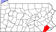
| County | Chester |
| Township | Charlestown |
| Elevation | 344 ft (105 m) |
| Time zone | Eastern (EST) (UTC-5) |
| • Summer (DST) | EDT (UTC-4) |
| Area code(s) | 610 and 484 |
| GNIS feature ID | 1173189[1] |
Devault is an unincorporated community in Charlestown Township in Chester County, Pennsylvania, United States. Devault is located at the intersection of Pennsylvania Route 29, Phoenixville Pike, and Charlestown Road.[2]
Climate
The climate in this area is characterized by hot, humid summers and generally mild to cool winters. According to the Köppen Climate Classification system, Devault has a humid subtropical climate, abbreviated "Cfa" on climate maps.[3]
| Climate data for Devault, Pennsylvania | |||||||||||||
|---|---|---|---|---|---|---|---|---|---|---|---|---|---|
| Month | Jan | Feb | Mar | Apr | May | Jun | Jul | Aug | Sep | Oct | Nov | Dec | Year |
| Average high °F (°C) | 37 (3) |
41 (5) |
50 (10) |
61 (16) |
72 (22) |
80 (27) |
85 (29) |
84 (29) |
76 (24) |
65 (18) |
52 (11) |
42 (6) |
62 (17) |
| Average low °F (°C) | 22 (−6) |
24 (−4) |
32 (0) |
41 (5) |
52 (11) |
61 (16) |
66 (19) |
65 (18) |
57 (14) |
47 (8) |
37 (3) |
28 (−2) |
44 (7) |
| Average precipitation inches (mm) | 3.8 (97) |
2.8 (71) |
3.5 (89) |
3.6 (91) |
4.5 (114) |
3.8 (97) |
4.2 (107) |
3.4 (86) |
4.3 (109) |
3.2 (81) |
3.4 (86) |
3.3 (84) |
43.7 (1,110) |
| Source: Weatherbase [4] | |||||||||||||
References
- ↑ "Devault". Geographic Names Information System. United States Geological Survey.
- ↑ Chester County, Pennsylvania Highway Map (PDF) (Map). PennDOT. 2012. Retrieved August 22, 2013.
- ↑ "Climate Summary for Devault, Pennsylvania". Weatherbase. Retrieved 16 November 2014.
- ↑ "Weatherbase.com". Weatherbase. 2013. Retrieved on October 24, 2013.
This article is issued from Wikipedia - version of the 9/19/2016. The text is available under the Creative Commons Attribution/Share Alike but additional terms may apply for the media files.