West Brandywine Township, Chester County, Pennsylvania
| West Brandywine Township | |
| Township | |
 | |
| Country | United States |
|---|---|
| State | Pennsylvania |
| County | Chester |
| Elevation | 748 ft (228.0 m) |
| Coordinates | 40°03′37″N 75°48′53″W / 40.06028°N 75.81472°WCoordinates: 40°03′37″N 75°48′53″W / 40.06028°N 75.81472°W |
| Area | 13.4 sq mi (34.7 km2) |
| - land | 13.4 sq mi (35 km2) |
| - water | 0.04 sq mi (0 km2), 0.3% |
| Population | 7,394 (2010) |
| Density | 551.8/sq mi (213.1/km2) |
| Timezone | EST (UTC-5) |
| - summer (DST) | EDT (UTC-4) |
| Area code | 610 |
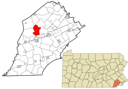 Location in Chester County and the state of Pennsylvania. | |
.svg.png) Location of Pennsylvania in the United States | |
| Website: http://www.wbrandywine.org | |
West Brandywine Township is a township in Chester County, Pennsylvania, United States. The population was 7,394 at the 2010 census.
History
The Hatfield-Hibernia Historic District was listed on the National Register of Historic Places in 1984.[1]
Geography
According to the United States Census Bureau, the township has a total area of 13.4 square miles (35 km2), of which 0.04 square miles (0.10 km2), or 0.22%, is water.
Demographics
At the 2010 census, the township was 92.0% non-Hispanic White, 3.5% Black or African American, 0.1% Native American, 0.9% Asian, and 1.0% were two or more races. 2.6% of the population were of Hispanic or Latino ancestry .
As of the census[2] of 2000, there were 7,153 people, 2,552 households, and 2,003 families residing in the township. The population density was 534.5 people per square mile (206.4/km²). There were 2,610 housing units at an average density of 195.0/sq mi (75.3/km²). The racial makeup of the township was 95.39% White, 3.27% African American, 0.14% Native American, 0.39% Asian, 0.27% from other races, and 0.55% from two or more races. Hispanic or Latino of any race were 0.70% of the population.
There were 2,552 households, out of which 38.4% had children under the age of 18 living with them, 68.8% were married couples living together, 6.0% had a female householder with no husband present, and 21.5% were non-families. 17.6% of all households were made up of individuals, and 8.7% had someone living alone who was 65 years of age or older. The average household size was 2.78 and the average family size was 3.17.
| Historical population | |||
|---|---|---|---|
| Census | Pop. | %± | |
| 1930 | 738 | — | |
| 1940 | 776 | 5.1% | |
| 1950 | 1,122 | 44.6% | |
| 1960 | 1,675 | 49.3% | |
| 1970 | 2,713 | 62.0% | |
| 1980 | 4,068 | 49.9% | |
| 1990 | 5,984 | 47.1% | |
| 2000 | 7,153 | 19.5% | |
| 2010 | 7,394 | 3.4% | |
| http://www.dvrpc.org/data/databull/rdb/db82/appedixa.xls. | |||
In the township the population was spread out, with 27.1% under the age of 18, 5.6% from 18 to 24, 30.1% from 25 to 44, 23.6% from 45 to 64, and 13.7% who were 65 years of age or older. The median age was 39 years. For every 100 females there were 97.1 males. For every 100 females age 18 and over, there were 94.2 males.
The median income for a household in the township was $62,500, and the median income for a family was $69,514. Males had a median income of $46,558 versus $31,362 for females. The per capita income for the township was $25,211. About 2.6% of families and 3.7% of the population were below the poverty line, including 4.6% of those under age 18 and 1.0% of those age 65 or over.
References
- ↑ National Park Service (2010-07-09). "National Register Information System". National Register of Historic Places. National Park Service.
- ↑ "American FactFinder". United States Census Bureau. Retrieved 2008-01-31.