Warwick Township, Chester County, Pennsylvania
| Warwick Township | |
|---|---|
| Township | |
|
| |
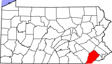
 Location in Chester County and the state of Pennsylvania. | |
| Coordinates: 40°11′16″N 75°44′56″W / 40.18778°N 75.74889°WCoordinates: 40°11′16″N 75°44′56″W / 40.18778°N 75.74889°W | |
| Country | United States |
| State | Pennsylvania |
| County | Chester |
| Area | |
| • Total | 19.2 sq mi (50 km2) |
| • Land | 19.2 sq mi (50 km2) |
| • Water | 0.0 sq mi (0 km2) |
| Elevation | 692 ft (211 m) |
| Population (2010) | |
| • Total | 2,507 |
| • Density | 130/sq mi (50/km2) |
| Time zone | EST (UTC-5) |
| • Summer (DST) | EDT (UTC-4) |
| Area code(s) | 610 |
Warwick Township is a township in Chester County, Pennsylvania, United States. The population was 2,507 at the 2010 census.
History
The Hockley Mill Farm, Hopewell Furnace National Historic Site, John Knauer House and Mill, Lahr Farm, North Warwick Historic and Archeological District, Reading Furnace Historic District, Philip Rogers House, St. Mary's Episcopal Church, St. Peters Village Historic District, Warrenpoint, Warwick Mills, and Jacob Winings House and Clover Mill are listed on the National Register of Historic Places.[1]
Geography
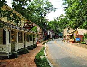
According to the United States Census Bureau, the township has a total area of 19.2 square miles (50 km2), all of it land. It is drained by the French Creek eastward into the Schuylkill River and areas near the border with Berks County are mountainous, exceeding 250 metres (825 feet) in places. Routes 23 and 345 (E-W and N-S respectively) serve the township and meet in the village of Warwick. Other unincorporated communities in the township include Knauertown, Pine Swamp, St. Peters, and Trythall. Warwick Township is located in the Hopewell Big Woods. French Creek State Park is partially located in the township and also in Berks County.
Neighboring municipalities
- North Coventry Township (northeast)
- South Coventry Township (east)
- East Nantmeal Township (south)
- West Nantmeal Township (southwest)
- Union Township, Berks County (northwest)
Demographics
At the 2010 census, the township was 96.1% non-Hispanic White, 1.2% Black or African American, 0.2% Native American, 1.0% Asian, and 1.1% were two or more races. 1.6% of the population were of Hispanic or Latino ancestry .
As of the census[2] of 2000, there were 2,556 people, 999 households, and 755 families residing in the township. The population density was 133.2 people per square mile (51.5/km²). There were 1,033 housing units at an average density of 53.8/sq mi (20.8/km²). The racial makeup of the township was 98.16% White, 0.23% African American, 0.27% Native American, 0.47% Asian, 0.31% from other races, and 0.55% from two or more races. Hispanic or Latino of any race were 0.67% of the population.
There were 999 households, out of which 30.7% had children under the age of 18 living with them, 67.7% were married couples living together, 5.2% had a female householder with no husband present, and 24.4% were non-families. 20.9% of all households were made up of individuals, and 6.6% had someone living alone who was 65 years of age or older. The average household size was 2.56 and the average family size was 2.98.
| Historical population | |||
|---|---|---|---|
| Census | Pop. | %± | |
| 1930 | 1,083 | — | |
| 1940 | 1,125 | 3.9% | |
| 1950 | 1,144 | 1.7% | |
| 1960 | 1,436 | 25.5% | |
| 1970 | 1,667 | 16.1% | |
| 1980 | 2,350 | 41.0% | |
| 1990 | 2,575 | 9.6% | |
| 2000 | 2,556 | −0.7% | |
| 2010 | 2,507 | −1.9% | |
| http://www.dvrpc.org/data/databull/rdb/db82/appedixa.xls. | |||
In the township the population was spread out, with 23.4% under the age of 18, 5.8% from 18 to 24, 27.3% from 25 to 44, 31.7% from 45 to 64, and 11.9% who were 65 years of age or older. The median age was 41 years. For every 100 females there were 105.3 males. For every 100 females age 18 and over, there were 102.0 males.
The median income for a household in the township was $56,771, and the median income for a family was $70,625. Males had a median income of $46,422 versus $31,429 for females. The per capita income for the township was $26,547. About 3.6% of families and 6.1% of the population were below the poverty line, including 11.0% of those under age 18 and 3.0% of those age 65 or over.
References
- ↑ National Park Service (2010-07-09). "National Register Information System". National Register of Historic Places. National Park Service.
- ↑ "American FactFinder". United States Census Bureau. Retrieved 2008-01-31.