West Marlborough Township, Chester County, Pennsylvania
| West Marlborough Township | |
| Township | |
 | |
| Country | United States |
|---|---|
| State | Pennsylvania |
| County | Chester |
| Elevation | 509 ft (155.1 m) |
| Coordinates | 39°53′33″N 75°48′36″W / 39.89250°N 75.81000°WCoordinates: 39°53′33″N 75°48′36″W / 39.89250°N 75.81000°W |
| Area | 17.1 sq mi (44.3 km2) |
| - land | 17.1 sq mi (44 km2) |
| - water | 0.0 sq mi (0 km2), 0% |
| Population | 814 (2010) |
| Density | 47.6/sq mi (18.4/km2) |
| Timezone | EST (UTC-5) |
| - summer (DST) | EDT (UTC-4) |
| Area code | 610 |
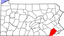
 Location in Chester County and the state of Pennsylvania. | |
.svg.png) Location of Pennsylvania in the United States | |
West Marlborough Township is a township in Chester County, Pennsylvania, United States. The population was 814 at the 2010 census. East Marlborough and West Marlborough townships were carved out of the larger Marlborough Township in 1729.
West Marlborough Township is a second class township, governed by a three-member Board of Supervisors who meet monthly at the township garage in the village of Doe Run. Other elected officials include an auditor, constable, and political party committee members. A Planning Commission is appointed by the supervisors and serve to advise the supervisors as to real estate subdivision, zoning, the township comprehensive plan, and similar matters.
History
For many years the King Ranch was the largest landowner in West Marlborough Township and adjoining municipalities Newlin and East Fallowfield townships. The ranch property, operated as Buck and Doe Run Valley Farms, Inc., received Texas longhorn cattle shipped north by railroad for fattening on the lush grass of eastern Pennsylvania before being delivered to cattle markets for sale and slaughter. The heart of the King Ranch property was preserved by land conservation easements in the 1980s through the tireless efforts of a number of local public spirited citizens. Today, much of the rich pasture and scenic vistas remain preserved perpetually from encroachment by intensive land development. Over time, the King Ranch still remains true to its roots with many families still today living there their whole life.
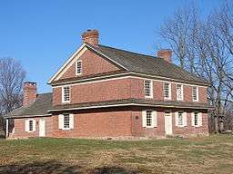
The Doe Run Village Historic District, Cyrus Hoopes House and Barn, House at Springdell, and Primitive Hall are listed on the National Register of Historic Places.[1]
Geography
According to the United States Census Bureau, the township has a total area of 17.1 square miles (44 km2), all of it land. The township is largely rural with several small villages including London Grove, Doe Run, and Upland.
Demographics
| Historical population | |||
|---|---|---|---|
| Census | Pop. | %± | |
| 1930 | 988 | — | |
| 1940 | 882 | −10.7% | |
| 1950 | 786 | −10.9% | |
| 1960 | 901 | 14.6% | |
| 1970 | 917 | 1.8% | |
| 1980 | 941 | 2.6% | |
| 1990 | 874 | −7.1% | |
| 2000 | 859 | −1.7% | |
| 2010 | 814 | −5.2% | |
| http://www.dvrpc.org/data/databull/rdb/db82/appedixa.xls. | |||
At the 2010 census, the township was 88.8% non-Hispanic White, 0.7% Black or African American, 0.1% Native American, 0.6% Asian, and 1.0% were two or more races. 8.7% of the population were of Hispanic or Latino ancestry .
As of the census[2] of 2000, there were 859 people, 349 households, and 224 families residing in the township. The population density was 50.1 people per square mile (19.4/km²). There were 375 housing units at an average density of 21.9/sq mi (8.5/km²). The racial makeup of the township was 93.95% White, 1.28% African American, 0.23% Native American, 0.58% Asian, 0.35% Pacific Islander, 3.49% from other races, and 0.12% from two or more races. Hispanic or Latino of any race were 8.61% of the population.
There were 349 households, out of which 30.4% had children under the age of 18 living with them, 54.4% were married couples living together, 6.3% had a female householder with no husband present, and 35.8% were non-families. 29.5% of all households were made up of individuals, and 6.0% had someone living alone who was 65 years of age or older. The average household size was 2.41 and the average family size was 3.03.
In the township the population was spread out, with 24.0% under the age of 18, 7.2% from 18 to 24, 31.0% from 25 to 44, 28.1% from 45 to 64, and 9.8% who were 65 years of age or older. The median age was 38 years. For every 100 females there were 105.0 males. For every 100 females age 18 and over, there were 104.7 males.
The median income for a household in the township was $52,283, and the median income for a family was $56,875. Males had a median income of $36,750 versus $26,875 for females. The per capita income for the township was $33,245. About 4.2% of families and 4.8% of the population were below the poverty line, including 3.5% of those under age 18 and none of those age 65 or over.
Notable people

- Esther D. du Pont, philanthropist
- Sandy Flash, noted Robin Hood type figure during the American revolutionary war
- John Berne Hannum, federal judge
- Michael R. Matz, professional horse trainer
- Joseph McMinn, fifth Governor of Tennessee[3]
References
- ↑ National Park Service (2010-07-09). "National Register Information System". National Register of Historic Places. National Park Service.
- ↑ "American FactFinder". United States Census Bureau. Retrieved 2008-01-31.
- ↑ "Tennessee Governor Joseph McMinn". National Governors Association. Retrieved September 29, 2012.