Toughkenamon, Pennsylvania
| Toughkenamon | |
| Census-designated place | |
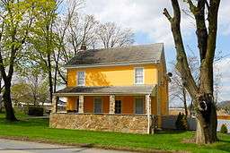 House in Toughkenamon | |
| Country | United States |
|---|---|
| State | Pennsylvania |
| County | Chester |
| Township | New Garden |
| Elevation | 338 ft (103.0 m) |
| Coordinates | 39°49′48″N 75°45′32″W / 39.83000°N 75.75889°WCoordinates: 39°49′48″N 75°45′32″W / 39.83000°N 75.75889°W |
| Area | 2.1 sq mi (5.4 km2) |
| - land | 2.1 sq mi (5 km2) |
| - water | 0.0 sq mi (0 km2), 0% |
| Population | 1,492 (2010) |
| Density | 710.5/sq mi (274.3/km2) |
| Timezone | EST (UTC-5) |
| - summer (DST) | EDT (UTC-4) |
| ZIP code | 19374 |
| Area code | 610 and 484 |
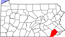
 Location in Chester County and the state of Pennsylvania. | |
.svg.png) Location of Pennsylvania in the United States | |
Toughkenamon is a census-designated place (CDP) in New Garden Township, Chester County, Pennsylvania, United States. The population was 1,492 at the 2010 census.
History
The area known as Toughkenamon was originally inhabited by Lenape Native Americans who spoke Unami. In the original survey, in 1700, the surveyor notes that he crossed the Dochcanamon Hill. Other forms of spelling this name were used, such as Tokenamon, Taukenamon, Taughlikenemon. The present spelling is Toughkenamon, pronounced by a Lenape descendant too-ken-ah-mahn', with accent on the last syllable. It is of Indian origin, and is said to signify "Fire-brand hill."
Thomas and Mary Rowland settled in the valley, near the present village of Toughkenamon, in 1706, being perhaps the first settlers who purchased lands in New Garden Township. They came to the township from old Ashton Township, old Chester County, now in Delaware County.
Toughkenamon has been of significant importance in the development of the United States. First, the characteristics of the interactions between settlers and Lenapes was a microcosm of the conflicts that would occur in the future. For example, the farmers dug trenches around their crops, and filled them with water, to prevent reoccurrence of the conflagration that occurred when local Lenapes started a burn. The fact that the original Toughkenamon settlers maintained water-filled trenches is evidence that they had dialogue and an understanding of the importance of the burn. The traditional burn was an ancient way to increase yields of local grains and tubers, and increase the deer population. But later settlers no longer interacted with the departed tribe, so falsely assumed the burns had been solely aimed at destroying their ancestors' crops, adding to mistrust of remaining Indian families in nearby counties.
Toughkenamon Hill has been quarried for centuries.
In later centuries Toughkenamon was considered a village. It was an early industrial center due to its strategic location on the old Baltimore Pike between Philadelphia and Washington, D.C., easy access to raw materials such as wood, water and ore. Even today, businesses critical to national wholesale distribution of perishable foods are located in and near Toughkenamon.
Geography
Toughkenamon is located at 39°49′48″N 75°45′32″W / 39.83000°N 75.75889°W (39.829874, -75.758847).[1]
According to the United States Census Bureau, the CDP has a total area of 2.1 square miles (5.4 km2), of which 0.48% is water.
Transportation
Toughkenamon is located east of PA-41 in Avondale on the old Baltimore Pike, a few miles west-southwest of Kennett Square. I-95, US 1, PA-41, and US 30 are used as approaches to Toughkenamon. The Philadelphia & Baltimore Central Railroad (now East Penn Railroad) parallels Baltimore Pike, originally crossing the Pennsylvania Rail Road in Avondale. East Penn Railroad now connects Toughkenamon to the national freight network at Chadd's Ford. New Garden Airport is northeast on Toughkenamon Hill.
Demographics
As of the census[2] of 2000, there were 1,375 people, 369 households, and 281 families residing in the CDP. The population density was 660.3 people per square mile (255.2/km²). There were 384 housing units at an average density of 184.4/sq mi (71.3/km²). The racial makeup of the CDP was 73.53% White, 2.47% African American, 0.15% Native American, 0.87% Asian, 20.65% from other races, and 2.33% from two or more races. Hispanic or Latino of any race were 48.36% of the population.
There were 369 households, out of which 40.9% had children under the age of 18 living with them, 59.3% were married couples living together, 6.8% had a female householder with no husband present, and 23.6% were non-families. 18.2% of all households were made up of individuals, and 8.9% had someone living alone who was 65 years of age or older. The average household size was 3.41 and the average family size was 3.69.
In the CDP the population was spread out, with 26.1% under the age of 18, 14.0% from 18 to 24, 36.0% from 25 to 44, 14.6% from 45 to 64, and 9.2% who were 65 years of age or older. The median age was 30 years. For every 100 females there were 146.9 males. For every 100 females age 18 and over, there were 158.5 males.
The median income for a household in the CDP was $63,109, and the median income for a family was $63,984. Males had a median income of $28,500 versus $39,000 for females. The per capita income for the CDP was $20,745. None of the families and 5.7% of the population were living below the poverty line, including no under eighteens and 18.3% of those over 64.
Notable Residents:
Vincent Civiletti - Latin teacher and husband of author Kaye Freemartin
Chris Nelms - construction worker, writer and son of Basketball Coach Rick Nelms
References
- ↑ "US Gazetteer files: 2010, 2000, and 1990". United States Census Bureau. 2011-02-12. Retrieved 2011-04-23.
- ↑ "American FactFinder". United States Census Bureau. Retrieved 2008-01-31.