Westwood, Chester County, Pennsylvania
| Westwood, Pennsylvania | |
|---|---|
| Census-designated place | |
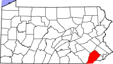
 Location in Chester County and the state of Pennsylvania. | |
| Coordinates: 39°58′17″N 75°51′12″W / 39.97139°N 75.85333°WCoordinates: 39°58′17″N 75°51′12″W / 39.97139°N 75.85333°W | |
| Country | United States |
| State | Pennsylvania |
| County | Chester |
| Township | Valley |
| Area | |
| • Total | 0.5 sq mi (1.2 km2) |
| • Land | 0.5 sq mi (1.2 km2) |
| • Water | 0.0 sq mi (0.0 km2) |
| Elevation | 360 ft (110 m) |
| Population (2010) | |
| • Total | 950 |
| • Density | 2,100/sq mi (790/km2) |
| Time zone | Eastern (EST) (UTC-5) |
| • Summer (DST) | EDT (UTC-4) |
| ZIP code | 19320 (Coatesville) |
| Area code(s) | 610 |
| FIPS code | 42-84248 |
| GNIS feature ID | 1191185 |
Westwood is a census-designated place (CDP) in Valley Township, Chester County, Pennsylvania, United States. The population was 950 at the 2010 census.[1]
Geography
Westwood is located at 39°57′51″N 75°53′11″W / 39.96417°N 75.88639°W,[2] immediately west of the city of Coatesville. Valley Road (Pennsylvania Route 372) passes through the center of the village, connecting Coatesville with Pomeroy and Parkesburg to the west.
According to the United States Census Bureau, the CDP has a total area of 0.46 square miles (1.2 km2), all of it land.[3]
References
- ↑ "Profile of General Population and Housing Characteristics: 2010 Demographic Profile Data (DP-1): Westwood CDP, Pennsylvania". U.S. Census Bureau, American Factfinder. Retrieved August 22, 2012.
- ↑ US Geological Survey 7.5 minute topographic map series
- ↑ "Geographic Identifiers: 2010 Demographic Profile Data (G001): Pomeroy CDP, Pennsylvania". U.S. Census Bureau, American Factfinder. Retrieved August 21, 2012.
This article is issued from Wikipedia - version of the 7/11/2016. The text is available under the Creative Commons Attribution/Share Alike but additional terms may apply for the media files.