List of protected areas of the Philippines

This is a list of protected areas of the Philippines administered by the Department of Environment and Natural Resources' Biodiversity Management Bureau under the National Integrated Protected Areas System (NIPAS) Act of 1992. As of 2012, there are 240 protected areas in the Philippines covering a total area of 35,700 square kilometres (13,800 sq mi) – 11.9% of the Philippines' total land area.[1]
History
The first important legislation that formed the basis of the current system of national parks and protected areas in the Philippines is the Philippine Commission Act No. 648 enacted in 1903 by the US Congress. This act authorized the Civil Governor to "reserve for civil public purposes, and from sale or settlement, any part of the public domain not appropriated by law for special public purposes." [2]
A total of eight national reserves had been established in July 26, 1904 pursuant to this law. These are: Lamao Forest Reserve in Bataan, Mariquina Reserve in Rizal, Angat River Reserve in Bulacan, Caliraya Falls Reserve in Laguna, La Carlota Reserve in Negros Occidental, San Ramon Reserve in Zamboanga, Magalang Reserve in Pampanga, and Hacienda San Antonio in Isabela.[3] In the same year, the Forest Act of 1904 (Act No. 1148) was adopted that expanded the scope of protected areas in the Philippines.[4] Among the first of such mountain forest reserves to be declared was Mount Maquiling declared in November 21, 1910.[5]
On February 1, 1932, the National Parks Act (Act No. 3195) was enacted that formally established the national parks system in the country.[6] Mount Arayat became the first national park in the Philippines established in June 27, 1933 following this act.
A series of acts and legislations were passed in the next decades that aimed to further strengthen these policies, including the Revised Forestry Code of 1975 (Presidential Decree No. 705) and Forest Administrative Order No. 7. Following the 1987 Constitution, the National Integrated Protected Areas System Act was enacted which further enhanced the administration and classification of protected areas, and broadened the mandate of the Department of Environment and Natural Resources in enforcing its provisions.
Classification
Protected areas in the Philippines are managed according to the following classifications described in Section 4 of the National Integrated Protected Areas System Act of 1992 (NIPAS Act).
National Parks
National parks refer to forest reservations essentially of natural wilderness character which have been withdrawn from settlement, occupancy or any form of exploitation except in conformity with approved management plan and set aside as such exclusively to conserve the area or preserve the scenery, the natural and historic objects, wild animals and plants therein and to provide enjoyment of these features in such areas.
Natural Parks
Natural parks are relatively large areas not materially altered by human activity where extractive resource uses are not allowed and maintained to protect outstanding natural and scenic areas of national or international significance for scientific, educational and recreational use.


World Heritage Site or part of a World Heritage Site
| Name | Area | Established | Location |
|---|---|---|---|
| Apo Reef | 15,792.00 ha (39,022.9 acres) |
1996 | Occidental Mindoro |
| Balinsasayao Twin Lakes | 8,016.05 ha (19,808.1 acres) |
2000 | Negros Oriental |
| Bicol | 5,201.00 ha (12,852.0 acres) |
2000 | |
| Bongsanglay | 244.72 ha (604.7 acres) |
2000 | Masbate |
| Bulusan Volcano | 3,672.00 ha (9,073.7 acres) |
2000 | Sorsogon |
| Kalbario-Patapat | 3,800.00 ha (9,390.0 acres) |
2007 | Ilocos Norte |
| Lake Danao | 2,193.00 ha (5,419.0 acres) |
1998 | Leyte |
| Mahagnao Volcano | 635.00 ha (1,569.1 acres) |
1998 | Leyte |
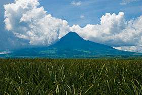
| Mayon Volcano | 5,775.70 ha (14,272.1 acres) |
2000 | Albay |
| Mount Apo | 54,974.87 ha (135,845.9 acres) |
1936 | |
| Mount Balatukan Range | 8,423.00 ha (20,813.7 acres) |
2007 | Misamis Oriental |
| Mount Guiting-Guiting | 15,265.48 ha (37,721.8 acres) |
1996 | Romblon |
| Mount Inayawan Range | 3,632.74 ha (8,976.7 acres) |
2007 | Lanao del Norte |
| Mount Isarog | 10,112.35 ha (24,988.2 acres) |
2002 | Camarines Sur |
| Mount Kalatungan Range | 21,247.73 ha (52,504.3 acres) |
2000 | Bukidnon |
| Mount Kanlaon | 24,388.00 ha (60,264.1 acres) |
1997 | |
| Mount Kitanglad Range | 31,235.19 ha (77,183.8 acres) |
1996 | Bukidnon |
| Mount Malindang | 34,694.00 ha (85,730.7 acres) |
2002 | Misamis Occidental |
| Northern Negros | 80,454.50 ha (198,807.4 acres) |
2002 | Negros Occidental |
| Northern Sierra Madre | 359,486.00 ha (888,309.3 acres) |
1997 | Isabela |
| Northwest Panay Peninsula | 12,009.29 ha (29,675.6 acres) |
2002 | |
| Pasonanca | 12,107.00 ha (29,917.0 acres) |
1999 | Zamboanga del Sur |
| Samar Island | 333,300.00 ha (823,602.2 acres) |
2003 | Eastern Visayas |
| Sibalom | 5,511.47 ha (13,619.1 acres) |
2000 | Antique |
| Tubbataha Reef | 97,030.00 ha (239,766.4 acres) |
2010 | Palawan |
Natural Monuments
A natural monument is a relatively small area focused on protection of small features to protect or preserve nationally significant natural features on account of their special interest or unique characteristics.

| Name | Area | Established | Location |
|---|---|---|---|
| Bessang Pass | 693.32 ha (1,713.2 acres) |
2000 | Ilocos Sur |
| Chocolate Hills | 14,145.00 ha (34,953.1 acres) |
1997 | Bohol |
| Salinas | 6,675.56 ha (16,495.7 acres) |
2000 | Nueva Vizcaya |
| Timpoong and Hibok-Hibok | 2,227.62 ha (5,504.6 acres) |
2004 | Camiguin |
Protected Landscape
Protected landscapes/seascapes are areas of national significance which are characterized by the harmonious interaction of man and land while providing opportunities for public enjoyment through recreation and tourism within the normal lifestyle and economic activity of these areas.


| Name | Area | Established | Location |
|---|---|---|---|
| Aliwagwag | 10,491.33 ha (25,924.6 acres) |
2011 | |
| Amro River | 6,471.08 ha (15,990.4 acres) |
2000 | Aurora |
| Baganga | 114.88 ha (283.9 acres) |
2000 | Davao Oriental |
| Bigbiga | 135.71 ha (335.3 acres) |
2000 | Ilocos Sur |
| Buenavista | 284.27 ha (702.4 acres) |
2000 | Quezon |
| Calbayog Pan-as–Hayiban | 7,832.00 ha (19,353.3 acres) |
1998 | Samar |
| Casecnan | 88,846.80 ha (219,545.2 acres) |
2000 | |
| Central Cebu | 29,062.00 ha (71,813.8 acres) |
2003 | Cebu |
| Dinadiawan River | 3,371.33 ha (8,330.7 acres) |
2000 | Aurora |
| Hinulugang Taktak | 3.20 ha (7.9 acres) |
2000 | Rizal |
| José Rizal Memorial | 439.00 ha (1,084.8 acres) |
2000 | Zamboanga del Norte |
| Libunao | 46.70 ha (115.4 acres) |
2000 | Ilocos Sur |
| Lidlidda | 1,157.44 ha (2,860.1 acres) |
2000 | Ilocos Sur |
| Magapit | 3,403.62 ha (8,410.5 acres) |
2000 | Cagayan |
| Mainit Hot Springs | 1,374.00 ha (3,395.2 acres) |
2000 | Compostela Valley |
| Manleluag Spring | 1,935.17 ha (4,781.9 acres) |
2004 | Pangasinan |
| Mati | 914.26 ha (2,259.2 acres) |
2005 | Davao Oriental |
| Maulawin Spring | 149.01 ha (368.2 acres) |
2000 | Quezon |
| Mimbilisan | 66.00 ha (163.1 acres) |
1999 | Misamis Oriental |
| Mounts Banahaw–San Cristobal | 10,900.59 ha (26,935.9 acres) |
2009 | |
| Mount Mantalingajan | 120,457.00 ha (297,655.7 acres) |
2009 | Palawan |
| Mount Matutum | 15,600.00 ha (38,548.4 acres) |
1995 | South Cotabato |
| Mounts Palay-Palay–Mataas-na-Gulod | 3,973.13 ha (9,817.8 acres) |
2007 | |
| Mount Timolan | 1,994.80 ha (4,929.3 acres) |
2000 | Zamboanga del Sur |
| Pamitinan | 600.00 ha (1,482.6 acres) |
1996 | Rizal |
| Quezon | 938.00 ha (2,317.8 acres) |
2003 | Quezon |
| Quirino | 164,364.46 ha (406,153.4 acres) |
2005 | Quirino |
| Rajah Sikatuna | 10,452.60 ha (25,828.9 acres) |
2000 | Bohol |
| Roosevelt | 786.04 ha (1,942.3 acres) |
2000 | Bataan |
| Santa Lucia | 174.16 ha (430.4 acres) |
2000 | Ilocos Sur |
| Simbahan-Talagas | 2,266.49 ha (5,600.6 acres) |
2000 | Aurora |
| Taal Volcano | 62,292.14 ha (153,927.2 acres) |
1996 | Batangas |
| Talaytay | 3,526.29 ha (8,713.7 acres) |
2000 | Aurora |
| Upper Marikina River Basin | 26,125.64 ha (64,557.9 acres) |
2011 | Rizal |
Protected Landscape and Seascape


| Name | Area | Established | Location |
|---|---|---|---|
| Agoo–Damortis | 10,513.30 ha (25,978.9 acres) |
2000 | La Union |
| Alburquerque-Loay-Loboc | 1,164.16 ha (2,876.7 acres) |
1999 | Bohol |
| Aliguay Island | 1,191.89 ha (2,945.2 acres) |
1999 | Zamboanga del Norte |
| Apo Island | 691.45 ha (1,708.6 acres) |
1994 | Negros Oriental |
| Baliangao | 295.00 ha (729.0 acres) |
2000 | Misamis Occidental |
| Batanes | 213,578.00 ha (527,762.7 acres) |
1994 | Batanes |
| Biri Larosa | 33,492.00 ha (82,760.5 acres) |
2000 | Northern Samar |
| Cuatro Islas | 12,500.00 ha (30,888.2 acres) |
2000 | Leyte |
| Dumanquilas Bay | 25,948.00 ha (64,118.9 acres) |
1999 | Zamboanga del Sur |
| Great and Little Santa Cruz Islands | 1,877.00 ha (4,638.2 acres) |
2000 | Zamboanga del Sur |
| Guiuan | 60,448.00 ha (149,370.3 acres) |
1994 | Eastern Samar |
| Initao–Libertad | 1,300.78 ha (3,214.3 acres) |
2002 | Misamis Oriental |
| Mabini | 6,106.00 ha (15,088.3 acres) |
2000 | Compostela Valley |
| Malabungot | 120.62 ha (298.1 acres) |
2000 | Camarines Sur |
| Malampaya Sound | 200,115.00 ha (494,494.9 acres) |
2000 | Palawan |
| Murcielagos Island | 151.00 ha (373.1 acres) |
2000 | Zamboanga del Norte |
| Peñablanca | 118,781.58 ha (293,515.7 acres) |
2003 | Cagayan |
| Pujada Bay | 21,200.00 ha (52,386.3 acres) |
1994 | Davao Oriental |
| Selinog Island | 1,294.35 ha (3,198.4 acres) |
2000 | Zamboanga del Norte |
| Siargao Island | 278,914.13 ha (689,211.8 acres) |
1996 | Surigao del Norte |
| Talibon Islands | 6,456.87 ha (15,955.3 acres) |
1999 | Bohol |
Protected Seascape

| Name | Area | Established | Location |
|---|---|---|---|
| Panglao Island | 385.67 ha (953.0 acres) |
2003 | Bohol |
| Sarangani Bay | 215,950.00 ha (533,624.1 acres) |
1996 | Sarangani |
| Tañon Strait | 450.00 ha (1,112.0 acres) |
1998 |
Game Refuge and Bird Sanctuaries
Strict nature reserve is an area possessing some outstanding ecosystem, features and/or species of flora and fauna of national scientific importance maintained to protect nature and maintain processes in an undisturbed state in order to have ecologically representative examples of the natural environment available for scientific study, environmental monitoring, education, and for the maintenance of genetic resources in a dynamic and evolutionary state.

| Name | Area | Established | Location |
|---|---|---|---|
| Calauit Safari Park | 3,400.00 ha (8,401.6 acres) |
1976 | Palawan |
| Calavite and FB Harrison | 121,983.81 ha (301,428.6 acres) |
1920 | Occidental Mindoro |
| Lake Buluan | 6,300.00 ha (15,567.6 acres) |
2006 | Cotabato |
| Lake Malimanga | 12.35 ha (30.5 acres) |
1980 | Zambales |
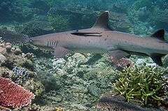
| Olango Island | 920.00 ha (2,273.4 acres) |
1992 | Cebu |
| Palawan | 761,416.00 ha (1,881,499.9 acres) |
1967 | Palawan |
Resource Reserves
Resource reserve is an extensive and relatively isolated and uninhabited area normally with difficult access designated as such to protect natural resources of the area for future use and prevent or contain development activities that could affect the resource pending the establishment of objectives which are based upon appropriate knowledge and planning.
| Name | Area | Established | Location |
|---|---|---|---|
| Siocon | 793.74 ha (1,961.4 acres) |
1999 | Zamboanga del Norte |
| Upper Agno River Basin | 77,561.00 ha (191,657.4 acres) |
2000 |
Managed Resource Protected Areas

| Name | Area | Established | Location |
|---|---|---|---|
| El Nido Managed Resource Protected Area | 89,134.76 ha (220,256.8 acres) |
1998 | Palawan |
Marine Reserves
| Name | Area | Established | Location |
|---|---|---|---|
| Masinloc and Oyon Bay | 7,568.00 ha (18,700.9 acres) |
1993 | Zambales |
| Palaui Island | 7,415.48 ha (18,324.1 acres) |
1994 | Cagayan |
| Sagay | 32,000.00 ha (79,073.7 acres) |
2001 | Negros Occidental |
| Taklong Island | 1,143.45 ha (2,825.5 acres) |
1990 |
Watershed Forest Reserves


| Name | Area | Established | Location |
|---|---|---|---|
| Aklan River | 23,185.00 ha (57,291.4 acres) |
1990 | Aklan |
| Alabat | 688.00 ha (1,700.1 acres) |
1987 | Quezon |
| Alijawan-Cansuhay-Anibongan River | 3,630.00 ha (8,969.9 acres) |
1992 | Bohol |
| Allah Valley | 92,450.00 ha (228,448.9 acres) |
1985 | South Cotabato |
| Angat River | 6,600.00 ha (16,309.0 acres) |
1968 | Bulacan |
| Aurora | 430.00 ha (1,062.6 acres) |
1936 | Aurora |
| Bawa | 8,955.00 ha (22,128.3 acres) |
1987 | Cagayan |
| Binahaan River | 465.00 ha (1,149.0 acres) |
1991 | Quezon |
| Calabgan | 4,803.00 ha (11,868.5 acres) |
1992 | Aurora |
| Calatrava-San Andres-San Agustin | 2,670.00 ha (6,597.7 acres) |
1982 | Romblon |
| Calauag | 328.00 ha (810.5 acres) |
1939 | Quezon |
| Capalonga | 752.00 ha (1,858.2 acres) |
1966 | Camarines Norte |
| Catanduanes | 26,010.00 ha (64,272.1 acres) |
1987 | Catanduanes |
| Dahican | 44.00 ha (108.7 acres) |
1933 | Camarines Norte |
| Dalanas River | 8,558.00 ha (21,147.3 acres) |
1990 | Antique |
| Dibalo-Pingit-Zabali-Malayat | 4,528.00 ha (11,188.9 acres) |
1992 | Aurora |
| Dipaculao | 1,786.00 ha (4,413.3 acres) |
1987 | Aurora |
| Doña Remedios-General Tinio | 20,760.00 ha (51,299.1 acres) |
1988 | |
| Dupax | 424.80 ha (1,049.7 acres) |
1934 | Nueva Vizcaya |
| Ilocos Norte Metro | 2,815.00 ha (6,956.0 acres) |
1934 | Ilocos Norte |
| Ilog-Hilabangan | 10,211.00 ha (25,231.9 acres) |
1990 | Negros Occidental |
| Infanta | 384.00 ha (948.9 acres) |
1967 | Quezon |
| Jalaur River | 9,228.00 ha (22,802.9 acres) |
1990 | Iloilo |
| Kabankalan | 432.00 ha (1,067.5 acres) |
1991 | Negros Occidental |
| Lake Lanao | 180,460.00 ha (445,926.4 acres) |
1992 | Lanao del Sur |
| Libungan | 52,820.00 ha (130,521.1 acres) |
1990 | Cotabato |
| Loboc River | 19,410.00 ha (47,963.2 acres) |
1953 | Bohol |
| Lopez | 418.00 ha (1,032.9 acres) |
1940 | Quezon |
| Lower Agno | 39,304.00 ha (97,122.3 acres) |
1983 | Benguet |
| Maasin | 6,150.00 ha (15,197.0 acres) |
1923 | Iloilo |
| Mahugunao | 136.00 ha (336.1 acres) |
1932 | Misamis Oriental |
| Malagos | 235.00 ha (580.7 acres) |
1933 | Davao del Sur |
| Marcos Highway | 6,105.00 ha (15,085.8 acres) |
1978 | Benguet |
| Mariveles (Palanas) | 325.00 ha (803.1 acres) |
1919 | Bataan |
| Mulanay | 26.00 ha (64.2 acres) |
1938 | Quezon |
| Naguilian | 90.00 ha (222.4 acres) |
1936 | La Union |
| Olongapo (Palanas) | 6,335.00 ha (15,654.1 acres) |
1987 | Zambales |
| Palawan | 4,776.00 ha (11,801.8 acres) |
1982 | Palawan |
| Palompon | 2,392.00 ha (5,910.8 acres) |
1988 | Leyte |
| Panay River | 4,350.00 ha (10,749.1 acres) |
1990 | Capiz |
| Pantabangan-Carranglan | 84,500.00 ha (208,804.0 acres) |
1969 | Nueva Ecija |
| Polillo | 130.00 ha (321.2 acres) |
1966 | Quezon |
| Santa | 25.00 ha (61.8 acres) |
1935 | Ilocos Sur |
| South Upi | 1,894.20 ha (4,680.7 acres) |
1987 | Maguindanao |
| Talavera | 37,156.00 ha (91,814.5 acres) |
1938 | |
| Tanap | 41.00 ha (101.3 acres) |
1971 | Ilocos Norte |
| Tibiang-Damagandong | 280.00 ha (691.9 acres) |
1938 | Quezon |
| Torrijos | 105.00 ha (259.5 acres) |
1932 | Marinduque |
| Tumauini | 17,670.00 ha (43,663.5 acres) |
1994 | Isabela |
| Wangag | 6,992.00 ha (17,277.6 acres) |
1987 | Cagayan |
Natural Biotic Areas
Natural biotic area is an area set aside to allow the way of life of societies living in harmony with the environment to adapt to modem technology at their pace.
| Name | Area | Established | Location |
|---|---|---|---|
| Abasig-Matogdon-Mananap | 5,420.12 ha (13,393.4 acres) |
2000 | Camarines Norte |
| Basilan | 4,497.00 ha (11,112.3 acres) |
2000 | Basilan |
| Buug | 1,095.00 ha (2,705.8 acres) |
1998 | Zamboanga del Sur |
| Lagonoy | 444.60 ha (1,098.6 acres) |
2000 | Camarines Sur |
Wildlife Sanctuaries
Wildlife sanctuary comprises an area which assures the natural conditions necessary to protect nationally significant species, groups of species, biotic communities or physical features of the environment where these may require specific human manipulation for the perpetuation.
World Heritage Site or part of a World Heritage Site
| Name | Area | Established | Location |
|---|---|---|---|
| Agusan Marsh | 14,835.99 ha (36,660.5 acres) |
1996 | Agusan del Sur |
| Chico Island | 7.77 ha (19.2 acres) |
2000 | Masbate |
| Marinduque | 8,827.96 ha (21,814.4 acres) |
2004 | Marinduque |
| Mount Calavite | 18,016.19 ha (44,519.0 acres) |
2000 | Occidental Mindoro |
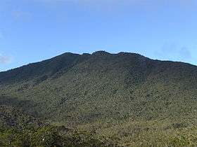
| Mount Hamiguitan Range | 6,834.00 ha (16,887.2 acres) |
2004 | Davao Oriental |
| Naro Island | 109.98 ha (271.8 acres) |
2000 | Masbate |
| Rasa Island | 1,983.00 ha (4,900.1 acres) |
2006 | Palawan |
| Turtle Islands | 242,967.00 ha (600,384.5 acres) |
1999 | Tawi-Tawi |
Wilderness Areas
| Name | Area | Established | Location |
|---|---|---|---|
| Alibijaban | 430.00 ha (1,062.6 acres) |
1981 | Quezon |
| Awasan Bay Islands | 1981 | Surigao del Norte | |
| Bantayan Island | 1981 | Cebu | |
| Basot-Quinalang-Malabungot Islands | 185.38 ha (458.1 acres) |
1981 | Camarines Sur |
| Caniago Strait Islands | 210.00 ha (518.9 acres) |
1981 | Bohol |
| Cebu Strait Islands | 34.00 ha (84.0 acres) |
1981 | Bohol |
| Dampalit Island | 1981 | Masbate | |
| Guinauyan-Naro-Chico-Pobre Islands | 23.25 ha (57.5 acres) |
1981 | Masbate |
| Isabela Monte Alto Timber Resource Corp. |
1,985.00 ha (4,905.0 acres) |
1987 | Isabela |
| Majaba-Napayuan Islands | 18.00 ha (44.5 acres) |
1981 | Masbate |
| Panag Bay Islands | 1981 | Surigao del Norte | |
| Rasa Island | 1981 | Surigao del Norte |
See also
References
- ↑ "Establishing and Managing Protected Areas". DENR-Protected Areas and Wildlife Bureau. Retrieved 11 June 2012.
- ↑ "Act No. 648". PhilippineLaw.info. Retrieved 18 June 2012.
- ↑ "Executive orders and proclamations issued by the governor-general. (1904)". University of Michigan Library. Retrieved 18 June 2012.
- ↑ "Act No. 1148". Chan Robles. Retrieved 18 June 2012.
- ↑ "Mount Makiling marks centennial". BusinessMirror. Retrieved 21 June 2012.
- ↑ "Act No. 3915 - National Parks Act of 1932". Chan Robles. Retrieved 18 June 2012.
External links
-
 Media related to National parks of the Philippines at Wikimedia Commons
 - National Integrated Protected Areas System Act of 1992 (archived)
- Protected areas (240) in the Philippines from Protected Areas and Wildlife Bureau
- Mount Kalatungan Range Natural Park Official Site (archived)
Philippines articles | |||||||||||||||||||||||||||||||
|---|---|---|---|---|---|---|---|---|---|---|---|---|---|---|---|---|---|---|---|---|---|---|---|---|---|---|---|---|---|---|---|
| History |
|  | |||||||||||||||||||||||||||||
| Geography | |||||||||||||||||||||||||||||||
| Politics |
| ||||||||||||||||||||||||||||||
| Economy | |||||||||||||||||||||||||||||||
| Society |
| ||||||||||||||||||||||||||||||