List of largest reservoirs of Wyoming
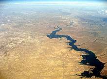
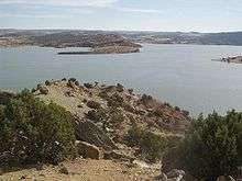
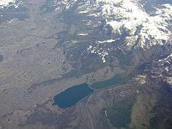
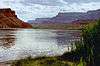
What follows is a list of the fourteen reservoirs in the state of Wyoming, the United States, that contain at least 40,000 acre feet when at full capacity. In addition to in-stream reservoirs, the list includes enhanced natural lakes, such as Jackson Lake. With five of the fourteen largest reservoirs in the state, the North Platte River holds the distinction of being the most dammed river in the state, as well as providing much of the water storage for the state.
The fourteen reservoirs on this list provide 10,221,672 acre feet of storage, though not all is allocated for the state of Wyoming.
| Key |
|---|
List


.jpg)


See also
- List of dams and reservoirs in Wyoming
- List of largest reservoirs in the United States
- List of rivers in Wyoming
- List of lakes in Wyoming
Notes
- ↑ Volume given is the maximum flood pool, not the operational or live storage capacity.
- ↑ Elevation given is the elevation of reservoir at full pool, measured in feet.
- ↑ Jackson Lake is a natural lake, but was expanded with a dam first built in 1911, and enlarged in 1916.
- ↑ The natural Bull Lake was expanded with the completion of Bull Lake Dam in 1938.
- ↑ New Fork Lake was expanded with the creation of New Fork Lake Dam.
References
- ↑ "Flaming Gorge Reservoir". Geographic Names Information System. United States Geological Survey. 1979-12-31. Retrieved 2014-12-22.
- ↑ "Flaming Gorge Dam". United States Bureau of Reclamation. 2009-02-20. Retrieved 2014-12-22.
- ↑ "Pathfinder Reservoir". Geographic Names Information System. United States Geological Survey. 1979-06-05. Retrieved 2014-12-22.
- ↑ "Pathfinder Reservoir Allocations" (PDF). United States Bureau of Reclamation. Retrieved 2014-12-22.
- ↑ "Seminoe Reservoir". Geographic Names Information System. United States Geological Survey. 1979-06-05. Retrieved 2014-12-22.
- ↑ "Seminoe Reservoir Allocations" (PDF). United States Bureau of Reclamation. Retrieved 2014-12-22.
- ↑ "Boysen Reservoir". Geographic Names Information System. United States Geological Survey. 1979-06-05. Retrieved 2014-12-22.
- ↑ "Boysen Reservoir Allocations" (PDF). United States Bureau of Reclamation. Retrieved 2014-12-22.
- ↑ "Jackson Lake". Geographic Names Information System. United States Geological Survey. 1979-06-05. Retrieved 2014-12-22.
- 1 2 "Jackson Lake Dam". United States Bureau of Reclamation. 2012-10-29. Retrieved 2014-12-22.
- ↑ "Glendo Reservoir". Geographic Names Information System. United States Geological Survey. 1979-06-05. Retrieved 2014-12-22.
- ↑ "Glendo Reservoir Allocations" (PDF). United States Bureau of Reclamation. 2012-10-04. Retrieved 2014-12-22.
- ↑ "Buffalo Bill Reservoir". Geographic Names Information System. United States Geological Survey. 1979-06-05. Retrieved 2014-12-22.
- ↑ "Buffalo Bill Reservoir" (PDF). United States Bureau of Reclamation. 2012-10-03. Retrieved 2014-12-22.
- ↑ "Fontenelle Reservoir". Geographic Names Information System. United States Geological Survey. 1979-06-05. Retrieved 2014-12-22.
- ↑ "Fontenelle Dam". United States Bureau of Reclamation. 2009-02-20. Retrieved 2014-12-22.
- ↑ "Keyhole Reservoir". Geographic Names Information System. United States Geological Survey. 1979-06-05. Retrieved 2014-12-22.
- ↑ "Keyhole Unit". United States Bureau of Reclamation. 2011-05-11. Retrieved 2014-12-22.
- ↑ "Alcova Reservoir". Geographic Names Information System. United States Geological Survey. 1979-06-05. Retrieved 2014-12-22.
- ↑ "Alcova Reservoir Allocations" (PDF). United States Bureau of Reclamation. 2012-10-03. Retrieved 2014-12-22.
- ↑ "Bull Lake". Geographic Names Information System. United States Geological Survey. 1979-06-05. Retrieved 2014-12-22.
- ↑ "Bull Lake Allocations" (PDF). United States Bureau of Reclamation. 2012-10-03. Retrieved 2014-12-22.
- ↑ "Wheatland Reservonir Number 2". Geographic Names Information System. United States Geological Survey. 1979-06-05. Retrieved 2014-12-22.
- 1 2 "Reservoirs in the United States" (PDF). United States Geological Survey. 1966. Retrieved 2014-12-22.
- ↑ "New Fork Lake". Geographic Names Information System. United States Geological Survey. Retrieved 2014-12-22.
- ↑ "Guernsey Reservoir". Geographic Names Information System. United States Geological Survey. 1979-06-05. Retrieved 2014-12-22.
- ↑ "Guersey Reservoir Allocation" (PDF). United States Bureau of Reclamation. 2012-10-04. Retrieved 2014-12-22.
Colorado River system | |||||||||||||||
|---|---|---|---|---|---|---|---|---|---|---|---|---|---|---|---|
| Jurisdictions |
|     | |||||||||||||
| Canyons |
| ||||||||||||||
| Natural features |
| ||||||||||||||
| Tributaries | |||||||||||||||
| Engineering |
| ||||||||||||||
| Designated areas | |||||||||||||||
| Related topics | |||||||||||||||
This article is issued from Wikipedia - version of the 9/11/2016. The text is available under the Creative Commons Attribution/Share Alike but additional terms may apply for the media files.