Fremont County, Wyoming
| Fremont County, Wyoming | |
|---|---|
.JPG) Fremont County Courthouse in Lander | |
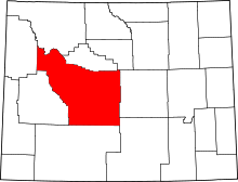 Location in the U.S. state of Wyoming | |
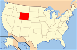 Wyoming's location in the U.S. | |
| Founded | 1884 |
| Named for | John C. Frémont |
| Seat | Lander |
| Largest city | Riverton |
| Area | |
| • Total | 9,266 sq mi (23,999 km2) |
| • Land | 9,184 sq mi (23,786 km2) |
| • Water | 82 sq mi (212 km2), 0.9% |
| Population (est.) | |
| • (2015) | 40,315 |
| • Density | 4.4/sq mi (2/km²) |
| Congressional district | At-large |
| Time zone | Mountain: UTC-7/-6 |
| Website |
www |

Fremont County is a county located in the U.S. state of Wyoming. As of the 2010 census, the population was 40,123.[1] Its county seat is Lander.[2] The county was founded in 1884 and is named for John C. Frémont, a general, explorer, and politician. It is roughly the size of the state of Vermont.
Fremont County comprises the Riverton, WY Micropolitan Statistical Area.
History
Fremont County was created on March 5, 1884 by the legislature of the Wyoming Territory[3] The county was created with land ceded by Sweetwater County. In 1890, Big Horn County was carved out of Fremont, Johnson, and Sheridan Counties. Hot Springs County was created in 1911 from parts of Fremont County, along with a portion of Big Horn County and Park County. In 1921, Sublette County was created from part of Fremont County and Lincoln County. The boundaries of Fremont County have remained unchanged since 1921.
Fremont County was named for John Charles Frémont, an explorer of the American West, Senator from California, and 1856 Republican presidential candidate.[4][5] Fremont County is the historical home of the Wind River Indian Reservation, home of the Eastern Shoshone and Northern Arapaho tribes of Native Americans.
Since 1998, Fremont County has been represented in the Wyoming State Senate by the economist/businessman Cale Case, a Republican.
Geography
According to the U.S. Census Bureau, the county has a total area of 9,266 square miles (24,000 km2), of which 9,184 square miles (23,790 km2) is land and 82 square miles (210 km2) (0.9%) is water.[6] It is the second-largest county by area in Wyoming, as well as in the six Rocky Mountain States. Elevations and climate range from desert at Boysen State Park to glaciers at 13,804-foot (4,207 m) Gannett Peak, the highest point not only in Wyoming but in the three Central Rockies states of Wyoming, Idaho and Montana. The southern end of the county is traversed by the Oregon Trail and in the northwest corner lies Dubois, a gateway town for Yellowstone National Park and Grand Teton National Park. Although the county seat is Lander, the largest community is Riverton, home of Central Wyoming College and the economic hub of the region. A large portion of the western edge of the county follows the Continental Divide at the crest of the Wind River Range of the Rocky Mountains, known for its vast wilderness areas and home of the largest glaciers in the American Rocky Mountains.
Adjacent counties
|
|
National protected areas
- Bridger National Forest (part)
- Shoshone National Forest (part)
- Teton National Forest (part)
Although the Bridger National Forest and the Teton National Forest have been administratively combined into the Bridger-Teton National Forest, it is important to note that the county contains portions of both original forests.
Demographics
| Historical population | |||
|---|---|---|---|
| Census | Pop. | %± | |
| 1890 | 2,463 | — | |
| 1900 | 5,357 | 117.5% | |
| 1910 | 11,822 | 120.7% | |
| 1920 | 11,820 | 0.0% | |
| 1930 | 10,490 | −11.3% | |
| 1940 | 16,095 | 53.4% | |
| 1950 | 19,580 | 21.7% | |
| 1960 | 26,168 | 33.6% | |
| 1970 | 28,352 | 8.3% | |
| 1980 | 38,992 | 37.5% | |
| 1990 | 33,662 | −13.7% | |
| 2000 | 35,804 | 6.4% | |
| 2010 | 40,123 | 12.1% | |
| Est. 2015 | 40,315 | [7] | 0.5% |
| U.S. Decennial Census[8] 1870–2000[9] 2010–2015[1] | |||
2000 census
As of the census[10] of 2000, there were 35,804 people, 13,545 households, and 9,481 families residing in the county. The population density was 4 people per square mile (2/km²). There were 15,541 housing units at an average density of 2 per square mile (1/km²). The racial makeup of the county was 76.49% White, 0.12% Black or African American, 19.68% Native American, 0.30% Asian, 0.03% Pacific Islander, 1.16% from other races, and 2.21% from two or more races. 4.37% of the population were Hispanic or Latino of any race. 22.1% were of German, 9.9% English, 8.2% Irish and 6.3% American ancestry.
There were 13,545 households out of which 32.20% had children under the age of 18 living with them, 54.30% were married couples living together, 10.90% had a female householder with no husband present, and 30.00% were non-families. 25.50% of all households were made up of individuals and 10.00% had someone living alone who was 65 years of age or older. The average household size was 2.58 and the average family size was 3.10.
In the county the population was spread out with 27.40% under the age of 18, 8.30% from 18 to 24, 25.90% from 25 to 44, 25.00% from 45 to 64, and 13.30% who were 65 years of age or older. The median age was 38 years. For every 100 females there were 98.20 males. For every 100 females age 18 and over, there were 95.40 males.
The median income for a household in the county was $32,503, and the median income for a family was $37,983. Males had a median income of $30,620 versus $19,802 for females. The per capita income for the county was $16,519. About 13.30% of families and 17.60% of the population were below the poverty line, including 23.70% of those under age 18 and 12.50% of those age 65 or over.
2010 census
As of the 2010 United States Census, there were 40,123 people, 15,455 households, and 10,360 families residing in the county.[11] The population density was 4.4 inhabitants per square mile (1.7/km2). There were 17,796 housing units at an average density of 1.9 per square mile (0.73/km2).[12] The racial makeup of the county was 74.3% white, 21.2% American Indian, 0.4% Asian, 0.3% black or African American, 1.0% from other races, and 2.8% from two or more races. Those of Hispanic or Latino origin made up 5.6% of the population.[11] In terms of ancestry, 21.7% were German, 13.5% were English, 12.2% were Irish, and 7.7% were American.[13]
Of the 15,455 households, 32.3% had children under the age of 18 living with them, 49.3% were married couples living together, 12.2% had a female householder with no husband present, 33.0% were non-families, and 27.0% of all households were made up of individuals. The average household size was 2.54 and the average family size was 3.07. The median age was 38.5 years.[11]
The median income for a household in the county was $46,397 and the median income for a family was $55,531. Males had a median income of $44,087 versus $27,751 for females. The per capita income for the county was $24,173. About 10.3% of families and 14.0% of the population were below the poverty line, including 20.7% of those under age 18 and 6.4% of those age 65 or over.[14]
Government and infrastructure
The Wyoming Department of Corrections Wyoming Honor Farm is located in Riverton.[15] The Wyoming Department of Health Wyoming Life Resource Center (WLRC), originally the Wyoming State Training School (WSTS), a residential facility for physically and mentally disabled people, is located in Lander.[16][17] Both facilities were operated by the Wyoming Board of Charities and Reform until that agency was dissolved as a result of a state constitutional amendment passed in November 1990.[18]
Communities
Cities
Towns
Census-designated places
Unincorporated communities
See also
References
- 1 2 "State & County QuickFacts". United States Census Bureau. Retrieved January 25, 2014.
- ↑ "Find a County". National Association of Counties. Retrieved 2011-06-07.
- ↑ Long, John H. (2006). "Wyoming: Individual County Chronologies". Wyoming Atlas of Historical County Boundaries. The Newberry Library. Retrieved 2011-09-06.
- ↑ Urbanek, Mae (1988). Wyoming Place Names. Missoula, MT: Mountain Press Publishing Company. ISBN 0-87842-204-8.
- ↑ Gannett, Henry (1905). The Origin of Certain Place Names in the United States. Govt. Print. Off. p. 132.
- ↑ "2010 Census Gazetteer Files". United States Census Bureau. August 22, 2012. Retrieved August 5, 2015.
- ↑ "County Totals Dataset: Population, Population Change and Estimated Components of Population Change: April 1, 2010 to July 1, 2015". Retrieved July 2, 2016.
- ↑ "U.S. Decennial Census". United States Census Bureau. Retrieved August 5, 2015.
- ↑ "Historical Decennial Census Population for Wyoming Counties, Cities, and Towns". Wyoming Department of Administration & Information, Division of Economic Analysis. Retrieved January 25, 2014.
- ↑ "American FactFinder". United States Census Bureau. Retrieved 2011-05-14.
- 1 2 3 "DP-1 Profile of General Population and Housing Characteristics: 2010 Demographic Profile Data". United States Census Bureau. Retrieved 2016-01-12.
- ↑ "Population, Housing Units, Area, and Density: 2010 - County". United States Census Bureau. Retrieved 2016-01-12.
- ↑ "DP02 SELECTED SOCIAL CHARACTERISTICS IN THE UNITED STATES – 2006-2010 American Community Survey 5-Year Estimates". United States Census Bureau. Retrieved 2016-01-12.
- ↑ "DP03 SELECTED ECONOMIC CHARACTERISTICS – 2006-2010 American Community Survey 5-Year Estimates". United States Census Bureau. Retrieved 2016-01-12.
- ↑ "Contact Institutions." Wyoming Department of Corrections. Retrieved on August 22, 2010.
- ↑ "WDH Who We Are - Wyoming Life Resource Center." Wyoming Department of Health. Retrieved on December 12, 2010.
- ↑ "Lander city, Wyoming." U.S. Census Bureau. Retrieved on December 12, 2010.
- ↑ "About the Department of Corrections." Wyoming Department of Corrections. Retrieved on August 22, 2010.
| Wikimedia Commons has media related to Fremont County, Wyoming. |
 |
Teton County and Park County | Hot Springs County | Washakie County | |
| Sublette County | |
Natrona County | ||
| ||||
| | ||||
| Sweetwater County | Carbon County |
Municipalities and communities of Fremont County, Wyoming, United States | ||
|---|---|---|
| Cities | | |
| Towns | ||
| CDPs | ||
| Unincorporated communities | ||
| Ghost town | ||
| Indian reservation | ||
Cheyenne (capital) | |
| Topics |
|
| Society |
|
| Regions | |
| Cities | |
| Counties | |
Coordinates: 43°02′N 108°38′W / 43.03°N 108.63°W