Converse County, Wyoming
| Converse County, Wyoming | |
|---|---|
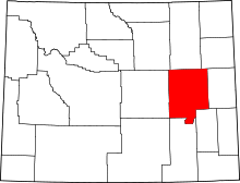 Location in the U.S. state of Wyoming | |
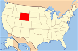 Wyoming's location in the U.S. | |
| Founded | 1888 |
| Seat | Douglas |
| Largest city | Douglas |
| Area | |
| • Total | 4,265 sq mi (11,046 km2) |
| • Land | 4,255 sq mi (11,020 km2) |
| • Water | 10 sq mi (26 km2), 0.2% |
| Population (est.) | |
| • (2015) | 14,236 |
| • Density | 3.3/sq mi (1/km²) |
| Congressional district | At-large |
| Time zone | Mountain: UTC-7/-6 |
| Website |
conversecounty |
Converse County is a county located in the U.S. state of Wyoming. As of the 2010 census, the population was 13,833.[1] Its county seat is Douglas.[2]
History
Converse County was created on March 9, 1888 by the legislature of the Wyoming Territory. The county was formed from land ceded by Albany County and Laramie County[3]
Converse County was named for A.R. Converse, a banker and rancher from Cheyenne, Wyoming. Converse was a partner with Francis E. Warren in a large ranch in the eastern part of Converse County.[4]
In 1911, Converse County lost territory when Niobrara County was created. The boundaries of Converse County were slightly modified in a special election in 1955, and land from Albany County was added.
The elected county commission governs each Wyoming county. Former Commissioner David R. Edwards resigned in January 2012 after three years of service because of health problems. He was a Republican who had previously served in the Wyoming House of Representatives from 2001 to 2008.[5]
Geography
According to the U.S. Census Bureau, the county has a total area of 4,265 square miles (11,050 km2), of which 4,255 square miles (11,020 km2) is land and 10 square miles (26 km2) (0.2%) is water.[6]
Adjacent counties
- Campbell County - north
- Weston County - northeast
- Niobrara County - east
- Platte County - southeast
- Albany County - south
- Carbon County - southwest
- Natrona County - west
- Johnson County - northwest
National protected areas
- Medicine Bow National Forest (part)
- Thunder Basin National Grassland (part)
Major Highways
Demographics
| Historical population | |||
|---|---|---|---|
| Census | Pop. | %± | |
| 1890 | 2,738 | — | |
| 1900 | 3,337 | 21.9% | |
| 1910 | 6,294 | 88.6% | |
| 1920 | 7,871 | 25.1% | |
| 1930 | 7,145 | −9.2% | |
| 1940 | 6,631 | −7.2% | |
| 1950 | 5,933 | −10.5% | |
| 1960 | 6,366 | 7.3% | |
| 1970 | 5,938 | −6.7% | |
| 1980 | 14,069 | 136.9% | |
| 1990 | 11,128 | −20.9% | |
| 2000 | 12,052 | 8.3% | |
| 2010 | 13,833 | 14.8% | |
| Est. 2015 | 14,236 | [7] | 2.9% |
| U.S. Decennial Census[8] 1870–2000[9] 2010–2015[1] | |||
2000 census
As of the census[10] of 2000, there were 12,052 people, 4,694 households, and 3,407 families residing in the county. The population density was 3 people per square mile (1/km²). There were 5,669 housing units at an average density of 1 per square mile (1/km²). The racial makeup of the county was 94.72% White, 0.15% Black or African American, 0.91% Native American, 0.27% Asian, 0.02% Pacific Islander, 2.46% from other races, and 1.47% from two or more races. 5.48% of the population were Hispanic or Latino of any race. 26.6% were of German, 13.5% American, 12.2% English and 11.1% Irish ancestry.
There were 4,694 households out of which 36.50% had children under the age of 18 living with them, 60.60% were married couples living together, 8.40% had a female householder with no husband present, and 27.40% were non-families. Of 4,694 households, 253 were unmarried partner households: 228 heterosexual, 12 same-sex male, and 13 same-sex female.
23.40% of all households were made up of individuals and 9.00% had someone living alone who was 65 years of age or older. The average household size was 2.55 and the average family size was 3.01.
In the county the population was spread out with 28.50% under the age of 18, 7.00% from 18 to 24, 28.10% from 25 to 44, 25.40% from 45 to 64, and 11.00% who were 65 years of age or older. The median age was 38 years. For every 100 females there were 99.40 males. For every 100 females age 18 and over, there were 96.40 males.
The median income for a household in the county was $39,603, and the median income for a family was $45,905. Males had a median income of $36,443 versus $19,032 for females. The per capita income for the county was $18,744. About 9.20% of families and 11.60% of the population were below the poverty line, including 15.70% of those under age 18 and 9.70% of those age 65 or over.
2010 census
As of the 2010 United States Census, there were 13,833 people, 5,673 households, and 3,860 families residing in the county.[11] The population density was 3.3 inhabitants per square mile (1.3/km2). There were 6,403 housing units at an average density of 1.5 per square mile (0.58/km2).[12] The racial makeup of the county was 95.1% white, 0.8% American Indian, 0.3% black or African American, 0.3% Asian, 0.1% Pacific islander, 1.7% from other races, and 1.7% from two or more races. Those of Hispanic or Latino origin made up 6.3% of the population.[11] In terms of ancestry, 36.8% were German, 19.8% were Irish, 18.0% were English, and 6.2% were American.[13]
Of the 5,673 households, 32.3% had children under the age of 18 living with them, 55.3% were married couples living together, 8.2% had a female householder with no husband present, 32.0% were non-families, and 26.5% of all households were made up of individuals. The average household size was 2.42 and the average family size was 2.93. The median age was 39.0 years.[11]
The median income for a household in the county was $54,599 and the median income for a family was $69,057. Males had a median income of $54,863 versus $32,025 for females. The per capita income for the county was $27,656. About 4.5% of families and 7.7% of the population were below the poverty line, including 7.8% of those under age 18 and 7.4% of those age 65 or over.[14]
Communities
City
- Douglas (county seat)
Towns
Census-designated place
Unincorporated communities
See also
References
- 1 2 "State & County QuickFacts". United States Census Bureau. Retrieved January 25, 2014.
- ↑ "Find a County". National Association of Counties. Archived from the original on 2011-05-31. Retrieved 2011-06-07.
- ↑ Long, John H. (2006). "Wyoming: Individual County Chronologies". Wyoming Atlas of Historical County Boundaries. The Newberry Library. Archived from the original on 2011-10-04. Retrieved 2008-01-31.
- ↑ Urbanek, Mae (1988). Wyoming Place Names. Missoula, MT: Mountain Press Publishing Company. ISBN 0-87842-204-8.
- ↑ "David Richard Edwards". wyomingnews.com. Retrieved January 9, 2013.
- ↑ "2010 Census Gazetteer Files". United States Census Bureau. August 22, 2012. Retrieved August 5, 2015.
- ↑ "County Totals Dataset: Population, Population Change and Estimated Components of Population Change: April 1, 2010 to July 1, 2015". Retrieved July 2, 2016.
- ↑ "U.S. Decennial Census". United States Census Bureau. Archived from the original on May 11, 2015. Retrieved August 5, 2015.
- ↑ "Historical Decennial Census Population for Wyoming Counties, Cities, and Towns". Wyoming Department of Administration & Information, Division of Economic Analysis. Retrieved January 25, 2014.
- ↑ "American FactFinder". United States Census Bureau. Archived from the original on 2013-09-11. Retrieved 2011-05-14.
- 1 2 3 "DP-1 Profile of General Population and Housing Characteristics: 2010 Demographic Profile Data". United States Census Bureau. Retrieved 2016-01-12.
- ↑ "Population, Housing Units, Area, and Density: 2010 - County". United States Census Bureau. Retrieved 2016-01-12.
- ↑ "DP02 SELECTED SOCIAL CHARACTERISTICS IN THE UNITED STATES – 2006-2010 American Community Survey 5-Year Estimates". United States Census Bureau. Retrieved 2016-01-12.
- ↑ "DP03 SELECTED ECONOMIC CHARACTERISTICS – 2006-2010 American Community Survey 5-Year Estimates". United States Census Bureau. Retrieved 2016-01-12.
External links
| Wikimedia Commons has media related to Converse County, Wyoming. |
 |
Johnson County | Campbell County | Weston County | |
| Natrona County | |
Niobrara County | ||
| ||||
| | ||||
| Carbon County | Albany County | Platte County |
Municipalities and communities of Converse County, Wyoming, United States | ||
|---|---|---|
| City | | |
| Towns | ||
| CDPs | ||
| Unincorporated communities | ||
Cheyenne (capital) | |
| Topics |
|
| Society |
|
| Regions | |
| Cities | |
| Counties | |
Coordinates: 42°58′N 105°30′W / 42.97°N 105.50°W