List of Pennsylvania state historical markers in Delaware County
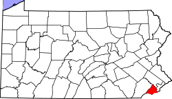
Location of Delaware County in Pennsylvania
This is a list of the Pennsylvania state historical markers in Delaware County.
This is intended to be a complete list of the official state historical markers placed in Delaware County, Pennsylvania by the Pennsylvania Historical and Museum Commission (PHMC). The locations of the historical markers, as well as the latitude and longitude coordinates as provided by the PHMC's database, are included below when available. There are 56 historical markers located in Delaware County.[1]
Historical markers
| Marker title | Image | Date dedicated | Location | Marker type | Topics |
|---|---|---|---|---|---|
| Abraham L. Pennock |  |
October 24, 1985 | At library on Maple Avenue between Wayne and Hazel, off S. State Rd. (SR 2026), Upper Darby 39°57′44″N 75°16′25″W / 39.9623°N 75.2736°W |
Roadside | African American, Government & Politics, Government & Politics 19th Century, Underground Railroad, Women |
| American Viscose Co. | _flickr.jpg) |
October 5, 2002 | Viscose Village Plaza, Marcus Hook 39°49′18″N 75°24′44″W / 39.8217°N 75.4122°W |
Roadside | Buildings, Business & Industry, Entrepreneurs, Labor, Military, Military Post-Civil War, Women |
| Battle of Brandywine | 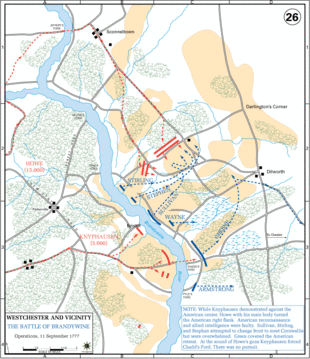 |
May 12, 1952 | US 1, at entrance to Brandywine Battlefield Park | Roadside | American Revolution, George Washington, Military |
| Battle of Brandywine | 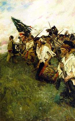 |
May 12, 1952 | US 202/322 just S of Brinton's Bridge/Dilworthtown Rd., 1.6 miles N of US 1, Chadds Ford | Roadside | American Revolution, George Washington, Military |
| Battle of Brandywine | |
May 12, 1952 | U.S. 1, at entrance to Brandywine Battlefield Park 39°49′22″N 75°35′18″W / 39.8227°N 75.5884°W |
Roadside | American Revolution, Military |
| Benjamin West |  |
March 3, 1948 | Pa. 320 in Swarthmore (Missing) | Roadside | Artists |
| Caleb Pusey | 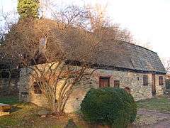 |
June 9, 1967 | Race St. at City Rd., Upland 39°51′06″N 75°33′05″W / 39.8516°N 75.55145°W |
City | Professions & Vocations, Religion, William Penn |
| Casimir Pulaski |  |
September 13, 1975 | U.S. 1 E of Chadds Ford near entrance to Brandywine Battlefield State Park 39°52′25″N 75°34′19″W / 39.8735°N 75.572°W |
Roadside | American Revolution, Ethnic & Immigration, George Washington, Military |
| Chester |  |
October 13, 1947 | U.S. 322 at NW end of city | Roadside | Cities & Towns, Early Settlement, Ethnic & Immigration, Government & Politics, Government & Politics 17th Century, William Penn |
| Colonial Courthouse | 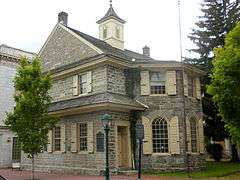 |
May 14, 1954 | Ave. of the States near 5th St., Chester 39°50′53″N 75°21′36″W / 39.848°N 75.3599°W |
City | Buildings, Government & Politics, Government & Politics 18th Century |
| Colonial Gristmill | 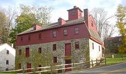 |
May 5, 1959 | U.S. 1, 1 mile E of Concordville 39°53′28″N 75°30′20″W / 39.8911°N 75.5056°W |
Roadside | Buildings, Business & Industry, Ethnic & Immigration, Mills, Religion |
| Darby Friends Burial Ground | 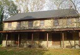 |
June 1952 | Landsdowne Avenue near 12th Street, Darby | Roadside | Religion |
| Delaware County |  |
October 3, 1982 | Courthouse, Front St. & Veterans Sq., Media 39°55′09″N 75°23′31″W / 39.9192°N 75.392°W |
City | Government & Politics, Government & Politics 18th Century, William Penn |
| Dr. George Smith | 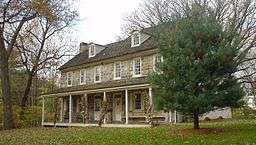 |
October 25, 1985 | Off Marvine Ave. at Mansion Dr. on Collenbrook property, Drexel Hill 39°57′05″N 75°19′16″W / 39.9514°N 75.3211°W |
Roadside | Education, Government & Politics, Government & Politics 19th Century, Medicine & Science, Professions & Vocations |
| Dr. Philip Jaisohn | 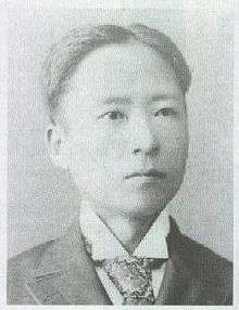 |
May 21, 1994 | 100 E. Lincoln St., Media 39°54′50″N 75°23′16″W / 39.9139°N 75.3877°W |
Roadside | Ethnic & Immigration, Government & Politics, Government & Politics 20th Century, Medicine & Science, Professions & Vocations |
| Fanny Jackson Coppin | 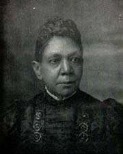 |
February 12, 1986 | Cheyney University campus, off Dilworthtown & Cheyney Rds., Cheyney 39°55′58″N 75°31′40″W / 39.9327°N 75.5277°W |
City | African American, Education, Professions & Vocations, Religion, Women, Writers |
| Finland |  |
May 21, 1955 | Concord Ave. at monument in Chester 39°50′59″N 75°22′41″W / 39.8496°N 75.378°W |
City | Early Settlement, Ethnic & Immigration |
| First Friends Meeting |  |
October 22, 1997 | 24th & Chestnut Sts., Chester 39°52′10″N 75°21′48″W / 39.8695°N 75.3632°W |
City | Religion, William Penn |
| Glen Mills |  |
September 23, 1997 | Railroad Station, Glen Mills 39°55′13″N 75°29′25″W / 39.9204°N 75.4904°W |
Roadside | Business & Industry, Government & Politics, Government & Politics 18th Century, Iron, Mills, Railroads |
| Governor Printz Park | 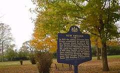 |
June 28, 1948 | At site, 2nd St. & Taylor Ave., Essington 39°51′44″N 75°18′09″W / 39.8623°N 75.3026°W |
Roadside | Early Settlement, Ethnic & Immigration, Government & Politics 17th Century |
| Great Trail (The) - Minquas or Susquehanna Indians (PLAQUE) |  |
June 5, 1926 | Rose Valley Rd. (SR 3019), west side, 1/2 mile S of Moylan 39°53′55″N 75°23′15″W / 39.8985°N 75.3876°W |
Plaque | Early Settlement, Ethnic & Immigration, Native American, Paths & Trails |
| Green-Bank | 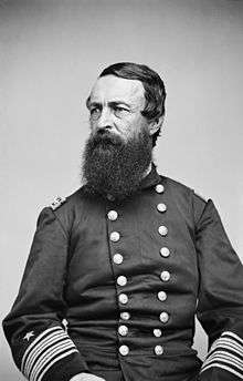 |
May 15, 1954 | 2nd St. near Welsh St., Chester | City | Buildings, Houses & Homesteads, Military |
| Haverford Meeting House | September 24, 1946 | U.S. 30 bypass near Haverford (Missing) | City | Houses & Homesteads, Religion | |
| Hilldale Athletic Club, The (The Darby Daisies) | 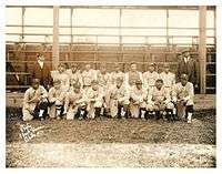 |
October 14, 2006 | Cedar Ave. & MacDade Blvd., Yeadon 39°55′30″N 75°15′23″W / 39.9249°N 75.2565°W |
Roadside | African American, Baseball, Sports |
| Ivy Mills | 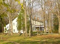 |
September 4, 2001 | 109 Ivy Mill Road at Polecat Road, Glen Mills 39°53′08″N 75°29′06″W / 39.8856°N 75.4849°W |
Roadside | Business & Industry, Government & Politics 18th Century, Mills, Religion |
| J. Edgar Thomson | 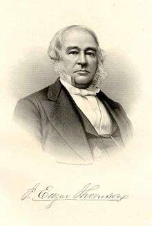 |
June 25, 1991 | Junction SR 2016 (Baltimore Pike) & SR 2027 (Thomson Ave.) just NE of Swarthmore 39°54′57″N 75°20′15″W / 39.91577°N 75.33737°W |
City | Professions & Vocations, Railroads, Transportation |
| John Chadd's House - PLAQUE | 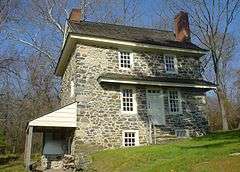 |
September 1915 | Lawn of Chadd homestead on PA 100 just N of US 1, Chadds Ford 39°52′29″N 75°35′30″W / 39.8748°N 75.5917°W |
Plaque | American Revolution, Houses & Homesteads, Military |
| John Morton |  |
January 27, 1967 | 420 E. Ridley Ave., Ridley Park, Chester 39°53′03″N 75°19′07″W / 39.8842°N 75.3185°W |
Roadside | Government & Politics, Government & Politics 18th Century |
| Joshua Humphrey | 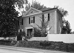 |
October 13, 1947 | SR 1001 (Haverford Ave.) near Haverford 39°59′49″N 75°18′12″W / 39.9969°N 75.3033°W |
Roadside | Military, Professions & Vocations |
| Joshua Pusey |  |
March 27, 1993 | #11 N. Middletown Rd. (Pa. 352), Lima 39°55′25″N 75°26′36″W / 39.9236°N 75.4434°W |
Roadside | Business & Industry, Civil War, Invention, Professions & Vocations, Religion |
| Lazaretto Quarantine Station | October 25, 2008 | 99 Wanamaker Ave., at 2nd St. intersection, Essington 39°51′44″N 75°17′59″W / 39.8622°N 75.2996°W |
Roadside | Ethnic & Immigration, Government & Politics 19th Century, Medicine & Science | |
| Leiper Railway | 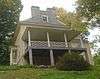 |
February 7, 1955 | SR 2008 (Bullens Ln.) E of Pa. 320, Nether Providence Twp. 39°52′35″N 75°21′27″W / 39.8763°N 75.3576°W |
Roadside | Railroads, Transportation |
| Lower Swedish Cabin | 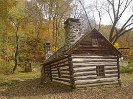 |
October 21, 1989 | At site on Creek Rd., Clifton Heights 39°56′17″N 75°18′05″W / 39.93818°N 75.30152°W |
City | Early Settlement, Ethnic & Immigration |
| Marcus Hook | |
October 13, 1947 | U.S. 13 at Municipal Bldg., Marcus Hook 39°49′08″N 75°25′08″W / 39.819°N 75.4188°W |
Roadside | Business & Industry, Early Settlement, Ethnic & Immigration |
| Martin Luther King, Jr. | 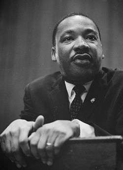 |
January 14, 1984 | Calvary Baptist Church, 1616 W. 2nd St. (Pa. 291), Chester 39°50′14″N 75°22′40″W / 39.8373°N 75.3779°W |
City | African American, Civil Rights, Religion |
| Martin Luther King, Jr. | |
July 27, 1992 | Crozer-Chester Medical Center, One Medical Center Blvd., Upland 39°51′21″N 75°22′15″W / 39.8559°N 75.3709°W |
City | African American, Civil Rights, Religion |
| Minquas' Path | |
October 13, 1947 | SR 3019 (Rose Valley Rd.) west side, 1/2 mile S of Moylan 39°53′55″N 75°23′15″W / 39.8985°N 75.3876°W |
Roadside | Native American, Paths & Trails, Transportation |
| Morton Homestead | 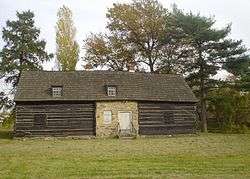 |
September 9, 1966 | At site, Pa. 420 at Darby Creek, Prospect Park 39°52′39″N 75°18′19″W / 39.8774°N 75.3053°W |
Roadside | Early Settlement, Government & Politics, Government & Politics 17th Century |
| Morton Mortonson House | 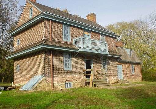 |
March 6, 1955 | Winona St. & Amosland Rd., Norwood (Missing) | Roadside | Buildings, Houses & Homesteads |
| New Sweden |  |
April 9, 1988 | Governor Printz Park, 2nd St. & Taylor Ave., Essington 39°51′40″N 75°18′10″W / 39.861°N 75.3027°W |
Roadside | Early Settlement, Ethnic & Immigration, Exploration |
| Old Haverford Friends' Meeting | 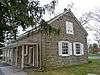 |
October 24, 1975 | SR 1005 (E. Eagle Rd.) at St. Denis Ave., Havertown 39°59′28″N 75°18′17″W / 39.991°N 75.3048°W |
Roadside | Religion, William Penn |
| Old Swedish Burial Ground |  |
May 15, 1954 | 3rd St., E of Ave. of the States 39°50′50″N 75°21′30″W / 39.8472°N 75.3584°W |
City | Ethnic & Immigration, Religion |
| Penn Landing | 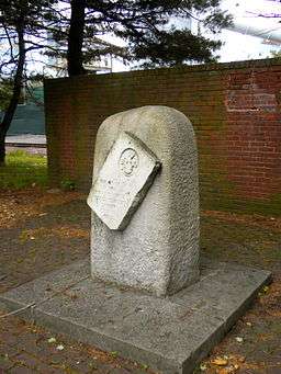 |
October 13, 1947 | SE corner, 2nd (Pa. 291) & Penn Sts., Chester 39°50′39″N 75°21′41″W / 39.84413°N 75.36143°W |
Roadside | Early Settlement, Exploration, Government & Politics, Government & Politics 17th Century, William Penn |
| Pennsylvania |  |
May 12, 1949 | U.S. 202 at state line 39°50′21″N 75°32′21″W / 39.8392°N 75.5393°W |
Roadside | Government & Politics, Government & Politics 17th Century, William Penn |
| Pennsylvania | |
May 12, 1949 | U.S. 13 by-pass, approx. 100 feet from state line | Roadside | Government & Politics, Government & Politics 17th Century, William Penn |
| Radnor Meeting House | 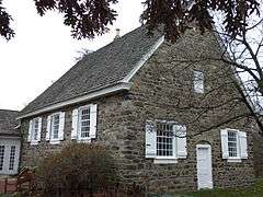 |
October 13, 1947 | Junction Pa. 320 & SR SR 1019 (Conestoga Rd.), Ithan, S of St. Davids 40°01′49″N 75°21′50″W / 40.0303°N 75.364°W |
Roadside | American Revolution, Early Settlement, Houses & Homesteads, Military, Religion |
| Rochambeau Route (Narragansett Bay to Yorktown) | 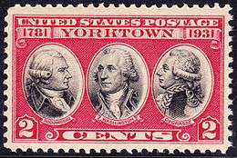 |
October 18, 1954 | U.S. 13 (Morton Ave.) near Melrose Ave., E end of Chester 39°51′31″N 75°21′09″W / 39.8585°N 75.3525°W |
Roadside | American Revolution, Military, Roads, Transportation |
| Sellers Hall | 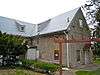 |
October 25, 1985 | N. side Walnut St. between Copley and Glendale Rds., Upper Darby 39°57′25″N 75°15′41″W / 39.9569°N 75.2615°W |
Roadside | Buildings, Early Settlement, Medicine & Science, Professions & Vocations |
| Springfield Friends Meeting |  |
October 25, 1951 | SR 2009 (Old Sproul & W. Springfield Rds.), Springfield 39°56′32″N 75°20′50″W / 39.9423°N 75.3471°W |
Roadside | Artists, Buildings, Education, Religion |
| St. David's Church | 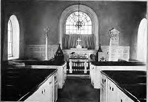 |
October 13, 1947 | SR 1046 (St. David's Rd.) at SR 1017 (Church Rd.) 2 miles SW of Wayne 40°01′21″N 75°23′58″W / 40.0226°N 75.3994°W |
Roadside | American Revolution, Ethnic & Immigration, Military, Religion |
| Sun Shipbuilding and Dry Dock Company |  |
October 6, 2007 | intersection of Industrial Hwy. (Rt. 291) & Harrahs Blvd., Chester | Roadside | Business & Industry, Labor, Military, Military Post-Civil War, Oil & Gas, Steel |
| Thomas Garrett |  |
October 25, 1981 | Garrett Rd. & Maple Ave., Drexel Hill 39°56′46″N 75°17′37″W / 39.9461°N 75.2935°W |
Roadside | African American, Religion, Underground Railroad |
| Thomas Massey House | 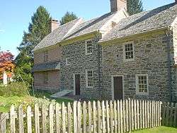 |
May 9, 1986 | 467 Lawrence Rd. (SR 1020), .5 mile NE of Pa. 320, Broomall 39°57′57″N 75°21′06″W / 39.9658°N 75.3518°W |
Roadside | Buildings, Houses & Homesteads |
| Tinicum |  |
October 13, 1947 | Pa. 291 eastbound, just NE of Essington 39°52′02″N 75°17′37″W / 39.8671°N 75.2937°W |
Roadside | Early Settlement, Ethnic & Immigration, Government & Politics 17th Century |
| Washington House | 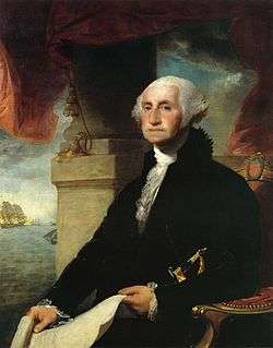 |
May 15, 1954 | Ave. of the States near 5th St., Chester 39°50′53″N 75°21′35″W / 39.8481°N 75.3596°W |
City | American Revolution, Buildings, George Washington, Houses & Homesteads |
| William Penn (1644-1718) - "Essex House" - PLAQUE | 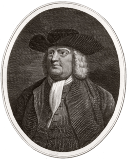 |
October 1932 | 102 Penn St., Chester | Plaque | Early Settlement, Houses & Homesteads, William Penn |
| Williamson Free School of Mechanical Trades | 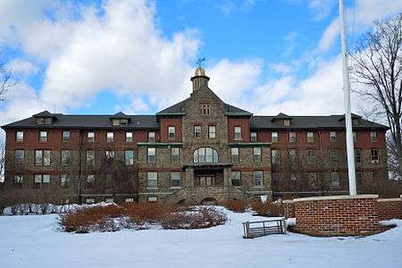 |
June 1, 2013 | 106 S New Middletown Rd, Media | Roadside | Buildings, Schools |
See also
- List of Pennsylvania state historical markers
- National Register of Historic Places listings in Delaware County, Pennsylvania
References
- ↑ "PHMC Historical Markers Search" (Searchable database). Pennsylvania Historical and Museum Commission. Commonwealth of Pennsylvania. Retrieved 2010-07-19.
External links
Municipalities and communities of Delaware County, Pennsylvania, United States | ||
|---|---|---|
| City | | |
| Boroughs | ||
| Townships | ||
| CDPs | ||
| Unincorporated communities |
| |
| Footnotes | ‡This populated place also has portions in an adjacent county or counties | |
This article is issued from Wikipedia - version of the 9/22/2016. The text is available under the Creative Commons Attribution/Share Alike but additional terms may apply for the media files.