Boothwyn, Pennsylvania
| Boothwyn, Pennsylvania | |
| Census-designated place | |
 Fire engine in front of Boothwyn Elementary School | |
| Country | United States |
|---|---|
| State | Pennsylvania |
| County | Delaware |
| Township | Upper Chichester |
| Elevation | 98 ft (29.9 m) |
| Coordinates | 39°50′06″N 75°26′40″W / 39.83500°N 75.44444°WCoordinates: 39°50′06″N 75°26′40″W / 39.83500°N 75.44444°W |
| Area | 1.2 sq mi (3.1 km2) |
| - land | 1.2 sq mi (3 km2) |
| - water | 0.0 sq mi (0 km2), 0% |
| Population | 4,933 (2010) |
| Density | 3,954.3/sq mi (1,526.8/km2) |
| Timezone | EST (UTC-5) |
| - summer (DST) | EDT (UTC-4) |
| ZIP code | 19061 |
| Area code | 610 and 484 |
| FIPS code | 42-07616 |
| GNIS feature ID | 1170006 |
 Location of Boothwyn in Pennsylvania
| |
 Location of Pennsylvania in the United States
| |
Boothwyn is a census-designated place (CDP) in Delaware County, Pennsylvania, United States. The population was 4,933 at the 2010 census,[1] down from 5,206 at the 2000 census.
History
The Chichester Friends Meeting, which was organized in 1682, with the current building constructed in 1769, is listed on the National Register of Historic Places.[2] Bill Haley, who pioneered Rock n' Roll with Bill Haley & His Comets, was a long-time resident of Boothwyn.
Geography
Boothwyn is located in southwestern Delaware County at 39°50′6″N 75°26′40″W / 39.83500°N 75.44444°W (39.835115, -75.444507),[3] in the southern part of Upper Chichester Township. The CDP contains the unincorporated communities of Boothwyn (southern part of the CDP) and Gardendale (northern part). Boothwyn is 6 miles (10 km) southwest of Chester and 10 miles (16 km) northeast of Wilmington, Delaware.
According to the United States Census Bureau, the CDP has a total area of 1.25 square miles (3.23 km2), all of it land.[1]
The Boothwyn, Reliance, and Ogden fire companies are located in Boothwyn.
Educational system
Boothwyn is a part of Chichester School District. Children within the area usually attend Boothwyn Elementary School or Hilltop School (Grades K-4), Chichester Middle School (Grades 5-8), or Chichester High School (Grades 9-12).
Demographics
As of the census[4] of 2000, there were 5,206 people, 2,047 households, and 1,367 families residing in the CDP. The population density was 4,236.1 people per square mile (1,634.2/km²). There were 2,126 housing units at an average density of 1,729.9/sq mi (667.4/km²). The racial makeup of the CDP was 90.70% White, 6.13% African American, 0.10% Native American, 1.67% Asian, 0.02% Pacific Islander, 0.40% from other races, and 0.98% from two or more races. Hispanic or Latino of any race were 1.11% of the population.

There were 2,047 households, out of which 29.0% had children under the age of 18 living with them, 49.6% were married couples living together, 12.7% had a female householder with no husband present, and 33.2% were non-families. 26.4% of all households were made up of individuals, and 9.2% had someone living alone who was 65 years of age or older. The average household size was 2.54 and the average family size was 3.12.
In the CDP the population was spread out, with 22.7% under the age of 18, 9.0% from 18 to 24, 31.8% from 25 to 44, 23.7% from 45 to 64, and 12.8% who were 65 years of age or older. The median age was 37 years. For every 100 females there were 91.6 males. For every 100 females age 18 and over, there were 89.3 males.
The median income for a household in the CDP was $46,433, and the median income for a family was $60,096. Males had a median income of $41,793 versus $29,962 for females. The per capita income for the CDP was $23,811. About 6.7% of families and 6.2% of the population were below the poverty line, including 9.2% of those under age 18 and 7.1% of those age 65 or over.
| Historical population | |||
|---|---|---|---|
| Census | Pop. | %± | |
| 2000 | 5,206 | — | |
| 2010 | 4,933 | −5.2% | |
| Sources:[5][4][6] | |||
References
- 1 2 "Geographic Identifiers: 2010 Demographic Profile Data (G001): Boothwyn CDP, Pennsylvania". U.S. Census Bureau, American Factfinder. Retrieved December 30, 2015.
- ↑ National Park Service (2010-07-09). "National Register Information System". National Register of Historic Places. National Park Service.
- ↑ "US Gazetteer files: 2010, 2000, and 1990". United States Census Bureau. 2011-02-12. Retrieved 2011-04-23.
- 1 2 "American FactFinder". United States Census Bureau. Archived from the original on 2013-09-11. Retrieved 2008-01-31.
- ↑ "Census of Population and Housing". U.S. Census Bureau. Archived from the original on 11 May 2015. Retrieved 11 December 2013.
- ↑ "Incorporated Places and Minor Civil Divisions Datasets: Subcounty Resident Population Estimates: April 1, 2010 to July 1, 2012". Population Estimates. U.S. Census Bureau. Archived from the original on 17 June 2013. Retrieved 11 December 2013.
Municipalities and communities of Delaware County, Pennsylvania, United States | ||
|---|---|---|
| City | 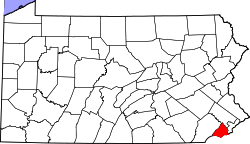 | |
| Boroughs | ||
| Townships | ||
| CDPs | ||
| Unincorporated communities |
| |
| Footnotes | ‡This populated place also has portions in an adjacent county or counties | |