Lower Paxton Township, Dauphin County, Pennsylvania
| Lower Paxton Township, Pennsylvania | |
|---|---|
| Township | |
|
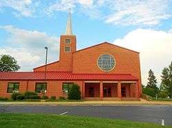
Colonial Park United Church of Christ | |
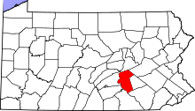
 Location in Dauphin County and state of Pennsylvania. | |
| Country | United States |
| State | Pennsylvania |
| County | Dauphin |
| Settled | 1717 |
| Incorporated | 1729 |
| Area | |
| • Total | 28.2 sq mi (73.0 km2) |
| • Land | 28.2 sq mi (73.0 km2) |
| • Water | 0.0 sq mi (0.0 km2) |
| Population (2010) | |
| • Total | 47,360 |
| • Density | 1,681/sq mi (649.1/km2) |
| Time zone | Eastern (EST) (UTC-5) |
| • Summer (DST) | EDT (UTC-4) |
| Area code(s) | 717 |
| Website |
lowerpaxton-pa |
Lower Paxton Township is a township in Dauphin County, Pennsylvania, United States. The township was incorporated in 1767 from Paxton Township. The population was 47,360 at the 2010 census.[1] It is the second-most populous municipality in the county, after Harrisburg (population 49,673).[2]
History
In 1729 the Paxtang Township was established within Lancaster County. The spelling "Paxtang" is from the original Indian name Peshtank, which meant "standing water".[3] Today the word "Paxton" is used instead of Paxtang.
On March 4, 1785, the boundaries of Paxtang Township also became the borders of Dauphin County, split from Lancaster County. "Dauphin" refers to the Dauphin of France, heir apparent to the French throne, whose country the area government wanted to honor for its assistance in the Revolutionary War. About two years later in August 1787 the legislature began to splinter Paxtang Township, first into Upper Paxtang, Middle Paxtang and Lower Paxtang.[4]
In the years after Dauphin County was established, the township was slowly divided. Hanover Township was cut off to the east in 1736, and Upper Paxton Township was cut off to the north in 1767. What remained in 1767 was then renamed Lower Paxton Township. The divisions continued. Harrisburg Borough (now the city of Harrisburg) was formed in 1791, and Swatara Township was created in 1799. In 1878 more land was cut off the north and became Middle Paxton Township.
Lower Paxtang Township embraced the areas now occupied by Lower Swatara, Swatara, Lower Paxton, Derry and Susquehanna townships. Lower Paxton has remained the same area since Susquehanna Township was formed from it on May 1, 1815.
Geography
Lower Paxton Township is located in south-central Dauphin County, bordered by Susquehanna Township to the west, Middle Paxton Township to the north, West Hanover and South Hanover townships to the east, and Swatara Township to the south. The eastern border of Lower Paxton Township is formed by Beaver Creek, a south-flowing tributary of Swatara Creek, which flows to the Susquehanna River. The northern border of the township follows or is close to the crest of Blue Mountain, the southernmost ridge of the Ridge-and-Valley Appalachians in this region. According to the United States Census Bureau, the township has a total area of 28.1 square miles (72.8 km²), all of it land.
There are four unincorporated communities, all of which are census-designated places, in Lower Paxton Township. Linglestown (population 6,334) is in the northeast part of the township, Paxtonia (population 5,412) is in the center, Colonial Park (population 13,229) is in the west and southwest, and a small portion of Progress is in the far west, though it is mainly in Susquehanna Township.
Interstate 83 runs through the western part of the township, terminating at Interstate 81, which crosses the center of the township from west to east. I-83 access in the township is from Exit 50 (U.S. Route 22/Jonestown Road) and Exit 48 (Union Deposit Road), while I-81 access is from Exit 72, between Linglestown and Paxtonia.
Demographics
As of the census[5] of 2000, there were 44,424 people, 18,584 households, and 12,153 families residing in the township. The population density was 1,580.9 people per square mile (610.4/km²). There were 19,606 housing units at an average density of 697.7/sq mi (269.4/km²). The racial makeup of the township was 86.51% White, 8.28% African American, 0.10% Native American, 2.69% Asian, 0.02% Pacific Islander, 1.04% from other races, and 1.35% from two or more races. Hispanic or Latino of any race were 2.37% of the population.
There were 18,584 households, out of which 29.0% had children under the age of 18 living with them, 53.2% were married couples living together, 9.2% had a female householder with no husband present, and 34.6% were non-families. 28.8% of all households were made up of individuals, and 8.4% had someone living alone who was 65 years of age or older. The average household size was 2.35 and the average family size was 2.92.
In the township the population was spread out, with 22.5% under the age of 18, 7.3% from 18 to 24, 30.9% from 25 to 44, 25.2% from 45 to 64, and 14.1% who were 65 years of age or older. The median age was 39 years. For every 100 females there were 91.4 males. For every 100 females age 18 and over, there were 87.8 males.
The median income for a household in the township was $49,566, and the median income for a family was $61,017. Males had a median income of $41,147 versus $30,837 for females. The per capita income for the township was $26,116. About 3.2% of families and 4.1% of the population were below the poverty line, including 5.0% of those under age 18 and 2.5% of those age 65 or over.
Infrastructure
In 2002 the Department of Environmental Protection mandated that the township eliminate sewer overflows in the Paxton Creek Basin by 2012. Overflows happen when extra water goes out manholes during heavy storms. The project involves the replacement of 42 miles (68 km) of asbestos cement pipes in the Paxton Creek basin, which drains the western half of the township. The $67 million plan will be paid for by residents' sewer bills which will double over the next 20 years.[6]
Ongoing pollution and soil erosion in the region continue to degrade the water quality and the environment locally as well as regionally. Farming, wastewater treatment facilities and industrial spills are cited as contributing factors to loss of water quality. It also contributes to the pollution of the Chesapeake Bay. Controlling the wastewater discharges alone is expected to cost local taxpayers along the Susquehanna River billions of dollars.[7]
Plans for a greenways project are moving forward. Part of the comprehensive plan developed in 2004, the greenway will connect via trails several neighborhoods to five schools, two parks and the Lower Paxton Township Municipal Building. The cost of the multiyear project is estimated at $14 million.[8]
In 2006, the Foundation for Enhancing Communities conducted an extensive study. They identified five critical lissues for Dauphin County which include access to health care, transportation to jobs, substance abuse, job training/workforce development and affordable housing.[9]
Environment
Local waterways have been significantly impacted by development. The Paxton Creek watershed, which drains much of the northern part of the township and flows west to the Susquehanna River, has experienced substantial change in land uses during the past several decades. Development is encroaching on some of Paxton Creek's headwaters. This has affected water levels and flow patterns, and caused significant erosion, sedimentation, and flooding. This 27-square-mile (70 km2) watershed now produces over twice the nutrients and 10 times the yields of suspended sediments that are released by typical forested basins, according to the Paxton Creek Watershed and Education Association.[10]
Education
Children in the township attend public school the Central Dauphin School District.
References
- ↑ "Geographic Identifiers: 2010 Demographic Profile Data (G001): Lower Paxton township, Dauphin County, Pennsylvania". U.S. Census Bureau, American Factfinder. Retrieved December 17, 2015.
- ↑ "Geographic Identifiers: 2010 Demographic Profile Data (G001): All County Subdivisions within Dauphin County, Pennsylvania". U.S. Census Bureau, American Factfinder. Retrieved December 17, 2015.
- ↑ "Early history". Reading Eagle. Jun 9, 1896. p. 25. Retrieved 18 October 2015.
- ↑
- ↑ "American FactFinder". United States Census Bureau. Archived from the original on 2013-09-11. Retrieved 2008-01-31.
- ↑ Fishlock, Diane. "Lower Paxton Twp. approves $67 million sewer plan", July 3, 2007. The Patriot News.
- ↑ Reducing Wastewater Pollution, Chesapeake Bay Foundation. July 2002.
- ↑ Fishlock, Diane Firm presents Lower Paxton Twp. greenways plan The Patriot News. July 10, 2007
- ↑ Critical Issues Community Investment", The Foundation for Enhancing Communities. Harrisburg, PA Sept. 2006.
- ↑ 2005 State Land Use and Growth Management Report, Pennsylvania Office of Community and Economic Development.
External links
Coordinates: 40°20′00″N 76°47′59″W / 40.33333°N 76.79972°W