Wallingford, Pennsylvania
| Wallingford, Pennsylvania | |
| Settlement | |
 Wallingford post office | |
| Country | United States |
|---|---|
| State | Pennsylvania |
| County | Delaware |
| Township | Nether Providence |
| Elevation | 131 ft (39.9 m) |
| Coordinates | 39°53′27″N 75°21′47″W / 39.89083°N 75.36306°WCoordinates: 39°53′27″N 75°21′47″W / 39.89083°N 75.36306°W |
| Timezone | EST (UTC-5) |
| - summer (DST) | EDT (UTC-4) |
| ZIP code | 19086 |
| Area code | 484, 610 |
 Location of Wallingford in Pennsylvania | |
 Location of Pennsylvania in the United States | |
| Website: http://www.netherprovidence.org | |
Wallingford is an unincorporated community in Nether Providence Township, Delaware County in Pennsylvania, United States. Founded in 1687, it is named for Wallingford, England. In 2007, Wallingford was named by Money Magazine as the 9th best place to live in the United States; two other towns in the area made the top 15.[1]
It is west of Interstate 476 (known locally as the "Blue Route") and east of S. Providence Road, PA 252. Crum Creek forms the township's eastern border with Swarthmore Borough. Wallingford lies north of Chester on the southwest edge of the Philadelphia urban area. Wallingford is about 9 miles from Philadelphia proper.

Located in Wallingford is the Helen Kate Furness Free Library,[2] which was renovated in 2006. There is a dry cleaning shop and a post office. Various doctors, dentists and lawyers are also located in Wallingford.
About half a dozen churches and chapels of several denominations are located in Wallingford, including Wallingford Presbyterian Church,[3] St. John Chrysostom Catholic Church on Providence Road and the Foundry Church,[4] near Media Parkway. Wallingford is also home to Congregation Ohev Shalom,[5] a conservative synagogue located at the corner of Rt. 252 and Rt. 320.
The local school district is the Wallingford-Swarthmore School District, which serves Wallingford, Swarthmore, Rutledge, and parts of Media, Morton and Rose Valley.
Wallingford is located along SEPTA's Media/Elwyn Line, and has a station whose design is attributed to the well-known Victorian architect Frank Furness. Wallingford is about 30 minutes from center city Philadelphia by rail. Effective July 1, 2013, the one-way ticketed fares are $5.75 weekdays and $5.00 evenings and weekends. On-board cash fares are $7.00 at all times.
The township's municipal offices are located at 214 Sykes Lane.
The Thomas Leiper Estate, Westlawn and Wolley Stille are listed on the National Register of Historic Places.[6]
Demographics

As of the census of 2000, Wallingford was declared a primarily white town. More specifically there were 13,456 people, 5,007 households and 3,755 families residing in the township. The population density was 2,857.7 people per square mile (1,103.1/km²). There were 5,125 housing units at an average density of 1,088.4/sq mi (420.1/km²). The racial makeup of the township was 88.08% White, 8.12% African American, 0.10% Native American, 2.34% Asian, 0.04% Pacific Islander, 0.27% from other races and 1.06% from two or more races. 1.13% of the population were Hispanic or Latino of any race.
There were 5,007 households, out of which 34.5% had children under the age of 18 living with them, 62.3% were married couples living together, 9.8% had a female householder with no husband present, and 25.0% were non-families. 21.7% of all households were made up of individuals, and 10.4% had someone living alone who was 65 years of age or older. The average household size was 2.62 and the average family size was 3.08.
In the township the population was spread out, with 25.4% under the age of 18, 4.9% from 18 to 24, 25.8% from 25 to 44, 26.3% from 45 to 64 and 17.5% who were 65 years of age or older. The median age was 42 years. For every 100 females there were 90.8 males. For every 100 females age 18 and over, there were 85.8 males.
The median income for a household in the town was $86,059, and the median income for a family was $93,491. Males had a median income of $72,370 versus $49,048 for females. The per capita income for the township was $36,946. About 3.1% of families and 3.4% of the population were below the poverty line, including 5.2% of those under age 18 and 2.1% of those age 65 or over.

Points of interest
- Pendle Hill Quaker Center for Study and Contemplation
- Taylor Memorial Arboretum
- Community Arts Center
- Saint John Chrysostom R.C.
Notable residents
- Edward Potts Cheyney (1861-1947), American historical and economic writer
- Dan Connor (born 1985), former American football linebacker
- Ida Dixon (1854-1916), American golf course architect
Neighborhoods
- Pendlehill
- Avonbrook
- Ridgewood
- South Summit
- Wallingford
- South Wallingford
- East Wallingford
- Bowling Green
- Pine Ridge
- Heatherwold
References
- ↑ Three Local Towns Make Top 15 Places To Live, Wallingford Makes Top 10
- ↑
- ↑ Wallingford Presbyterian Church
- ↑ The Foundry Church
- ↑ Congregation Ohev Shalom
- ↑ National Park Service (2010-07-09). "National Register Information System". National Register of Historic Places. National Park Service.
External links
Municipalities and communities of Delaware County, Pennsylvania, United States | ||
|---|---|---|
| City | 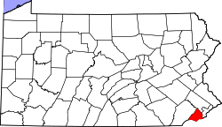 | |
| Boroughs | ||
| Townships | ||
| CDPs | ||
| Unincorporated communities |
| |
| Footnotes | ‡This populated place also has portions in an adjacent county or counties | |