| [3] |
Name on the Register |
Image |
Date listed[4] |
Location |
Municipality |
Description |
|---|
| 1 |
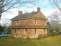
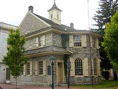
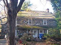
1724 Chester Courthouse |
|
000000001971-05-27-0000May 27, 1971
(#71000702) |
Market Street below 5th Street
39°50′52″N 75°21′36″W / 39.8478°N 75.36°W / 39.8478; -75.36 (1724 Chester Courthouse) |
Chester |
|
| 2 |
Henry Albertson Subdivision Historic District |
|
000000001998-01-30-0000January 30, 1998
(#98000044) |
Roughly bounded by North Lansdowne, Clover, Wycombe, Price, and Stewart Avenues, and Balfour Cir.
39°56′34″N 75°16′21″W / 39.942778°N 75.2725°W / 39.942778; -75.2725 (Henry Albertson Subdivision Historic District) |
Lansdowne |
|
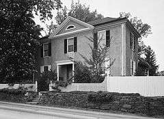
| 3 |
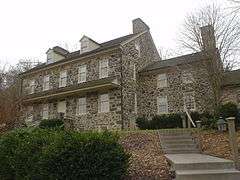
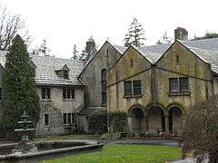
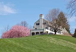
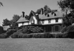
Allgates |
|
000000001979-05-15-0000May 15, 1979
(#79002222) |
Coopertown Road
39°59′54″N 75°19′36″W / 39.998333°N 75.326667°W / 39.998333; -75.326667 (Allgates) |
Haverford Township |
Wilson Eyre, architect (1910, expanded 1917).
|
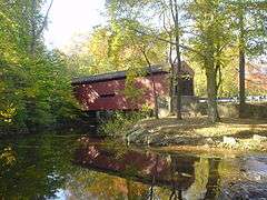
| 4 |
Bartram's Covered Bridge |
|
000000001980-12-10-0000December 10, 1980
(#80003462) |
West of Newtown on Legislative Route 15098
39°59′23″N 75°26′15″W / 39.989722°N 75.4375°W / 39.989722; -75.4375 (Bartram's Covered Bridge) |
Newtown Township |
Extends into Willistown Township in Chester County
|
| 5 |
Booth Farm |
|
000000002003-06-13-0000June 13, 2003
(#03000527) |
3221 Foulk Road
39°51′15″N 75°29′24″W / 39.854167°N 75.49°W / 39.854167; -75.49 (Booth Farm) |
Bethel Township |
|
| 6 |
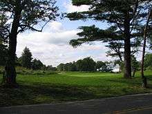
Brandywine Battlefield |
|
000000001966-10-15-0000October 15, 1966
(#66000660) |
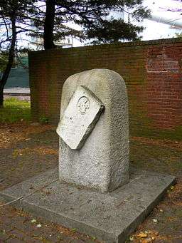
Brandywine Battlefield Park
39°53′17″N 75°35′37″W / 39.888056°N 75.593611°W / 39.888056; -75.593611 (Brandywine Battlefield) |
Chadds Ford Township |
|
| 7 |
Brandywine Summit Camp Meeting |
|
000000001995-02-24-0000February 24, 1995
(#95000132) |
119 Beaver Valley Road, Chadds Ford
39°51′04″N 75°32′50″W / 39.851111°N 75.547222°W / 39.851111; -75.547222 (Brandywine Summit Camp Meeting) |
Concord Township |
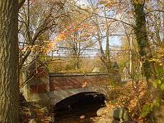
|
| 8 |
Bridge in Radnor Township No. 1 |
|
000000001988-06-22-0000June 22, 1988
(#88000791) |
Goshen Road over Darby Creek
40°00′13″N 75°22′19″W / 40.003611°N 75.371944°W / 40.003611; -75.371944 (Bridge in Radnor Township No. 1) |
Radnor Township |
|
| 9 |
Bridge in Radnor Township No. 2 |
|
000000001988-06-22-0000June 22, 1988
(#88000784) |
Bryn Mawr Avenue over Meadow Brook Creek
40°00′41″N 75°20′39″W / 40.011389°N 75.344167°W / 40.011389; -75.344167 (Bridge in Radnor Township No. 2) |
Radnor Township |
|
| 10 |
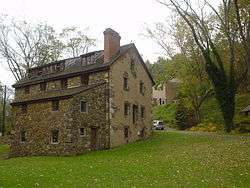
Camp-Woods |
|
000000001983-09-01-0000September 1, 1983
(#83002239) |
745 Newtown Road
40°01′15″N 75°22′30″W / 40.020833°N 75.375°W / 40.020833; -75.375 (Camp-Woods) |
Radnor Township |
|
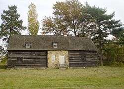
| 11 |
Chad House |
|
000000001971-03-11-0000March 11, 1971
(#71000698) |
Pennsylvania Route 100
39°52′29″N 75°35′31″W / 39.874722°N 75.591944°W / 39.874722; -75.591944 (Chad House) |
Chadds Ford Township |
|
| 12 |
Chadds Ford Historic District |
|
000000001971-11-23-0000November 23, 1971
(#71000699) |
Junction of U.S. Route 1 and Pennsylvania Route 100
39°52′17″N 75°35′31″W / 39.871389°N 75.591944°W / 39.871389; -75.591944 (Chadds Ford Historic District) |
Chadds Ford Township |
|
| 13 |
Chamberlain-Pennell House |
|
000000001977-12-27-0000December 27, 1977
(#77001165) |
West of Media off U.S. Route 1 at Valley Brook Road
39°53′52″N 75°28′47″W / 39.897778°N 75.479722°W / 39.897778; -75.479722 (Chamberlain-Pennell House) |
Chester Heights |
|
| 14 |
Chanticleer |
|
000000001984-07-24-0000July 24, 1984
(#84003350) |
786 Church Road[5]
40°01′50″N 75°23′12″W / 40.0305°N 75.3866°W / 40.0305; -75.3866 (Chanticleer) |
Radnor Township |
|
| 15 |
Chester Creek Historic District |
|
000000001972-03-24-0000March 24, 1972
(#72001120) |
North, east, and south of Glen Mills along the western branch of Chester Creek
39°55′23″N 75°29′27″W / 39.923056°N 75.490833°W / 39.923056; -75.490833 (Chester Creek Historic District) |
Thornbury Township |
|
| 16 |
Chester Heights Camp Meeting Historic District |
|
000000002001-05-08-0000May 8, 2001
(#01000460) |
320 Valley Brook Road
39°53′24″N 75°28′03″W / 39.89°N 75.4675°W / 39.89; -75.4675 (Chester Heights Camp Meeting Historic District) |
Chester Heights |
|
| 17 |
Chester Waterside Station of the Philadelphia Electric Company |
|
000000002007-05-24-0000May 24, 2007
(#07000467) |
2501 Seaport Dr.
39°49′45″N 75°23′02″W / 39.829167°N 75.383889°W / 39.829167; -75.383889 (Chester Waterside Station of the Philadelphia Electric Company) |
Chester |
|
| 18 |
John Cheyney Log Tenant House and Farm |
|
000000001978-11-21-0000November 21, 1978
(#78002390) |
Station Road
39°55′50″N 75°30′52″W / 39.930556°N 75.514444°W / 39.930556; -75.514444 (John Cheyney Log Tenant House and Farm) |
Thornbury Township |
|
| 19 |
Chichester Friends Meetinghouse |
|
000000001973-03-14-0000March 14, 1973
(#73001622) |
611 Meetinghouse Road
39°50′11″N 75°25′53″W / 39.836389°N 75.431389°W / 39.836389; -75.431389 (Chichester Friends Meetinghouse) |
Upper Chichester Township |
|
| 20 |
Collen Brook Farm |
|
000000001988-12-22-0000December 22, 1988
(#88003048) |
Off Mansion and Marvine Roads
39°57′05″N 75°19′16″W / 39.951389°N 75.321111°W / 39.951389; -75.321111 (Collen Brook Farm) |
Upper Darby Township |
|
| 21 |
Concord Friends Meetinghouse |
|
000000001977-06-17-0000June 17, 1977
(#77001164) |
Old Concord Road
39°53′07″N 75°31′13″W / 39.885278°N 75.520278°W / 39.885278; -75.520278 (Concord Friends Meetinghouse) |
Concord Township |
|
| 22 |
Concordville Historic District |
|
000000001973-04-03-0000April 3, 1973
(#73001624) |
Concord Road and Baltimore Pike
39°53′09″N 75°31′15″W / 39.885833°N 75.520833°W / 39.885833; -75.520833 (Concordville Historic District) |
Concord Township |
|
| 23 |
Crosley-Garrett Mill Workers' Housing, Store and Mill Site |
|
000000002003-02-27-0000February 27, 2003
(#03000074) |
Paper Mill Road and St. David's Road
40°01′09″N 75°24′16″W / 40.019167°N 75.404444°W / 40.019167; -75.404444 (Crosley-Garrett Mill Workers' Housing, Store and Mill Site) |
Newtown Township |
|
| 24 |
George K. Crozer Mansion |
|
000000001973-08-14-0000August 14, 1973
(#73001625) |
6th Street
39°51′19″N 75°23′16″W / 39.855278°N 75.387778°W / 39.855278; -75.387778 (George K. Crozer Mansion) |
Upland |
Destroyed by fire in June 1990, and subsequently demolished.
|
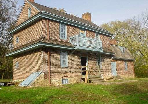
| 25 |
John P. Crozer II Mansion |
|
000000001980-07-23-0000July 23, 1980
(#80003486) |
900, 922, 924 and 926 Main Street
39°51′31″N 75°23′00″W / 39.858611°N 75.383333°W / 39.858611; -75.383333 (John P. Crozer II Mansion) |
Upland |
|
| 26 |
Darby Meeting |
|
000000001978-09-13-0000September 13, 1978
(#78002392) |
1017 Main Street
39°55′15″N 75°15′48″W / 39.920833°N 75.263333°W / 39.920833; -75.263333 (Darby Meeting) |
Darby |
|
| 27 |
Delaware County National Bank |
|
000000001987-11-05-0000November 5, 1987
(#87001947) |
1 West Third Street
39°50′49″N 75°21′34″W / 39.846944°N 75.359444°W / 39.846944; -75.359444 (Delaware County National Bank) |
Chester |
|
| 28 |
Downtown Wayne Historic District |
|
000000002012-09-05-0000September 5, 2012
(#12000607) |
Roughly bounded by Louella Ct., West Ave., and S. Wayne Ave., at Wayne
40°02′41″N 75°23′07″W / 40.044736°N 75.385202°W / 40.044736; -75.385202 (Downtown Wayne Historic District) |
Radnor Township |
|
| 29 |
Eden Cemetery |
|
000000002010-12-13-0000December 13, 2010
(#10001031) |
1434 Springfield Rd.
39°55′20″N 75°16′24″W / 39.922222°N 75.273333°W / 39.922222; -75.273333 (Eden Cemetery) |
Collingdale |
|
| 30 |
Federal School |
|
000000001971-11-05-0000November 5, 1971
(#71000704) |
Haverford-Darby Road
39°59′48″N 75°19′34″W / 39.996667°N 75.326111°W / 39.996667; -75.326111 (Federal School) |
Haverford County |
|
| 31 |
Forge Hill |
|
000000001973-03-07-0000March 7, 1973
(#73001627) |
Off U.S. Route 1
39°54′02″N 75°27′48″W / 39.900556°N 75.463333°W / 39.900556; -75.463333 (Forge Hill) |
Chester Heights |
|
| 32 |
Gilpin Homestead |
|
000000001971-05-27-0000May 27, 1971
(#71000700) |
Harvey Road
39°53′02″N 75°33′50″W / 39.883889°N 75.563889°W / 39.883889; -75.563889 (Gilpin Homestead) |
Chadds Ford Township |
|
| 33 |
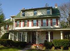
Glenays |
|
000000001977-12-27-0000December 27, 1977
(#77001163) |
926 Coopertown Road
40°00′41″N 75°19′49″W / 40.011389°N 75.330278°W / 40.011389; -75.330278 (Glenays) |
Radnor Township |
|
| 34 |
The Grange |
|
000000001976-01-11-0000January 11, 1976
(#76001636) |
Grove Pl.
39°58′33″N 75°17′05″W / 39.975833°N 75.284722°W / 39.975833; -75.284722 (The Grange) |
Haverford |
|
| 35 |
Handwrought |
|
000000001978-01-18-0000January 18, 1978
(#78002391) |
Concord and Station Road
39°52′52″N 75°30′52″W / 39.881111°N 75.514444°W / 39.881111; -75.514444 (Handwrought) |
Concord Township |
|
| 36 |
High Hill Farm |
|
000000001986-08-21-0000August 21, 1986
(#86001784) |
180 Thornton Road
39°53′48″N 75°31′30″W / 39.896667°N 75.525°W / 39.896667; -75.525 (High Hill Farm) |
Concord Township |
|
| 37 |
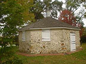
Hood Octagonal School |
|
000000002006-02-14-0000February 14, 2006
(#06000045) |
3500 West Chester Pike, Newtown Square
39°59′10″N 75°23′22″W / 39.986111°N 75.389444°W / 39.986111; -75.389444 (Hood Octagonal School) |
Newtown Township |
On grounds of Dunwoody Village
|
| 38 |
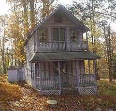
Idlewild |
|
000000002013-05-08-0000May 8, 2013
(#13000255) |
110 Idlewild Circle
39°54′44″N 75°23′18″W / 39.912336°N 75.388465°W / 39.912336; -75.388465 (Idlewild) |
Upper Providence Township |
Summer cottage owned and designed by Frank Furness
|
| 39 |
Ivy Mills Historic District |
|
000000001972-08-21-0000August 21, 1972
(#72001117) |
Corner of Ivy Mills and Pole Cat Roads
39°53′10″N 75°29′14″W / 39.886111°N 75.487222°W / 39.886111; -75.487222 (Ivy Mills Historic District) |
Concord Township |
|
| 40 |
Lansdowne Park Historic District |
|
000000001987-11-05-0000November 5, 1987
(#87001986) |
West Greenwood, Owen, West Baltimore, Windermere, and West Stratford Avenues
39°56′22″N 75°16′33″W / 39.939444°N 75.275833°W / 39.939444; -75.275833 (Lansdowne Park Historic District) |
Lansdowne |
|
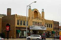
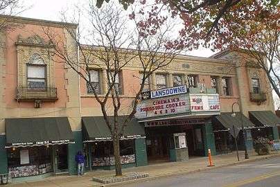
| 41 |
Lansdowne Theatre |
|
000000001987-01-06-0000January 6, 1987
(#86003575) |
29 North Lansdowne Avenue
39°56′20″N 75°16′20″W / 39.938889°N 75.272222°W / 39.938889; -75.272222 (Lansdowne Theatre) |
Lansdowne |
|
| 42 |
The Lazaretto |
|
000000001972-03-16-0000March 16, 1972
(#72001119) |
Wanamaker Avenue and 2nd Street
39°51′38″N 75°18′02″W / 39.860556°N 75.300556°W / 39.860556; -75.300556 (The Lazaretto) |
Tinicum Township |
|
| 43 |
Thomas Leiper Estate |
|
000000001970-12-29-0000December 29, 1970
(#70000547) |
Avondale Road
39°53′12″N 75°21′30″W / 39.886667°N 75.358333°W / 39.886667; -75.358333 (Thomas Leiper Estate) |
Nether Providence Township |
|
| 44 |
Lower Swedish Cabin |
|
000000001980-06-09-0000June 9, 1980
(#80003484) |
Creek Road
39°56′05″N 75°17′43″W / 39.934722°N 75.295278°W / 39.934722; -75.295278 (Lower Swedish Cabin) |
Upper Darby Township |
|
| 45 |
Thomas Massey House |
|
000000001970-11-16-0000November 16, 1970
(#70000904) |
Lawrence and Springhouse Roads
39°57′57″N 75°21′07″W / 39.965778°N 75.351889°W / 39.965778; -75.351889 (Thomas Massey House) |
Marple Township |
|
| 46 |
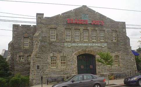
Media Armory |
|
000000001989-12-22-0000December 22, 1989
(#89002077) |
12 East State Street
39°55′06″N 75°23′20″W / 39.918333°N 75.388889°W / 39.918333; -75.388889 (Media Armory) |
Media |
Will Price, architect.
|
| 47 |
Melrose |
|
000000001986-09-04-0000September 4, 1986
(#86001780) |
Hill Dr.
39°55′56″N 75°31′38″W / 39.932222°N 75.527222°W / 39.932222; -75.527222 (Melrose) |
Thornbury Township |
|
| 48 |
Merion Golf Club, East and West Courses |
|
000000001989-12-21-0000December 21, 1989
(#89002085) |
Ardmore Avenue
39°59′36″N 75°19′35″W / 39.993333°N 75.326389°W / 39.993333; -75.326389 (Merion Golf Club, East and West Courses) |
Haverford Township |
|
| 49 |
Morton Homestead |
|
000000001970-12-02-0000December 2, 1970
(#70000546) |
100 Lincoln Avenue
39°52′37″N 75°18′21″W / 39.876944°N 75.305833°W / 39.876944; -75.305833 (Morton Homestead) |
Prospect Park |
|
| 50 |
Morton Morton House |
|
000000002000-02-04-0000February 4, 2000
(#00000055) |
Junction of Muckinipates and Darby Creeks
39°52′50″N 75°17′27″W / 39.880556°N 75.290833°W / 39.880556; -75.290833 (Morton Morton House) |
Norwood |
|
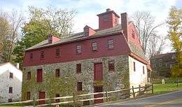
| 51 |
Newlin Mill Complex |
|
000000001983-03-09-0000March 9, 1983
(#83002240) |
South Cheyney Road
39°53′25″N 75°30′22″W / 39.890278°N 75.506111°W / 39.890278; -75.506111 (Newlin Mill Complex) |
Concord Township |
|
| 52 |
Nicholas Newlin House |
|
000000001972-04-26-0000April 26, 1972
(#72001118) |
Concord Road
39°53′10″N 75°31′19″W / 39.886111°N 75.521944°W / 39.886111; -75.521944 (Nicholas Newlin House) |
Concord Township |
|
| 53 |
Nitre Hall |
|
000000001970-12-18-0000December 18, 1970
(#70000545) |
Karakung Dr.
39°59′01″N 75°17′09″W / 39.983611°N 75.285833°W / 39.983611; -75.285833 (Nitre Hall) |
Haverford Township |
|
| 54 |
North Wayne Historic District |
|
000000001985-07-25-0000July 25, 1985
(#85001619) |
Roughly bounded by Eagle Road, Woodland Ct., Radnor Street, Poplar, and North Wayne Avenue
40°02′59″N 75°23′12″W / 40.049722°N 75.386667°W / 40.049722; -75.386667 (North Wayne Historic District) |
Radnor Township |
|
| 55 |
Ogden House |
|
000000001979-11-20-0000November 20, 1979
(#79002223) |
530 Cedar Lane
39°54′41″N 75°21′04″W / 39.911389°N 75.351111°W / 39.911389; -75.351111 (Ogden House) |
Swarthmore |
|
| 56 |
Old Main |
|
000000001973-06-18-0000June 18, 1973
(#73001626) |
21st Street and Upland Avenue
39°51′21″N 75°22′17″W / 39.855833°N 75.371389°W / 39.855833; -75.371389 (Old Main) |
Upland |
|
| 57 |
Old Main and Chemistry Building |
|
000000001978-05-22-0000May 22, 1978
(#78002389) |
14th Street between Melrose Avenue and Walnut Street
39°51′42″N 75°21′19″W / 39.861667°N 75.355278°W / 39.861667; -75.355278 (Old Main and Chemistry Building) |
Chester |
|
| 58 |
Old Rose Tree Tavern |
|
000000001971-06-21-0000June 21, 1971
(#71000705) |
Northeast of the junction of Rose Tree and Providence Roads
39°56′17″N 75°23′34″W / 39.938056°N 75.392778°W / 39.938056; -75.392778 (Old Rose Tree Tavern) |
Upper Providence Township |
Inside Rose Tree Park
|
| 59 |
William Painter Farm |
|
000000001971-07-27-0000July 27, 1971
(#71000701) |
2 miles (3.2 km) northeast of Chadds Ford on U.S. Route 1
39°52′42″N 75°33′10″W / 39.878333°N 75.552778°W / 39.878333; -75.552778 (William Painter Farm) |
Chadds Ford Township |
|
| 60 |
William Penn Landing Site |
|
000000001971-03-11-0000March 11, 1971
(#71000703) |
Penn and Front Streets
39°50′36″N 75°21′41″W / 39.843333°N 75.361389°W / 39.843333; -75.361389 (William Penn Landing Site) |
Chester |
|
| 61 |
Pennsylvania Railroad Station at Wayne |
|
000000001999-05-07-0000May 7, 1999
(#99000674) |
Junction of North Wayne Avenue and Station Road
40°02′44″N 75°23′16″W / 40.045556°N 75.387778°W / 40.045556; -75.387778 (Pennsylvania Railroad Station at Wayne) |
Radnor Township |
|
| 62 |
Pont Reading |
|
000000001972-10-26-0000October 26, 1972
(#72001116) |
2713 Haverford Road
39°59′47″N 75°18′10″W / 39.996389°N 75.302778°W / 39.996389; -75.302778 (Pont Reading) |
Haverford Township |
|
| 63 |
The Printzhof |
|
000000001966-10-15-0000October 15, 1966
(#66000661) |
Taylor Avenue and 2nd Street
39°51′40″N 75°18′11″W / 39.861111°N 75.303056°W / 39.861111; -75.303056 (The Printzhof) |
Tinicum Township |
|
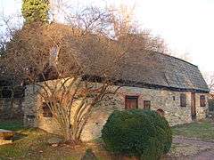
| 64 |
Caleb Pusey House |
|
000000001971-03-11-0000March 11, 1971
(#71000706) |
15 Race Street
39°51′04″N 75°23′13″W / 39.851111°N 75.386944°W / 39.851111; -75.386944 (Caleb Pusey House) |
Upland |
|
| 65 |
Pusey-Crozier Mill Historic District |
|
000000001976-09-27-0000September 27, 1976
(#76001638) |
Race Street
39°51′05″N 75°23′12″W / 39.851389°N 75.386667°W / 39.851389; -75.386667 (Pusey-Crozier Mill Historic District) |
Upland |
|
| 66 |
Radnor Friends Meetinghouse |
|
000000001978-08-31-0000August 31, 1978
(#78002393) |
Sproul and Conestoga Roads
40°01′48″N 75°21′53″W / 40.03°N 75.364722°W / 40.03; -75.364722 (Radnor Friends Meetinghouse) |
Radnor Township |
|
| 67 |
Ridley Creek State Park |
|
000000001976-10-08-0000October 8, 1976
(#76001637) |
Northwest of Media between Pennsylvania Routes 3 and 352
39°57′13″N 75°26′41″W / 39.953611°N 75.444722°W / 39.953611; -75.444722 (Ridley Creek State Park) |
Edgmont, Middletown, and Upper Providence Townships |
|
| 68 |
Dr. Samuel D. Risley House |
|
000000001990-04-26-0000April 26, 1990
(#90000697) |
430 North Monroe Street
39°55′19″N 75°23′14″W / 39.921944°N 75.387222°W / 39.921944; -75.387222 (Dr. Samuel D. Risley House) |
Media |
|
| 69 |
Rose Valley Historic District |
|
000000002010-07-19-0000July 19, 2010
(#10000470) |
Roughly bounded by Ridley Creek, Woodward Rd., Providence and Brookhaven Rds. and Todmorden Ln. within Rose Valley Borough
39°53′46″N 75°23′06″W / 39.896111°N 75.385°W / 39.896111; -75.385 (Rose Valley Historic District) |
Rose Valley |
|
| 70 |
St. David's Church and Graveyard |
|
000000001978-09-20-0000September 20, 1978
(#78002394) |
7 miles (11 km) north of Media
40°01′37″N 75°24′16″W / 40.026944°N 75.404583°W / 40.026944; -75.404583 (St. David's Church and Graveyard) |
Newtown Township |
|
| 71 |
Saturday Club |
|
000000001978-03-14-0000March 14, 1978
(#78002395) |
117 West Wayne Avenue
40°02′36″N 75°23′21″W / 40.043333°N 75.389167°W / 40.043333; -75.389167 (Saturday Club) |
Radnor Township |
|
| 72 |
Second Street Bridge |
|
000000001988-06-22-0000June 22, 1988
(#88000752) |
Pennsylvania Route 291/Second Street over Chester Creek
39°50′41″N 75°21′39″W / 39.844722°N 75.360833°W / 39.844722; -75.360833 (Second Street Bridge) |
Chester |
Destroyed[6]
|
| 73 |
Seventeen-hundred-and-four House |
|
000000001967-12-24-0000December 24, 1967
(#67000018) |
Oakland Road, near junction of U.S. Route 202 and County Road 15199
39°53′47″N 75°33′40″W / 39.896389°N 75.561111°W / 39.896389; -75.561111 (Seventeen-hundred-and-four House) |
Chadds Ford Township |
|
| 74 |
South Wayne Historic District |
|
000000001991-04-18-0000April 18, 1991
(#91000477) |
Roughly bounded by Lancaster Avenue, Conestoga Road and Iven Avenue, Radnor Township
40°02′22″N 75°22′59″W / 40.039444°N 75.383056°W / 40.039444; -75.383056 (South Wayne Historic District) |
Radnor Township |
|
| 75 |
Square Tavern |
|
000000001984-09-07-0000September 7, 1984
(#84003353) |
Newtown Street Road and Goshen Road
39°59′46″N 75°24′30″W / 39.996111°N 75.408333°W / 39.996111; -75.408333 (Square Tavern) |
Newtown Township |
|
| 76 |
Stonehaven |
|
000000001996-10-24-0000October 24, 1996
(#96001197) |
484 Lenni Road, junction with New Road
39°53′35″N 75°27′09″W / 39.893056°N 75.4525°W / 39.893056; -75.4525 (Stonehaven) |
Chester Heights |
|
| 77 |
Thompson Cottage |
|
000000001977-04-13-0000April 13, 1977
(#77001166) |
Southeast of West Chester on Thornton Road
39°53′38″N 75°31′24″W / 39.893889°N 75.523333°W / 39.893889; -75.523333 (Thompson Cottage) |
Concord Township |
|
| 78 |
Thornton Village Historic District |
|
000000002006-11-14-0000November 14, 2006
(#06000745) |
Centered on Thornton and Glen Mills Roads
39°54′36″N 75°31′54″W / 39.91°N 75.531667°W / 39.91; -75.531667 (Thornton Village Historic District) |
Thornbury Township |
|
| 79 |
Thunderbird Lodge |
|
000000001989-08-18-0000August 18, 1989
(#89001053) |
45 Rose Valley Road
39°53′55″N 75°23′17″W / 39.898611°N 75.388056°W / 39.898611; -75.388056 (Thunderbird Lodge) |
Rose Valley |
Will Price, architect.
|
| 80 |
Twaddell's Mill and House |
|
000000001973-03-07-0000March 7, 1973
(#73001623) |
Rock Hill Road south of Chadds Ford
39°50′39″N 75°34′43″W / 39.844167°N 75.578611°W / 39.844167; -75.578611 (Twaddell's Mill and House) |
Chadds Ford Township |
|
| 81 |
Twentieth Century Club of Lansdowne |
|
000000001980-07-23-0000July 23, 1980
(#80003485) |
84 South Lansdowne Avenue
39°56′08″N 75°16′24″W / 39.935556°N 75.273333°W / 39.935556; -75.273333 (Twentieth Century Club of Lansdowne) |
Lansdowne |
|
| 82 |
John J. Tyler Arboretum |
|
000000002003-02-27-0000February 27, 2003
(#03000080) |
515 Painter Road
39°56′05″N 75°25′52″W / 39.934722°N 75.431111°W / 39.934722; -75.431111 (John J. Tyler Arboretum) |
Middletown Township |
|
| 83 |
Wayne Hotel |
|
000000001987-11-05-0000November 5, 1987
(#87001966) |
139 East Lancaster Avenue
40°02′38″N 75°23′12″W / 40.043889°N 75.386667°W / 40.043889; -75.386667 (Wayne Hotel) |
Radnor Township |
|
| 84 |
Benjamin West Birthplace |
|
000000001966-10-15-0000October 15, 1966
(#66000662) |
Swarthmore College campus
39°54′18″N 75°21′06″W / 39.905°N 75.351667°W / 39.905; -75.351667 (Benjamin West Birthplace) |
Swarthmore |
|
| 85 |
Westlawn |
|
000000001988-11-18-0000November 18, 1988
(#88002188) |
123 North Providence Road
39°54′23″N 75°22′37″W / 39.906389°N 75.376944°W / 39.906389; -75.376944 (Westlawn) |
Nether Providence Township |
|
| 86 |
Wolley Stille |
|
000000001980-06-27-0000June 27, 1980
(#80003487) |
Harvey Road
39°52′28″N 75°21′58″W / 39.874444°N 75.366111°W / 39.874444; -75.366111 (Wolley Stille) |
Nether Providence Township |
|
| 87 |
Woodcrest |
|
000000002008-12-30-0000December 30, 2008
(#08001265) |
610 King of Prussia Road, Cabrini College campus
40°03′16″N 75°22′30″W / 40.054444°N 75.375°W / 40.054444; -75.375 (Woodcrest) |
Radnor Township |
|
| 88 |
Andrew Wyeth Studio and Kuerner Farm |
|
000000002011-07-11-0000July 11, 2011
(#11000564) |
14 Ring Road; also 415 Ring Road and 1821 Murphy Road
39°52′09″N 75°34′32″W / 39.869167°N 75.575556°W / 39.869167; -75.575556 (Andrew Wyeth Studio and Kuerner Farm) |
Chadds Ford Township |
The Kuerner Farm was the inspiration for more than 1,000 Wyeth paintings over a 64-year period. Second set of addresses represents a boundary increase of 000000002014-08-25-0000August 25, 2014
|
| 89 |
N. C. Wyeth House and Studio |
|
000000001997-12-09-0000December 9, 1997
(#97001680) |
Murphy Road
39°51′59″N 75°35′09″W / 39.866342°N 75.585785°W / 39.866342; -75.585785 (N. C. Wyeth House and Studio) |
Chadds Ford Township |
Home and studio of painter N.C. Wyeth and family. Managed by the Brandywine River Museum |


_2009.jpg)