Schuylkill County, Pennsylvania
| Schuylkill County, Pennsylvania | ||
|---|---|---|
| ||
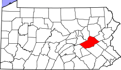 Location in the U.S. state of Pennsylvania | ||
 Pennsylvania's location in the U.S. | ||
| Founded | March 1, 1811 | |
| Named for | Schuylkill River | |
| Seat | Pottsville | |
| Largest city | Pottsville | |
| Area | ||
| • Total | 783 sq mi (2,028 km2) | |
| • Land | 779 sq mi (2,018 km2) | |
| • Water | 4.2 sq mi (11 km2), 0.5% | |
| Population (est.) | ||
| • (2015) | 144,590 | |
| • Density | 186/sq mi (72/km²) | |
| Congressional district | 17th | |
| Time zone | Eastern: UTC-5/-4 | |
| Website |
www | |

Schuylkill County (pronounced /ˈskuːlkɪl/,[1] locally /ˈskuːkəl/) is a county in the Commonwealth of Pennsylvania. As of the 2010 census, the population was 148,289.[2] The county seat is Pottsville.[3] The county was created on March 1, 1811, from parts of Berks, Northampton, and Northumberland counties and named for the Schuylkill River.
Schuylkill County comprises the Pottsville, PA Micropolitan Statistical Area. It is located in the heart of the anthracite Coal Region of Eastern Pennsylvania.
History
18th century
In the year 1754, the area that would become Schuylkill County was settled by Germans, as were areas that are now part of Berks, Dauphin, Lebanon, and Lehigh counties. The earliest settlers in southeastern Schuylkill County, which was then part of Northampton County, were primarily Moravian missionaries from Saxony. Other early settlers in southern Schuylkill County were German Palatines. An early mill in the county was built in 1744 by John Finscher, but it later burned down. The first log church in the county was built in 1755. Native American massacres were commonplace in Schuylkill County between 1755 and 1765. Warrant for tracts of land in the vicinity of McKeansburg were in existence as early as 1750.[4]
19th century
Schuylkill County was created via an Act of Assembly on March 1, 1811, from portions of Berks, Lancaster, and Northampton counties. More land was added to the county in 1818, from Columbia and Lehigh counties. An early book of Schuylkill County history was written by Daniel Deibert in 1802.[4]
McKeansburg was the first community in Schuylkill County to be laid out. Initial construction of the community was done in 1803, and the community was expanded in 1809. During the early years of Schuylkill County, there was an attempt to make McKeansburg the county seat of the new county. The community of Orwigsburg was also a contender for the county seat. Orwigsburg was agreed upon to be the county seat, as it was deemed to be well-suited for industries.[4]
Railroad history
The Reading and Pennsylvania railroads: In the early 19th century southern Schuylkill County was served by the Union Canal out of Pine Grove Township with connections west, and the Schuylkill Canal southward from Port Carbon. Coal mined by Lehigh Coal and Navigation in the Tamaqua and Coaldale areas was often shipped down the Lehigh Canal from Jim Thorpe in neighboring Carbon County. To the north, Broad Mountain was a natural barrier to navigation. Other means would be required to transport coal out of the rich basin of the Mahanoy Valley. Numerous railroads were begun north of the headwaters of the Schuylkill Canal.
Through the 1830s and 1840s, short railroads sprouted up at numerous areas in the county. Of prime importance was the Mine Hill and Schuylkill Haven, which served the Schuylkill Canal. Chartered in 1831, tracks were laid from the "flats" in Schuylkill Haven along the river through Cressona and Minersville to Tremont. The railroad eventually reached Ashland and Locust Gap via the Gordon Planes.
Construction beginning in 1829, the Little Schuylkill Railroad ran from Port Clinton northward to Mahanoy Junction above Tamaqua. It would become the keystone of the Philadelphia and Reading system, serving as a gauntlet for its eastern and western branches. Connecting with it were four important lines. The 146 mile (235 km) Catawissa Railroad operated from Mahanoy Junction to West Milton, providing access to the Mahanoy region by joining the northern terminus of the Little Schuylkill with connections to New York City and Scranton. At Port Clinton, it connected with the P&R's main line from Mount Carbon. Its most important connection would be with the Mahanoy and Broad Mountain Railway via Mahanoy Tunnel and East Mahanoy Railroad.
There was once over 1,000 miles (1600 km) of railroad track in Schuylkill County.
Geography
According to the U.S. Census Bureau, the county has a total area of 783 square miles (2,030 km2), of which 779 square miles (2,020 km2) is land and 4.2 square miles (11 km2) (0.5%) is water.[5]
The Schuylkill River headwaters are found in the county, starting in the Appalachian Mountains, and flows through many towns and the city of Reading, Pennsylvania to Philadelphia where it flows into the Delaware River. The Schuylkill drains the majority of the county while some western and northern areas of the county are drained by the Susquehanna River. The Swatara Creek, Wiconisco Creek, Mahantango Creek, Mahanoy Creek, and Catawissa Creek all start in Schuylkill County and are tributaries of the Susquehanna. Areas of the eastern portion of the county drain into the Lehigh River via the Quakake Creek, Nesquehoning Creek, Mahoning Creek, and Lizard Creek, all of which also start in the county. To the south, southern Schuylkill county is home to Blue Mountain and the Appalachian Trail. Broad Mountain crosses the county from northeast to southwest.
Schuylkill County is located in northeastern Pennsylvania's Coal Region. It is located just north of the Lehigh Valley and Reading metropolitan areas. Portions of eastern Schuylkill County around Tamaqua are located in the Pocono Mountains. As a result, like other portions of the Poconos, eastern Schuylkill has experienced an influx of people from New York City and New Jersey who commute into Manhattan each day. The commute can take up to two hours each way due to distance and traffic. Far western areas of the county are located near Harrisburg and are sometimes considered to be located in South Central Pennsylvania.
Adjacent counties
- Luzerne County (north)
- Carbon County (northeast)
- Lehigh County (southeast)
- Berks County (south)
- Lebanon County (southwest)
- Dauphin County (southwest)
- Northumberland County (northwest)
- Columbia County (northwest)
Major highways
Demographics
| Historical population | |||
|---|---|---|---|
| Census | Pop. | %± | |
| 1820 | 11,339 | — | |
| 1830 | 20,744 | 82.9% | |
| 1840 | 29,053 | 40.1% | |
| 1850 | 60,713 | 109.0% | |
| 1860 | 89,510 | 47.4% | |
| 1870 | 116,428 | 30.1% | |
| 1880 | 129,974 | 11.6% | |
| 1890 | 154,163 | 18.6% | |
| 1900 | 172,927 | 12.2% | |
| 1910 | 207,894 | 20.2% | |
| 1920 | 217,754 | 4.7% | |
| 1930 | 235,505 | 8.2% | |
| 1940 | 228,331 | −3.0% | |
| 1950 | 200,577 | −12.2% | |
| 1960 | 173,027 | −13.7% | |
| 1970 | 160,089 | −7.5% | |
| 1980 | 160,630 | 0.3% | |
| 1990 | 152,585 | −5.0% | |
| 2000 | 150,336 | −1.5% | |
| 2010 | 148,289 | −1.4% | |
| Est. 2015 | 144,590 | [6] | −2.5% |
| U.S. Decennial Census[7] 1790–1960[8] 1900–1990[9] 1990–2000[10] 2010–2013[2] | |||
As of the census[11] of 2000, there were 150,336 people, 60,530 households, and 40,131 families residing in the county. The population density was 193 people per square mile (75/km²). There were 67,806 housing units at an average density of 87 per square mile (34/km²). The racial makeup of the county was 96.62% White, 0.08% Native American, 0.42% Asian, 0.01% Pacific Islander, 0.35% from other races, 2.09% African American, and 0.43% from two or more races. Hispanic or Latino of any race were 1.11% of the population. 29.0% were of German, 14.1% Irish, 9.7% Polish, 7.5% Italian, 5.6% American and 5.1% Lithuanian ancestry according to Census 2000. 95.7% spoke English and 1.2% Spanish as their first language.
There were 60,530 households out of which 26.80% had children under the age of 18 living with them, 51.40% were married couples living together, 10.20% had a female householder with no husband present, and 33.70% were non-families. 29.90% of all households were made up of individuals and 16.50% had someone living alone who was 65 years of age or older. The average household size was 2.36 and the average family size was 2.93.
In the county, the population was spread out with 20.90% under the age of 18, 7.20% from 18 to 24, 28.30% from 25 to 44, 23.80% from 45 to 64, and 19.90% who were 65 years of age or older. The median age was 41 years. For every 100 females there were 99.10 males. For every 100 females age 18 and over, there were 97.20 males.
Schuylkill County is one of the most heavily Lithuanian parts of the United States. New Philadelphia, West Mahanoy, Shenandoah, and Girardville have the highest proportions of Lithuanian Americans of all places in the country. Lithuanian Roman Catholic parishes could be found in Shenandoah (St. George); Mahanoy City (St Joseph); Minersville (St. Francis of Assisi); Tamaqua (SS. Peter and Paul); Frackville (Annunciation BVM); Girardville (St. Vincent de Paul); Gilberton (Our Lady of Siluva, formerly St. Louis); and Coaldale (St. John the Baptist). Also in Schuylkill County (as well as its neighbor to the north, Luzerne County) are Tyroleans, whose ancestors immigrated from the County of Tyrol. Although they bore Italian surnames, the ancestors of the Tyroleans, who immigrated to the Coal Region in the late 19th century and early 20th century, spoke German as their native language. The Tirolesi Alpini organization in Hazleton continues to preserve and promote Tyrolean culture. Irish Americans and Polish Americans are also predominant. The southern and western portions of Schuylkill County which border Berks, Lehigh, and Lebanon counties are predominantly Pennsylvania Dutch.
- Birth rate
Schuylkill County's live birth rate was 1,794 births in 1990. The County's live birth rate in 2000 declined to 1,439 births, while in 2011 it was 1,446 babies.[12][13][14] From 1960 to 2010, rural Pennsylvania has experienced an ongoing decline in the number of residents under 18 years old.[15]
- Teen Pregnancy rate
Schuylkill County had 33 babies born to teens (age 15-19) in 2011. In 2015, the number of teen births in Schuylkill County was 32.[16]
- County poverty demographics
According to research by The Center for Rural Pennsylvania, which is a legislative agency of the Pennsylvania General Assembly, the poverty rate for Schuylkill County was 13.5% in 2014.[17] The statewide poverty rate was 13.6% in 2014. The 2012 childhood poverty rate by school district was: Blue Mountain School District - 24.1% living at 185% or below than the Federal Poverty Level; Mahanoy Area School District - 64.6%; Minersville Area School District - 47.1%; North Schuylkill School District - 44.3%; Pine Grove Area School District - 38%; Pottsville Area School District - 53.5%; Saint Clair Area School District - 53.4%; Schuylkill Haven Area School District - 37.7%; Shenandoah Valley School District - 75.5%; Tamaqua Area School District - 40.9%; Tri-Valley School District - 36.8% and Williams Valley School District - 43.4%.[18] The child poverty rate is collected by the school districts as part of the federal free school lunch program.
Micropolitan Statistical Area
The United States Office of Management and Budget[19] has designated Schuylkill County as the Pottsville, PA Micropolitan Statistical Area (µSA).[20] As of the 2010 U.S. Census[21] the micropolitan area ranked the number 1 most populous in the State of Pennsylvania and the 5th most populous in the United States with a population of 148,289.
Law and government
| Schuylkill County Sheriff's Department | |
|---|---|
| Abbreviation | SCSD |
|
Patch of the Schuylkill County Sheriff's Department | |
| Agency overview | |
| Legal personality | Governmental: Government agency |
| Jurisdictional structure | |
| Operations jurisdiction* | County (US) of Schuylkill in the state of Pennsylvania, USA |
|
| |
| Map of Schuylkill County Sheriff's Department's jurisdiction. | |
| Size | 778 square miles (2,000 km2) |
| Population | 150,336(est.) |
| General nature |
|
| Operational structure | |
| Headquarters | Pottsville, Pennsylvania |
| Police Officers | 12 |
| Elected officer responsible | Joseph G. Groody, Sheriff |
| Agency executive | Dennis Kane, Acting Chief Deputy |
| Website | |
| Schuylkill Sheriff Webpage | |
| Footnotes | |
| * Divisional agency: Division of the country, over which the agency has usual operational jurisdiction. | |

The Schuylkill County Sheriff's Department in Schuylkill County, Pennsylvania consists of the Sheriff's Office, Security Guard Service, and Central Booking. The Sheriff's Office is composed of a Civil and Criminal Division. The Civil Division processes real estate and property paperwork, as well as issue firearms permits. The Criminal Division is responsible for the security of the courthouses, as well as the transport of prisoners. The Security Guard Service is responsible for detecting and interdicting weapons before they can enter a courthouse. Central Booking processes fingerprints and photographs of arrested individuals.
As of November 2008, there are 94,110 registered voters in Schuylkill County.[22]
- Republican: 45,054 (47.87%)
- Democratic: 40,092 (42.60%)
- Other Parties: 8,964 (9.53%)
While the Republican Party has been historically dominant in Schuylkill County politics, Democrats became dominant at the county level after the 2007 elections. John McCain received 53.6% of the vote to 44.9% for Barack Obama in November 2008. In the state row offices of the same election, each statewide winner carried the county. In 2006 Democrat Tim Seip won the heavily Republican 125th House district and Bob Casey Jr. carried Schuylkill when he unseated incumbent Republican US Senator Rick Santorum. Former State Representative Dave Argall won the special election of March 3 to succeed the late State Senator Jim Rhoades and was sworn in on March 17. Jerry Knowles won the special election for Argall's seat in the 124th House district on May 19. In 2010, the GOP regained ground when Seip was defeated for reelection by Republican Mike Tobash. In 2011, the GOP reclaimed the county government.
Commissioners
- Frank Staudenmeier, Chair, Republican
- George Halcovage, Republican
- Gary J. Hess, Democrat
Other county officials
- Clerk of Courts, Thomas J. Campion,Jr., Democrat (appointed)
- Controller, Christy Joy, Republican
- Coroner, David J. Moylan, Republican
- District Attorney, Christine A. Holman, Republican
- Prothonotary, David J. Dutcavich, Republican
- Recorder of Deeds, Ann Dudish, Republican (appointed)
- Register of Wills, Theresa Santai-Gaffney, Republican
- Sheriff, Joseph Groody, Democrat
- Treasurer, Jacqueline McGovern, Republican
State Representatives
- Neal Goodman, Democrat, 123rd district
- Jerry Knowles, Republican, 124th district
- Mike Tobash, Republican, 125th district
State Senator
- Dave Argall, Republican, 29th district
US Representative
- Matthew Cartwright, Democrat, 17th district
Education
Colleges and universities
- Penn State Schuylkill Campus, Schuylkill Haven
- Alvernia University, Cressona
- McCann School of Business and Technology, Pottsville
- Lehigh Carbon Community College - Morgan Center, Tamaqua
Public School Districts

- Blue Mountain School District
- Hazleton Area School District (also in Luzerne County)
- Mahanoy Area School District
- Minersville Area School District
- North Schuylkill School District (also in Columbia County)
- Panther Valley School District (also in Carbon County)
- Pine Grove Area School District
- Pottsville Area School District
- Saint Clair Area School District
- Schuylkill Haven Area School District
- Shenandoah Valley School District
- Tamaqua Area School District
- Tri-Valley School District
- Williams Valley School District (also in Dauphin County)
Communities


.jpg)
Under Pennsylvania law, there are four types of incorporated municipalities: cities, boroughs, townships, and, in at most two cases, towns. The following cities, boroughs and townships are located in Schuylkill County:
City
- Pottsville (county seat)
Boroughs
- Ashland (partly in Columbia County)
- Auburn
- Coaldale
- Cressona
- Deer Lake
- Frackville
- Gilberton
- Girardville
- Gordon
- Landingville
- Mahanoy City
- McAdoo
- Mechanicsville
- Middleport
- Minersville
- Mount Carbon
- New Philadelphia
- New Ringgold
- Orwigsburg
- Palo Alto
- Pine Grove
- Port Carbon
- Port Clinton
- Ringtown
- Schuylkill Haven
- Shenandoah
- St. Clair
- Tamaqua
- Tower City
- Tremont
Townships
- Barry
- Blythe
- Branch
- Butler
- Cass
- Delano
- East Brunswick
- East Norwegian
- East Union
- Eldred
- Foster
- Frailey
- Hegins
- Hubley
- Kline
- Mahanoy
- New Castle
- North Manheim
- North Union
- Norwegian
- Pine Grove
- Porter
- Reilly
- Rush
- Ryan
- Schuylkill
- South Manheim
- Tremont
- Union
- Upper Mahantongo
- Walker
- Washington
- Wayne
- West Brunswick
- West Mahanoy
- West Penn
Census-designated places
Census-designated places are geographical areas designated by the U.S. Census Bureau for the purposes of compiling demographic data. They are not actual jurisdictions under Pennsylvania law.
- Altamont
- Beurys Lake
- Branchdale
- Brandonville
- Buck Run
- Cumbola
- Delano
- Donaldson
- Englewood
- Forestville
- Fountain Springs
- Friedensburg
- Grier City
- Heckscherville
- Hegins
- Hometown
- Kelayres
- Klingerstown
- Lake Wynonah
- Lavelle
- Locustdale
- Marlin
- McKeansburg
- Muir
- Newtown
- Nuremberg
- Oneida
- Orwin
- Park Crest
- Ravine
- Reinerton
- Renningers
- Seltzer
- Shenandoah Heights
- Sheppton
- Summit Station
- Tuscarora
- Valley View
Unincorporated communities
- Andreas
- Barnesville
- Boston Run
- Brockton
- Clamtown
- Connerton
- Drehersville
- Ginthers
- Glen Carbon
- Goodspring
- Haddock
- Hauto
- Hauto
- Llewellyn
- Mahoning Valley
- Mantzville
- Mary D
- Molino
- Newkirk
- Orwin
- Owl Creek
- Pitman
- Quakake
- Rauschs
- Reedsville
- Reevesdale
- Rough and Ready
- Sacramento
- Seek
- Snyders
- South Tamaqua
- Still Creek
- Weishample
Population ranking
The population ranking of the following table is based on the 2010 census of Schuylkill County.[21]
† county seat
| Rank | City/Town/etc. | Municipal type | Population (2010 Census)
|
|---|---|---|---|
| 1 | † Pottsville | City | 14,324 |
| 2 | Tamaqua | Borough | 7,107 |
| 3 | Schuylkill Haven | Borough | 5,437 |
| 4 | Shenandoah | Borough | 5,071 |
| 5 | Minersville | Borough | 4,397 |
| 6 | Mahanoy City | Borough | 4,162 |
| 7 | Frackville | Borough | 3,805 |
| 8 | Orwigsburg | Borough | 3,099 |
| 9 | St. Clair | Borough | 3,004 |
| 10 | Ashland (partially in Columbia County) | Borough | 2,817 |
| 11 | Lake Wynonah | CDP | 2,640 |
| 12 | McAdoo | Borough | 2,300 |
| 13 | Coaldale | Borough | 2,281 |
| 14 | Pine Grove | Borough | 2,186 |
| 15 | Port Carbon | Borough | 1,889 |
| 16 | Tremont | Borough | 1,752 |
| 17 | Valley View | CDP | 1,683 |
| 18 | Cressona | Borough | 1,651 |
| 19 | Girardville | Borough | 1,519 |
| 20 | Hometown | CDP | 1,349 |
| 21 | Tower City | Borough | 1,346 |
| 22 | Shenandoah Heights | CDP | 1,233 |
| 23 | New Philadelphia | Borough | 1,085 |
| 24 | Palo Alto | Borough | 1,032 |
| 25 | Tuscarora | CDP | 980 |
| 26 | Friedensburg | CDP | 858 |
| 27 | Ringtown | Borough | 818 |
| 28 | Hegins | CDP | 812 |
| 29 | Gilberton | Borough | 769 |
| 30 | Gordon | Borough | 763 |
| 31 | Lavelle | CDP | 742 |
| 32 | Auburn | Borough | 741 |
| 33 | Deer Lake | Borough | 687 |
| 34 | Ravine | CDP | 662 |
| 35 | Marlin | CDP | 661 |
| 36 | Altamont | CDP | 602 |
| 37 | Renningers | CDP | 574 |
| 38 | Park Crest | CDP | 542 |
| 39 | Kelayres | CDP | 533 |
| 40 | Englewood | CDP | 532 |
| 41 | Mechanicsville | Borough | 457 |
| 42 | Muir | CDP | 451 |
| 43 | Cumbola | CDP | 443 |
| 44 | Forestville | CDP | 435 |
| 45 | Nuremberg (partially in Luzerne County) | CDP | 434 |
| 46 | Reinerton | CDP | 424 |
| 47 | Middleport | Borough | 405 |
| 48 | Branchdale | CDP | 388 |
| 49 | Seltzer | CDP | 350 |
| 50 | Delano | CDP | 342 |
| 51 | Donaldson | CDP | 328 |
| 52 | Port Clinton | Borough | 326 |
| 53 | Orwin | CDP | 314 |
| 54 | Fountain Springs | CDP | 278 |
| 55 | New Ringgold | Borough | 276 |
| 56 | Newtown | CDP | 243 |
| 57 | Grier City | CDP | 241 |
| 58 | Sheppton | CDP | 239 |
| 59 | Heckscherville | CDP | 220 |
| 60 | Oneida | CDP | 200 |
| 61 | Brandonville | CDP | 197 |
| 62 | Locustdale (partially in Columbia County) | CDP | 177 |
| 63 | Buck Run | CDP | 176 |
| 64 | Summit Station | CDP | 174 |
| 65 | McKeansburg | CDP | 163 |
| 66 | Landingville | Borough | 159 |
| 67 | Klingerstown | CDP | 127 |
| 68 | Beurys Lake | CDP | 124 |
| 69 | Mount Carbon | Borough | 91 |
Notable people
- Ashland Boys' Association - was the most unusual homecoming organization in Pennsylvania and also known throughout the United States after erecting the Mothers' Memorial statue that's a bronze reproduction of "Whistler's Mother" that is located in Ashland, Pennsylvania.
- Boxing heavyweight great Muhammad Ali had his training camp in Deer Lake.
- Charles Justin Bailey, commanding general of the 81st Division in World War I, was born in Tamaqua on June 21, 1859.
- Gary Becker, 1930–2014, American economist. A professor at the Univ. of Chicago, he was awarded the 1992 Nobel Memorial Prize in Economic Sciences for extending the scope of microeconomic analysis. Sociology, demography, criminology, and other areas of market and nonmarket behavior are included in his work. (born December 2, 1930, Pottsville)
- Shenandoah, Pennsylvania born, Francis Brennan (7 May 1894 – 2 July 1968) was a cardinal of the Catholic Church, Dean of the Sacra Rota Romana 1959–68, and prefect of the Congregation for Divine Worship and the Discipline of the Sacraments 1968. Francis Brennan was the first American to receive an appointment to the Roman Curia, or church court, the highest honor in the Roman Catholic Church.
- Les Brown born Lester Raymond Brown(March 14, 1912 – January 4, 2001)in Reinerton, outside of Tower City, was the American musician and the leader of "Les Brown and the Band of Renown" that toured with Bob Hope for over fifty years.
- Walter Ciszek, a Roman Catholic priest, best selling author, and GULAG survivor was born to a Polish-American family in Shenandoah, Pennsylvania. He is currently under investigation for possible Sainthood.
- George Washington Deitzler, Born in Pine Grove, November 30, 1826. Moved to Kansas and became a prominent member of the Free-State Party, Kansas Territorial Speaker of the House of Representatives, Territorial Senator, and Mayor of Lawrence, Kansas. Most notably, he raised the 1st Kansas Volunteer Regiment and was appointed colonel by Kansas Territorial Governor Charles Robinson. He went on to fight in several battles of the Civil War, including Vickburg, but is most famous for his leadership of the Kansas Militia in the Battle of Westport. (Taken from Article by Christopher Alan Edwards, Military Order of the Loyal Legion of the United States, website: suvew.org/mollus)
- Tommy Dorsey and Jimmy Dorsey - famous jazz musicians and bandleaders were born in Shenandoah, Pennsylvania.
- Judge John E. Jones III of the 2005 Kitzmiller v. Dover Area School District intelligent design trial.
- The Jordan Brothers. From Frackville,PA, the Jordans were the most successful rock act to emerge from Schuylkill County. Their biggest hit was "Gimme Some Lovin'" from 1966.[23]
- General George Joulwan (retired), was Supreme Allied Commander, Europe, from 1993 to 1997. General Joulwan was born in Pottsville.
- The Molly Maguires, a clandestine society of Irish miners who engaged in a violent confrontation with Pennsylvania mining companies in the 19th century.
- John O'Hara - a short story writer, best-selling novelist and National Book Award recipient who brought Pottsville into the national spotlight through his "Gibbsville" stories, accounts of 1920s Pottsville socialites. O'Hara's single family home is located at 606 Mahantongo Street, Pottsville.
- Henry Pleasants (February 16, 1833 – March 26, 1880) was a coal mining engineer and a brigadier general in the Union Army during the American Civil War. He is best known for organizing the building of an underground tunnel filled with explosives under the Confederate lines outside Petersburg, Virginia, resulting in the Battle of the Crater on July 30, 1864, an opportunity for Union troops to break the defense of Petersburg. He is buried in the Charles Baber Cemetery in Pottsville.
- Darryl Ponicsan was born in Shenandoah, Pennsylvania. Mr. Ponicsan has written a number of novels, like 1973's, Andoshen, Pa, based on his hometown. Among his novels two were made into motion pictures (Cinderella Liberty and The Last Detail). Mr Ponicsan has also written or co-written many screenplays for Hollywood movies, including Vision Quest, Taps, Nuts and Random Hearts. Mr. Ponicsan has been nominated for a number of awards, such as the Golden Globe and the Writer's Guild Award.
- Conrad Richter, a Pulitzer-Prize and National Book Award-winning American novelist. Books written by Richter include The Light in the Forest and The Awakening Land trilogy. He was born in Pine Grove.
- Pottsville Maroons, revolutionary NFL franchise in the 1920s who won the 1925 National Football League Championship only to have it taken away for playing an exhibition game against Notre Dame.
- David Horst, born October 25, 1985 in Pine Grove, Pennsylvania, is an American soccer player currently playing for Houston Dynamo in Major League Soccer
See also
- Anthracite
- Ashland Boys' Association
- Coal Region
- Jimmy Dorsey
- John O'Hara
- National Register of Historic Places listings in Schuylkill County, Pennsylvania
- Mahantongo
- Molly Maguires
- Reading Company
- Schuylkill River
- Shenandoah
- Tommy Dorsey
- Yuengling
References
- ↑ Oxford Dictionary: definition of Schuylkill River (American English)
- 1 2 "State & County QuickFacts". United States Census Bureau. Retrieved November 22, 2013.
- ↑ "Find a County". National Association of Counties. Retrieved 2011-06-07.
- 1 2 3 Old Schuylkill Tales: A History of Interesting Events, Traditions and ... - Ella Zerbey Elliott - Google Books. Books.google.com. Retrieved on 2013-08-15.
- ↑ "2010 Census Gazetteer Files". United States Census Bureau. August 22, 2012. Retrieved March 10, 2015.
- ↑ "County Totals Dataset: Population, Population Change and Estimated Components of Population Change: April 1, 2010 to July 1, 2015". Retrieved July 2, 2016.
- ↑ "U.S. Decennial Census". United States Census Bureau. Retrieved March 10, 2015.
- ↑ "Historical Census Browser". University of Virginia Library. Retrieved March 10, 2015.
- ↑ Forstall, Richard L., ed. (March 24, 1995). "Population of Counties by Decennial Census: 1900 to 1990". United States Census Bureau. Retrieved March 10, 2015.
- ↑ "Census 2000 PHC-T-4. Ranking Tables for Counties: 1990 and 2000" (PDF). United States Census Bureau. April 2, 2001. Retrieved March 10, 2015.
- ↑ "American FactFinder". United States Census Bureau. Retrieved 2008-01-31.
- ↑ Pennsylvania Department of Health, Birth Age County Reports 1990, 1990
- ↑ Pennsylvania Department of Health, Birth Age County Reports 2000, 2000
- ↑ Pennsylvania Department of Health, Birth Age County Reports 2011, 2011
- ↑ Center for Rural Pennsylvania, Number of Children Decreasing in Rural Pennsylvania, 2011
- ↑ Robert Wood Johnson Foundation, (2016). "Pennsylvania Teen Births 2015,".
- ↑ US Census Bureau (2015). "Poverty Rates by County Small Area Income and Poverty Estimates".
- ↑ Pennsylvania Budget and Policy Center (2012). "Student Poverty Concentration 2012".
- ↑ http://www.whitehouse.gov/omb
- ↑ http://www.census.gov/econ/census/media/forms/pa.html
- 1 2 http://www.census.gov/2010census/
- ↑ Commonwealth of Pennsylvania Department of State. "November 2008 Voter Registration Statistics" (XLS). Retrieved 2008-11-03.
- ↑ Furek,Maxim.The Jordan brothers: A Musical Biography of Rock's Fortunate Sons. Kimberley press, 1986.
External links
- Schuylkill County Historical Society
- Schuylkill Chamber of Commerce
- Anthracite Miners
- Black Diamonds Anthacite Coal region
- Mining the Anthacite coal country long ago abdicated in this Pennsylvania region starting in Mahanoy City
- Necho Allen by George Luks; the legend of Necho Allen, often credited with being the first white man to "discover" coal in Schuylkill County
- The name Schuylkill
- USGS Mining drainage and the Schuylkill River
- Upper Schuylkill
- Schuylkill County Visitors Bureau
 |
Columbia County and Northumberland County | Luzerne County | Carbon County | |
| |
||||
| ||||
| | ||||
| Dauphin County and Lebanon County | Berks County | Lehigh County |
Coordinates: 40°42′N 76°13′W / 40.70°N 76.21°W