Yeadon, Pennsylvania
| Yeadon, Pennsylvania | |
| Borough | |
 Downtown stores | |
| Country | United States |
|---|---|
| State | Pennsylvania |
| County | Delaware |
| Elevation | 69 ft (21.0 m) |
| Coordinates | 39°55′58″N 75°15′06″W / 39.93278°N 75.25167°WCoordinates: 39°55′58″N 75°15′06″W / 39.93278°N 75.25167°W |
| Area | 1.6 sq mi (4.1 km2) |
| - land | 1.6 sq mi (4 km2) |
| - water | 0.0 sq mi (0 km2), 0% |
| Population | 11,443 (2010) |
| Density | 7,175.0/sq mi (2,770.3/km2) |
| Incorporated | 1893 |
| Timezone | EST (UTC-5) |
| - summer (DST) | EDT (UTC-4) |
| ZIP code | 19050 |
| Area code | 610 and 484 |
| FIPS code | 42-86968 |
| GNIS feature ID | 1191867 |
 Location of Yeadon in Delaware County | |
 Location of Yeadon in Pennsylvania | |
 Location of Pennsylvania in the United States | |
| Website: yeadonborough | |
Yeadon is a borough in Delaware County, Pennsylvania, United States. It borders the city of Philadelphia. The population was 11,443 at the 2010 census.[1]
Geography
Yeadon is located in eastern Delaware County at 39°55′58″N 75°15′6″W / 39.93278°N 75.25167°W (39.932862, -75.251540).[2] It is bordered to south by the borough of Darby, to the northwest by the borough Lansdowne, to the west and north by Upper Darby Township, and to the east, across Cobbs Creek, by the city of Philadelphia, whose Center City is 6 miles (10 km) to the east.
According to the United States Census Bureau, Yeadon has a total area of 1.6 square miles (4.1 km2), all of it land.[1]
Demographics
| Historical population | |||
|---|---|---|---|
| Census | Pop. | %± | |
| 1900 | 689 | — | |
| 1910 | 882 | 28.0% | |
| 1920 | 1,308 | 48.3% | |
| 1930 | 5,430 | 315.1% | |
| 1940 | 8,524 | 57.0% | |
| 1950 | 11,068 | 29.8% | |
| 1960 | 11,610 | 4.9% | |
| 1970 | 12,136 | 4.5% | |
| 1980 | 11,727 | −3.4% | |
| 1990 | 11,980 | 2.2% | |
| 2000 | 11,762 | −1.8% | |
| 2010 | 11,443 | −2.7% | |
| Est. 2015 | 11,523 | [3] | 0.7% |
| Sources:[4][5][6][7] | |||
As of the census[6] of 2000, there were 11,762 people, 4,696 households, and 2,967 families residing in the borough. The population density was 7,297.1 people per square mile (2,820.7/km²). There were 4,958 housing units at an average density of 3,075.9 per square mile (1,189.0/km²). The racial makeup of the borough was 79.77% African American, 15.56% White, 0.21% Native American, 0.89% Asian, 0.01% Pacific Islander, 0.41% from other races, and 2.15% from two or more races. Hispanic or Latino of any race were 1.02% of the population.
There were 4,696 households, out of which 31.2% had children under the age of 18 living with them, 37.6% were married couples living together, 20.0% had a female householder with no husband present, and 36.8% were non-families. 32.2% of all households were made up of individuals, and 10.9% had someone living alone who was 65 years of age or older. The average household size was 2.43 and the average family size was 3.09.
In the borough the population was spread out, with 24.5% under the age of 18, 7.7% from 18 to 24, 29.8% from 25 to 44, 22.7% from 45 to 64, and 15.4% who were 65 years of age or older. The median age was 38 years. For every 100 females there were 79.7 males. For every 100 females age 18 and over, there were 74.1 males.
The median income for a household in the borough was $45,550, and the median income for a family was $55,169. Males had a median income of $39,830 versus $35,118 for females. The per capita income for the borough was $22,546. About 12.5% of families and 14.6% of the population were below the poverty line, including 5.1% of those under age 18 and 6.7% of those age 65 or over.
History
Yeadon and its surrounding land were once part of New Sweden. During that era, Yeadon was known as the Swedish settlement of Mölndal (founded in 1645). The borough of Yeadon took its name from Yeadon Manor, which takes its name from Yeadon, West Yorkshire, in England.
Notable residents
- Rose Coyle, Miss America 1936; lived in Yeadon, buried in Holy Cross Cemetery
- H. H. Holmes (Herman Mudgett, 1861–1896), serial killer who is believed to have killed over 200 young women during the Chicago 1893 World's Columbian Exposition; buried in Holy Cross Cemetery
- John McDermott, first U.S. born golfer to win the U.S. Open; lived in Yeadon, buried in Holy Cross Cemetery
- Betsy Ross, who according to legend sewed the first flag of the United States. Betsy Ross never actually lived in Yeadon, but rather spent some time buried there, in Mount Moriah Cemetery, before being exhumed to be re-buried in the city of Philadelphia.
- Tony Taylor, second baseman for the Philadelphia Phillies in 1960s and 1970s
- Frank Tinney, Philadelphia-born vaudeville comedian buried at Holy Cross Cemetery
Education
William Penn School District serves Yeadon.
- Bell Avenue Elementary School (K-6)
- Evans Elementary School (K-6)
- Penn Wood Middle School (7-8) (Darby)
- Penn Wood High School, Cypress Street Campus (9-10)
- Penn Wood High School, Green Ave Campus (11-12) (Lansdowne)
References
- 1 2 "Geographic Identifiers: 2010 Demographic Profile Data (G001): Yeadon borough, Pennsylvania". U.S. Census Bureau, American Factfinder. Retrieved December 29, 2015.
- ↑ "US Gazetteer files: 2010, 2000, and 1990". United States Census Bureau. 2011-02-12. Retrieved 2011-04-23.
- ↑ "Annual Estimates of the Resident Population for Incorporated Places: April 1, 2010 to July 1, 2015". Retrieved July 2, 2016.
- ↑ "Number of Inhabitants: Pennsylvania" (PDF). 18th Census of the United States. U.S. Census Bureau. Retrieved 22 November 2013.
- ↑ "Pennsylvania: Population and Housing Unit Counts" (PDF). U.S. Census Bureau. Retrieved 22 November 2013.
- 1 2 "American FactFinder". United States Census Bureau. Retrieved 2008-01-31.
- ↑ "Incorporated Places and Minor Civil Divisions Datasets: Subcounty Population Estimates: April 1, 2010 to July 1, 2012". U.S. Census Bureau. Retrieved 25 November 2013.
External links
- Borough of Yeadon official website
- Yeadon Fire Company #1
- Yeadon Police Department
- Yeadon Public Library
| Preceded by Darby |
Bordering communities of Philadelphia |
Succeeded by Upper Darby |
Municipalities and communities of Delaware County, Pennsylvania, United States | ||
|---|---|---|
| City | 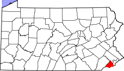 | |
| Boroughs | ||
| Townships | ||
| CDPs | ||
| Unincorporated communities |
| |
| Footnotes | ‡This populated place also has portions in an adjacent county or counties | |