Upper Chichester Township, Delaware County, Pennsylvania
| Upper Chichester Township, Pennsylvania | |
| Township | |
 | |
| Country | United States |
|---|---|
| State | Pennsylvania |
| County | Delaware |
| Elevation | 98 ft (29.9 m) |
| Coordinates | 39°50′18″N 75°26′26″W / 39.83833°N 75.44056°WCoordinates: 39°50′18″N 75°26′26″W / 39.83833°N 75.44056°W |
| Area | 6.7 sq mi (17.4 km2) |
| - land | 6.7 sq mi (17 km2) |
| - water | 0.0 sq mi (0 km2), 0% |
| Population | 16,738 (2010) |
| Density | 2,503.1/sq mi (966.5/km2) |
| Timezone | EST (UTC-5) |
| - summer (DST) | EDT (UTC-4) |
| ZIP code | 19061 |
| Area code | 610 |
| Communities | Boothwyn Ogden Twin Oaks |
 Location of Upper Chichester Township in Delaware County | |
 Location of Upper Chichester Township in Pennsylvania | |
 Location of Pennsylvania in the United States | |
| Website: www | |
Upper Chichester Township is a civil township in Delaware County, Pennsylvania, United States. The population was 16,738 at the 2010 census.[1]
Geography
Upper Chichester Township is in southwestern Delaware County, west of the city of Chester. It is bordered to the south by the state of Delaware, to the west by Bethel Township, to the north by Aston Township, to the east by Chester Township and the city of Chester, and to the south by the borough of Trainer and Lower Chichester Township. The unincorporated community of Boothwyn is in the center and southern part of the township.
According to the United States Census Bureau, the township has a total area of 6.70 square miles (17.34 km2), of which 6.69 square miles (17.32 km2) is land and 0.01 square miles (0.03 km2), or 0.15%, is water.[1]
Educational system
Upper Chichester is a part of Chichester School District. Children within the township usually attend Boothwyn Elementary School (Grades K-4) or Hilltop Elementary School (Grades K-4), Chichester Middle School (Grades 5-8), or Chichester High School (Grades 9-12).
Demographics
| Historical population | |||
|---|---|---|---|
| Census | Pop. | %± | |
| 1930 | 3,743 | — | |
| 1940 | 5,280 | 41.1% | |
| 1950 | 6,997 | 32.5% | |
| 1960 | 9,682 | 38.4% | |
| 1970 | 11,414 | 17.9% | |
| 1980 | 14,377 | 26.0% | |
| 1990 | 15,044 | 4.6% | |
| 2000 | 16,842 | 12.0% | |
| 2010 | 16,738 | −0.6% | |
As of the census[2] of 2000, there were 16,842 people, 6,500 households, and 4,439 families residing in the township. The population density was 2,508.2 people per square mile (969.1/km²). There were 6,705 housing units at an average density of 998.5/sq mi (385.8/km²). The racial makeup of the township was 86.00% White, 10.36% African American, 0.18% Native American, 2.02% Asian, 0.01% Pacific Islander, 0.30% from other races, and 1.14% from two or more races. Hispanic or Latino of any race were 1.16% of the population.
There were 6,500 households, out of which 30.3% had children under the age of 18 living with them, 52.9% were married couples living together, 11.2% had a female householder with no husband present, and 31.7% were non-families. 26.0% of all households were made up of individuals, and 10.9% had someone living alone who was 65 years of age or older. The average household size was 2.58 and the average family size was 3.15.
In the township the population was spread out, with 23.6% under the age of 18, 8.0% from 18 to 24, 32.6% from 25 to 44, 22.9% from 45 to 64, and 12.9% who were 65 years of age or older. The median age was 37 years. For every 100 females there were 90.9 males. For every 100 females age 18 and over, there were 88.2 males.
The median income for a household in the township was $53,962, and the median income for a family was $63,125. Males had a median income of $43,159 versus $31,349 for females. The per capita income for the township was $23,412. About 4.2% of families and 5.5% of the population were below the poverty line, including 8.1% of those under age 18 and 7.8% of those age 65 or over.
History
Upper Chichester Township was originally part of the section of Chester County called Chichester. Chichester comprised the area now known as Upper and Lower Chichester.
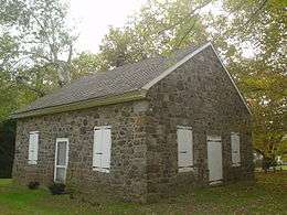
Among the earliest settlers of the township was Walter Martin, the founder of St. Martin's Church, in the late 17th century. The road from Chichester to Aston traversing the township almost due north, was laid out 1688, while the Upper Chichester road was laid out on Oct. 25, 1687. At the southwestern limit of the territory was a tract of 250 acres (100 ha), which was located September 5 and 6, 1681. The "Twelve-Mile Circle" (the circular northern boundary line of the state of Delaware) traverses this tract.
The division of Chichester into Upper and Lower Chichester was made early in 1700 to facilitate public business. In 1753, an effort was made to have the division officially recognized. The movement was, however, met by sturdy opposition from the leading citizens and land-owners of Lower Chichester, stating that the township as it currently stood was convenient enough and did not need any separation. They further argued that recent work to mend the highways in Lower Chichester, and the need to provide for several poor in the township were more important uses of funds than the cost of the survey.
The matter was permitted to drag along for six years, during which time the reasons for the official recognition of the separation of the two townships became apparent to all. Hence in August 1759, a petition to formally separate the two townships was presented, bearing the signatures of almost every freeholder in Upper and Lower Chichester as well as those in Nether Providence.
References
- 1 2 "Geographic Identifiers: 2010 Demographic Profile Data (G001): Upper Chichester township, Delaware County, Pennsylvania". U.S. Census Bureau, American Factfinder. Retrieved December 30, 2015.
- ↑ "American FactFinder". United States Census Bureau. Retrieved 2008-01-31.
- Ashmead's History of Delaware County Chapter XXXVII, "Upper Chichester Township", pp 448–453.
External links
Municipalities and communities of Delaware County, Pennsylvania, United States | ||
|---|---|---|
| City |  | |
| Boroughs | ||
| Townships | ||
| CDPs | ||
| Unincorporated communities |
| |
| Footnotes | ‡This populated place also has portions in an adjacent county or counties | |