Aldan, Pennsylvania
| Borough of Aldan | |
| Borough | |
 Municipal Building | |
| Country | United States |
|---|---|
| State | Pennsylvania |
| County | Delaware |
| Elevation | 128 ft (39.0 m) |
| Coordinates | 39°55′14″N 75°17′12″W / 39.92056°N 75.28667°WCoordinates: 39°55′14″N 75°17′12″W / 39.92056°N 75.28667°W |
| Area | 0.6 sq mi (1.6 km2) |
| - land | 0.6 sq mi (2 km2) |
| - water | 0.0 sq mi (0 km2), 0% |
| Population | 4,152 (2010) |
| Density | 7,235.4/sq mi (2,793.6/km2) |
| Mayor | James R. Hopely |
| Timezone | EST (UTC-5) |
| - summer (DST) | EDT (UTC-4) |
| Area code | 610 |
 Location of Aldan in Delaware County
| |
 Location of Aldan in Pennsylvania
| |
 Location of Pennsylvania in the United States
| |
Aldan is a borough in Delaware County, Pennsylvania, United States. The population was 4,152 at the 2010 census.
Geography
According to the United States Census Bureau, the borough has a total area of 0.6 square miles (1.6 km2), all of it land.
Demographics
| Historical population | |||
|---|---|---|---|
| Census | Pop. | %± | |
| 1900 | 296 | — | |
| 1910 | 661 | 123.3% | |
| 1920 | 1,136 | 71.9% | |
| 1930 | 2,269 | 99.7% | |
| 1940 | 2,642 | 16.4% | |
| 1950 | 3,430 | 29.8% | |
| 1960 | 4,324 | 26.1% | |
| 1970 | 5,001 | 15.7% | |
| 1980 | 4,671 | −6.6% | |
| 1990 | 4,549 | −2.6% | |
| 2000 | 4,313 | −5.2% | |
| 2010 | 4,152 | −3.7% | |
| Est. 2015 | 4,165 | [1] | 0.3% |
| Sources:[2][3] | |||
As of the census[4] of 2000, there were 4,313 people, 1,751 households, and 1,157 families residing in the borough. The population density was 7,235.4 people per square mile (2,775.4/km²). There were 1,817 housing units at an average density of 3,048.1 per square mile (1,169.2/km²). The racial makeup of the borough was 93.30% White, 4.34% African American, 0.19% Native American, 1.34% Asian, 0.12% from other races, and 0.72% from two or more races. Hispanic or Latino of any race were 0.93% of the population.
There were 1,751 households, out of which 28.6% had children under the age of 18 living with them, 51.6% were married couples living together, 10.1% had a female householder with no husband present, and 33.9% were non-families. 29.5% of all households were made up of individuals, and 12.8% had someone living alone who was 65 years of age or older. The average household size was 2.46 and the average family size was 3.08.
In the borough the population was spread out, with 22.8% under the age of 18, 6.9% from 18 to 24, 30.4% from 25 to 44, 24.1% from 45 to 64, and 15.9% who were 65 years of age or older. The median age was 39 years. For every 100 females there were 90.3 males. For every 100 females age 18 and over, there were 86.1 males.
The median income for a household in the borough was $47,292, and the median income for a family was $59,595. Males had a median income of $42,047 versus $31,129 for females. The per capita income for the borough was $22,134. About 4.0% of families and 5.9% of the population were below the poverty line, including 6.5% of those under age 18 and 12.4% of those age 65 or over.
In 2010 Aldan had a population of 4152. The racial and ethnic composition of the population was 75.2% non-Hispanic white, 18.5% black or African American, o.1% Native American, 2.6% Asian, 2.0% from two or more races and 2.1% Hispanic or Latino.[5]
Notable features
Aldan has a Trolley Stop Museum, a swim club, a non-denominational church named Aldan Union Church, a Municipal Building, and a Veterans Memorial that has been expanded into a park right outside of Aldan Elementary.
Parks
- Aldan Gateway Park (2007)
- Aldan Veterans Memorial Park (2000–Present), dedicated to the veterans of Aldan, There is playground equipment in the background of the park.
- Carr Field (1990s), has two baseball fields and basketball court.
- Duffy Field (1990s)
- Jack Edmundson Park (2007), dedicated to Jack P. Edmundson, former mayor. It was formerly known as the Triangle and located at W. Providence Road at Ridley Avenue.
- Providence Park (2006), former historical house purchased by Aldan Union Church and converted into a park.
Education
William Penn School District serves Aldan.
- Aldan Elementary School (K-6)
- Penn Wood Middle School (7-8) (Darby)
- Penn Wood High School, Cypress Street Campus (9-10) (Yeadon)
- Penn Wood High School, Green Ave Campus (11-12) (Lansdowne)
References
- ↑ "Annual Estimates of the Resident Population for Incorporated Places: April 1, 2010 to July 1, 2015". Retrieved July 2, 2016.
- ↑ "Census of Population and Housing: Decennial Censuses". United States Census Bureau. Retrieved 2012-03-04.
- ↑ "Incorporated Places and Minor Civil Divisions Datasets: Subcounty Resident Population Estimates: April 1, 2010 to July 1, 2012". Population Estimates. U.S. Census Bureau. Archived from the original on 17 June 2013. Retrieved 11 December 2013.
- ↑ "American FactFinder". United States Census Bureau. Archived from the original on 2013-09-11. Retrieved 2008-01-31.
- ↑ 2010 population chart for Aldan Archived May 20, 2011, at the Wayback Machine.
External links
Municipalities and communities of Delaware County, Pennsylvania, United States | ||
|---|---|---|
| City | 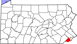 | |
| Boroughs | ||
| Townships | ||
| CDPs | ||
| Unincorporated communities |
| |
| Footnotes | ‡This populated place also has portions in an adjacent county or counties | |