Concord Township, Delaware County, Pennsylvania
| Concord Township | |
| Township | |
 | |
| Country | United States |
|---|---|
| State | Pennsylvania |
| County | Delaware |
| Elevation | 338 ft (103.0 m) |
| Coordinates | 39°52′39″N 75°29′29″W / 39.87750°N 75.49139°WCoordinates: 39°52′39″N 75°29′29″W / 39.87750°N 75.49139°W |
| Area | 13.7 sq mi (35.5 km2) |
| - land | 13.7 sq mi (35 km2) |
| - water | 0.04 sq mi (0 km2), 0.29% |
| Population | 17,231 (2010) |
| Density | 1,257.7/sq mi (485.6/km2) |
| Timezone | EST (UTC-5) |
| - summer (DST) | EDT (UTC-4) |
| Area code | 610 |
 Location of Concord Township in Delaware County
| |
 Location of Concord Township in Pennsylvania
| |
 Location of Pennsylvania in the United States
| |
| Website: www.twp.concord.pa.us | |
Concord Township is a township in Delaware County, Pennsylvania, United States. The population was 17,231 at the 2010 census. Concord is pronounced "conquered," not "Concorde."
Geography
According to the United States Census Bureau, the township has a total area of 13.7 square miles (35 km2), of which, 13.7 square miles (35 km2) of it is land and 0.04 square miles (0.10 km2) of it (0.22%) is water.
Concord Township sits along the border-arc between Pennsylvania and Delaware, in both the Brandywine Creek and Chester Creek watersheds.
One of the busiest intersections in the state, where Route 1 and Route 202 meet, is locally known as "Painters' Crossing." While there are no boroughs or other major population centers in the township, the unincorporated area known as Concordville has historical houses and a Quaker meetinghouse dating from the early colonial period.
Geology
Some of the most impressive garnet deposits in the world are located in Concord and neighboring Bethel Township.
Demographics
| Historical population | |||
|---|---|---|---|
| Census | Pop. | %± | |
| 1930 | 1,546 | — | |
| 1940 | 2,076 | 34.3% | |
| 1950 | 1,945 | −6.3% | |
| 1960 | 3,149 | 61.9% | |
| 1970 | 4,592 | 45.8% | |
| 1980 | 6,437 | 40.2% | |
| 1990 | 6,933 | 7.7% | |
| 2000 | 9,933 | 43.3% | |
| 2010 | 17,231 | 73.5% | |
| www.dvrpc.org/data/databull/rdb/db82/appedixa.xls | |||
As of the census[1] of 2010, there were 17,231 people, 6,193 households, and 4,168 families residing in the township. The population density was 1,257.7 people per square mile (485.7/km²). There were 6,711 housing units. The racial makeup of the township was 86.1% White, 6.9% African American, 0.1% Native American, 5.1% Asian, 0.06% from other races, and 1.2% from two or more races. Hispanic or Latino of any race were 2.0% of the population.
There were 4,168 households, out of which 29.4% had children under the age of 18 living with them, 59.7% were married couples living together, 5.3% had a female householder with no husband present, and 32.7% were non-families. 28.9% of all households were made up of individuals, and 18.3% were individuals living alone 65 years of age or older. The average household size was 2.5 and the average family size was 3.13.
In the township the population was spread out, with 22.1% under the age of 18, 8.1% from 18 to 24, 22.5% from 25 to 44, 26.5% from 45 to 64, and 20.8% who were 65 years of age or older. The median age was 43.4 years. For every 100 females there were 104.3 males. For every 100 females age 18 and over, there were 105.4 males.
The median income (2010 inflation-adjusted dollars) for a household in the township was $86,680, and the median income for a family was $121,389. Males had a median income of $91,470 versus $58,555 for females. The per capita income for the township was $42,358. About 4.0% of families and 4.8% of the population were below the poverty line, including 6.8% of those under age 18 and 3.2% of those age 65 or over.
History
The paper for the first currency printed by the Continental Congress was made at the Willcox Ivy Mill. The mill specialized in making paper for legal and ecclesiastical uses. The oldest Catholic church in the Diocese of Philadelphia was located at the Willcox Ivy Mill. The church was later moved approximately one mile east to the top of the hill into what later would become the Borough of Chester Heights and is known as St. Thomas the Apostle Church.
The Newlin Grist Mill has been grinding grain since 1704. It has an 11 feet (3.4 m) tall stone wheel housed in a timber frame. The mill and processing complex had later passed through various hands, but in the 1950s it was purchased by a direct descendant of Nicholas Newlin, which along with 200 acres (0.81 km2) of surrounding countryside became the Newlin Mill Historic Park. The mill complex area was home to the Markham post office and Markham train station (Philadelphia/Baltimore rail traffic)
The name "Concord" was believed to have been given by the earliest European settlers of the township and reflects the harmonious feelings among them at the time. Title to all real estate in the township can be traced back to a grant from William Penn.
Concord Township was a part of Chester County until 1789, at which point Delaware County was created by act of legislature. Farmers in the northern and western reaches of Chester County were weary of travelling a period of days to get to the county seat in Chester, on the Delaware River. The seat of Chester County was moved to Turk's Head, now West Chester, and was centrally located in the county.
The Ivy Mills Historic District, Brandywine Summit Camp Meeting, and Thompson Cottage are listed on the National Register of Historic Places.[2]
References
- ↑ "American FactFinder". United States Census Bureau. Archived from the original on 2013-09-11. Retrieved 2015-05-15.
- ↑ National Park Service (2010-07-09). "National Register Information System". National Register of Historic Places. National Park Service.
External links
Municipalities and communities of Delaware County, Pennsylvania, United States | ||
|---|---|---|
| City | 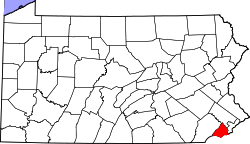 | |
| Boroughs | ||
| Townships | ||
| CDPs | ||
| Unincorporated communities |
| |
| Footnotes | ‡This populated place also has portions in an adjacent county or counties | |