Grapevine, Texas
| Grapevine, Texas | ||
|---|---|---|
| City | ||
|
City Hall | ||
| ||
| Motto: Aged to Perfection | ||
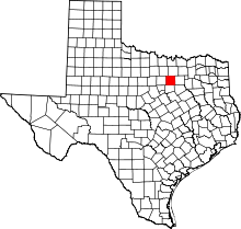
 Location of Grapevine in Tarrant County, Texas | ||
| Coordinates: 32°56′6″N 97°5′9″W / 32.93500°N 97.08583°WCoordinates: 32°56′6″N 97°5′9″W / 32.93500°N 97.08583°W | ||
| Country |
| |
| State |
| |
| Counties | Tarrant, Dallas, Denton | |
| Grape Vine Prairie | 1844 | |
| Grape Vine | 1854 | |
| Grapevine | 1907 | |
| Government | ||
| • Type | Council-Manager | |
| • City Council |
Mayor William D. Tate Mike Lease Chris Coy Sharron Spencer Roy Stewart C. Shane Wilbanks Darlene Freed | |
| • City Manager | Bruno Rumbelow | |
| Area | ||
| • City | 35.9 sq mi (92.9 km2) | |
| • Land | 32.3 sq mi (83.6 km2) | |
| • Water | 3.6 sq mi (9.3 km2) 9.98% | |
| Elevation | 640 ft (195 m) | |
| Population (2010)[1] | ||
| • City | 46,334 | |
| • Estimate (2013)[2] | 50,195 | |
| • Rank | (US: 740th) | |
| • Density | 1,303.0/sq mi (503.1/km2) | |
| • Urban | 5,121,892 (6th) | |
| • Metro | 6,810,913 (4th) | |
| Time zone | CST (UTC-6) | |
| • Summer (DST) | CDT (UTC-5) | |
| ZIP codes | 76051, 76092, 76099 | |
| Area code(s) | 214, 469, 972, 817 | |
| FIPS code | 48-30644[3] | |
| GNIS feature ID | 1336834[4] | |
| Website | grapevinetexas.gov | |

Grapevine is a city located predominantly in Tarrant County and has areas that extend into Dallas and Denton counties.[5][6] Highways SH 26, SH 121, SH 360, SH 114, Spur 97, and FM 2499 run into Grapevine. With its central location in the Metroplex, being approximately 22 to 24 miles from the downtowns of both Dallas and Fort Worth, Grapevine is a suburb of the Dallas/Fort Worth metroplex.
The city is part of the Dallas Fort Worth Statistical Area and a significant part of the city limits are mostly within the Dallas/Fort Worth International Airport, with neighboring cities such as Coppell, Euless, and Irving.
In recent years several wineries have opened in Grapevine, and the city has been very active in maintaining its historic downtown corridor. The city is adjacent to Grapevine Lake, a large reservoir impounded by the Army Corps of Engineers in 1952 and serves as both a source of water and recreational area. Part of Dallas/Fort Worth International Airport is located within Grapevine city limits, the largest portion of any municipality bordering the facility. In 2007 CNNMoney.com rated Grapevine as one of "America's Best Places to Live."[7]
History
In October 1843, General Sam Houston and fellow Republic of Texas Commissioners camped at Tah-Wah-Karro Creek, also known as Grape Vine Springs, to meet with leaders of 10 Indian nations.[8] This meeting culminated in the signing of a treaty of "peace, friendship, and commerce," which opened the area for homesteaders. The settlement that emerged was named Grape Vine due to its location on the appropriately-named Grape Vine Prairie near Grape Vine Springs, both names an homage to the wild grapes that grew in the area.
The first recorded white settlement in what would become the modern city occurred in the late 1840s and early 1850s. General Richard Montgomery Gano owned property near Grape Vine and helped organize the early settlement against Comanche raiding parties before leading his band of volunteers to battle in the American Civil War. Growth during the 19th century was slow but steady; by 1890 roughly 800 residents called Grapevine home, supported by such amenities as a newspaper, a public school, several cotton gins, a post office and railroad service. The settlement made continued gains early in the 20th century, and on January 12, 1914, the post office altered the town's name to one word, Grapevine. On Easter Sunday, April 1, 1934, Henry Methvin, an associate of Bonnie Parker and Clyde Barrow, killed two police officers, E.B. Wheeler and H.D. Murphy, during an altercation near Grapevine. A historical marker remains at the intersection of Dove Road and State Highway 114.[9]
The population of Grapevine fell during the interwar period as the economy stagnated, though the city was officially incorporated in 1936. Cotton was the primary crop for Grapevine until the early 20th century when it was overtaken by cantaloupe farms which accounted for as many as 25,000 acres. For several decades until the early 1970s, the Rotary Club sign outside of town boasted Grapevine as "Cantaloupe Capital of the World".[10] Population growth and economic gains resumed to some extent in the decades immediately after the Second World War, though the opening of Dallas-Fort Worth International Airport in 1974 spurred massive development in the area. Prior to the mid-20th century, Grapevine depended heavily upon agricultural production, but quickly transformed into a regional center of commerce because of its proximity to the airport's north entrance. The economic benefits of the airport's construction continue to encourage new levels of development in Grapevine to this day.

Geography
Grapevine is located at 32°56′6″N 97°5′9″W / 32.93500°N 97.08583°W (32.935025, −97.085784).[11]
According to the United States Census Bureau, the city has a total area of 35.9 square miles (93 km2), of which 32.3 sq mi (84 km2) is land and 3.6 sq mi (9.3 km2) (9.98%) is water.
| Climate data for Grapevine, Texas (Grapevine Dam), 1981–2010 normals | |||||||||||||
|---|---|---|---|---|---|---|---|---|---|---|---|---|---|
| Month | Jan | Feb | Mar | Apr | May | Jun | Jul | Aug | Sep | Oct | Nov | Dec | Year |
| Average high °F (°C) | 56.1 (13.4) |
60.1 (15.6) |
67.6 (19.8) |
75.9 (24.4) |
83.4 (28.6) |
90.8 (32.7) |
95.5 (35.3) |
96.5 (35.8) |
88.6 (31.4) |
78.8 (26) |
67.0 (19.4) |
57.2 (14) |
76.5 (24.7) |
| Average low °F (°C) | 32.1 (0.1) |
35.3 (1.8) |
44.1 (6.7) |
51.8 (11) |
61.5 (16.4) |
68.7 (20.4) |
72.7 (22.6) |
72.5 (22.5) |
64.6 (18.1) |
53.2 (11.8) |
43.5 (6.4) |
33.9 (1.1) |
52.8 (11.6) |
| Average precipitation inches (mm) | 2.24 (56.9) |
2.80 (71.1) |
3.62 (91.9) |
3.16 (80.3) |
4.80 (121.9) |
4.00 (101.6) |
2.38 (60.5) |
1.83 (46.5) |
3.26 (82.8) |
4.02 (102.1) |
2.94 (74.7) |
2.68 (68.1) |
37.73 (958.4) |
| Average precipitation days (≥ 0.01 in) | 7.1 | 7.4 | 8.7 | 6.8 | 9.2 | 8.3 | 5.2 | 5.2 | 6.2 | 7.6 | 7.1 | 7.6 | 86.4 |
| Source: NOAA [12] | |||||||||||||
Surrounding Cities
Here is the list of surrounding cities, they can also be seen from here.[13]
Surrounding municipalities
 |
Southlake (5 miles) |
Flower Mound (12 miles) |
Coppell (4 miles) |
|
| Colleyville (6 miles) |
|
Irving | ||
| ||||
| | ||||
| Hurst (11 miles) |
Euless (9 miles) |
Irving (16 miles) |
Demographics
| Historical population | |||
|---|---|---|---|
| Census | Pop. | %± | |
| 1880 | 199 | — | |
| 1890 | 442 | 122.1% | |
| 1910 | 681 | — | |
| 1920 | 821 | 20.6% | |
| 1930 | 936 | 14.0% | |
| 1940 | 1,043 | 11.4% | |
| 1950 | 1,824 | 74.9% | |
| 1960 | 2,821 | 54.7% | |
| 1970 | 7,049 | 149.9% | |
| 1980 | 11,801 | 67.4% | |
| 1990 | 29,202 | 147.5% | |
| 2000 | 42,059 | 44.0% | |
| 2010 | 46,334 | 10.2% | |
| Est. 2015 | 51,404 | [14] | 10.9% |
As of the census[3] of 2010, there were 46,334 people, 18,223 households, and 12,332 families residing in the city. The population density was 1,451 people per square mile. There were 19,685 housing units. The racial makeup of the city was 81.1% White, 3.3% African American, 0.7% Native American, 4.5% Asian, 0.2% Pacific Islander, 8.0% from other races, and 2.2% from two or more races. Hispanic or Latino of any race were 18.0% of the population.
There were 18,223 households out of which 33.6% had children under the age of 18 living with them, 51.9% were married couples living together, 10.5% had a female householder with no husband present, and 33.3% were non-families. 27.1% of all households were made up of individuals and 14.4% had someone living alone who was 65 years of age or older. The average household size was 2.49 and the average family size was 3.06.
In the city the population was spread out with 25.1% under the age of 18, 74.9% over the age of 18, 5.6% from 20 to 24, 13.3% from 25 to 34, 24.7% from 35 to 49, 20.9% from 50 to 64, and 7.9% who were 65 years of age or older. The median age was 37.5 years.
According to a 2010 estimate, the median income for a household was $76,040, and the median income for a family was $93,587.[16] Males had a median income of $66,378 versus $47,995 for females. The per capita income for the city was $38,304. About 5.2% of families and 7.9% of the population were below the poverty line, including 11.3% of those under age 18 and 5.5% of those age 65 or over.[17]
Crime
The Grapevine Police Department is the presiding jurisdiction, located on Dallas Road near downtown Grapevine. Since July 2010, there have been 33 car thefts, 23 assaults, 10 burglaries, and 2 robberies. According to the FBI, as of 2010, 28 registered sex offenders live in Grapevine.
On Christmas morning of 2011, AOL News (Huffington Post Crime) and the Associated Press reported that, after the receipt of an open-ended 911 call, all seven individuals (four women and three men, aged 15 to 60) in an apartment in a complex in suburban Grapevine (said to be most likely family members with related visitors) were found murdered, with the shooter, a man dressed as Santa Claus, believed to be one of the deceased extended family members. It was the worst incident of its kind ever in the Grapevine area and the first homicide since June 2010, according to police spokesman Sgt. Robert Eberling.[18]
Economy

Grapevine's economy is largely centered around tourism of several varieties. Chiefly, travelers arriving and departing from Dallas/Fort Worth International Airport remain the majority of visits to the city, benefiting the numerous hotels. Among these facilities, the Gaylord Texan and Great Wolf Lodge stand in a separate class as massive entertainment complexes that offer hotel, convention, and performance space in addition to serving the recreational desires of both locals and tourists alike. Nearby Grapevine Mills Mall exists as a regional outlet shopping center with many amenities including an indoor ice rink and movie theater. Many of the top brands in fashion and other retail sectors maintain a space within the mall. Embassy Suites Grapevine and the DFW Lakes Hilton complex also lay adjacent to Grapevine Mills and Bass Pro Shops. In addition to these popular areas, Main Street in historic downtown Grapevine is a center of attraction for many people. City Hall, the Grapevine Convention and Visitor's Bureau, public library, and recreation center are located on Main Street in addition to a myriad of small business. These include antique stores, restaurants, bars, theaters, a park, and many specialty shops. The Grapevine Vintage Railroad follows a scenic route between Grapevine and the Fort Worth Stockyards, departing from a station located on South Main Street. The city is also the home of several wineries and tasting rooms to include Umbra Winery as well as the Texas Wine and Grape Growers Association.
According to the City's 2014 Comprehensive Annual Financial Report,[19] the top employers in the city are:
| # | Employer | # of Employees |
|---|---|---|
| 1 | Dallas/Fort Worth International Airport | 60,000 |
| 2 | Game Stop Corporation | 2,400 |
| 3 | United Parcel Service | 2,000 |
| 4 | Grapevine Colleyville ISD | 1,800 |
| 5 | Gaylord Texan Resort | 1,800 |
| 6 | Baylor Scott & White Medical Center | 1,100 |
| 7 | Great Wolf Lodge | 600 |
| 8 | City of Grapevine | 600 |
| 9 | Pavestone Mfg. | 400 |
| 10 | Hilton DFW Lakes | 400 |
GameStop, a national electronics retailer, is currently headquartered in Grapevine, one of the largest corporate employers in the city.[20]
As of 2015 Kubota Corp. is establishing a new U.S. headquarters in Grapevine, moving about 350 employees from California and spending $51 million.[21]
The facility at 1639 West 23rd Street is located on the property of DFW Airport and in Grapevine.[22][23][24] Tenants include China Airlines,[25] Lufthansa Cargo,[26] and the U.S. Fish and Wildlife Service.[27]
Historically, Grapevine was the headquarters of a collection of now-defunct air carriers. In 1978 Braniff Place, the final world headquarters for Braniff International Airways, was built in what is now Grapevine, on the grounds of Dallas/Fort Worth International Airport. Following Braniff's 1982 bankruptcy, the structure is now known as Verizon Place.[28][29][30] In the 1990s Metro Airlines maintained its main offices in the city of Grapevine, as did Kitty Hawk Aircargo for a time.[31][32][33][34]
Transportation
Highways
Two grade-separated highways run through the city. State Highways 114 and 121 trisect Grapevine south and slightly west of downtown. 121 runs from the south and 114 from the northwest. The highways intersect near Mustang Drive and William D. Tate Avenue and continue together towards the airport before splitting again at the north entrance of Dallas/Fort Worth International Airport. Grapevine's highways as of 2010 underwent a significant overhaul to improve traffic flow through the area, with heavy construction expected to last until 2014.
Airports
Dallas/Fort Worth International Airport is the main provider of air service to Grapevine and the region at large, providing connections to places around the state, country, and abroad. DFW is the main hub for American Airlines, though other major carriers maintain a significant presence. Love Field in Dallas is relatively close to Grapevine.
Rail
The aforementioned Grapevine Vintage Railroad provides service to and from Fort Worth along the former Cotton Belt Railroad right-of-way. The service is not intended for commuting and acts more as a tourist attraction due to its slow speeds. However, the city's 50-year commitment to the Fort Worth Transportation Authority and approval of a half-cent sales tax increase is expected to pay dividends through the introduction of the TEX Rail service to northeast Tarrant County by 2018. New train stations downtown and north of the airport are included in the plans, as is a connection to DART Rail to provide mass transit service to the eastern half of the metroplex.[35]
Currently, the closest connections to rail are the DFW airport, Terminal A, DART Rail station and the Hurst station for the Trinity Rail Express. Amtrak passenger service is available in both downtown Dallas and Fort Worth.
Bus
The Convention and Visitor's Bureau operates the Grapevine Visitor's Shuttle between points of interest within the city. Additional information including stops and pricing can be found here.[36]
Bicycle
The majority of Grapevine's transportation infrastructure is centered around the automobile, though amenities for bicycles can be found. A bicycle route runs along the length of Dove Road beginning at the intersection of Dove and North Main Street, connecting Grapevine and Southlake. Additionally, the Cotton Belt trail runs parallel to State Highway 26, from the Colleyville city limits to downtown Grapevine. Other bicycle paths can be found at the various city parks, most notably the trail from Parr Park to Bear Creek Park. Off-road trails are also available. Northshore Mountain Bike trail begins at Rockledge Park on the north side of Grapevine Lake and continues into Flower Mound along the shore. Mileage is 22.5 miles broken up into two major loops: East Loops, 1 - 4, which are 12.5 miles and the West Loops, 5 - 7. Horseshoe Trail begins at Catfish Lane, continues to Dove Road, and loops back to the trail head, for a total of 5.4 miles.
Running
Grapevine received the Runner Friendly Community designation from the Road Runners Club of America. The goals of the Runner Friendly Community program are to shine a national spotlight on communities that standout as runner-friendly and provide incentives and ideas for communities to work towards becoming runner friendly communities. Grapevine has approximately 24-miles of hike and bike trails that link parks, schools, and businesses. The hike and bike trails have mileage markers that also have GPS coordinates for location identification in case of emergencies. The city also has an indoor 1/8 mile walking/jogging track and several outdoor tracks that belong to the local school district. The city has joint-use agreement with the school district for the use of school facilities.
The hike and bike trails in Grapevine include water fountains, community bathrooms or portable toilets, available parking, signs linking pedestrian networks, mile markers, walk lights at busy intersections, stop signs at residential intersections, and painted crosswalks. One trail in Grapevine links with four other communities, creating an additional 11-mile trail.
The City Parks & Recreation Board has worked with the running club, Lake Grapevine Runners and Walkers (LGRAW), over the last 15 years to make the city's trails runner friendly. The City of Grapevine invites LGRAW club to city sponsored health events to promote running, walking a healthy lifestyle
Government
Local government
The structure of the management and coordination of city services is:[37]
| Department | Director |
|---|---|
| City Manager | Bruno Rumbelow |
| Assistant City Manager | Jennifer Hibbs |
| Administrative Services Director | Greg Jordan |
| Municipal Court Judge | David Florence |
| Parks and Recreation Director | Kevin Mitchell |
| Public Works Director | Stan Laster |
| Police Chief | Edward Salame |
| Fire Chief | Darrell Brown |
| City Secretary | Tara Brooks |
| Development Services Director | Scott Williams |
| Personnel Director | Carolyn Van Duzee |
| Director of Golf | Russell Pulley |
| Executive Director, Convention and Visitors Bureau | P. W. McCallum |
| Library Director | Janis Roberson |
The city of Grapevine is a voluntary member of the North Central Texas Council of Governments association, the purpose of which is to coordinate individual and collective local governments and facilitate regional solutions, eliminate unnecessary duplication, and enable joint decisions.
Education
School Districts
Most of Grapevine is served by the Grapevine-Colleyville Independent School District. A large portion of northwest Grapevine is served by Carroll ISD, while very small parts are served by Lewisville and Coppell ISDs.
Public High schools
Grapevine High School has been named both a National Blue Ribbon School and a New American High School. It was ranked by Newsweek as the 41st-best high school in the nation in 2007.
Colleyville Heritage High School also serves a large portion of Grapevine.
Private schools
The Faith Christian School is located in Grapevine.
State government
Grapevine is represented in the Texas Senate by Republican Jane Nelson District 12, and in the Texas House of Representatives by Republican Giovanni Capriglione, District 98.
Federal government
At the federal level, the two U.S. Senators from Texas are Republicans John Cornyn and Ted Cruz; Grapevine is part of Texas' US Congressional 24th District, which is currently represented by Republican Kenny Marchant.
Media
- Grapevine is mentioned in the National Geographic Channel special, The Real Bonnie and Clyde. The historical marker (located at Dove Road and Highway 114) where Bonnie, Clyde, and Henry Methvin shot two Texas state troopers is shown.[38]
- An episode of true crime show Snapped is set in Grapevine.
- Some scenes from the film Tender Mercies are also set in Grapevine.
- Miracle Dogs Too was filmed in Grapevine in 2006
- Portions of Robocop filmed at B&D Mills
Notable people
- Jaimie Alexander, actress, born in Greenville, South Carolina, she lived in Grapevine from age 4 to age 18.
- Zach Bolton, voice actor and ADR director affiliated with Funimation
- Joe Bob Briggs, film critic
- Jenna Dewan, actress
- Greg Garza, Professional soccer player, currently with Tijuana
- Norah Jones, singer-songwriter and actress, born in Brooklyn, New York, lived in Grapevine as a child.
- Amy Miller, actress
- Crown the Empire, band
- George McFarland, actor, Spanky of Our Gang/The Little Rascals
- Post Malone, rapper
Places
- Dallas/Fort Worth International Airport
- Fellowship Church
- Gaylord Texan
- Grapevine Craft Brewery
- Grapevine Mills Mall
- Lake Grapevine
- Great Wolf Lodge Grapevine
- Historic Downtown[39]
- 9/11 Flight Crew Memorial[40]
Gallery
 The Train Station on Main Street
 Main Street
 The Tarantula Train
 Statue in front of the train station
 Looking north-west on Main Street
 Public bench advertising free municipal WiFi in Historic Downtown
 The old calaboose (jail) built in 1909
 Grapevine City Hall on Main Street
 Front entrance to Grapevine City Hall
 The Nightwatchman statue atop City Hall
 Grapevine Water Tower from Main Street
 Water-pumping windmill on Main Street
 The "Torian Log Cabin" on Main Street
Sister cities
-
 Krems an der Donau, Austria (since 1999)
 -
 Parras de la Fuente, Mexico (since 1996)
 -
 Linlithgow, Scotland (since 2008).[41]
Notes
- ↑ "American FactFinder". United States Census Bureau. Retrieved September 10, 2014.
- ↑ "Population Estimates". United States Census Bureau. Archived from the original on April 17, 2016. Retrieved March 19, 2015.
- 1 2 "American FactFinder". United States Census Bureau. Archived from the original on 2013-09-11. Retrieved 2008-01-31.
- ↑ "US Board on Geographic Names". United States Geological Survey. 2007-10-25. Retrieved 2008-01-31.
- ↑ "Population of Texas Cities and Towns Sorted by County". The County Information Project Texas Association of Counties. Retrieved 16 March 2015.
- ↑ Watkins, Matthew (30 January 2015). "Grapevine pushes for alcohol sales in tiny area that remains dry". The Dallas Morning News. The Dallas Morning News. Retrieved 18 May 2015.
- ↑ "Best Places To Live: Grapevine, TX". CNNMoney.com. Retrieved 2007-10-31.
- ↑ "Tehuacana Creek Treaty". Republic-of-Texas.net. Retrieved 2009-01-03.
- ↑ Anderson, Brian (2003-04-15). "Reality less romantic than outlaw legend". Dallas Morning News. Archived from the original on February 25, 2008. Retrieved 2008-03-17.
- ↑ Cantaloupe capital – Community Impact Newspaper
- ↑ "US Gazetteer files: 2010, 2000, and 1990". United States Census Bureau. 2011-02-12. Retrieved 2011-04-23.
- ↑ "NowData – NOAA Online Weather Data". National Oceanic and Atmospheric Administration. Retrieved 2012-10-01.
- ↑ Grapevine Texas – Google Maps
- ↑ "Annual Estimates of the Resident Population for Incorporated Places: April 1, 2010 to July 1, 2015". Retrieved July 2, 2016.
- ↑ "Census of Population and Housing". Census.gov. Archived from the original on May 11, 2015. Retrieved June 4, 2015.
- ↑ "2006–2008 American Community Survey 3-Year Estimates". U.S. Census Bureau. Retrieved 11 October 2010.
- ↑ Bird, Chris (2008). The Concealed Handgun Manual (5th ed.). San Antonio, TX: Privateer Publications. pp. 375–382. ISBN 978-0-9656784-7-6.
- ↑ "Christmas Shooting: 7 People Shot Dead In Texas Home, Motive Unclear". Huffington Post. December 26, 2011.
- ↑ City of Grapevine CAFR - Sept 30, 2014
- ↑ "Contact Us." GameStop. Retrieved on December 8, 2009. Archived January 22, 2012, at the Wayback Machine.
- ↑ "Japan hopes for closer ties with Texas" (Archive). The Dallas Morning News. June 17, 2015. Retrieved on September 4, 2015.
- ↑ "U.S. Federal Inspection Agencies." Dallas-Fort Worth International Airport. Retrieved on November 17, 2011. "U.S. Fish & Wildlife Service (FWS) 1639 West 23rd Street, Suite 105 DFW Airport, TX 75261"
- ↑ "2010 Zoning Maps." (Archive) City of Grapevine. Retrieved on November 17, 2011."Archived copy". Archived from the original on 2012-05-26. Retrieved 2011-11-17.
- ↑ "Tax Maps." (Archive) City of Grapevine. Retrieved on November 17, 2011."Archived copy". Archived from the original on 2012-05-26. Retrieved 2012-07-16.
- ↑ "North America." China Airlines. Retrieved on November 17, 2011. "1639 W. 23rd street, Suite 300 P.O. Box 610065 Dallas-Fort Worth, Texas 75261"
- ↑ "Contact USA." Lufthansa Cargo. Retrieved on November 17, 2011. "1639 West 23rd Street," "Ste 400 Dallas Fort Worth, TX 75261"
- ↑ "WILDLIFE INSPECTOR-DALLAS/FORT WORTH AIRPORT, TEXAS." U.S. Fish and Wildlife Service. Retrieved on November 17, 2011.
- ↑ Miller, Robert (November 8, 1985). "Their inspiration of entrepreneurship wins honors". The Dallas Morning News. Retrieved August 17, 2009.
- ↑ "Hotels" (PDF). City of Grapevine. Retrieved August 17, 2009.
- ↑ "Resorts for rent: Once mainly for top executives, some private conference and training centers with high amenities now welcome outside business as their owners seek ways to break even". Fort Worth Star-Telegram. February 13, 2006. Retrieved August 17, 2009.
- ↑ "World Airline Directory". Flight Global Archive. March 14–20, 1990. Retrieved 11 October 2010.
- ↑ "Trails" (PDF). City of Grapevine. Archived from the original (PDF) on May 27, 2010. Retrieved December 10, 2009.
- ↑ "Grapevine 1990 Tiger Data". U.S. Census Bureau. Retrieved December 11, 2009.
- ↑ "Kitty Hawk Overview". Kitty Hawk Aircargo. February 14, 1997. Archived from the original on February 14, 1997. Retrieved January 29, 2010.
- ↑ Archived October 7, 2011, at the Wayback Machine.
- ↑ Grapevine, TX Shuttle Schedule | GrapevineTexasUSA.com
- ↑ City of Grapevine 2009 CAFR Retrieved 2010-11-09 Archived March 1, 2012, at the Wayback Machine.
- ↑ "Inside: The Real Bonnie and Clyde". Website. National Geographic Channel. Archived from the original on March 27, 2010. Retrieved 6/1/2011. Check date values in:
|access-date=(help) - ↑ Historic Downtown "Discover Historic Downtown Grapevine" Check
|url=value (help). Retrieved 11 October 2011. - ↑ "9/11 Flight Crew Memorial". Retrieved 11 October 2010.32°56′27″N 097°03′54″W / 32.94083°N 97.06500°W
- ↑ "International Sister City Program". City official website. Retrieved 26 December 2011.
External links
| Wikivoyage has a travel guide for Grapevine, Texas. |
| Wikimedia Commons has media related to Grapevine, Texas. |
- City of Grapevine Official Website
- Historic Downtown Merchants Association Website
- Grapevine-Colleyville Independent School District
- Grapevine Convention & Visitors Bureau
- Grapevine Courier newspaper
- Krems, Austria Becomes Sister City to Grapevine
- Brief history of Grapevine
- Headlines and community information about Grapevine from The Dallas Morning News
- Historic photos of Grapevine hosted by the Portal to Texas History
Municipalities and communities of Tarrant County, Texas, United States | ||
|---|---|---|
| Cities |
|  |
| Towns | ||
| CDPs | ||
| Unincorporated communities | ||
| Historical communities | ||
| Ghost towns | ||
| Footnotes | ‡ This populated place also has portions in an adjacent county or counties ‡‡ Previously considered a census-designated place | |
Municipalities and communities of Denton County, Texas, United States | ||
|---|---|---|
| Cities |  | |
| Towns | ||
| CDPs | ||
| Unincorporated communities | ||
| Ghost towns | ||
| Footnotes | ‡This populated place also has portions in an adjacent county or counties | |
Municipalities and communities of Dallas County, Texas, United States | ||
|---|---|---|
| Cities |  | |
| Towns | ||
| Unincorporated communities | ||
| Historical communities | ||
| Footnotes | ‡This populated place also has portions in an adjacent county or counties | |
