Argyle, Texas
| Argyle, Texas | |
|---|---|
| City | |
 | |
 Location of Argyle in Denton County, Texas | |
| Coordinates: 33°6′59″N 97°11′8″W / 33.11639°N 97.18556°WCoordinates: 33°6′59″N 97°11′8″W / 33.11639°N 97.18556°W | |
| Country | United States |
| State | Texas |
| County | Denton |
| Area | |
| • Total | 11.4 sq mi (29.6 km2) |
| • Land | 11.4 sq mi (29.5 km2) |
| • Water | 0.04 sq mi (0.1 km2) |
| Elevation | 699 ft (213 m) |
| Population (2010) | |
| • Total | 3,282 |
| • Density | 290/sq mi (110/km2) |
| Time zone | Central (CST) (UTC-6) |
| • Summer (DST) | CDT (UTC-5) |
| ZIP code | 76226 |
| Area code(s) | 940 |
| FIPS code | 48-03768[1] |
| GNIS feature ID | 1329667[2] |
| Website | www.argyletx.com |
Argyle is a city in Denton County, Texas, United States, with a population of 3,282 as of the 2010 census.[3] It is a suburb of Fort Worth. The master-planned community of Lantana shares the Argyle mailing address.
History
The first European settlement, consisting of a few families, occurred in the Argyle area in the 1850s. The place was then known as Pilot Knob or Waintown. The settlement gradually acquired a few amenities in the late 1800s: a school in 1875, a Baptist church in 1876, and a post office in 1878. The community was formally founded and renamed Argyle in 1881, after the Texas and Pacific railroad built a track through the area. Some believe a railroad surveyor named the town after a garden in France. However, others believe the town to be named after the region of Argyll in Scotland. Also around this time was when Sam Bass, an infamous outlaw who stole $60,000 in gold coins from the Union Pacific Railroad, was rumored to have stashed the gold in a cave. Sam Bass died when he was 27, and it was rumored he never lived to retrieve the gold.
Growth was very slow during the nineteenth century, and by 1890 Argyle only had a population of 148. The town did boast several agriculture-related industries, such as grist mills, general stores, and a cotton gin. In 1885 Argyle built a two-story brick school, and population grew until it reached 238 in 1930. A bank was also established in 1906, a little red brick building with a drugstore in the front. The bank wasn't around long before it was robbed in 1912. The robbers made away with $1700 and were never caught. Electricity and telephone service became available in the mid-1930s.
The Great Depression took its toll on the Argyle area, and the population declined to only ninety in 1950. Argyle incorporated as a separate city on September 19, 1960, with M.H. Wilson as the first mayor. Gradually the town grew in population as more people from the Dallas-Fort Worth area discovered its rural charm. By the 1970s a number of retail establishments were located in Argyle, and the population reached 1,575 in 1990, and doubled from that figure to 3,282 at the 2010 census. The high rate of growth is expected to continue as part of the general development of northern areas in the Dallas-Fort Worth metroplex.
Geography
Argyle is located at 33°6′59″N 97°11′8″W / 33.11639°N 97.18556°W (33.116422, -97.185461).[4]
According to the United States Census Bureau, the city has a total area of 11.4 square miles (29.6 km2), of which 11.4 square miles (29.5 km2) is land and 0.04 square miles (0.1 km2), or 0.41%, is water.[5]
Demographics
| Historical population | |||
|---|---|---|---|
| Census | Pop. | %± | |
| 1970 | 443 | — | |
| 1980 | 1,111 | 150.8% | |
| 1990 | 1,575 | 41.8% | |
| 2000 | 2,365 | 50.2% | |
| 2010 | 3,282 | 38.8% | |
| Est. 2015 | 3,905 | [6] | 19.0% |
As of the census of 2010, there were 3,282 people, 1,083 households, and 925 families residing in the city. The population density was 287.9 people per square mile (111.3/km²). There were 1,145 housing units, at an average density of 100.4 per square mile (38.8/km²). The racial makeup of the city was 95.9% White, 0.3% African American, 0.5% Native American, 0.6% Asian, 0.0% Native Hawaiian or other Pacific Islander, 1.4% some other race, and 1.3% from two or more races. Hispanic or Latino of any race were 5.6% of the population.
There were 1.083 households, out of which 45.0% had children under the age of 18 living with them, 75.1% were headed by married couples living together, 7.4% had a female householder with no husband present, and 14.6% were non-families. 12.3% of all households were made up of individuals, and 3.9% were someone living alone who was 65 years of age or older. The average household size was 3.03, and the average family size was 3.30.
In the city the population was spread out with 30.0% under the age of 18, 7.4% from 18 to 24, 19.6% from 25 to 44, 34.8% from 45 to 64, and 8.4% who were 65 years of age or older. The median age was 41.9 years. For every 100 females there were 96.3 males. For every 100 females age 18 and over, there were 92.9 males.[3]
At the 2000 census the median income for a household in the city was $91,161, and the median income for a family was $94,309. Males had a median income of $58,500 versus $36,250 for females. The per capita income for the city was $39,791. About 2.8% of families and 3.4% of the population were below the poverty line, including 3.4% of those under age 18 and 6.5% of those age 65 or over.
Education and local notes
The Argyle Independent School District serves the city of Argyle and neighboring areas. The district operates one elementary school, a middle school, an intermediate school and a high school. Current enrollment in all schools is about 1,500. The Argyle High School marching band has won 6 state marching band titles, and is ranked the 74th best high school within Texas.
Argyle has established a police department and a municipal court, and enjoys a low crime rate. The city sponsored an annual bluegrass music festival, but this ended in 2012.
Argyle Liberty Christian School is located in Argyle.
Argyle is in between two major cities, but still obtains a quiet small town atmosphere.
Notable people
- Walt Garrison, former professional football player for the NFL's Dallas Cowboys
- Todd Mankin, Texas Music Recording Artist, Singer Songwriter www.toddmankin.com
- Joelle "Jojo" Fletcher, The Bachelorette season 12
References
- ↑ "American FactFinder". United States Census Bureau. Archived from the original on 2013-09-11. Retrieved 2008-01-31.
- ↑ "US Board on Geographic Names". United States Geological Survey. 2007-10-25. Retrieved 2008-01-31.
- 1 2 "Profile of General Population and Housing Characteristics: 2010 Demographic Profile Data (DP-1): Argyle city, Texas". U.S. Census Bureau, American Factfinder. Archived from the original on September 11, 2013. Retrieved June 28, 2012.
- ↑ "US Gazetteer files: 2010, 2000, and 1990". United States Census Bureau. 2011-02-12. Retrieved 2011-04-23.
- ↑ "Geographic Identifiers: 2010 Demographic Profile Data (G001): Argyle city, Texas". U.S. Census Bureau, American Factfinder. Archived from the original on September 11, 2013. Retrieved June 28, 2012.
- ↑ "Annual Estimates of the Resident Population for Incorporated Places: April 1, 2010 to July 1, 2015". Retrieved July 2, 2016.
- ↑ "Census of Population and Housing". Census.gov. Archived from the original on May 11, 2015. Retrieved June 4, 2015.
External links
- Town of Argyle official website
- The CrossTimbers Gazette
- The Argyle Sun
- Argyle Independent School District
- Argyle from the Handbook of Texas Online
Municipalities and communities of Denton County, Texas, United States | ||
|---|---|---|
| Cities | 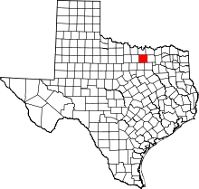 | |
| Towns | ||
| CDPs | ||
| Unincorporated communities | ||
| Ghost towns | ||
| Footnotes | ‡This populated place also has portions in an adjacent county or counties | |
