Seagoville, Texas
| City of Seagoville, Texas | |
|---|---|
| City | |
 Location of Seagoville in Dallas County, Texas | |
| Coordinates: 32°39′7″N 96°33′0″W / 32.65194°N 96.55000°WCoordinates: 32°39′7″N 96°33′0″W / 32.65194°N 96.55000°W | |
| Country |
|
| State |
|
| Counties | Dallas, Kaufman |
| Government | |
| • Type | Council-Manager |
| • City Council |
Mayor Dennis Childress Jose Hernandez Rick Howard Tommy Lemond Mike Fruin Jon Epps |
| • City Manager | Pat Stallings |
| Area | |
| • Total | 19.0 sq mi (49.2 km2) |
| • Land | 18.7 sq mi (48.4 km2) |
| • Water | 0.3 sq mi (0.8 km2) 1.58% |
| Elevation | 440 ft (134 m) |
| Population (2010) | |
| • Total | 14,835 |
| • Density | 780/sq mi (300/km2) |
| Time zone | CST (UTC-6) |
| • Summer (DST) | CDT (UTC-5) |
| ZIP code | 75159 |
| Area code(s) | 214, 469, 972 |
| FIPS code | 48-66428[1] |
| GNIS feature ID | 1346844[2] |
| Website | seagoville.us |
Seagoville is a city in Dallas County, Texas, United States, and a suburb of Dallas. A small portion of Seagoville extends into Kaufman County. The population was 14,835 at the 2010 census.[3] The city is located along U.S. Highway 175 and the Southern Pacific Railroad, 10 miles (16 km) from downtown Mesquite.[4]
History
Seagoville was originally called Seago, and under the latter name was laid out in 1876 by T. K. Seago (1836–1904), and named for him. The United States Post Office changed the town's name to "Seagoville" in 1910 to prevent confusion with another city in Texas called Sego.[4]
During World War II, the Federal Reformatory for Women in Seagoville was the site of a Immigration and Naturalization Service detention camp for Japanese, German and Italian Americans classified as "enemy aliens" and women of Japanese and German ancestry deported from Latin America.[4][5] Internees at Seagoville published a German language newsletter called the Sägedorfer Fliegende Blätter.[6] The camp housed up to 647 people, and was closed in June 1945, after the internees were either "repatriated" to Japan or Germany, or transferred to Crystal City, Texas.[5][7]
Geography
Seagoville is located at 32°39′7″N 96°33′0″W / 32.65194°N 96.55000°W (32.651920, -96.550033).[8]
According to the United States Census Bureau, the city has a total area of 19.0 square miles (49.2 km2), of which 18.7 square miles (48.4 km2) is land and 0.31 square miles (0.8 km2), or 1.58%, is water.[9]
Demographics
| Historical population | |||
|---|---|---|---|
| Census | Pop. | %± | |
| 1930 | 604 | — | |
| 1940 | 760 | 25.8% | |
| 1950 | 1,927 | 153.6% | |
| 1960 | 3,745 | 94.3% | |
| 1970 | 4,390 | 17.2% | |
| 1980 | 7,304 | 66.4% | |
| 1990 | 8,969 | 22.8% | |
| 2000 | 10,823 | 20.7% | |
| 2010 | 14,835 | 37.1% | |
| Est. 2015 | 15,894 | [10] | 7.1% |
At the 2000 census,[1] there were 10,823 people, 3,308 households and 2,464 families residing in the city. The population density was 666.3 per square mile (257.3/km²). There were 3,608 housing units at an average density of 222.1 per square mile (85.8/km²). The racial makeup of the city was 78.76% White, 9.62% African American, 0.75% Native American, 0.56% Asian, 0.07% Pacific Islander, 7.78% from other races, and 2.46% from two or more races. Hispanic or Latino of any race were 17.60% of the population.
There were 3,308 households of which 38.5% had children under the age of 18 living with them, 54.2% were married couples living together, 15.4% had a female householder with no husband present, and 25.5% were non-families. 21.0% of all households were made up of individuals and 9.2% had someone living alone who was 65 years of age or older. The average household size was 2.84 and the average family size was 3.29.
25.8% of the population were under the age of 18, 9.6% from 18 to 24, 36.2% from 25 to 44, 19.4% from 45 to 64, and 9.0% who were 65 years of age or older. The median age was 33 years. For every 100 females there were 117.8 males. For every 100 females age 18 and over, there were 126.0 males.
The median household income was $40,168 and the median family income was $45,590. Males had a median income of $33,061 versus $25,753 for females. The per capita income for the city was $17,398. About 9.3% of families and 11.8% of the population were below the poverty line, including 13.1% of those under age 18 and 17.4% of those age 65 or over.
Government and infrastructure

Federal Correctional Institution, Seagoville is located in Seagoville.
The United States Postal Service operates the Seagoville Post Office on Seagoville Road in Kleberg, Dallas.[12][13] It was previously located at 314 Glendale Avenue, in a rented facility in Seagoville.[13][14] Since circa 1882 there had been a post office in the Seagoville city limits. In 2011 the USPS announced that it was closing the existing Seagoville post office and consolidating it into the Kleberg Post Office, a USPS-owned facility since renamed to the Seagoville Post Office, citing cost-cutting reasons in response to a budget shortfall. Even though individuals had offered to pay for the rental costs at Seagoville the USPS insisted on closing the city post office. As of 2011 the Seagoville city post office was busier than the Kleberg one.[13]
Education
Primary and secondary schools
Public schools
Portions of Seagoville are within three separate independent school districts.[15]
Dallas Independent School District
Almost all of the Dallas County portion of Seagoville is served by the Dallas Independent School District. The area is within the Board of Trustees District 4.[16] Portions of Seagoville are zoned to Central Elementary School, Seagoville North Elementary School, and Seagoville Elementary School.[17] All of the city is zoned to Seagoville Middle School (6-8), and Seagoville High School (9-12).
Seagoville North Elementary School was scheduled to open in 2012.[18] Prior to 2012, the students in the Dallas County portion were zoned to Seagoville Elementary School (at the time, grades PK-2) and Central Elementary School (at the time, grades 3-5).
Seagoville Elementary, Seagoville North, and Central Elementary are within the Seagoville city limits, while Seagoville Middle and Seagoville High are in Dallas, near the city of Seagoville. Seagoville Alternative Center, an alternative school is within the city limits.
DISD maintains the Seagoville Stadium.[19]
Seagoville Independent School District was previously the town's school district. In 1965 the district was absorbed into the Dallas Independent School District.[4]
Crandall Independent School District
The minuscule Kaufman County portion is served by Crandall Independent School District. The students in the Crandall portion are zoned to Wilson Elementary School, Crandall Middle School, and Crandall High School. Wilson Elementary and Crandall Middle are within the city of Crandall. Crandall High is partially in Crandall and partially in unincorporated Kaufman County.
Mesquite Independent School District
A very small portion of northeast Seagoville is within the boundaries of Mesquite Independent School District. That portion is served by Achziger Elementary School, Terry Middle School, and John Horn High School (all three schools are in Mesquite).[20] The area was formerly zoned to Thompson Elementary School.[21]
History of schools
The first school established in Seagoville was the Brinegar School. The one room log school house, which featured split-log seating, was constructed around 1867 in the area of the modern-day Heard Park. Professor J.T. Doss built a new school building in 1880;[22] it was called Woodside. Another school opened in a four-frame building. A cyclone destroyed one of its rooms in 1903,[23] and in 1909 that school was destroyed in a fire. In 1910 a new brick high school building opened on the site of what is now Seagoville Elementary School.[22] The building, a two story facility with four rooms for upper grades upstairs and four rooms for lower grades downstairs, on land on North Kaufman Street was donated by Ben H. Fly. It was built for about $10,000 ($254392.86 according to inflation), and was known as "The High School" and "the Old Red Schoolhouse".[23]
Seagoville High School first opened in 1928 on land purchased in 1927. This high school building later burned down, and Central Elementary School opened on the former high school site. The current high school facility and Seagoville Middle School opened on a 22-acre (8.9 ha) plot of land donated by M.D. Reeves in 1952: one building opened in 1955 and the other opened in September 1958. Seagoville was in the Seagoville Independent School District until August 1964, when it merged into DISD.[23]
Public libraries
Seagoville has its own public library called the Seagoville Public Library at 702 North U.S. Highway 175.[24]
Parks and recreation
The Dallas Independent School District operates the Seagoville Stadium in Seagoville.[25]
References
- 1 2 "American FactFinder". United States Census Bureau. Retrieved 2008-01-31.
- ↑ "US Board on Geographic Names". United States Geological Survey. 2007-10-25. Retrieved 2008-01-31.
- ↑ "Profile of General Population and Housing Characteristics: 2010 Demographic Profile Data (DP-1): Seagoville city, Texas". U.S. Census Bureau, American Factfinder. Retrieved January 19, 2012.
- 1 2 3 4 Seagoville, Texas from the Handbook of Texas Online
- 1 2 Mak, Stephen. "Seogoville (detention facility)" Densho Encyclopedia (accessed 17 Jun 2014).
- ↑ "Seagoville Internee Newspaper: Sägedorfer Fliegende Blätter" (PDF). The Freedom of Information Times (in German). Retrieved 2014-02-06.
- ↑ Texas State Historical Association (TSHA). "World War II Internment Camps". The Handbook of Texas Online. Retrieved 2014-02-06.
- ↑ "US Gazetteer files: 2010, 2000, and 1990". United States Census Bureau. 2011-02-12. Retrieved 2011-04-23.
- ↑ "Geographic Identifiers: 2010 Demographic Profile Data (G001): Seagoville city, Texas". U.S. Census Bureau, American Factfinder. Retrieved January 19, 2012.
- ↑ "Annual Estimates of the Resident Population for Incorporated Places: April 1, 2010 to July 1, 2015". Retrieved July 2, 2016.
- ↑ "Census of Population and Housing". Census.gov. Retrieved June 4, 2015.
- ↑ "SEAGOVILLE." United States Postal Service. Retrieved on June 9, 2016. "15300 SEAGOVILLE RD DALLAS, TX 75253-9998"
- 1 2 3 Harris, Byron. "Seagoville post office to close ." WFAA. March 3, 2011. Retrieved on June 9, 2016.
- ↑ "Post Office Location - SEAGOVILLE." United States Postal Service. Retrieved on December 4, 2008.
- ↑ "Official Zoning Map." City of Seagoville. Retrieved on June 9, 2016.
- ↑ "Trustee District 4 with School Locations." Dallas Independent School District. Retrieved on November 24, 2008.
- ↑ "PROPOSED 2012-13 Seagoville North ES Zone." (Archive) Dallas Independent School District. Retrieved on March 11, 2013.
- ↑ "New Schools-2008 Bond Program." Dallas Independent School District. Retrieved on January 8, 2010.
- ↑ "Dallas ISD – Athletic Facilities." Dallas Independent School District. Retrieved on June 27, 2016.
- ↑ "AttendZones1213.pdf." Mesquite Independent School District. Retrieved on April 4, 2014.
- ↑ "AttendZones0809.pdf." Mesquite Independent School District. Retrieved on April 4, 2014.
- 1 2 "History." City of Seagoville. Retrieved on February 13, 2012.
- 1 2 3 Phillips, Billie Frank. Seagoville (Images of America). Arcadia Publishing, 2011. ISBN 0738578630, 9780738578637. p. 71.
- ↑ "Welcome to the Seagoville Public Library." Seagoville Public Library. Retrieved on December 4, 2008.
- ↑ "Athletic Facilities." Dallas Independent School District. Retrieved on February 24, 2012.
External links
- City of Seagoville official website
- SeagovilleGazette.com - News & Information website
- Seagoville Library
- Seagoville Chamber of Commerce
- Seagoville Economic Development Corporation
- The Suburbia News - Seagoville's Official Newspaper
- Seagoville, Texas from the Handbook of Texas Online
Municipalities and communities of Dallas County, Texas, United States | ||
|---|---|---|
| Cities | 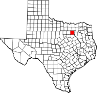 | |
| Towns | ||
| Unincorporated communities | ||
| Historical communities | ||
| Footnotes | ‡This populated place also has portions in an adjacent county or counties | |
Municipalities and communities of Kaufman County, Texas, United States | ||
|---|---|---|
| Cities | 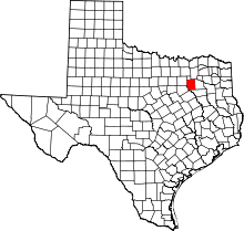 | |
| Towns | ||
| Villages | ||
| CDPs | ||
| Unincorporated communities | ||
| Footnotes | ‡This populated place also has portions in an adjacent county or counties | |
