Azle, Texas
| City of Azle, Texas | |
|---|---|
| City | |
 Location of Azle in Tarrant County, Texas | |
| Coordinates: 32°53′34″N 97°32′12″W / 32.89278°N 97.53667°WCoordinates: 32°53′34″N 97°32′12″W / 32.89278°N 97.53667°W | |
| Country |
|
| State |
|
| Counties | Parker, Tarrant[1] |
| Government | |
| • Type | Council-Manager |
| • City Council |
Mayor Alan Brundrett Dr. William Chambers David McClure Bill Jones Paul Crabtree Rouel Rothenberger, Jr. Lee Barrett |
| • City Manager | Tom Muir |
| Area | |
| • Total | 8.8 sq mi (22.9 km2) |
| • Land | 8.8 sq mi (22.8 km2) |
| • Water | 0.02 sq mi (0.04 km2) 0.20% |
| Elevation | 712 ft (217 m) |
| Population (2010)[2] | |
| • Total | 10,947 |
| • Estimate (2013)[2] | 11,334 |
| • Density | 1,241.2/sq mi (479.2/km2) |
| Time zone | CST (UTC-6) |
| • Summer (DST) | CDT (UTC-5) |
| ZIP code | 76020 |
| Area code(s) | 682 |
| FIPS code | 48-05168[3] |
| GNIS feature ID | 1329893[4] |
| Website | www.cityofazle.org |
Azle is a small city located in Parker and Tarrant counties in the U.S. state of Texas. As of the 2010 census, the city population was 10,947.[5]
Geography
Azle is on State Highway 199, 16 miles (26 km) northwest of downtown Fort Worth, in the northwest corner of Tarrant County; the town extends partly into Parker County and Wise County.
According to the United States Census Bureau, the city has a total area of 8.8 square miles (22.9 km2), of which 8.8 square miles (22.8 km2) is land and 0.015 square miles (0.04 km2), or 0.20%, is water.[6]
History
The first recorded settlement at the site occurred in 1846, when a young doctor named James Azle Stewart moved into a cabin built by a Dutchman named Rumsfeldt. Other settlers came and established themselves near the local streams, Ash Creek, Silver Creek, and Walnut Creek. Stewart helped establish the first cemetery, Ash Creek. The oldest graves there are those of Dave Morrison (1849–1874) and W. P. Gregg (1833–1874).[7] The first post office opened in 1881, and the town took the name of O'Bar, in honor of the man who obtained the postal service. A short time later in 1883, the name was changed at the request of Stewart, who donated the land for a townsite, in order to have the town named Azle.[8] The community's economy was based on agriculture. Multiple crops were grown, including wheat, corn, peanuts, sorghum, and cotton. Watermelons, cantaloupes, peaches, plums, and pears were also produced. Dairy farming became important in the early decades of the twentieth century, when local milk products were sold to creameries in Fort Worth. The population of Azle grew steadily, and by 1920, the census recorded 150 residents. By 1933, State Highway 34 (later State Highway 199), had reached Azle from Fort Worth, greatly improving transportation capabilities between the town and the city. Also, Eagle Mountain Lake was formed by a dam on the Trinity River, east of Azle.
In the late 1930s, electricity was supplied to Azle and the surrounding countryside. The population grew between 1940 and 1960 from 800 to 2,696. It was 5,822 by 1980. After the 1930s, agriculture gradually declined; fields were converted from wheat and corn production to housing developments. Manufacturing increased, and in 1984, Azle had 26 businesses. In 1985, the population was estimated at more than 7,000. The town's proximity to Fort Worth and its position as the "Gateway to Eagle Mountain Lake" have made Azle a popular place to live. In 1990, the population was 8,868. The population grew to 9,600 by 2000.[9]
Demographics
| Historical population | |||
|---|---|---|---|
| Census | Pop. | %± | |
| 1960 | 2,969 | — | |
| 1970 | 4,493 | 51.3% | |
| 1980 | 5,822 | 29.6% | |
| 1990 | 8,868 | 52.3% | |
| 2000 | 9,600 | 8.3% | |
| 2010 | 10,947 | 14.0% | |
| Est. 2015 | 11,693 | [10] | 6.8% |
As of the census[3] of 2000, there were 9,600 people, 3,716 households, and 2,701 families residing in the city. The population density was 1,170.8 people per square mile (452.0/km²). There were 3,957 housing units at an average density of 482.6 per square mile (186.3/km²). The racial makeup of the city was 95.90% White, 0.22% African American, 0.66% Native American, 0.51% Asian, 0.02% Pacific Islander, 1.41% from other races, and 1.29% from two or more races. Hispanic or Latino of any race were 4.20% of the population.
There were 3,716 households out of which 35.3% had children under the age of 18 living with them, 57.5% were married couples living together, 11.2% had a female householder with no husband present, and 27.3% were non-families. 24.0% of all households were made up of individuals and 10.1% had someone living alone who was 65 years of age or older. The average household size was 2.54 and the average family size was 3.00.
In the city the population was spread out with 26.3% under the age of 18, 7.8% from 18 to 24, 29.3% from 25 to 44, 23.7% from 45 to 64, and 12.8% who were 65 years of age or older. The median age was 37 years. For every 100 females there were 92.2 males. For every 100 females age 18 and over, there were 88.1 males.
The median income for a household in the city was $43,304, and the median income for a family was $51,660. Males had a median income of $37,522 versus $26,998 for females. The per capita income for the city was $20,817. About 6.9% of families and 9.1% of the population were below the poverty line, including 11.0% of those under age 18 and 13.3% of those age 65 or over.
Economy
Top employers
According to Azle’s 2014 Comprehensive Annual Financial Report,[12] the top employers in the city are:
| # | Employer | # of Employees |
|---|---|---|
| 1 | Azle ISD | 775 |
| 2 | Walmart | 369 |
| 3 | Harris Methodist Hospital | 248 |
| 4 | Bur-Mont Inc. | 146 |
| 5 | Tri-County Electric Coop | 142 |
| 6 | Albertson’s Grocery | 118 |
| 7 | City of Azle | 115 |
| 8 | Rockwell American (Quality Trailer) | 100 |
| 9 | TJ Machine and Tool | 95 |
| 10 | Brookshire’s Grocery | 61 |
Education
The City of Azle is served by the Azle Independent School District. The Azle High School Math/Science and Journalism teams combined won the 2005 UIL State Academic Meet championship with a total of 110 points. In 2003, 2007, and 2009 the Marching Green Pride band of Azle directed by Dr. Ross Grant advanced to the State Marching competition in San Antonio. In November 2011, the Marching Green Pride, under the direction of Shawn Murphy, placed 18th out of 244 4A marching bands in the state of Texas. In 2013, the Marching Green Pride placed 13th out of the same category.
Schools:
- Azle High School
- Santo J. Forte Junior High
- Azle Junior High
- W.E. Hoover Elementary (5-6)
- Azle Elementary (Rock School) (5-6)
- Walnut Creek Elementary
- Liberty Elementary
- Silver Creek Elementary
- Eagle Heights Elementary
- Cross Timbers Elementary
Notable people
- Chas Skelly, UFC Fighter
- James Casey (American football)
- Andrew Greer, musician
- Stephanie Klick, member of the Texas House of Representatives from District 91, formerly resided in Azle; since, Fort Worth
- Robert Landers, Senior PGA golfer
- James Reasoner, author of over 150 Westerns
- Jon Shirley, President of Microsoft Corporation
- Lawrence Sonntag, member of Funhaus
- Shelbi Vaughan, Olympic discus thrower
References
- ↑ "Azle, Texas". citytowninfo.com. QuinStreet, Inc.
- 1 2 "State and County Quick Facts". United States Census Bureau. Retrieved March 3, 2015.
- 1 2 "American FactFinder". United States Census Bureau. Archived from the original on 2013-09-11. Retrieved 2008-01-31.
- ↑ "US Board on Geographic Names". United States Geological Survey. 2007-10-25. Retrieved 2008-01-31.
- ↑ "Profile of General Population and Housing Characteristics: 2010 Demographic Profile Data (DP-1): Azle city, Texas". U.S. Census Bureau, American Factfinder. Archived from the original on September 11, 2013. Retrieved November 29, 2011.
- ↑ "Geographic Identifiers: 2010 Demographic Profile Data (DP-1): Azle city, Texas". U.S. Census Bureau, American Factfinder. Archived from the original on September 11, 2013. Retrieved November 29, 2011.
- ↑ "Historical Markers in Tarrant County - pg. 13". Tarrant County TXGenWeb.
- ↑ Texas State Historical Commission. "James Azle Stewart Historical Marker".
- ↑ Ruby Schmidt, ed., Fort Worth and Tarrant County (Fort Worth: Texas Christian University Press, 1984). Kathleen E. and Clifton R. St. Clair, eds., Little Towns of Texas (Jacksonville, Texas: Jayroe Graphic Arts, 1982).
- ↑ "Annual Estimates of the Resident Population for Incorporated Places: April 1, 2010 to July 1, 2015". Retrieved July 2, 2016.
- ↑ "Census of Population and Housing". Census.gov. Archived from the original on May 11, 2015. Retrieved June 4, 2015.
- ↑ City of Azle CAFR Retrieved 2015-07-08
External links
Municipalities and communities of Parker County, Texas, United States | ||
|---|---|---|
| Cities | 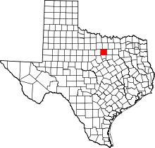 | |
| Towns | ||
| CDPs | ||
| Other unincorporated communities | ||
| Footnotes | ‡This populated place also has portions in an adjacent county or counties | |
Municipalities and communities of Tarrant County, Texas, United States | ||
|---|---|---|
| Cities |
|  |
| Towns | ||
| CDPs | ||
| Unincorporated communities | ||
| Historical communities | ||
| Ghost towns | ||
| Footnotes | ‡ This populated place also has portions in an adjacent county or counties ‡‡ Previously considered a census-designated place | |
