Grapevine Lake
| Grapevine Lake | |
|---|---|
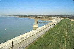 The reservoir's earthen dam | |
 Reservoir and its parks | |
| Location | Denton / Tarrant counties, North Texas, United States |
| Coordinates | 32°58′20″N 97°3′24″W / 32.97222°N 97.05667°WCoordinates: 32°58′20″N 97°3′24″W / 32.97222°N 97.05667°W |
| Type | Reservoir |
| Primary inflows | Denton Creek |
| Primary outflows | Denton Creek |
| Basin countries | Texas, United States |
| Surface area | 7,280 acres (2,950 ha) |
| Max. depth | 65 ft (20 m) |
| Water volume | 181,100 acre·ft (0.2234 km3) |
| Shore length1 | 60 miles (100 km) |
| Surface elevation | 535 ft (163 m) |
| Settlements | Grapevine, Texas |
| 1 Shore length is not a well-defined measure. | |
Grapevine Lake is a reservoir located in the North Texas region, approximately 20 mi (32 km) northwest of Dallas and northeast of Fort Worth. It was impounded in 1952 by the US Army Corps of Engineers when they dammed Denton Creek, a tributary of Trinity River.
The reservoir's primary purposes are flood control and to act as a municipal water reservoir, with a secondary function of providing recreation and open space areas. The lake's name comes from the city of Grapevine, Texas, to which the lake is adjacent.

History and construction
On March 2, 1945, the U.S. Congress approved the River & Harbors Act of 1945 which, among many projects, provided for the construction of Benbrook Lake, Grapevine Lake, Lavon Lake and Ray Roberts Lake, as well as modifications to the existing Garza Dam for the construction of Lewisville Lake. All the projects were for the purposes of both flood control and navigation. These lakes became part of an extensive floodway system that is operated in a coordinated manner to minimize flooding along the Trinity river floodplain.[1]
The Grapevine Dam and Reservoir project, as it was originally known, was initiated in January 1948. Located on Denton Creek, a tributary of the Elm Fork of the Trinity river, the project spans both Tarrant County and Denton County. In this area immediately north of the City of Grapevine, the Corps of Engineers obtained approximately 15,700 acres (63.5 km²) of land and placed easements on another 2,200 acres (8.9 km²) to be flooded by the new reservoir. The project was completed in June 1952, and impounding of water began July 3, 1952.[2]
Statistics
The dam is a rolled earth-fill type, 28 feet (8.5 m) thick, which spans 12,850 feet (3,920 m). The crest of the dam is located at 588 feet (179 m) above sea level. At the dam, the original creek bed was at 451 feet (137 m), making the dam approximately 137 ft (42 m) tall.
The dam's spillway is located at approximately 560 feet (170 m) above sea level. This gives it a flood capacity of at least 425,500 acre feet (524,800,000 m3), including an allowance for the build of up sediment in the lake's bottom. Typically, the lake is maintained near its conservation level, at 535 ft (163 m), giving it a capacity of 181,100 acre feet (223,400,000 m3) and a surface area of 7,280 acres (29.5 km²).[2]
At conservation level, the lake has approximately 60 mi (97 km) of shoreline.
Water rights
Three municipalities have water rights to the lake; the city of Grapevine, the city of Dallas, and the Dallas County Park Cities (DCPC), which provides water to various communities in Dallas County.
Under its September 1953 contract, Grapevine obtained 1,250 acre feet (1,540,000 m3) of the water in the elevations between 500 and 535 feet (152 and 163 m) above sea-level. In February 1981, the city obtained an additional 25,000 acre feet (31,000,000 m3) in the same elevations "until such time as this [water] is needed for navigation purposes." In March 1953, the city of Dallas obtained 85,000 acre feet (105,000,000 m3) of the water between 500 and 535 feet (152 and 163 m), and in March 1955, DCPC obtained 50,000 acre feet (62,000,000 m3) at the same elevations.[2]
Recreation
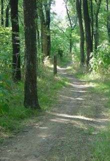 Crosstimbers horse trail. |
 The north shore of Grapevine lake. |
Parks and trails
Numerous parks surround the lake. Some of the parks are owned, leased or maintained by the local community. Others remain in the Corp of Engineer's control. The area contains 30 miles (50 km) of natural surface trails including nature, biking and equestrian trails.[3]
Trails listed by the Corps of Engineers include the nine mile (14 km) Northshore trail, the three mile (5 km) Rocky Point trail, the five mile (8 km) Crosstimbers horse trail, and the four mile (6 km) Knob Hill trail.[4]
Camping
The lake has primitive camping, prepared camping sites, and trailer / RV camping. Murrell park currently has tent and primitive camping, but is undergoing an expansion to increase camping facilities. Vineyards campground, managed by the city of Grapevine, offers site camping, RV parking, and cabins.
Marinas and boating
There are three marinas located on the lake, all operated by the private company Marinas International. On the south shore, in Grapevine, are Scott's Landing and Silver Lake. On the north shore, in Flower Mound, is Twin Coves. The marinas support an active boating community on the lake; combined, the three marinas have approximately 1,400 moorings, with land-based storage for an additional 575 vessels.[5]
Both the Grapevine Sailing Club and the United States Coast Guard Auxiliary (Flotilla 5-11 of District 8) are based at Scott's Landing.
Twelve boat ramps provide access to the lake, of which only the two ramps at Murrell park are controlled by the Corps of Engineers and available for free. Of the remaining ramps:
- The City of Trophy Club operates Trophy Club Park (formerly Marshall Creek Park) which includes a fee-based ramp ($5 for boats on trailers, $1 for kayaks and canoes).[6]
- The City of Grapevine operates public fee-based ramps at Meadowmere, Lakeview, Oak Grove, and Katie's Woods parks.
- The private company Marinas International operates a fee-based ramp at Silver Lake Marina.
- The City of Flower Mound operates a fee-based ramp at Twin Coves Park ($5 gate entry, the current ramp is being reconstructed with completion estimated in April 2014)[7]
Fishing and hunting
The lake is home to a number of fish species, including largemouth bass, spotted bass, white bass, white crappie, channel catfish, and alligator gar. Fishing regulations of most species are managed under statewide regulations. The exception is a 14 to 18 inch (36 to 46 cm) slot limit on largemouth bass; (46 cm) . Daily bag limit for all species of black bass is 5 in any combination. Murrell Park, a premier spot for catching sand and black bass on the north shore, was heavily damaged in the summer 2007 flood and was partially closed.
With a Hunting license, hunting permit, and in season, public hunting is allowed on the Corp of Engineers land located at the north-west end of the lake.[8] Waterfowl and small game hunting, as well as bow hunting of feral hogs and deer is permitted. Hunting licenses are obtained from the state of Texas and an additional permit from the U.S. Army Corps of Engineers required.
On March 24, 2010, Kris Howe found four bones of a 96-million-year-old bird. Two Dallas scientists say that the bird is the oldest in America.[9]
Adjacency to Dallas Fort Worth International Airport (DFW)
Grapevine Lake borders Dallas/Fort Worth International Airport to the northwest, making it a major landmark to persons flying into or out of that airport. Many of its features, such as its parks, marinas, and dam, are visible in great detail to the airline passengers upon takeoff or landing.
See also
Notes and references
- ↑ Benbrook Lake history
- 1 2 3 See Grapevine Lake Pertinent Data
- ↑ Savvy center's Grapevine Lake information
- ↑ Fort Worth Elm Fork District, List of Grapevine Lake trails
- ↑ 600 slips / 300 land at Scott's Landings, 400 / 200 at Silver Lake, 400 / 75 at Twin Coves, per each marina's website.
- ↑ Trophy Club Park
- ↑ Flower Mound, TX Parks and Recreation
- ↑ U.S. Army Corp of Engineers - Hunting at Grapevine Lake
- ↑ http://keranews.org/post/fossil-hunter-and-his-95-million-year-old-bird-land-new-perot-museum
- US Corps of Engineers Pertinent Data - Grapevine Lake
External links
- Maps
- Corps of Engineers' map of Grapevine lake and parks
- Corps of Engineers' map of Northshore Trail
- Information
- Elm Fork Project office of the Corps of Engineer's Grapevine Lake page
- Grapevine lake water level - database of daily lake levels from mid-1970s to current.
- Texas Parks and Wildlife's site about fishing Grapevine Lake
- Guide to Texas Outside's review of Grapevine lake
- Sailing Texas's visit to Grapevine lake
- US Coast Guard Auxiliary Flotilla 5-11 District 8, based at Scott's Landing
- Grapevine sailing club, based at Scott's Landing
- Buoys on the Lake at Twin Coves Marina
- Twin Coves Park