Fort Worth, Texas
| Fort Worth, Texas | ||
|---|---|---|
| City | ||
| City of Fort Worth | ||
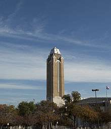
|
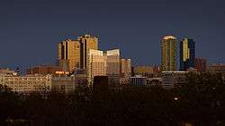
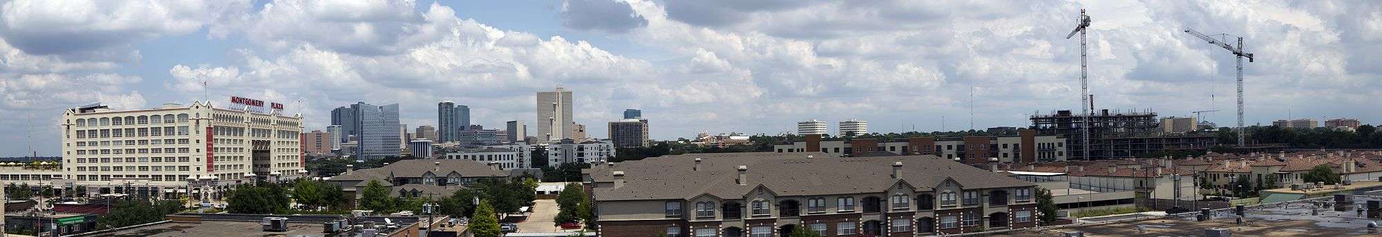
Skyline of Fort Worth | ||
| ||
| Nickname(s): Cowtown,[1] Panther City | ||
| Motto: "Where the West begins"[1] | ||
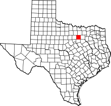
 Location of Fort Worth in Tarrant County, Texas | ||
 Fort Worth Location in the United States | ||
| Coordinates: 32°45′26.49″N 97°19′59.45″W / 32.7573583°N 97.3331806°WCoordinates: 32°45′26.49″N 97°19′59.45″W / 32.7573583°N 97.3331806°W | ||
| Country |
| |
| State |
| |
| Counties | Tarrant, Denton, Parker, Wise[2] | |
| Incorporated | 1873[3] | |
| Government | ||
| • Type | Council-Manager | |
| • Body | Fort Worth City Council | |
| • Mayor | Betsy Price (R) | |
| • City Manager | David Cooke | |
| • City Council |
List
| |
| Area | ||
| • City | 349.2 sq mi (904.4 km2) | |
| • Land | 342.2 sq mi (886.3 km2) | |
| • Water | 7.0 sq mi (18.1 km2) | |
| Elevation | 653 ft (216 m) | |
| Population (2015)[4] | ||
| • City | 833,319 (US: 16th) | |
| • Density | 2,181.0/sq mi (842.0/km2) | |
| • Metro | 7,102,796 (US: 4th) | |
| • Demonym | Fort Worther | |
| Time zone | CST (UTC-6) | |
| • Summer (DST) | CDT (UTC-5) | |
| ZIP Codes | 76008, 76028, 76036, 76101-76124, 76126-76127, 76130-76137, 76140, 76147-76148, 76150, 76155, 76161-76164, 76166, 76177, 76179, 76180-76182, 76185, 76191-76193, 76195-76199, 76244, 76247, 76262, 76129 (exclusive to TCU), 76107 | |
| Area code(s) | 214, 972,[5][6] 682, 817 | |
| FIPS code | 48-27000 | |
| GNIS feature ID | 1380947[7] | |
| Interstates |
| |
| Website | fortworthtexas.gov | |
Fort Worth is the 16th-largest city in the United States and the fifth-largest city in the state of Texas.[8] The city is in North Central Texas and covers nearly 350 square miles (910 km2) in the counties of Denton, Parker, Wise, and Tarrant, of which it is the county seat. According to the 2015 census, estimates, Fort Worth's population is 833,319.[4] The city is the second-largest in the Dallas–Fort Worth–Arlington metropolitan area (the "DFW Metroplex").
The city was established in 1849 as an Army outpost on a bluff overlooking the Trinity River. Today, Fort Worth still embraces its Western heritage and traditional architecture and design.[9][10] USS Fort Worth (LCS-3) is the first ship of the United States Navy named after the city.
Fort Worth is home to the Van Cliburn International Piano Competition and several world-class museums designed by internationally known contemporary architects. The Kimbell Art Museum, considered to have one of the best collections in Texas, is housed in what is widely regarded as one of Texas' foremost works of modern architecture, designed by Louis Kahn with an addition by Renzo Piano. Also of note is the Modern Art Museum of Fort Worth, designed by Tadao Ando. The Amon Carter Museum of American Art, designed by Philip Johnson, houses one of the most extensive collections of American art in the world in a building. The city is stimulated by several university communities: Texas Christian, Texas Wesleyan, University of North Texas Health Science Center, and Texas A&M University School of Law, and many multinational corporations, including Bell Helicopter, Lockheed Martin, American Airlines, BNSF Railway, Pier 1 Imports, and Radio Shack.
History
Treaty of Bird's Fort
The Treaty of Bird's Fort between the Republic of Texas and several Native American tribes was signed in 1843 at Bird's Fort in present-day Arlington, Texas.[11][12] Article XI of the treaty provided that no one may "pass the line of trading houses" (at the border of the Indians' territory) without permission of the President of Texas, and may not reside or remain in the Indians' territory. These "trading houses" were later established at the junction of the Clear Fork and West Fork of the Trinity River in present-day Fort Worth.[13] At this river junction, the U.S. War Department established Fort Worth in 1849 as the northernmost of a system of 10 forts for protecting the American Frontier following the end of the Mexican–American War.[14] The City of Fort Worth continues to be known as "where the West begins."[15]
The Mexican–American War
A line of seven army posts were established in 1848–49 after the Mexican War to protect the settlers of Texas along the western American Frontier and included Fort Worth, Fort Graham, Fort Gates, Fort Croghan, Fort Martin Scott, Fort Lincoln, and Fort Duncan.[16] Originally 10 forts had been proposed by Major General William Jenkins Worth (1794–1849), who commanded the Department of Texas in 1849. In January 1849, Worth proposed a line of 10 forts to mark the western Texas frontier from Eagle Pass to the confluence of the West Fork and Clear Fork of the Trinity River. One month later, Worth died from cholera in South Texas.[16]
General William S. Harney assumed command of the Department of Texas and ordered Major Ripley A. Arnold (Company F, Second United States Dragoons)[16] to find a new fort site near the West Fork and Clear Fork. On June 6, 1849, Arnold, advised by Middleton Tate Johnson, established a camp on the bank of the Trinity River and named the post Camp Worth in honor of the late General Worth. In August 1849, Arnold moved the camp to the north-facing bluff, which overlooked the mouth of the Clear Fork of the Trinity River. The United States War Department officially named the post Fort Worth on November 14, 1849.[17]
Native American attacks were still a threat in the area, as this was their traditional territory and they resented encroachment by European-American settlers, but people from the United States set up homesteads near the fort. E. S. Terrell (1812–1905) from Tennessee claimed to be the first resident of Fort Worth.[18] The fort was flooded the first year and moved to the top of the bluff; the current courthouse was built on this site. The fort was abandoned September 17, 1853.[16] No trace of it remains.
Town development
As a stop on the legendary Chisholm Trail, Fort Worth was stimulated by the business of the cattle drives and became a brawling, bustling town. Millions of head of cattle were driven north to market along this trail. Fort Worth became the center of the cattle drives, and later, the ranching industry. It was given the nickname of "Cowtown".
During Civil War, Fort Worth suffered from shortages of money, food, and supplies. the population dropped as low a 175, but began to recover during Reconstruction. By 1872, Jacob Samuels, William Jesse Boaz, and William Henry Davis had opened general stores. The next year, Khleber M. Van Zandt established Tidball, Van Zandt, and Company, which became Fort Worth National Bank in 1884.
Panther City and "Hell's Half-Acre"
In 1875, the Dallas Herald published an article by a former Fort Worth lawyer, Robert E. Cowart, who wrote that the decimation of Fort Worth's population, caused by the economic disaster and hard winter of 1873, had dealt a severe blow to the cattle industry. Added to the slowdown due to the railroad's stopping the laying of track 30 miles (48 km) outside of Fort Worth, Cowart said that Fort Worth was so slow that he saw a panther asleep in the street by the courthouse. Although an intended insult, the name Panther City was enthusiastically embraced when in 1876 Fort Worth recovered economically.[19] Many businesses and organizations continue to use Panther in their name. A panther is set at the top of the police department badges.[20]

The "Panther City" tradition is also preserved in the names and design of some of the city's geographical/architectural features, such as Panther Island (in the Trinity River), the Flat Iron Building, the Intermodal Transportation Center, and in two or three "Sleeping Panther" statues.
In 1876, the Texas and Pacific Railway finally was completed to Fort Worth, stimulating a boom and transforming the Fort Worth Stockyards into a premier center for the cattle wholesale trade.[21] Migrants from the devastated war-torn South continued to swell the population, and small, community factories and mills yielded to larger businesses. Newly dubbed the "Queen City of the Prairies", Fort Worth supplied a regional market via the growing transportation network.
Fort Worth became the westernmost railhead and a transit point for cattle shipment. With the city's main focus on cattle and the railroads, local businessman, Louville Niles, formed the Fort Worth Stockyards Company in 1893. Shortly thereafter, the two biggest cattle-slaughtering firms at the time, Armour and Swift, both established operations in the new stockyards.
With the boom times came a variety of entertainments and related problems. Fort Worth had a knack for separating cattlemen from their money. Cowboys took full advantage of their last brush with civilization before the long drive on the Chisholm Trail from Fort Worth up north to Kansas. They stocked up on provisions from local merchants, visited the colorful saloons for a bit of gambling and carousing, then galloped northward with their cattle only to whoop it up again on their way back. The town soon became home to "Hell's Half-Acre", the biggest collection of saloons, dance halls, and bawdy houses south of Dodge City (the northern terminus of the Chisholm Trail), giving Fort Worth the nickname of "The Paris of the Plains".[22]Template:Page 2016[23]
Certain sections of town were off-limits for proper citizens. Shootings, knifings, muggings, and brawls became a nightly occurrence. Cowboys were joined by a motley assortment of buffalo hunters, gunmen, adventurers, and crooks. Hell's Half Acre (the Acre) expanded as more people were drawn to the town. Occasionally, the Acre was referred to as "the bloody Third Ward" after it was designated one of the city's three political wards in 1876. By 1900, the Acre covered four of the city's main north-south thoroughfares. Local citizens became alarmed about the activities, electing Timothy Isaiah "Longhair Jim" Courtright in 1876 as city marshal with a mandate to tame it.
Courtright sometimes collected and jailed 30 people on a Saturday night, but allowed the gamblers to operate, as they attracted money to the city. After learning that train and stagecoach robbers, such as the Sam Bass gang, were using the area as a hideout, he intensified law enforcement, but certain businessmen advertised against too many restriction in the area as having bad effects on the legitimate businesses. Gradually, the cowboys began to avoid the area; as businesses suffered, the city moderated its opposition. Courtright lost his office in 1879.
Despite crusading mayors such as H. S. Broiles and newspaper editors such as B. B. Paddock, the Acre survived because it generated income for the city (all of it illegal) and excitement for visitors. Longtime Fort Worth residents claimed the place was never as wild as its reputation, but during the 1880s, Fort Worth was a regular stop on the "gambler's circuit" by such gambler/gunmen as Bat Masterson, Doc Holliday, and the Earp brothers (Wyatt, Morgan, and Virgil). James Earp, the eldest of his brothers, lived with his wife in Fort Worth during this period; their house was at the edge of Hell's Half Acre, at 9th and Calhoun. He often tended bar at the Cattlemen's Exchange saloon in the "uptown" part of the city.
Reforming citizens objected to the dance halls, where men and women mingled; by contrast, the saloons or gambling parlors had primarily male customers.
In the late 1880s, Mayor Broiles and County Attorney R. L. Carlock initiated a reform campaign. In a public shootout on February 8, 1887, Jim Courtright was killed on Main Street by Short, who claimed he was "King of Fort Worth Gamblers." As Courtright had been popular, when Short was jailed for his murder, rumors floated of lynching him. Short's good friend Bat Masterson came armed and spent the night in his cell to protect him.
The first prohibition campaign in Texas was mounted in Fort Worth in 1889, helping to shut down the Acre's worst excesses. Other business development began in the area, as well as residential.
Another change was the influx of black residents. Excluded by state segregation from the business end of town and the more costly residential areas, the city's black citizens, who numbered some 7,000 of a total population of 50,000 around 1900, settled into the southern portion of the city. Though some joined in the profitable vice trade (to run, for instance, the Black Elephant Saloon), many others found legitimate work and bought homes.
The popularity and profitability of the Acre declined and more derelicts and the homeless were seen on the streets. By 1900, most of the dance halls and gamblers were gone. Cheap variety shows and prostitution became the chief forms of entertainment. Some politicians sought reforms under the Progressive Era.
In 1911, the Reverend J. Frank Norris launched an offensive against racetrack gambling in the Baptist Standard and used the pulpit of the First Baptist Church of Fort Worth to attack vice and prostitution. Norris used the Acre to scourge the leadership of Fort Worth. When he began to link certain Fort Worth businessmen with property in the Acre and announce their names from his pulpit, the battle heated up. On February 4, 1912, Norris's church was burned to the ground; that evening, his enemies tossed a bundle of burning oiled rags onto his porch, but the fire was extinguished and caused minimal damage. A month later, the arsonists succeeded in burning down the parsonage.
In a sensational trial lasting a month, Norris was charged with perjury and arson in connection with the two fires. He was acquitted, but his continued attacks on the Acre accomplished little until 1917. A new city administration and the federal government, which was eyeing Fort Worth as a potential site for a major military training camp, joined forces with the Baptist preacher to bring down the final curtain on the Acre.
The police department compiled statistics showing that 50% of the violent crime in Fort Worth occurred in the Acre, which confirmed respectable citizens' opinion of the area. After Camp Bowie (a World War I Army training installation) was located on the outskirts of Fort Worth in 1917, the military used martial law to regulate prostitutes and barkeepers of the Acre. Fines and stiff jail sentences curtailed their activities. By the time Norris held a mock funeral parade to "bury John Barleycorn" in 1919, the Acre had become a part of Fort Worth history. The name continues to be associated with the southern end of Fort Worth.[24]
Late 20th and early 21st centuries
On March 28, 2000, at 6:15 pm, an F3 (some estimates claim an F4) tornado smashed through downtown, tearing many buildings into shreds and scrap metal. One of the hardest-hit structures was the Bank One Tower, which was one of the dominant features of the Fort Worth skyline and which had Reata, a popular restaurant, on its top floor. It has since been converted to upscale condominiums and officially renamed "The Tower". This was the first major tornado to strike Fort Worth proper since the early 1940s.[25]
When oil began to gush in West Texas in the early 20th century, and again in the late 1970s, Fort Worth was at the center of the wheeling and dealing. In July 2007, advances in horizontal drilling technology made vast natural gas reserves in the Barnett Shale available directly under the city, helping many residents receive royalty checks for their mineral rights.[26] Today, the city of Fort Worth and many residents are dealing with the benefits and issues associated with the natural gas reserves under ground.[27][28]
Fort Worth was the fastest-growing large city in the United States from 2000 to 2006[29] and was voted one of "America's Most Livable Communities."[30]
Geography and climate
Fort Worth is located in North Texas, and has a generally humid subtropical climate.[31] It is part of the Cross Timbers region;[32] this region is a boundary between the more heavily forested eastern parts and the rolling hills and prairies of the central part. Specifically, the city is part of the Grand Prairie ecoregion within the Cross Timbers.
The Dallas–Fort Worth metroplex is the hub of the North Texas region. According to the United States Census Bureau, the city has a total area of 298.9 square miles (774 km2), of which 292.5 square miles (758 km2) is land and 6.3 square miles (16 km2) (2.12%) is covered by water.
A large storage dam was built in 1913 on the West Fork of the Trinity River, 7 miles (11 km) from the city, with a storage capacity of 30 billion US gallons (110,000,000 m³) of water. The lake formed by this dam is known as Lake Worth. The cost of the dam was nearly US$1,500,000.
The city is not entirely contiguous and has several enclaves, practical enclaves, semi-enclaves and cities that are otherwise completely or nearly surrounded by it, including: Westworth Village, Texas, River Oaks, Texas, Saginaw, Texas, Blue Mound, Texas, Benbrook, Texas, Everman, Texas, Forest Hill, Texas, Edgecliff Village, Texas, Westover Hills, Texas, White Settlement, Texas, Sansom Park, Texas, Lake Worth, Texas, and Haslet, Texas.
Cityscape
Architecture
Downtown is mainly known for its Art Deco-style buildings. The Tarrant County Courthouse was created in the American Beaux Arts design, which was modeled after the Texas State Capitol building. Most of the structures around Sundance Square have preserved their early 20th-century façades. Downtown has a unique rustic architecture.
Natural gas wells
The city of Fort Worth contains over 1000 natural gas wells (December 2009 count) tapping the Barnett Shale. Each well site is a bare patch of gravel 2–5 acres (8,100–20,200 m2) in size. As city ordinances permit them in all zoning categories, including residential, well sites can be found in a variety of locations. Some wells are surrounded by masonry fences, but most are secured by chain link.
Surrounding municipalities
 |
River Oaks (4.9 miles) |
Saginaw (11.5 miles) Blue Mound (9.7 miles) |
Haltom City (5.5 miles) |
|
| Westworth Village (7.5 miles) |
|
Arlington (15 miles) | ||
| ||||
| | ||||
| Benbrook (11.6 miles) |
Edgecliff Village (8.7 miles) Burleson (15.8 miles) |
Forest Hill (8.6 miles) |
Climate
Fort Worth has a humid subtropical climate according to the Köppen climate classification system[33] and is within USDA hardiness zone 8a. The hottest month of the year is July, when the average high temperature is 95 °F (35.0 °C), and overnight low temperatures average 72 °F (22.2 °C), giving an average temperature of 84 °F (28.9 °C).[34] The coldest month of the year is January, when the average high temperature is 55 °F (12.8 °C) and low temperatures average 31 °F (−0.6 °C).[34] The average temperature in January is 43 °F (6 °C).[34] The highest temperature ever recorded in Fort Worth is 113 °F (45.0 °C), on June 26, 1980, during the Great 1980 Heat Wave,[35] and June 27, 1980.[36] The coldest temperature ever recorded in Fort Worth was −8 °F (−22.2 °C) on February 12, 1899.[37] Because of its position in North Texas, Fort Worth is very susceptible to supercell thunderstorms, which produce large hail and can produce tornados.
The average annual precipitation for Fort Worth is 34.01 inches (863.9 mm).[34] The wettest month of the year is May, when an average of 4.58 inches (116.3 mm) of precipitation falls.[34] The driest month of the year is January, when only 1.70 inches (43.2 mm) of precipitation falls.[34] The driest calendar year since records began has been 1921 with 17.91 inches (454.9 mm) and the wettest 2015 with 62.61 inches (1,590.3 mm). The wettest calendar month has been April 1922 with 17.64 inches (448.1 mm), including 8.56 inches (217.4 mm) on April 25.
The average annual snowfall in Fort Worth is 2.6 inches (0.07 m).[38] The most snowfall in one month has been 13.5 inches (0.34 m) in February 1978, and the most in a season 17.6 inches (0.45 m) in 1977/1978.
The National Weather Service office which serves the Dallas-Fort Worth Metroplex is based in the northeastern part of Fort Worth.[39]
| Climate data for Fort Worth, Texas | |||||||||||||
|---|---|---|---|---|---|---|---|---|---|---|---|---|---|
| Month | Jan | Feb | Mar | Apr | May | Jun | Jul | Aug | Sep | Oct | Nov | Dec | Year |
| Record high °F (°C) | 80 (27) |
79 (26) |
87 (31) |
92 (33) |
97 (36) |
102 (39) |
110 (43) |
113 (45) |
111 (44) |
103 (39) |
89 (32) |
83 (28) |
113 (45) |
| Average high °F (°C) | 54.1 (12.3) |
60.1 (15.6) |
68.3 (20.2) |
75.9 (24.4) |
83.2 (28.4) |
91.1 (32.8) |
95.4 (35.2) |
94.8 (34.9) |
87.7 (30.9) |
77.9 (25.5) |
65.1 (18.4) |
56.5 (13.6) |
75.84 (24.35) |
| Daily mean °F (°C) | 44.1 (6.7) |
49.4 (9.7) |
57.4 (14.1) |
65.0 (18.3) |
73.1 (22.8) |
80.9 (27.2) |
85.0 (29.4) |
84.4 (29.1) |
77.5 (25.3) |
67.2 (19.6) |
55.1 (12.8) |
46.7 (8.2) |
65.48 (18.6) |
| Average low °F (°C) | 34.0 (1.1) |
38.7 (3.7) |
46.4 (8) |
54.0 (12.2) |
63.0 (17.2) |
70.7 (21.5) |
74.6 (23.7) |
74.0 (23.3) |
67.2 (19.6) |
56.4 (13.6) |
45.1 (7.3) |
36.8 (2.7) |
55.08 (12.83) |
| Record low °F (°C) | −7 (−22) |
−5 (−21) |
−2 (−19) |
21 (−6) |
32 (0) |
43 (6) |
52 (11) |
59 (15) |
31 (−1) |
24 (−4) |
−3 (−19) |
−5 (−21) |
−7 (−22) |
| Average precipitation inches (mm) | 1.89 (48) |
2.37 (60.2) |
3.06 (77.7) |
3.20 (81.3) |
5.15 (130.8) |
3.23 (82) |
2.12 (53.8) |
2.03 (51.6) |
2.42 (61.5) |
4.11 (104.4) |
2.57 (65.3) |
2.57 (65.3) |
34.72 (881.9) |
| Average precipitation days | 7.2 | 6.1 | 7.5 | 7.2 | 9.3 | 7.2 | 4.7 | 4.5 | 5.8 | 7.1 | 6.7 | 6.5 | 79.8 |
| Source: National Climatic Data Center[40] | |||||||||||||
Demographics
| Historical population | |||
|---|---|---|---|
| Census | Pop. | %± | |
| 1880 | 6,663 | — | |
| 1890 | 23,076 | 246.3% | |
| 1900 | 26,668 | 15.6% | |
| 1910 | 73,312 | 174.9% | |
| 1920 | 106,482 | 45.2% | |
| 1930 | 163,447 | 53.5% | |
| 1940 | 177,662 | 8.7% | |
| 1950 | 278,778 | 56.9% | |
| 1960 | 356,268 | 27.8% | |
| 1970 | 393,476 | 10.4% | |
| 1980 | 385,164 | −2.1% | |
| 1990 | 447,619 | 16.2% | |
| 2000 | 534,697 | 19.5% | |
| 2010 | 741,206 | 38.6% | |
| Est. 2015 | 833,319 | [41] | 12.4% |
| U.S. Decennial Census[42] 2013 Estimate[43] | |||
| Racial composition | 2010[44] | 1990[45] | 1970[45] | 1940[45] |
|---|---|---|---|---|
| White | 61.6% | 63.8% | 79.4% | 85.7% |
| —Non-Hispanic | 41.7% | 56.5% | 72.0%[46] | n/a |
| Black or African American | 18.9% | 22.0% | 19.9% | 14.2% |
| Hispanic or Latino (of any race) | 34.1% | 19.5% | 7.9%[46] | n/a |
| Asian | 3.7% | 2.0% | 0.1% | - |
According to the 2010 census, the racial composition of Fort Worth was:
- White: 61.1% (non-Hispanic Whites: 41.7%)
- Black or African American: 18.9%
- Native American: 0.6%
- Asian: 3.7% (1.0% Vietnamese, 0.6% Indian, 0.4% Laotian, 0.3% Filipino, 0.3% Korean, 0.3% Chinese, 0.1% Pakistani, 0.1% Burmese, 0.1% Cambodian, 0.1% Nepalese, 0.1% Thai, 0.1% Japanese)
- Native Hawaiian and Other Pacific Islander: 0.1%
- Two or more races: 3.1%
- Hispanic or Latino (of any race): 34.1% (29.6% Mexican, 1.3% Salvadoran, 0.8% Puerto Rican, 0.6% Honduran, 0.4% Guatemalan, 0.2% Cuban)
As of the census of 2000, 534,694 people, 195,078 households, and 127,581 families resided in the city. The July 2004 census estimates have placed Fort Worth in the top 20 most populous cities (# 19) in the U.S. with the population at 604,538. Fort Worth is also in the top five cities with the largest numerical increase from July 1, 2003 to July 1, 2004, with 17,872 more people or a 3.1% increase.[47] The population density was 1,827.8 people per square mile (705.7/km²). There were 211,035 housing units at an average density of 721.4 per square mile (278.5/km²). The racial makeup of the city was 59.69% White, 20.26% Black or African American, 0.59% Native American, 2.64% Asian, 0.06% Pacific Islander, 14.05% from other races, and 2.72% from two or more races. About 29.81% of the population were Hispanics or Latinos of any race.
In 1970, the Census Bureau reported Fort Worth's population as 72% non-Hispanic White, 19.9% Black, and 7.9% Hispanic.[45]
Of the 195,078 households, 34.7% had children under the age of 18 living with them, 45.8% were married couples living together, 14.7% had a female householder with no husband present, and 34.6% were not families; 9,599 were unmarried partner households: 8,202 heterosexual, 676 same-sex male, and 721 same-sex female households. About 28.6% of all households were made up of individuals and 7.7% had someone living alone who was 65 years of age or older. The average household size was 2.67 and the average family size was 3.33.
In the city, the population was distributed as 28.3% under the age of 18, 11.3% from 18 to 24, 32.7% from 25 to 44, 18.2% from 45 to 64, and 9.6% who were 65 years of age or older. The median age was 31 years. For every 100 females, there were 97.3 males. For every 100 females age 18 and over, there were 94.5 males.
The median income for a household in the city was $37,074, and for a family was $42,939. Males had a median income of $31,663 versus $25,917 for females. The per capita income for the city was $18,800. About 12.7% of families and 15.9% of the population were below the poverty line, including 21.4% of those under age 18 and 11.7% of those age 65 or over.
Economy
Major companies based in Fort Worth include American Airlines Group (and subsidiaries American Airlines and Envoy Air), D. R. Horton, the John Peter Smith Hospital, Pier 1 Imports, RadioShack, and the BNSF Railway.
In 2013, Fort Worth-Arlington ranked 15th on Forbes' list of the Best Places for Business and Careers.[48]
Top employers
According to the city's 2011 Comprehensive Annual Financial Report,[49] the top employers in the Fort Worth area are:
| # | Employer | Number of employees |
|---|---|---|
| 1 | Lockheed Martin Aeronautics | 13,500 |
| 2 | Naval Air Station Joint Reserve Base Fort Worth | 11,400 |
| 3 | Fort Worth Independent School District | 10,100 |
| 4 | American Airlines Group | 6,500 |
| 5 | City of Fort Worth | 6,100 |
| 6 | JPS Health Network | 4,300 |
| 7 | Harris Methodist Hospital | 4,000 |
| 8 | Bell Helicopter | 3,800 |
| 9 | Alcon | 3,300 |
| 10 | Cook Children's Health Care System | 3,100 |
Culture
Building on its frontier western heritage and a history of strong local arts patronage, Fort Worth, in recent years, has begun promoting itself as the "City of Cowboys and Culture".[50] Fort Worth has the world's first and largest indoor rodeo.
Arts and sciences
- Theatre
Bass Performance Hall, Casa Mañana, Stage West Theatre, Kids Who Care Inc., Jubilee Theater, Circle Theatre, Amphibian Stage Productions
- Museums
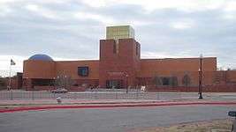
Kimbell Art Museum, Amon Carter Museum of American Art, Modern Art Museum of Fort Worth, Sid Richardson Museum, Fort Worth Museum of Science and History, National Cowgirl Museum and Hall of Fame, Military Museum of Fort Worth, Texas Civil War Museum, Texas Cowboy Hall of Fame, Fort Worth Stockyards Museum, Al and Ann Stohlman Museum, Lenora Rolla Heritage Center Museum, National Multicultural Western Heritage Museum
- Music
Fort Worth Symphony Orchestra, Billy Bob's, Texas Ballet Theater, Van Cliburn International Piano Competition, Fort Worth Opera, Live Eclectic Music (Ridglea Theater[51])
The Academy of Western Artists, based in Gene Autry, Oklahoma presents its annual awards in Fort Worth in fields related to the American cowboy, including music, literature, and even chuckwagon cooking.[52]
- Nature
The Fort Worth Zoo is home to over 5000 animals and has been named as a top zoo in the nation by Family Life magazine, the Los Angeles Times, and USA Today and one of the top zoos in the South by Southern Living Reader's Choice Awards; it has been ranked in the top 10 zoos in the United States.
The Fort Worth Botanic Garden and the Botanical Research Institute of Texas are also in the city. For those interested in hiking, birding, or canoeing, the Fort Worth Nature Center and Refuge in northwest Fort Worth is a 3621-acre preserved natural area designated by the Department of the Interior as a National Natural Landmark Site in 1980. Established in 1964 as the Greer Island Nature Center and Refuge, it celebrated its 50th anniversary in 2014. The Nature Center has small, genetically pure bison herd, a resident prairie dog town, and the prairie upon which they live. It is one of the largest urban parks of its type in the U.S.
Parks
Fort Worth has a total of 263 parks with 179 of those bring neighborhood parks. The total acres of park land is 11,700.72 acres with the average being about 12.13 acres per park. [53]
There are two dog parks located in the city including ZBonz Dog Park and Fort Woof. These are both off-leash dog parks. Fort Woof was recognized by Dog Fancy Magazine as the No. 1 Dog Park in the Nation in 2006, and as City Voter’s the Best Dog Park in the Metroplex in 2009. The park includes an agility course, water fountains, shaded shelters and waste stations. [54]
Sports and recreation
While much of Fort Worth's sports attention is focused on the Metroplex's professional sports teams, the city has its own athletic identity. The TCU Horned Frogs compete in NCAA Division I athletics, including the football team, consistently ranked in the top 25, and the baseball team, which has competed in the last six NCAA tournaments and 3 straight CWS, coming within a win of making the College World Series finals in 2009 and 2016. The women's basketball team has competed in the last seven NCAA tournaments. Texas Wesleyan University competes in the NAIA, and won the 2006 NAIA Div. I Men's Basketball championship and three-time National Collegiate Table Tennis Association (NCTTA) team championships (2004–2006). Fort Worth is also home to the NCAA football Bell Helicopter Armed Forces Bowl, as well as four minor-league professional sports teams. One of these minor league teams, the Fort Worth Cats baseball team, was reborn in 2001. The original Cats were a very popular minor league team in Fort Worth from the 19th century (when they were called the Panthers) until 1960, when the team was merged into the Dallas Rangers.
TCU Horned Frogs
The presence of Texas Christian University less than 5 miles (8 km) from downtown and national competitiveness in football, baseball, and men's and women's basketball have sustained TCU as an important part of Fort Worth's sports scene.
The Horned Frog football team produced two national championships in the 1930s and remained a strong competitor in the Southwest Conference into the 1960s before beginning a long period of underperformance. The revival of the TCU football program began under Coach Dennis Franchione with the success of running back LaDainian Tomlinson. Under Head Coach Gary Patterson, the Horned Frogs have developed into a perennial top-10 contender, and a Rose Bowl winner in 2011. Notable players include Sammy Baugh, Davey O'Brien, Bob Lilly, LaDainian Tomlinson, Jerry Hughes, and Andy Dalton.[55] The Horned Frogs, along with their rivals and fellow non-AQ leaders the Boise State Broncos and University of Utah Utes, were deemed the quintessential "BCS Busters", having appeared in both the Fiesta and Rose Bowls. Their "BCS Buster" role ended in 2012 when they joined the Big 12 athletic conference in all sports. The Horned Frog football teams have one of the best winning percentages of any school in the Football Bowl Subdivision in recent years.
Colonial National Invitational Golf Tournament
Fort Worth hosts an important professional men's golf tournament every May at the Colonial Country Club. The Colonial Invitational Golf Tournament, now officially known as the Dean & DeLuca Invitational, is one of the more prestigious and historical events of the tour calendar. The Colonial Country Club was the home course of golfing legend Ben Hogan, who was from Fort Worth.
Professional sports teams
The Fort Worth Cats were a professional baseball team founded in 2001 as part of the All-American Association. Their home venue is LaGrave Field. As of 2013, the team was affiliated with United League Baseball.
Fort Worth Vaqueros FC are a minor league soccer team[56] which began play in the summer of 2014. They are part of the National Premier Soccer League and play their home games at Martin Field.
Motor racing
Fort Worth is home to Texas Motor Speedway, also known as "The Great American Speedway". Texas Motor Speedway is a 1.5-mile quad-oval track located in the far northern part of the city in Denton County. The speedway opened in 1997, and currently hosts an IndyCar event and six NASCAR events among three major race weekends a year.[57][58]
Amateur sports-car racing in the greater Fort Worth area occurs mostly at two purpose-built tracks: Motorsport Ranch and Eagles Canyon Raceway. Sanctioning bodies include the Porsche Club of America, the National Auto Sports Association, and the Sports Car Club of America.
Cowtown Marathon
The annual Cowtown Marathon has been held every last weekend in February since 1978. The two-day activities include two 5Ks, a 10K, the half marathon, marathon, and ultra marathon. With just under 27,000 participants in 2013, the Cowtown is the largest multiple-distance event in Texas.
Government
City government
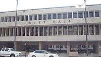
Fort Worth has a council-manager government, with elections held every two years for a mayor, elected at large, and eight council members, elected by district. The mayor is a voting member of the council and represents the city on ceremonial occasions. The council has the power to adopt municipal ordinances and resolutions, make proclamations, set the city tax rate, approve the city budget, and appoint the city secretary, city attorney, city auditor, municipal court judges, and members of city boards and commissions. The day-to-day operations of city government are overseen by the city manager, who is also appointed by the council.[59]
City departments
- Fort Worth Police Department - provides crime prevention, investigation, and other emergency services.
- Fort Worth Fire Department - provides fire and emergency services.
State representation
The Texas Department of Transportation operates the Fort Worth District Office in Fort Worth.[60]
The North Texas Intermediate Sanction Facility, a privately operated prison facility housing short-term parole violators, was in Fort Worth. It was operated on behalf of the Texas Department of Criminal Justice. In 2011, the state of Texas decided not to renew its contract with the facility.[61]
State Senator Konni Burton (R) Represents Fort Worth (district 10)
Federal representation
Fort Worth is split between Texas's 6th congressional district, represented by Republican Joe Barton; Texas's 12th congressional district, represented by Republican Kay Granger; Texas's 24th congressional district, represented by Republican Kenny Marchant; Texas's 26th congressional district, represented by Republican Michael Burgess; and Texas's 33rd congressional district, represented by Democrat Marc Veasey.
Federal facilities
Fort Worth is home to one of the two locations of the Bureau of Engraving and Printing. In 1987, construction on this second facility began. In addition to meeting increased production requirements, a western location was seen to serve as a contingency operation in case of emergencies in the Washington, DC, metropolitan area; as well, costs for transporting currency to Federal Reserve banks in San Francisco, Dallas, and Kansas City would be reduced. Currency production began in December 1990 at the Fort Worth facility, the official dedication took place April 26, 1991.
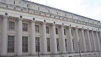
The Eldon B. Mahon United States Courthouse building contains three oil-on-canvas panels on the fourth floor by artist Frank Mechau (commissioned under the Public Works Administration's art program).[62] Mechau's paintings, The Taking of Sam Bass, Two Texas Rangers, and Flags Over Texas were installed in 1940, becoming the only New Deal art commission sponsored in Fort Worth. The courthouse, built in 1933, serves the United States District Court for the Northern District of Texas and was listed in the National Register of Historic Places in 2001.
Federal Medical Center, Carswell, a federal prison and health facility for women, is located in the Naval Air Station Joint Reserve Base Fort Worth.[63] Carswell houses the federal death row for female inmates.[64]
The Federal Aviation Administration and Federal Bureau of Investigation have offices in Fort Worth.
Education
Public libraries
Fort Worth Library is the public library system.
Public schools
Most of Fort Worth is served by the Fort Worth Independent School District.
Other school districts that serve portions of Fort Worth include:
- Arlington Independent School District (wastewater plant only)
- Azle Independent School District
- Birdville Independent School District
- Burleson Independent School District
- Castleberry Independent School District
- Crowley Independent School District
- Eagle Mountain-Saginaw Independent School District
- Everman Independent School District
- Hurst-Euless-Bedford Independent School District
- Keller Independent School District
- Kennedale Independent School District
- Lake Worth Independent School District
- Mansfield Independent School District (residential)
- Northwest Independent School District
- White Settlement Independent School District
The portion of Fort Worth within the Arlington Independent School District contains a wastewater plant. No residential areas are in the portion.
Pinnacle Academy of the Arts (K-12) is a state charter school, as is Crosstimbers Academy.
Private schools
Private schools in Fort Worth include both secular and parochial.
- All Saints' Episcopal School (Fort Worth, TX) (PreK-12)
- Bethesda Christian School (K-12)
- Colleyville Covenant Christian Academy (PreK-12)
- Fort Worth Christian School (K-12)
- Fort Worth Country Day School (K-12)
- Nolan Catholic High School (9-12)
- Trinity Valley School (K-12)
- Temple Christian School (PreK-12)
- Trinity Baptist Temple Academy (K-12)
- Hill School of Fort Worth (2–12)
- Southwest Christian School (K-12)
- St. Paul Lutheran School (K-8)
- The Roman Catholic Diocese of Fort Worth oversees several Catholic elementary and middle schools.[65]
Institutes of higher education
- Texas Christian University
- Texas Wesleyan University
- University of Texas at Arlington Fort Worth campus
- University of North Texas Health Science Center
- Texas A&M University School of Law
- Tarleton State University Fort Worth campus
- Southwestern Baptist Theological Seminary
- Brite Divinity School
- Tarrant County College
Other institutions:
- The Art Institute of Fort Worth
- Brightwood College - Fort Worth Campus
- Fisher More College
- Remington College Fort Worth campus
- Westwood College Fort Worth campus
- The Culinary School of Fort Worth
Media
Fort Worth is shared by Dallas's media market.
Magazines
The city's magazine is Fort Worth, Texas Magazine, which publishes information about Fort Worth events, social activity, fashion, dining, and culture.[66]
Radio stations
Many radio stations are in and around Fort Worth, with many different formats.
AM
On the AM dial, like in all other markets, political talk radio is prevalent, with WBAP 820, KLIF 570, KEXB 620, KSKY 660, KRLD 1080 the conservative talk stations serving Fort Worth and KMNY 1360 the sole progressive talk station serving the city. KFXR 1190 is a news/talk/classic country station. Sports talk can be found on KTCK 1310 ("The Ticket"). WBAP, a 50,000-watt clear-channel station which can be heard over much of the country at night, was a long-successful country music station before converting to its current talk format.
Several religious stations are also on AM in the Dallas/Fort Worth area; KHVN 970 and KGGR 1040 are the local urban gospel stations and KKGM 1630 has a Southern gospel format.
Fort Worth's Spanish-speaking population is served by many stations on AM:
A few mixed Asian language stations serve Fort Worth:
Other formats found on the Fort Worth AM dial are urban KKDA 730, business talk KJSA 1120, country station KCLE 1460.
FM
KLNO is a commercial radio station licensed to Fort Worth. Long-time Fort Worth resident Marcos A. Rodriguez operated Dallas Fort Worth radio stations KLTY and KESS on 94.1 FM.
Noncommercial stations serve the city fairly well. Three college stations can be heard - KTCU 88.7, KCBI 90.9, and KNTU 88.1, with a variety of programming. Also, the local NPR station is KERA 90.1, along with community radio station KNON 89.3. Downtown Fort Worth also hosts the Texas Country radio station KFWR 95.9 The Ranch.
A wide variety of commercial formats, mostly music, are on the FM dial in Fort Worth.
Internet radio stations and shows
When local radio station KOAI 107.5 FM, now KMVK, dropped its smooth jazz format, fans set up smoothjazz1075.com, an internet radio station, to broadcast smooth jazz for disgruntled fans.
A couple of internet radio shows are in the Fort Worth area, DFDubbIsHot and The Broadband Brothers.
Television stations
Fort Worth shares a television market with nearby Dallas. Owned-and-operated stations of their affiliated networks are highlighted in bold.
- KDFW – FOX Channel 4
- KXAS-TV – NBC Channel 5
- WFAA – ABC Channel 8
- KTVT – CBS Channel 11
- KERA – PBS Channel 13
- KTXA – Independent Channel 21
- KDFI – MNTV Channel 27
- KDAF – CW Channel 33
- KFWD – Independent Channel 52
- K31GL-D – TV31.4
Newspapers
Fort Worth has one newspaper published daily, the Fort Worth Star-Telegram. The Star-Telegram is the 45-most widely circulated newspaper in the United States, with a daily circulation of 210,990 and a Sunday circulation of 304,200.
The Fort Worth Weekly is an alternative weekly newspaper that serves the Dallas/Fort Worth Metroplex. The newspaper has an approximate circulation of 50,000. The Fort Worth Weekly publishes every Wednesday and features, among many things, news reporting, cultural event guides, movie reviews, and editorials.
Fort Worth Business Press is a weekly publication that chronicles news in the Fort Worth business community. Fort Worth, Texas Magazine is a monthly publication that highlights the social and cultural life of the city.
The Fort Worth Press was a daily newspaper, published weekday afternoons and on Sundays from 1900 until 1975. It was owned by the E. W. Scripps Company and published under the then-prominent Scripps-Howard Lighthouse logo. The paper reportedly last made money in the early 1950s. Scripps Howard stayed with the paper until mid-1975. Circulation had dwindled to fewer than 30,000 daily, just more than 10% of that of the Fort Worth Star Telegram. The name Fort Worth Press was resurrected briefly in a new Fort Worth Press paper operated by then-former publisher Bill McAda and briefer still by William Dean Singleton, then-owner of the weekly Azle (Texas) News, now owner of the Media Central news group. The Fort Worth Press operated from offices and presses at 500 Jones Street in downtown Fort Worth.[67]
Transportation
Like most cities that grew quickly after World War II, Fort Worth's main mode of transportation is the automobile, but bus transportation via The T is available, as well as an interurban train service to Dallas via the Trinity Railway Express.
History
Electric streetcars
The first streetcar company in Fort Worth was the Fort Worth Street Railway Company. Its first line began operating in December 1876, and traveled from the courthouse down Main Street to the T&P Depot.[68] By 1890, more than 20 private companies were operating streetcar lines in Fort Worth. The Fort Worth Street Railway Company bought out many of its competitors, and was eventually itself bought out by the Bishop & Sherwin Syndicate in 1901.[69] The new ownership changed the company's name to the Northern Texas Traction Company, which operated 84 miles of streetcar railways in 1925, and their lines connected downtown Fort Worth to TCU, the Near Southside, Arlington Heights, Lake Como, and the Stockyards.
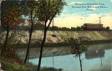
Electric interurban railways
At its peak, the electric interurban industry in Texas consisted of almost 500 miles of track, making Texas the second in interurban mileage in all states west of the Mississippi River. Electric interurban railways were prominent in the early 1900s, peaking in the 1910s and fading until all electric interurban railways were abandoned by 1948. Close to three-fourths of the mileage was in the Dallas-Fort Worth area, running between Fort Worth and Dallas and to other area cities including Cleburne, Denison, Corsicana, and Waco. The line depicted in the associated image was the second to be constructed in Texas and ran 35 miles between Fort Worth and Dallas. Northern Texas Traction Company built the railway, which was operational from 1902 to 1934.[70]
Current transport
Roads
Fort Worth is served by four interstates and two US highways. It also contains a number of arterial streets in a grid formation.
Interstate highways 30, 20, 35W, and 820 all pass through the city limits.
Interstate 820 is a spur of Interstate 20 and serves as a beltway for the city. Interstate 30 and Interstate 20 connect Fort Worth to Arlington, Grand Prairie, and Dallas. Interstate 35W connects Fort Worth with Hillsboro to the south and the cities of Denton and Gainesville to the north.
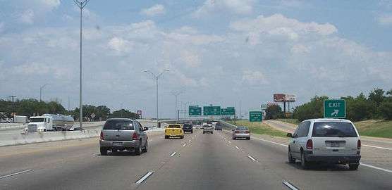
U.S. Route 287 runs southeast through the city connecting Wichita Falls to the north and Mansfield to the south. U.S. Route 377 runs south through the northern suburbs of Haltom City and Keller through the central business district.
Notable state highways:
- Texas State Highway 114 (east-west)
- Texas State Highway 183 (east-west)
- Texas State Highway 121 (north-south)
(List of Dallas-Fort Worth area freeways)
Public transportation
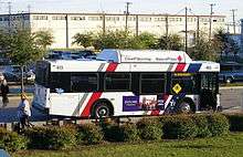
The Fort Worth Transportation Authority, better known as The T, serves Fort Worth with dozens of different bus routes throughout the city, including a downtown bus circulator known as Molly the Trolley. The T operates buses in the suburbs of Richland Hills (route 41) and Arlington (MAX).[71]
In 2010, Fort Worth won a $25 million Federal Urban Circulator grant to build a streetcar system.[72] In December 2010, though, the city council forfeited the grant by voting to end the streetcar study.[73]
Rail transportation
- The Trinity Railway Express is a commuter rail line that connects downtown Fort Worth with downtown Dallas and several suburban stations between the two major cities.[74]
- Two Amtrak routes stop at the Fort Worth Intermodal Transportation Center: The Heartland Flyer and Texas Eagle.
Airports
- Dallas/Fort Worth International Airport is a major commercial airport located between the major cities of Fort Worth and Dallas. DFW Airport is the world's third-busiest airport based on operations and tenth-busiest airport based on passengers.[75]
Prior to the construction of DFW, the city was served by Greater Southwest International Airport, which was located just to the south of the new airport. Originally named Amon Carter Field after one of the city's influential mayors, Greater Southwest opened in 1953 and operated as the primary airport for Fort Worth until 1974. It was then abandoned until the terminal was torn down in 1980. The site of the former airport is now a mixed-use development straddled by Texas State Highway 183 and 360. One small section of runway remains north of Highway 183, and serves as the only reminder that a major commercial airport once occupied the site.
Fort Worth is home to these four airports within city limits:
- Fort Worth Alliance Airport
- Fort Worth Meacham International Airport
- Fort Worth Spinks Airport
- Naval Air Station Joint Reserve Base Fort Worth
Walkability
A 2011 study by Walk Score ranked Fort Worth 47th-most walkable of 50 largest U.S. cities.[76]
Biking
The Fort Worth Bike Sharing is a nonprofit organization that controls Fort Worth B-Cycle, a bike-sharing program introduced to the area on April 22, 2013. There are 45 stations across the city with 350 bikes available for rent all day, every day of the year. These areas include Downtown, the Cultural District, the Trinity Trails, the Stockyards, Near Southside and on TCU’s campus. Their mission is to “enhance our community by providing an affordable, efficient, environmentally-friendly bike share program that complements our existing public transportation system and provides both residents and visitors a healthy, convenient way to move around our city”.[77]
Notable people
Sister cities
Fort Worth is a part of the Sister Cities International program and maintains cultural and economic exchange programs with its eight sister cities.[78][79]
 Reggio Emilia, Italy (1985)
 Nagaoka, Niigata Prefecture, Japan (1987)
 Trier, Germany (1987)
 Bandung, Indonesia (1990)
 Budapest, Hungary (1990)[80]
 Toluca, Mexico (1998)
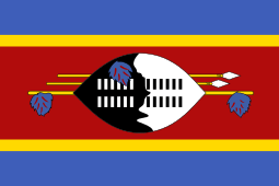 Mbabane, Swaziland (2004)
 Guiyang, China (2010)
See also
References
- 1 2 "From a cowtown to Cowtown". Retrieved October 6, 2011.
- ↑ "Fort Worth Geographic Information Systems". Retrieved February 14, 2009.
- ↑ http://fortworthtexas.gov/uploadedFiles/Finance/Financial_Reports/2011_CAFR.pdf
- 1 2 "American FactFinder – Results". United States Census Bureau, Population Division. Retrieved June 17, 2016.
- ↑ "Area Code Lookup (NPA NXX)". area-codes.com. Retrieved March 3, 2016.
- ↑ "Area Code Lookup (NPA NXX)". area-codes.com. Retrieved March 3, 2016.
- ↑ "US Board on Geographic Names". United States Geological Survey. October 25, 2007. Retrieved January 31, 2008.
- ↑ McCann, Ian (July 10, 2008). "McKinney falls to third in rank of fastest-growing cities in U.S.". The Dallas Morning News. Archived from the original on December 29, 2010.
- ↑ "Fort Worth, from uTexas.com". Retrieved December 30, 2008.
- ↑ "International Programs: Fort Worth". Archived from the original on January 29, 2009. Retrieved December 30, 2008.
- ↑ http://atlas.thc.state.tx.us/map/viewform.asp?atlas_num=5439004731
- ↑ http://atlas.thc.state.tx.us/viewform.asp?atlas_num=5439004732&site_name=Bird%27s%20Fort&class=5000
- ↑ "Fort Worth". google.com. Retrieved March 3, 2016.
- ↑ "Frontier Forts". texasbeyondhistory.net. Retrieved March 3, 2016.
- ↑ "FORT WORTH, TX". tshaonline.org. Retrieved March 3, 2016.
- 1 2 3 4 Crimmins, M.L., 1943, "The First Line of Army Posts Established in West Texas in 1849," Abilene: West Texas Historical Association, Vol. XIX, pp. 121–127
- ↑ "Fort Worth, TX". Texas State Historical Association. Archived from the original on October 9, 2014. Retrieved June 9, 2015.
- ↑ Image of E. S. Terrell with note: "E. S. Terrell. Born May 24, 1812, in Murry [sic] County, Tenn. The first white man to settle in Fort Worth, Texas in 1849. His wife was Lou Preveler. They had seven children. In 1869, the Terrells took up residence in Young County, Texas, where he died Nov 1, 1905. He is buried at True, Texas." Image on display in historical collection at Fort Belknap, Newcastle, Texas. Viewed November 13, 2008.
- ↑ "History of Panther Mascot". The Panther Foundation. May 2009. Retrieved May 9, 2009.
- ↑ "Badge of Fort Worth Police Department". Fort Worth Police Department. May 2009. Archived from the original on October 12, 2008. Retrieved May 9, 2009.
- ↑ Archived November 2, 2006, at the Wayback Machine.
- ↑ Julia Kathryn Garrett, Fort Worth: A Frontier Triumph (Austin: Encino, 1972)
- ↑ Mack H. Williams, In Old Fort Worth: The Story of a City and Its People as Published in the News-Tribune in 1976 and 1977 (1977). Mack H. Williams, comp., The News-Tribune in Old Fort Worth (Fort Worth: News-Tribune, 1975)
- ↑ Fort Worth Daily Democrat, April 10, 1878, April 18, 1879, July 18, 1881. Oliver Knight, Fort Worth, Outpost on the Trinity (Norman: University of Oklahoma Press, 1953). Leonard Sanders, How Fort Worth Became the Texasmost City (Fort Worth: Amon Carter Museum, 1973). Richard F. Selcer, Hell's Half Acre: The Life and Legend of a Red Light District (Fort Worth: Texas Christian University Press, 1991). F. Stanley, Stanley F. L. Crocchiola, Jim Courtright (Denver: World, 1957).
- ↑ National Weather Service statistics, "Tornados in North Texas, 1920–2009"
- ↑ "Barnett Shale – Fort Worth Texas". Maysrealty.com. Retrieved August 7, 2010.
- ↑ "In Fort Worth, gas boom fuels public outreach plan". Reuters. July 11, 2007.
- ↑ "Drilling for Natural Gas Faces Hurdle: Fort Worth". RealEstateJournal. April 29, 2005. Retrieved August 7, 2010.
- ↑ Christie, Les (June 28, 2007). "The fastest growing U.S. cities". CNN. Retrieved May 2, 2010.
- ↑ "America's Most Livable: Fort Worth, Texas". Archived from the original on July 11, 2007. Retrieved July 19, 2007.
- ↑ "NWS Ft. Worth". noaa.gov. Retrieved March 3, 2016.
- ↑ "Cross Timbers and Prairies Ecological Region".
- ↑ http://www.weatherbase.com/weather/weather-summary.php3?s=196014&cityname=Fort+Worth%2C+Texas%2C+United+States+of+America&units=
- 1 2 3 4 5 6 Average and record temperatures and precipitation, Fort Worth, Texas, The Weather Channel.
- ↑ "Summer Heat of 1980 (Houston, Dallas, Denton: homes, movie theater, living in) – Texas (TX) – Page 2 – City-Data Forum". City-data.com. June 25, 2008. Retrieved August 7, 2010.
- ↑ Daily and average temperatures for July, Fort Worth, Texas, The Weather Channel.
- ↑ "Temperature High and Low (weather, year, time) – Fort Worth – Texas (TX) – City-Data Forum". City-data.com. Retrieved August 7, 2010.
- ↑ Average annual snowfall by month, NOAA.
- ↑ "NWS Fort Worth-Home". Retrieved 23 July 2016.
- ↑ "NOW Data-NOAA Online Weather Data". National Oceanic and Atmospheric Administration. 2009. Retrieved August 2, 2009.
- ↑ "Annual Estimates of the Resident Population for Incorporated Places: April 1, 2010 to July 1, 2015". Retrieved July 2, 2016.
- ↑ United States Census Bureau. "Census of Population and Housing". Retrieved June 14, 2013.
- ↑ "Annual Estimates of the Resident Population: April 1, 2010 to July 1, 2013". Retrieved June 6, 2014.
- ↑ "Fort Worth (city), Texas". State & County QuickFacts. U.S. Census Bureau.
- 1 2 3 4 "Texas - Race and Hispanic Origin for Selected Cities and Other Places: Earliest Census to 1990". U.S. Census Bureau. Retrieved April 20, 2012.
- 1 2 From 15% sample
- ↑ United States Census Bureau – Port St. Lucie, Fla., is Fastest-Growing City, Census Bureau Says." Published June 30, 2005. Retrieved November 20, 2006. Archived copy at the Portuguese Web Archive (October 13, 1996).
- ↑ "Best Places For Business and Careers - Forbes". Forbes. Retrieved January 15, 2014.
- ↑ "City of Fort Worth CAFR" (PDF). Retrieved November 17, 2012.
- ↑ "Fort Worth Visitor and Vacation Guide – Hotels, Restaurants, Things to Do and more from the Official Fort Worth Convention and Visitors Bureau". Fortworth.com. Retrieved August 7, 2010.
- ↑ "Ridglea Theater". Ridglea Theater. Retrieved August 7, 2010.
- ↑ "About the Academy". awaawards.org. Retrieved July 13, 2012.
- ↑ "Fort Worth Park Facts". City of Fort Worth, Texas. Retrieved 2016-11-08.
- ↑ "Fort Worth Dog Parks". City of Fort Worth, Texas. Retrieved 2016-11-08.
- ↑ TCU Horned Frogs football
- ↑ "THE NPSL COMES TO FORT WORTH - National Premier Soccer League". nationalpremiersoccerleague.com. Retrieved March 3, 2016.
- ↑ "Firestone 600". IndyCar.com. Retrieved March 3, 2016.
- ↑ "Texas Motor Speedway - NASCAR.com". nascar.com. Retrieved March 3, 2016.
- ↑ "City Government," City of Fort Worth official website, accessed September 18, 2013.
- ↑ "Fort Worth District Office." Texas Department of Transportation. Retrieved on January 11, 2010.
- ↑ Mitchell, Mitch. "Texas prison boom going bust." Fort Worth Star-Telegram. Saturday September 3, 2011. Retrieved on September 23, 2011.
- ↑ Park, Marlene and Gerald E. Markowitz, Democratic vistas: Post Offices and Public Art in the New Deal, Temple University Press, Philadelphia 1984
- ↑ "FMC Carswell Contact Information." Federal Bureau of Prisons. Retrieved on October 14, 2010.
- ↑ Marshall, John. "Lisa Montgomery gets death penalty for killing pregnant woman." Associated Press at the Southeast Missourian. Friday April 4, 2008. Retrieved on October 3, 2010. "Department of Justice spokesman Don Ledford said Montgomery will likely be sent to the Federal Medical Center Carswell in Fort Worth, Texas, a women's correctional facility that has medical services for inmates."
- ↑ The Catholic Diocese of Fort Worth. Retrieved January 2, 2015.
- ↑ "FWTX.com". FWTX.com. Retrieved March 3, 2016.
- ↑ "MAYBORN, WARD CARLTON | The Handbook of Texas Online| Texas State Historical Association (TSHA)". Tshaonline.org. Retrieved February 13, 2012.
- ↑ Knight, Oliver. Fort Worth: Outpost on the Trinity. Fort Worth: Texas Christian University Press. p. 85. ISBN 0-87565-077-5.
- ↑ Knight, Oliver. Fort Worth: Outpost on the Trinity. Fort Worth: Texas Christian University Press. p. 133. ISBN 0-87565-077-5.
- ↑ Robert A. Rieder, "Electric Interurban Railways," Handbook of Texas Online , accessed March 23, 2012. Published by the Texas State Historical Association.
- ↑ http://www.the-t.com/
- ↑ Freemark, Yonah. "Fort Worth Wins Grant for Streetcar, But Whether It's Ready Is Another Question". Retrieved April 30, 2012.
- ↑ Wolinsky, Robert (December 8, 2010). "Fort Worth Council Votes Against Streetcar Project, Gives Up $25 Million in Federal Grant". Retrieved April 30, 2012.
- ↑ "Stations". trinityrailwayexpress.org. Retrieved March 3, 2016.
- ↑ "dfwairport.com - DFW Fast Facts". dfwairport.com. Retrieved March 3, 2016.
- ↑ "2011 City and Neighborhood Rankings". Walk Score. 2011. Retrieved August 28, 2011.
- ↑ "Who We Are". fortworth.bcycle.com. Retrieved 2016-11-08.
- ↑ Mae Ferguson, Executive Director Fort Worth Sister Cities International. "The Programs and Exchanges of Fort Worth Sister Cities". Retrieved May 11, 2015.
- ↑ "Fort Worth". Sister Cities International. Retrieved April 11, 2014.
- ↑ "Budapest - Testvérvárosok" [Budapest - Twin Cities]. Budapest Főváros Önkormányzatának hivatalos oldala [Official site of the Municipality of Budapest] (in Hungarian). Archived from the original on August 9, 2013. Retrieved August 14, 2013.
Further reading
- Cervantez, Brian. "'For the Exclusive Benefit of Fort Worth': Amon G. Carter, the Great Depression, and the New Deal." Southwestern Historical Quarterly 119.2 (2015): 120-146.
- Delia Ann Hendricks, The History of Cattle and Oil in Tarrant County (M.A. thesis, Texas Christian University, 1969).
- Oliver Knight, Fort Worth, Outpost on the Trinity (Norman: University of Oklahoma Press, 1953).
- Richard G. Miller, "Fort Worth and the Progressive Era: The Movement for Charter Revision, 1899–1907", in Essays on Urban America, ed. Margaret Francine Morris and Elliot West (Austin: University of Texas Press, 1975).
- Ruth Gregory Newman, The Industrialization of Fort Worth (M.A. thesis, North Texas State University, 1950).
- Buckley B. Paddock, History of Texas: Fort Worth and the Texas Northwest Edition (4 vols., Chicago: Lewis, 1922).
- J'Nell Pate, Livestock Legacy: The Fort Worth Stockyards, 1887–1987 (College Station: Texas A&M University Press, 1988).
- Warren H. Plasters, A History of Amusements in Fort Worth from the Beginning to 1879 (M.A. thesis, Texas Christian University, 1947).
- Robert H. Talbert, Cowtown-Metropolis: Case Study of a City's Growth and Structure (Fort Worth: Texas Christian University, 1956).
- Joseph C. Terrell, Reminiscences of the Early Days of Fort Worth (Fort Worth, 1906).
- Farber, James (1960). Fort Worth in the Civil War. Belton, Texas: Peter Hansborough Bell Press.
- Garrett, Julia Kathryn (1972). Fort Worth: A Frontier Triumph. Austin: Encino.
- Knight, Oliver (1953). Fort Worth, Outpost on the Trinity. Norman: University of Oklahoma Press.
- Miller, Richard G. (1975). "Fort Worth and the Progressive Era: The Movement for Charter Revision, 1899–1907". In Morris, Margaret Francine; West, Elliot. Essays on Urban America. Austin: University of Texas Press.
- Pate, J'Nell (1988). Livestock Legacy: The Fort Worth Stockyards, 1887–1987. College Station: Texas A&M University Press.
- Pinkney, Kathryn Currie (2003). From stockyards to defense plants, the transformation of a city: Fort Worth, Texas, and World War II. Ph.D. thesis, University of North Texas.
- Sanders, Leonard (1973). How Fort Worth Became the Texasmost City. Fort Worth: Amon Carter Museum.
- Talbert, Robert H. (1956). Cowtown-Metropolis: Case Study of a City's Growth and Structure. Fort Worth: Texas Christian University.
External links
Official sites and resources
- City of Fort Worth official website
- Fort Worth Convention and Visitors Bureau
- Downtown Fort Worth official website
- Fort Worth, Texas from the Handbook of Texas Online
Digital collections
- Fort Worth... The Way We Were
- Fort Worth Public Library Local History Pamphlets
- W.D. Smith Commercial Photography
- The Reeder Children's Theatre Presents... Memories of Fort Worth's Reeder School
- Time Frames Online. University of Texas Arlington Library Special Collections
Geography
-
 Geographic data related to Fort Worth, Texas at OpenStreetMap