University, Orange County, Florida
| University, Florida | |
|---|---|
| Census-designated place & Unincorporated community | |
 University, Florida  University, Florida Location within the state of Florida | |
| Coordinates: 28°35′23″N 81°12′16″W / 28.58972°N 81.20444°WCoordinates: 28°35′23″N 81°12′16″W / 28.58972°N 81.20444°W | |
| Country | United States |
| State | Florida |
| County | Orange |
| Area | |
| • Total | 9.4 sq mi (24.4 km2) |
| • Land | 9.1 sq mi (23.5 km2) |
| • Water | 0.3 sq mi (0.9 km2) |
| Population (2010) | |
| • Total | 31,084 |
| • Density | 3,300/sq mi (1,300/km2) |
| Time zone | Eastern (EST) (UTC-5) |
| • Summer (DST) | EDT (UTC-4) |
| ZIP codes | 32816 and 32817 |
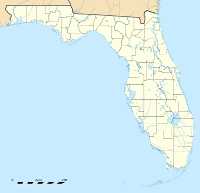
University is a census-designated place (CDP) and unincorporated community in Orange County, Florida, United States, east of Orlando. The community is centered round the University of Central Florida and includes a location on its south side known as University Park. The area is served by the zip codes 32816 and 32817. As of the 2010 census, the CDP had a population of 31,084.[1] It is part of the Orlando–Kissimmee–Sanford, Florida Metropolitan Statistical Area.
Geography
The University CDP is located at 28.5900 north, 81.2045 west,[2] or approximately 15 miles (24 km) east of downtown Orlando.
According to the U.S. Census Bureau, the CDP has a total area of 9.4 square miles (24.4 km2), of which 9.1 square miles (23.5 km2) is land and 0.35 square miles (0.9 km2), or 3.50%, is water.[3]
The University CDP is northeast of Union Park and north of Alafaya. The community is reachable by SR 408, SR 434, and SR 50 (Colonial Drive), which forms the CDP's southern edge.
References
- ↑ "Profile of General Population and Housing Characteristics: 2010 Demographic Profile Data (DP-1): University CDP (Orange County), Florida". U.S. Census Bureau, American Factfinder. Retrieved September 25, 2012.
- ↑ "US Gazetteer files: 2010, 2000, and 1990". United States Census Bureau. 2011-02-12. Retrieved 2011-04-23.
- ↑ "Geographic Identifiers: 2010 Demographic Profile Data (G001): University CDP (Orange County), Florida". U.S. Census Bureau, American Factfinder. Retrieved September 25, 2012.
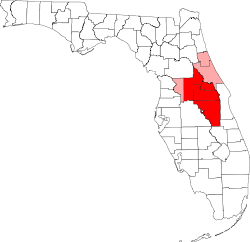
Municipalities and communities of Orange County, Florida, United States | ||
|---|---|---|
| Cities | 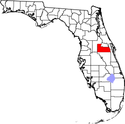 | |
| Towns | ||
| CDPs |
| |
| Unincorporated communities | ||
| Footnotes | ‡This populated place also has portions in an adjacent county or counties | |
| Attractions |
|  |
|---|---|---|
| Colleges and universities | ||
| Media |
| |
| Airports | ||
| Counties | ||
| Cities and towns 25k+ | ||
| Cities and towns 10k–25k | ||
‡ This populated place is included in the Orlando–Deltona–Daytona Beach, FL Combined Statistical Area. See also: | ||
