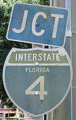
Interstate 4
| |||||||
|---|---|---|---|---|---|---|---|
_map.svg.png) | |||||||
| Route information | |||||||
| Maintained by FDOT | |||||||
| Length: | 132.298 mi[1][2] (212.913 km) | ||||||
| Existed: | 1957 – present | ||||||
| Major junctions | |||||||
| West end: |
| ||||||
| East end: |
| ||||||
| Location | |||||||
| Counties: | Hillsborough, Polk, Osceola, Orange, Seminole, Volusia | ||||||
| Highway system | |||||||
| |||||||

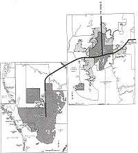
Interstate 4 (I-4) is a 132.298-mile-long (212.913 km) Interstate Highway in the U.S. state of Florida, along a southwest–northeast axis from I-275 in Tampa to I-95 at Daytona Beach. The entirety of I-4 overlaps nearly the entirety of State Road 400 (SR 400), which extends as a contiguous, signed 4.216-mile (6.785 km) surface street in Daytona Beach from I-95 to US Highway 1 (US 1, also SR 5). I-4 has no auxiliary Interstate Highway spurs or loops; however, it intersects several tolled expressways—designated as state roads—that serve as spur and partial loop routes in the Orlando metropolitan area, which (unlike most major U.S. cities) lacks any auxiliary interstate highways.
The first segment of I-4 opened to traffic in 1959 and the highway was largely completed in 1967. I-4's original western terminus was in St. Petersburg, but in 1971 the highway segment from St. Petersburg to its present terminus at I-275 was redesignated as part of I-75 before being redesignated again as I-275. The median of I-4 between Tampa and Orlando was the planned route of a high-speed rail line between these cities, which was cancelled in 2011. The "I-4 corridor" is a strategic region in politics, due to the large number of undecided voters in a large swing state.
Route description
I-4 maintains a diagonal, northeast–southwest route for much of its length, although it is signed east–west.
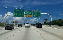
The 132-mile-long (212 km) highway's western terminus is with an interchange with Interstate 275—known as "Malfunction Junction"— near downtown Tampa and is the starting point for mile markers and exit numbers (which are mileage-based). Just east of Malfunction Junction, I-4 passes along the north side of Tampa's Ybor City district, where a mile-long connector links to the Lee Roy Selmon Expressway (SR 618) and Port Tampa Bay. I-4 continues east past the Florida State Fairgrounds towards a turbine interchange (uncommon in the U.S.)[3] with Interstate 75.
After passing near the eastern suburbs of Hillsborough County—including Brandon and Plant City—it enters Polk County, where I-4 crosses along the north side of Lakeland. The Polk Parkway (SR 570) forms a semi-loop through Lakeland's southern suburbs and returns to I-4 at the Florida Polytechnic University campus, near Polk City; it does not serve as a bypass route for I-4 traffic. Just after the western junction with the Polk Parkway, I-4 turns from an eastward to a northeastward heading. Between SR 33 (at exit 38) and US 27, I-4 passes through the fog-prone Green Swamp, although the landscape beside the highway is mostly forest as opposed to water-logged swampland. Ten variable-message signs and dozens of cameras & vehicle detection systems monitor this stretch of mostly-rural highway as a result of several large, deadly pile-ups caused by dense fog.[4][5]
At mile 57, I-4 enters Osceola County and soon thereafter intersects the Orlando area's beltways: the incomplete Western Expressway (SR 429) on the western side and the Central Florida GreeneWay (SR 417) which rounds the eastern side before returning to I-4 in Sanford. Additionally, an exit to World Drive (signed as just "Disney World") runs north as a limited-access highway into the Walt Disney World Resort and an electric pylon in the shape of Mickey Mouse can be seen on the southwest corner of the intersection. The single GreeneWay/World Drive exit (Exit 62) also marks an abrupt change from rural to suburban/urban landscape. The highway passes beside Celebration and Kissimmee on the east side and Walt Disney World Resort (not visible) on the west side.
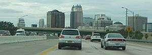
For the next 40 miles (64 km), I-4 passes through the Orlando metropolitan area, where the highway forms the main north-south artery. It enters Orange County, passes through Walt Disney World, and by SeaWorld Orlando, & Universal Orlando—and intersects all of the area's major toll roads, including the Beachline Expressway (SR 528) and Florida's Turnpike. Orlando's main tourist strip—International Drive—runs parallel and no more than 1.5 mi (2 km) from I-4 between Kissimmee and Florida's Turnpike. Between Michigan St. and Kaley Ave. (about mile 81), I-4 changes to a north heading past downtown Orlando and its northern suburbs. A 21-mile (34 km) section of I-4 from west of Kirkman Road to east of SR 434 (miles 75-96) is currently undergoing a $2.3 billion reconstruction, expected to be completed in 2021, that replaces most bridges, changes the configuration of many intersections, and adds two express toll lanes—named 4 Express—in each direction (details in the I-4 Ultimate section).[6][7]
After passing along the west side of Downtown Orlando, I-4 continues through the city's northern suburbs—including Winter Park, Maitland, Altamonte Springs, and Sanford. Around mile 91, I-4 enters Seminole County and soon thereafter shifts to a northeast heading. The Seminole Expressway (SR 417), after passing around the east side of the Orlando metropolitan area, has its northern terminus (exit 101B) at I-4 in Sanford. This intersection will also connect with the Wekiva Parkway (SR 429), currently under construction, when it is completed in 2021, at which point a full beltway (SR 429 & SR 417; concurrent with I-4 for 2 mi) around the Orlando metro area will be available.
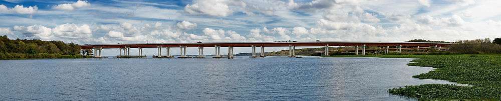
North of Sanford, I-4 is carried by the St. Johns River Veterans Memorial Bridge over the St. Johns River at the mouth of Lake Monroe. Along the bridge, I-4 enters Volusia County and passes Deltona & DeLand. The segment north of SR 44 is being widened from four to six lanes; when completed in 2016,[8] the entire length of I-4 will have 6 or more lanes (3+ per direction). I-4 terminates at a junction with I-95 in Daytona Beach. SR 400 continues east into Daytona Beach 4 mi to US 1.
Services
I-4 has two pairs of rest areas, one near Polk City and the other near Longwood. At each location, there are separate facilities on opposite sides of the freeway, providing services to traffic in both directions. The rest areas all provide handicapped facilities with restrooms, picnic tables, drinking water, pet exercise areas, outside night lights, telephones, vending machines and nighttime security.[9][10][11]
FDOT closed a pair of rest areas at the Daryl Carter Parkway overpass (mile 70) near Lake Buena Vista in early 1999 and replaced them with retention ponds to serve runoff from an additional lane in each direction of I-4.[12] Another former rest area, without any bathrooms, existed on the eastbound side near milepost 127 in Volusia County.[13]
A pair of weigh stations including weigh in motion scales is present at mile 12 between Tampa and Plant City. They were opened in January 2009 to replace a pair just west of the SR 566 interchange at mile 19.[14]
History
I-4 was one of the first Interstate Highways to be constructed in Florida, with the first section opening between Plant City and Lakeland in 1959. By early 1960, the Howard Frankland Bridge was opened to traffic, as well as the segment from the Hillsborough Avenue/US 301 junction in Tampa to Plant City. The stretch from Lake Monroe to Lake Helen, including the original St. Johns River Bridge also opened during that period. The segment from Tampa to Orlando was complete by 1962.[15] By the mid 1960s, several segments were already complete, including Malfunction Junction in Tampa and parts of I-4 through Orlando. The original western terminus was set at Central Avenue (County Road 150) in St. Petersburg,[16] though a non-Interstate extension would have continued south and west to Pasadena. Proposed I-4 was later extended southwest to the present location of exit 20, with a planned temporary end at US 19 and 13th Avenue South,[17] and a continuation to the Sunshine Skyway was also designated as part of Interstate 4.[18] Construction was stalled at 9th Street North (CR 803) for several years.
The entire Interstate Highway was completed by the late 1960s; however, the western terminus was truncated to Malfunction Junction in 1971 when I-75 was extended over the Frankland Bridge. Eventually, that stretch was again redesignated to become part of I-275.[19]
In maps and atlases dating to the 1950s, 1960s, and 1970s, the Tampa–St. Petersburg section of I-4/I-275 was marked as the Tampa Expressway. The Orlando segment was marked as the Orlando Expressway. Both names have since faded from maps.
Although many post-1970 interchanges along I-4 were constructed before the recent widening projects, they were designed with I-4 expansion in mind. In other words, there is enough room available to widen I-4 to up to ten lanes without extensively modifying the interchanges. Some of these interchanges include the I-75 stack (constructed in the 1980s) and several interchanges serving the Walt Disney World Resort (constructed in the late 1980s and early 1990s).
In 2002, I-4, along with most of Florida's interstates, switched over from a sequential exit numbering system to a mileage-based exit numbering system.[20]
A section of I-4 between Daytona Beach and Orlando called the "dead zone" is rumored to be haunted.[21] In 2010, the ECFRPC using GIS technology performed an analysis to determine if this identified zone had an increased fatality rate related to crashes. The analysis which compared this section of I-4 to several other dangerous I-4 sections found that while the dead zone area did not have the highest accident or fatality rate, it did identify that the percentage of fatality to accident was significantly higher in this location.
The median of I-4 between Tampa and Orlando was slated to be used for the Florida High Speed Rail line between those cities. As a result of a state constitutional amendment to build a high speed rail system between its 5 largest cities passed by voters in 2000, construction projects on I-4 included a wide median to accommodate a high speed rail line. The high speed rail project was cancelled in 2004, but revived again in 2009. In 2010, the federal government awarded Florida over $2 billion—nearly the entire projected construction cost—to build the line, with work on the project to begin in 2011 and be completed by 2014.
Tampa area
The I-4/I-275 interchange (Malfunction Junction) was rebuilt from 2002 to 2007,[22] and I-4 has been widened from four to six lanes (with eight lanes in certain segments). Eventually, I-4 will be widened again to a total of at least ten lanes (five in each direction). Studies for this project are already underway and construction should commence sometime in the 2010s. Completion of the project should be around 2020.
Eastbound I-4 shifted to its new, permanent alignment between Malfunction Junction and 50th Street on August 8, 2006. The new alignment includes a right-lane ramp exit/entry at the 22nd St/21st St Interchange (The previous left-lane configuration was causing hazardous conditions to commuters since its opening in 2005). On August 11, 2006, a fourth lane opened on eastbound I-4 between the downtown junction and 50th Street (led in by a newly opened third lane on the eastbound I-4 ramp from northbound I-275). And on August 18, the new westbound alignment, just west of 50th Street, opened. The newly opened lanes will improve flow throughout the interchange. The 50th Street overpass, however, would not be complete until late 2007.[23][24][25][26] Also, the eastbound I-4 exit ramp to Columbus Drive/50th Street is situated to the left-hand side of the highway (as opposed to its former right-hand side exit). This exit shift went into effect in spring 2006 and is part of the new, permanent interstate configuration.
In Tampa, the exit to 40th Street (SR 569), exit 2, was closed and demolished in late 2005 due to the ongoing reconstruction of I-4 and to accommodate a proposed connector highway with the Lee Roy Selmon Expressway.[27]
The interchange with what is today I-75 was constructed in the early 1980s.
Orlando area
As Orlando grew in the 1970s and 1980s, traffic became a growing concern, especially after the construction of the original interchange with the East–West Expressway in 1973, which proved to become a principal bottleneck. The term "highway hostages" was coined in the 1980s to describe people stuck in long commutes to and from Orlando on I-4.
In the early-to-mid 1990s, several interchanges near Kissimmee were constructed or upgraded to accommodate increasing traffic going to and from Walt Disney World. However, I-4's main lanes were not widened in the process. Around the same time, SR 417 was extended to I-4. Improvements to the US 192 junction were completed in 2007.[28]
The St. Johns River Veterans Memorial Bridge, a two-span, six-lane replacement to the original four-lane bridge over the St. Johns River northeast of Orlando, was completed in 2004.
During the early 2000s, tolled express lanes were being planned in the Orlando area as a traffic congestion relief technique for rush hour commuters. The name for them was to be Xpress 400, numbered after the state road designation for I-4. The express lanes were slated to extend from Universal Orlando, east to SR 434 in Longwood, and tolls were to be collected electronically via transponders like SunPass and Orlando-Orange County Expressway Authority's E-Pass, with prices dependent on the congestion of the eight main lanes. However, the project was effectively banned by the passage of the SAFETEA-LU Federal transportation bill in 2005, introduced by U.S. Representative John Mica. The plan for tolled express lanes is now moving forward as part of the $2.3 billion I-4 Ultimate project (see "I-4 Ultimate" section below).
Interim improvements to the interchange at SR 408 were completed at the end of 2008.[29] The eastbound exit to Robinson Street (SR 526) permanently closed on April 25, 2006, to make way for construction of the new eastbound onramp from SR 408.[30] The westbound offramp to Gore Street was permanently closed in the same project on November 2, 2008.
The new overpass from I-4 west to John Young Parkway (County Road 423, CR 423) opened the morning of April 27, 2006.[31][32][33]
2008 pileup
On January 9, 2008, 70 vehicles were involved in a large pileup on I-4 near Polk City. The pileup was caused by an unexpected thick morning fog that was mixed with a scheduled—and approved—environmental burn by the Florida Wildlife Commission. The fog drifted across I-4, mixing with the smoke, reducing visibility to near-zero conditions. Four people were killed, and 38 were injured. The section of I-4 did not re-open until the next day, January 10.[34]
Future
I-4 Ultimate

A $2.3 billion (in year-of-expenditure dollars) project—dubbed I-4 Ultimate—will reconstruct 21-mile (34 km) of I-4 through Orlando from SR 435 (exit 75) east to SR 434 (exit 94).[35] The most noticeable improvement will be the addition of four variable-toll express lanes along this section, to be called 4 Express. The express lanes will be variably tolled in an attempt to maintain an average speed of 50 miles per hour (80 km/h). Additionally, the general-use lanes will be rebuilt, 15 major interchanges will be reconfigured, 53 new bridges will be added, and 75 bridges will be replaced.[36] Two pedestrian bridges will be built over the highway near Kirkman Road and Maitland Boulevard.[37] The project will also reduce the curve radius and improve line-of-sight along the notorious Fairbanks Curve south of Fairbanks Avenue, which is the most accident-prone section of I-4.[38][39]
FDOT proposed adding barrier-separated HOV lanes to I-4 through the Orlando metro area in the 1990s, possibly funded by tolls,[40][41] but proposals for express lanes (including reversible toll lanes and HOT lanes) were blocked by politics for the next 15 years. In 2012, a ban on tolls on I-4 inserted in federal legislation, which had been in place for seven years, ended and FDOT began soliciting private enterprises to build and help finance the project in a public-private partnership.[42] In February 2013, the state legislature and governor gave approval for FDOT to proceed with the public-private partnership on this section of I-4 in February 2013[43] and the following year, FDOT selected I-4 Mobility Partners to design, construct, finance, maintain and operate the project for 40 years. FDOT and I-4 Mobility Partners reached commercial and financial close and a public-private partnership concession agreement was executed in September 2014.[44] The final design phase began in October 2014.[45] On February 1, 2015, FDOT turned the project over to I-4 Mobility Partners[46] and on February 18, transportation officials and the governor held a groundbreaking ceremony for the project in Maitland.[47] I-4 Mobility Partners has a March 2021 deadline to complete the project.[47]
Additional express lanes and Tampa Bay Express (TBX)
Extensions of the 4 Express toll lanes both southwest and northeast of the I-4 Ultimate project are being considered. In 2013, FDOT initiated a reevaluation study to reevaluate previous feasibility studies, made between 1998 and 2005, in which the addition of HOV or express toll lanes were considered.[48][49] The extensions cover approximately 40 miles (64 km) of I-4 through the Orlando metro area. Southwest of the I-4 Ultimate, the study is examining an extension through Osceola County to US 27 in Polk County. Northeast of the I-4 Ultimate, the study is examining an extension through Seminole County to SR 472 in Volusia County. The reevaluation is expected to be complete in July 2015.[49]
Express toll lanes are also being considered for I-4 in the Tampa Bay area. In January 2015, FDOT unveiled its master plan for a system of express toll lanes—dubbed Tampa Bay Express (TBX)—on I-4, I-75, and I-275 and began public meetings for community input.[50] On I-4, these lanes would extend approximately 26 miles (42 km) from I-275 to west of the Polk Parkway (SR 570). At the junction with I-275, the initial concept alignment calls for a direct connection between the express toll lanes of both highways.[51] Express bus lanes for regional, long distance bus service were studied for inclusion in the plan. The I-4 corridor was considered in the bus lane study,[52] but the resultant proposal only included installation on I-275 and I-75[53]
Other projects
Connections with two new expressways are planned. The Wekiva Parkway—a 25-mile (40 km) segment of SR 429—will connect to SR 417 at the I-4 interchange in Sanford. When completed in 2021, it will complete the beltway around Orlando, although the southern ends of SR 429 and SR 417 do not connect and are separated by a 3.4-mile (5.5 km) drive along I-4.[54] The Central Polk Parkway is a planned tolled expressway in eastern Polk County that will connect I-4 near Davenport with the Polk Parkway near Bartow; it is currently in the design phase, but funding for right-of-way acquisition of the initial segments is not planned until fiscal year 2019/20.[55] Additionally, FDOT is conducting a feasibility study for a 5–11.5-mile (8.0–18.5 km)[56] connection between I-4 and the Poinciana Parkway—a short, tolled expressway under construction between US 17/US 92 and the community of Poinciana.[57][58]
The final four-lane segment of I-4, from SR 44 to I-95, is being widened to six lanes. When completed in summer 2016, the entire length of the highway will be at least six lanes wide.[59]
In 2014, the Florida Department of Transportation began a study of the feasibility of extending the SunRail commuter train line to Daytona Beach, primarily focusing on the use of the I-4 median. The ongoing widening project from SR 44 to I-95 maintains a median wide enough to accommodate a future rail line.[60]
Exit list
| County | Location | mi[2] | km | Old exit | New exit | Destinations | Notes |
|---|---|---|---|---|---|---|---|
| Hillsborough | Tampa | 0.000 | 0.000 | — | — | Westbound splits into 3 ramps: Northbound & southbound I-275 and "Exit 45A" (in reference to the I-275 exit number)/"Downtown East-West", which joins the southbound I-275 Exit 45A ramp without joining the southbound I-275 mainline. | |
| 1.154 | 1.857 | 1 | 1 | ||||
| 1.76[61] | 2.83 | — | 2 | I-4–Selmon Expressway Connector (left exits, both directions); access to or from SR 618 only in the same direction; US 41 Bus. (trucks only, signed only as "Port Tampa Bay") access from westbound I-4 and to eastbound I-4 | |||
| 2.463[61] | 3.964 | 2 | 2 | Former interchange | |||
| 3.266 | 5.256 | 3 | 3 | Eastbound left exit and westbound left entrance; eastbound right entrance and westbound left entrance | |||
| | 4.706 | 7.574 | 4 | 5 | |||
| | 5.573 | 8.969 | 5 | 6 | Orient Road | Eastbound exit and westbound entrance | |
| | 6.683 | 10.755 | 6 | 7 | |||
| | 8.610 | 13.856 | 7 | 9 | I-75 exit 261 | ||
| Mango | 10.142 | 16.322 | 8 | 10 | |||
| | 13.876 | 22.331 | 9 | 14 | McIntosh Road | ||
| | 17.434 | 28.057 | 10 | 17 | Branch Forbes Road | Serves Dinosaur World | |
| Plant City | 19.518 | 31.411 | 11 | 19 | |||
| 21.280 | 34.247 | 13 | 21 | Alexander Street was originally exit 12, but was combined with 13 | |||
| 22.596 | 36.365 | 14 | 22 | Park Road (SR 553) | |||
| Hillsborough–Polk county line | Lakeland | 25.563 | 41.140 | 15 | 25 | County Line Road | |
| Polk | 26.530 | 42.696 | 15A | 27 | |||
| 28.365 | 45.649 | 16 | 28 | ||||
| 30.675 | 49.367 | 17 | 31 | ||||
| 32.003 | 51.504 | 18 | 32 | ||||
| 33.440 | 53.816 | 19 | 33 | Eastbound exit/entrance with SR 33 only (signed "SR 33"); westbound exit/entrance with CR 582 only (signed "CR 582"/"To SR 33") | |||
| 37.894 | 60.984 | 20 | 38 | ||||
| 41.223 | 66.342 | 20A | 41 | Serves Florida Polytechnic University (southwest corner of interchange). | |||
| | 43.981 | 70.781 | 21 | 44 | Serves Fantasy of Flight | ||
| | Polk County Rest Area | ||||||
| | 47.982 | 77.220 | 22 | 48 | |||
| Four Corners | 54.733 | 88.084 | 23 | 55 | |||
| Osceola | 57.723 | 92.896 | 24 | 58 | |||
| 59.663 | 96.018 | — | 60 | ||||
| Celebration | 61.781 | 99.427 | 24C-D-E | 62 | Collector/distributor lanes serve two junctions with one exit. Full interchange with World Drive. Eastbound exit to SR 417. Westbound entrance from SR 417. | ||
| 64.165 | 103.264 | 25A-B | 64 | ||||
| 65.322 | 105.126 | 26C–D | 65 | Osceola Parkway (CR 522) – Animal Kingdom, Wide World of Sports | |||
| Orange | Lake Buena Vista | 66.565 | 107.126 | 26A-B | 67 | ||
| 68.107 | 109.608 | 27 | 68 | ||||
| Williamsburg | 70.983 | 114.236 | 27A | 71 | Sea World (Central Florida Parkway) | Eastbound exit and westbound entrance | |
| 71.744 | 115.461 | 28 | 72 | ||||
| Orlando | 73.732 | 118.660 | 29A | 74A | |||
| 75.246 | 121.097 | 29B | 74B | Universal (Adventure Way) | Westbound exit and entrance | ||
| 75.246 | 121.097 | 30 | 75 | Signed as exits 75A (south) and 75B (north); serves Wet 'n Wild and Fun Spot America | |||
| 76.359 | 122.888 | 31 | 77 | Turnpike exit 259 | |||
| 77.760 | 125.143 | 31A | 78 | Conroy Road | Serves The Mall at Millenia, Holy Land Experience | ||
| 79.147 | 127.375 | 32 | 79 | ||||
| 80.474 | 129.510 | 33 | 80 | Signed as exits 80A (south/west) and 80B (north/east) eastbound; previously signed as exits 33A and 33B accordingly; westbound is a left exit, signed as exit 80 and only providing south/west access | |||
| 81.004 | 130.363 | 34 | 81A | Westbound exit and eastbound entrance | |||
| 81.469 | 131.112 | 35 | 81BC | Kaley Avenue | Eastbound-only exchange, westbound exchange closed in 2015. | ||
| 82.116 | 132.153 | 36 | 82A | ||||
| 82.24[61] | 132.35 | 37 | 82B | Gore Street | Former westbound-only interchange; westbound entrance remains | ||
| 82.636 | 132.990 | 38 | 82B | Anderson Street / South Street | To Amway Center, History Center; formerly signed as exit 82C | ||
| 82.78[61] | 133.22 | 39 | 83 | South Street | Closed interchange; no eastbound exit | ||
| 83.30[61] | 134.06 | 40 | 83A | Former interchange; eastbound exit and westbound entrance | |||
| 83.792 | 134.850 | 41 | 83A | Signed as exit 84A westbound; formerly signed as exit 83B eastbound | |||
| 84.279 | 135.634 | 42 | 84 | Ivanhoe Boulevard | Westbound exit (signed as exit 84B westbound), eastbound entrance; eastbound exit closed in 2015 | ||
| 85.135 | 137.012 | 43 | 85 | Princeton Street | |||
| 85.890 | 138.227 | 44 | 86 | Par Street | Eastbound exit and westbound entrance | ||
| Winter Park | 86.789 | 139.673 | 45 | 87 | Fairbanks Avenue (SR 426) | ||
| 87.767 | 141.247 | 46 | 88 | Western end of US 17 Truck / US 92 Truck overlap; serves Eatonville | |||
| Maitland | 89.491 | 144.022 | 47 | 90 | Eastern end of US 17 Truck / US 92 Truck overlap; signed as exits 90A (east) and 90B (west) eastbound | ||
| Seminole | Altamonte Springs | 91.631 | 147.466 | 48 | 92 | ||
| Longwood | 93.613 | 150.656 | 49 | 94 | |||
| Lake Mary | 98.400 | 158.359 | 50 | 98 | Lake Mary, Heathrow (Lake Mary Boulevard) | ||
| 100.628 | 161.945 | 51A | 101A | ||||
| Sanford | 101.366 | 163.133 | — | 101B | |||
| 102.505 | 164.966 | 51 | 101C | ||||
| | 103.997 | 167.367 | 52 | 104 | |||
| St. Johns River (Lake Monroe) | St. Johns River Veterans Memorial Bridge | ||||||
| Volusia | Deltona–DeBary city line | 107.821 | 173.521 | 53 | 108 | DeBary, Deltona (CR 4162) | |
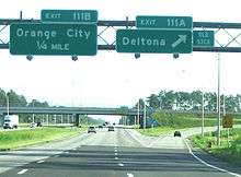
| Deltona–Orange City city line | 110.636 | 178.051 | 53C | 111 | Deltona, Orange City (CR 4146) | Signed as exits 111A (Deltona) and 111B (Orange City); previously signed as exits 53CA and 53CB accordingly | |
| Deltona–DeLand city line | 113.783 | 183.116 | 54 | 114 | |||
| Lake Helen | 115.898 | 186.520 | 55 | 116 | DeLand, Lake Helen Historic District (CR 4116) | ||
| DeLand | 118.456 | 190.636 | 56 | 118 | Signed as exits 118A (east) and 118B (west) | ||
| Daytona Beach | 129.131 | 207.816 | 57 | 129 | Eastbound exit and westbound entrance | ||
| 131.987 | 212.412 | — | 132 | I-95 exit 260B; signed as exits 132A (north) and 132B (south) | |||
| 132.298 | 212.913 | 58, 132 | — | ||||
1.000 mi = 1.609 km; 1.000 km = 0.621 mi
| |||||||
State Road 400
| |
|---|---|
| Location: | Tampa-Daytona Beach |
| Length: | 136.514 mi[2][61] (219.698 km) |
State Road 400 (SR 400), unsigned while concurrent with I-4, becomes signed east of I-95. The road extends for three miles (4.8 km) from the northeast terminus of I-4, on the south side of Daytona International Speedway and Daytona Beach International Airport, to an intersection with US 1 (SR 5) in Daytona Beach. Named Beville Road, it runs along the boundary between the cities of Daytona Beach and South Daytona. Sections of Beville Road are classified as a "Scenic Thoroughfare" by the City of Daytona Beach.[62]
Major intersections
The entire route is in Volusia County.
| Location | mi[61] | km | Destinations | Notes | |
|---|---|---|---|---|---|
| Daytona Beach | 0.000 | 0.000 | Eastern end of I-4 overlap; west exits 132A-B; I-95 exit 260A | ||
| 0.271 | 0.436 | ||||
| 2.181 | 3.510 | ||||
| Daytona Beach–South Daytona city line | 2.852 | 4.590 | |||
| 4.216 | 6.785 | ||||
1.000 mi = 1.609 km; 1.000 km = 0.621 mi
| |||||
In politics
| Year | Democrat | Republican | Other |
|---|---|---|---|
| 2012 | 52.6% 953,186 | 46.2% 838,377 | 1.2% 21,907 |
| 2008 | 53.3% 946,929 | 45.7% 811,159 | 1.0% 17,034 |
| 2004 | 46.5% 724,618 | 52.9% 824,887 | 0.6% 9,929 |
| 2000 | 48.0% 569,746 | 49.7% 590,030 | 2.2% 26,531 |
| 1996 | 45.7% 462,403 | 44.7% 451,902 | 9.6% 96,818 |
| 1992 | 37.5% 379,821 | 42.1% 426,297 | 20.3% 205,621 |
In the 2004 U.S. presidential election, the I-4 corridor, a commonly used term to refer to the counties in which Interstate 4 runs through and a site of significant population growth, was a focus of political activity within the swing state of Florida. Communities along the I-4 corridor were perceived by both major political parties as having higher proportions of undecided voters as compared to more Republican- or Democratic-leaning portions of the state. It played an equally key role in the 2008 U.S. presidential election, but whereas the corridor had voted heavily for George W. Bush in 2004, which helped Bush win the state, in 2008 it swung behind Democratic candidate Barack Obama, helping Obama win Florida.[63] The I-4 corridor has voted for the statewide winner since at least 1992, but has supported the national winner since 1996. The Republicans and Democrats have each carried the region three times in the past six presidential elections. Republicans George H. W. Bush and George W. Bush won more votes than other candidates in 1992, 2000, and 2004, while Democrats Bill Clinton and Barack Obama captured the region's vote total in the elections of 1996, 2008, and 2012.
See also
- Hurricane Charley, sometimes referred to as the "I-4 Hurricane"
References
- ↑ Staff (October 31, 2002). "Table 1: Main Routes of the Dwight D. Eisenhower National System of Interstate and Defense Highways as of October 31, 2002". Route Log and Finder List. Federal Highway Administration. Retrieved June 7, 2007.
- 1 2 3 Florida Department of Transportation (August 4, 2010). "Florida Department of Transportation Interchange Report" (PDF). Florida Department of Transportation. pp. 2–3. Retrieved November 2, 2010.
- ↑ Boniface, Russell (November 1, 2001). "Interchange". CE Magazine. American Society of Civil Engineers. Archived from the original on August 19, 2014. Retrieved August 19, 2014.
The turbine design, which is rare in the United States, is a first of its kind in North Carolina; another notable example exists at the interchange of I-4 and I-75 in Tampa, Florida.
- ↑ Maready, Jim (January 9, 2009). "One Year After Tragic I-4 Pileup, Questions Remain". Lakeland Ledger. p. 2. Retrieved August 19, 2014.
The Florida Department of Transportation is in the process of installing 10 electronic signs...The system will also include a series of 22 cameras, which can be rotated, and 77 vehicle-detection systems, which will observe the amount of traffic and speed of the vehicles.
- ↑ Chambliss, John (January 14, 2008). "Fog Has Caused Deaths Before". Ocala Star Banner. Retrieved August 19, 2014.
- ↑ "FAQs". I-4 Ultimate. Florida Department of Transportation. Retrieved August 19, 2014.
- ↑ "I-4 Express PD&E Study". i4express.com. Florida Department of Transportation. Retrieved August 19, 2014.
- ↑ "408464-1 I-4 Widening from SR 44 to East of I-95". Central Florida Roads. Florida Department of Transportation. Retrieved August 19, 2014.
- ↑ Staff (2013). "Florida's Rest Area, Service Plaza, Truck Comfort Station (WIM), and Welcome Center Locations". Florida Department of Transportation. Retrieved February 3, 2013.
- ↑ Google (February 3, 2013). "Map of Polk County Rest Area vicinity" (Map). Google Maps. Google. Retrieved February 3, 2013.
- ↑ Google (February 3, 2013). "Map of Seminole County Rest Area vicinity" (Map). Google Maps. Google. Retrieved February 3, 2013.
- ↑ Stratton, Jim (September 10, 2001). "Nowhere To Rest, But More Room To Drive". Orlando Sentinel. Retrieved March 9, 2014.
- ↑ Florida Official Transportation Map, 1989 Archived April 2, 2015, at the Wayback Machine.
- ↑ Nicholson, Dave (January 2, 2009). New High-Tech Weigh Stations Open Monday On I-4. Plant City Courier.
- ↑ "Highways to Your Vacationland". All Florida and TV Week Magazine. The Evening Independent. Jacksonville, FL. June 3, 1962.
- ↑ "Time Now to Plan for Interstate 4". Editorials. The Evening Independent. Jacksonville, FL. July 14, 1965. p. 10A. Retrieved March 13, 2014.
- ↑ Yogman, Ron (November 22, 1967). "City Buzzes at Interstate Impact on 1,600 Parcels". The Evening Independent. Jacksonville, FL. p. 2A. Retrieved March 13, 2014; Subsequent articles:
- "Section 2 of Interstate-4". The Evening Independent. Jacksonville, FL. November 23, 1967. p. 3A. Retrieved March 13, 2014;
- "Section 4 of Interstate 4". The Evening Independent. Jacksonville, FL. November 24, 1967. p. 6A. Retrieved March 13, 2013;
- "I-4 Closeup: Sections 6, 7". The Evening Independent. Jacksonville, FL. November 25, 1967. p. 4A. Retrieved March 13, 2014;
- "A Final, Closeup Look at Interstate 4 Route". The Evening Independent. Jacksonville, FL. November 27, 1967. p. 4A. Retrieved March 13, 2014.
- ↑ "State Agents Lay Out I-4's Tour to the South". St. Petersburg Times. July 19, 1968. p. 1B. Retrieved March 13, 2014.
- ↑ Droz, Robert V. "Historic Florida Interstate Information". Florida in Kodachrome. Self-published. Retrieved November 27, 2011.
- ↑ Staff. "Florida's Interstate Exit Numbers- I-4". Florida Department of Transportation. Retrieved November 18, 2010.
- ↑ "Ghostly Images Seen, Photographed on 'Deadly' Stretch of I-4". Orlando: WKMG-TV. Archived from the original on September 14, 2008.
- ↑ Staff. "Construction Projects: I-4/I-275 Interchange (operational improvements, completed December 2006)". Tampa Bay Interstates. Florida Department of Transportation. Retrieved November 27, 2011.
- ↑ Staff (August 8, 2006). "Eastbound I-4 in new alignment". Tampa Bay Interstates. Florida Department of Transportation. Archived from the original on September 27, 2007.
- ↑ "Eastbound I-4 Traffic: New Lanes, New Exit through Ybor City". St. Petersburg, FL: WTSP-TV. August 7, 2006.
- ↑ "New I-4 Lanes Help Drivers Get to Concert Early". St. Petersburg, FL: WTSP-TV. August 10, 2006.
- ↑ Staff (August 8, 2006). "New Eastbound I-4 Lane Open!". Tampa Bay Interstates (Press release). Florida Department of Transportation. Archived from the original on September 26, 2007.
- ↑ Staff. "I-4/Crosstown Connector Project Page". Tampa Bay Interstates. Florida Department of Transportation. Archived from the original on October 14, 2008.
- ↑ Staff. "US 192 Interchange_Project Overview". Trans4mation. Florida Department of Transportation. Retrieved November 27, 2011.
- ↑ Staff. "I-4 Trans4mation (FSTR 408 Interchange Project)". Trans4mation. Florida Department of Transportation. Retrieved November 27, 2011.
- ↑ "On the Move". Orlando, FL: Central Florida News 13. April 25, 2006. Archived from the original on May 24, 2006.
- ↑ "Rising above I-4 Crowds". Orlando Sentinel. April 26, 2006.
- ↑ "Changes Under Way on I-4". Daytona Beach, FL: WESH-TV. April 26, 2006.
- ↑ "On the Move". Orlando, FL: Central Florida News 13. April 26, 2006.
- ↑ "Interstate 4 Deadly Collisions". January 10, 2008. Retrieved December 13, 2014.
- ↑ Staff. "Future I-4 Improvements". Moving-4-Ward. Florida Department of Transportation. Retrieved February 18, 2013.
- ↑ "FAQs". I-4 Ultimate. Florida Department of Transportation. Retrieved January 22, 2015.
- ↑ "Special Features". I-4 Ultimate. Florida Department of Transportation. Retrieved February 19, 2015.
- ↑ "Fairbanks Ave. / Winter Park". I-4 Ultimate. Florida Department of Transportation. Retrieved February 19, 2015.
- ↑ "I-4 Ultimate Project to Address Dangerous Fairbanks Curve". Orlando: WFTV-TV. February 18, 2015. Retrieved February 19, 2015.
- ↑ Roy, Roger (August 23, 1993). "Express Lanes Lead Alternatives to Avoid I-4 Jams". Orlando Sentinel. Retrieved February 19, 2015.
- ↑ Roger, Roy (August 18, 1995). "I-4 Plan: Promote Car Pools, Light Rail". Orlando Sentinel. Retrieved February 19, 2015.
- ↑ Tracy, Dan (July 8, 2012). "State Seeks Investors to Help Foot Bill to Build I-4 Toll Lanes". Orlando Sentinel. Retrieved February 19, 2015.
- ↑ Orben, Bill (February 4, 2013). "FDOT Gets Backing on $2.1B I-4 Project". Orlando Business Journal. Retrieved February 19, 2015.
- ↑ "FDOT and I-4 Mobility Partners Reach Commercial and Financial Close for I-4 Ultimate Project" (PDF). I-4 Ultimate (Press release). Florida Department of Transportation. September 9, 2014. Retrieved January 22, 2015.
- ↑ Fluker, Anjali (November 3, 2014). "FDOT Shares New I-4 Ultimate Design, Construction Milestones". Orlando Business Journal. Retrieved January 22, 2015.
- ↑ Vargas, Lena (February 2, 2015). "I-4 Ultimate Project Underway in Orange, Seminole Counties". Orlando: Central Florida News 13. Retrieved February 18, 2015.
- 1 2 Tracy, Dan. "I-4 Ultimate Overhaul Gets Ceremonial Start". Orlando Sentinel. Retrieved February 18, 2015.
- ↑ "Original Documents". Interstate 4 Beyond the Ultimate. Florida Department of Transportation. Retrieved February 19, 2015.
- 1 2 "Frequently Asked Questions". Interstate 4 Beyond the Ultimate. Florida Department of Transportation. Retrieved February 19, 2015.
- ↑ Carson, Kris (January 16, 2015). "FDOT Media Advisory" (PDF). Tampa Bay Express (Press release). Florida Department of Transportation. Retrieved February 19, 2015.
- ↑ Master Plan Project: I-275 from South of SR 60 to North of MLK Boulevard (3) (PDF) (Map). Florida Department of Transportation. January 2015. Retrieved February 19, 2015 – via Tampa Bay Express.
- ↑ "Express Bus in the Tampa Bay Express Lanes (Draft)". Hillsborough County City-County Planning Commission. Archived from the original on September 28, 2014. Retrieved February 19, 2015.
- ↑ "Express Bus in Tampa Bay Express Lanes" (PDF). Tampa Bay Express. Florida Department of Transportation. January 2015. Retrieved February 19, 2015.. FDOT said that the project will be completed in the near future.
- ↑ "Frequently Asked Questions". Wekiva Parkway. Florida Department of Transportation/Central Florida Expressway. Retrieved February 19, 2015.
- ↑ "Central Polk Parkway". Central Polk Parkway. Florida Department of Transportation. Retrieved February 19, 2015.
- ↑ "Draft Summary of Potential Environmental Impacts: Preliminary Corridors" (PDF). I-4 Poinciana Parkway Connector. Florida Department of Transportation. December 2013. Retrieved February 19, 2015.
- ↑ "About the Study". I-4 Poinciana Parkway Connector. Florida Department of Transportation. Retrieved February 19, 2015.
- ↑ Project Study Area (PDF) (Map). Florida Department of Transportation. Retrieved February 19, 2015 – via I-4 Poinciana Parkway Connector.
- ↑ "408464-1 I-4 widening from SR 44 to East of I-95". Central Florida Roads. Florida Department of Transportation. Retrieved February 18, 2015.
- ↑ Harper, Mark (April 17, 2014). "Volusia Supports $2.5M Study of SunRail to Daytona". Daytona Beach News Journal. Retrieved August 20, 2014.
- 1 2 3 4 5 6 7 Florida Department of Transportation. "Straight Line Diagrams". Florida Department of Transportation. Retrieved March 8, 2014.
- ↑ "Scenic Thoroughfare Classification". Land Development Code. Daytona Beach, Florida. Retrieved November 27, 2011 – via Municode. (subscription required (help)).
- ↑ "Candidates Eye Voters on Florida's I-4". CNN. October 11, 2004.
External links
| Wikimedia Commons has media related to Interstate 4. |
FDOT websites about Interstate 4:
- Tampa Bay Interstates—current, future, and past (since 1999) projects on I-4
- Central Florida Roads—current and future projects on I-4 in Osceola, Orange, Seminole, and Volusia counties
FDOT websites about specific I-4 projects and proposals:
- I-4 Ultimate—project info about I-4 Ultimate in the Orlando area
- I-4 Beyond the Ultimate—information about a proposed extension of express lanes southwest of the I-4 Ultimate project through Osceola and Polk counties.
- Tampa Bay Express—information about the proposed express lanes on Interstates 4, 75, & 275 in the Tampa Bay area.
- I-4 Poinciana Parkway Connector—information about a feasibility study being conducted for a connection between I-4 and the Poinciana Parkway
| Signed | |||||||||||
|---|---|---|---|---|---|---|---|---|---|---|---|
| Unsigned | |||||||||||
| Lists |
| ||||||||||
Major Interstates highlighted | |||||||||||