Ontario Highway 7
| ||||
|---|---|---|---|---|
|
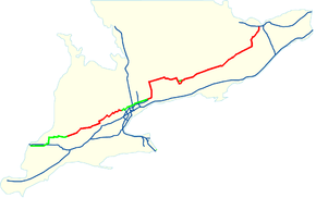
Location of Highway 7 in Southern Ontario. Current route Former route | ||||
| Route information | ||||
| Length: | 535.7 km[1] (332.9 mi) | |||
| Existed: | 1920 – present | |||
| Western segment | ||||
| Length: | 154.1 km (95.8 mi) | |||
| West end: |
| |||
| Major junctions: |
| |||
| East end: | Halton–Peel boundary (near Norval) | |||
| Eastern segment | ||||
| Length: | 381.6 km (237.1 mi) | |||
| West end: |
| |||
| Major junctions: |
| |||
| East end: |
| |||
| Location | ||||
| Major cities: | Stratford, Kitchener–Waterloo, Guelph, Brampton, Vaughan, Markham, Pickering, Peterborough, Ottawa | |||
| Towns: | Halton Hills (Acton, Georgetown, Norval), Whitby, Lindsay, Perth, Carleton Place | |||
| Highway system | ||||
| ||||

King's Highway 7, commonly referred to as Highway 7 and historically as the Northern Highway, is a provincially maintained highway in the Canadian province of Ontario. At its peak, Highway 7 measured 716 km (445 mi) in length, stretching from Highway 40 east of Sarnia in Southwestern Ontario to Highway 17 west of Ottawa in Eastern Ontario. However, due in part to the construction of Highways 402 and 407, the province transferred the sections of Highway 7 west of London and through the Greater Toronto Area to county and regional jurisdiction. The highway is now 535.7 km (332.9 mi) long; the western segment begins at Highway 4 north of London and extends 154.1 km (95.8 mi) to Georgetown, while the eastern segment begins at Donald Cousens Parkway in Markham and extends 381.6 km (237.1 mi) to Highway 417 in Ottawa.
Highway 7 was first designated in 1920 between Sarnia and Guelph and extended to Brampton the following year. Between 1927 and 1932, the highway more than doubled in length as it was gradually extended eastward to Perth, where Highway 15 continued to Ottawa. In the early 1960s, that section of Highway 15 was renumbered as Highway 7. In that same decade, the Conestoga Parkway and Peterborough Bypass were constructed. During the 1970s and 1980s, many sections of Highway 7 were widened from the initial two lane cross-section to four or six lanes. Within York Region, the route was upgraded to a limited-access expressway in preparation for the construction of Highway 407.
Soon thereafter, that new tollway would act as justification for transferring the section of Highway 7 through the Greater Toronto Area (GTA) to regional governments. In the west, the construction of Highway 402 between Sarnia and London provided an uninterrupted alternative to Highway 7, resulting in the transfer of the section west of Highway 4. A third transfer took place in Peterborough, briefly separating the route into three discontinuous segments, but has since been rectified by renumbering a section of Highway 7A. From 2007 to 2012, the section of Highway 7 between Carleton Place and Ottawa has been widened to a divided freeway. In addition, work is underway to extend the Conestoga Parkway to New Hamburg as well as to build a new freeway between Kitchener and Guelph.
Route description
Western segment
The western segment of Highway 7 travels from Elginfield in Middlesex County in the southwest to the Halton - Peel border at Norval near Brampton; a distance of 152.6 kilometres (94.8 mi). A 23.4 km (14.5 mi) portion of this segment, from Waterloo Regional Road 51 south of Baden to Highway 85 in Kitchener is a freeway, forming part of the Conestoga Parkway. Plans to build a freeway bypass of Highway 7 from Kitchener to Guelph are currently underway.
At one point Highway 7 travelled as far west as Sarnia, being the main route to the Blue Water Bridge. Upon entering Sarnia from the east on London Line, drivers encountered a plethora of motels and restaurants, the Sarnia Airport, and attractions such as Hiawatha Racetrack and Waterpark, earning the stretch between Modeland Road and Airport Road the nickname of the "Golden Mile".[2] At Highway 40, Highway 7 ended and the much shorter than today Highway 402 continued westwards to the Bluewater Bridge at the American border. Highway 402 was completed between Sarnia and Highway 401 in 1982,[3] resulting in the redundancy of Highway 7 west of London as traffic shifted to the high-speed alternate. Nonetheless, Highway 7 remained provincially maintained until the segment west of Highway 4 was transferred to county jurisdiction on January 1, 1998; a process referred to as downloading. The former highway now known as Lambton County Road 22 (London Line) and Middlesex County Road 22 (Elginfield Road).[4]
The current route begins at Highway 4, approximately 20 km (12 mi) north of London and immediately southeast of the village of Lucan; the former routing continued west along Elginfield Road through Parkhill and Arkona. Though the highway changes direction several times between Elginfield and Kitchener, it is mostly straight and two lanes wide, except east of New Hamburg where it widens to four lanes. Proceeding east-northeast through farmland, the highway the southern terminus of Highway 23 just 1.2 kilometres (0.75 mi) later. It continues, serving as the boundary between Lucan Biddulph to the north and Middlesex Centre to the south, and later as the boundary between Perth County to the north and Middlesex and Oxford counties, with the tripoint of the three at County Road 120A south of St. Marys. Southeast of St. Marys, Highway 7 curves northeast into Perth County until it reaches downtown Stratford, where it meets Highway 8.[4][5]
The two highways travel east concurrently for 45.1 kilometres (28.0 mi), passing through the town of Shakespeare as it travels in a straight line through farmland. Southwest of New Hamburg, the route curves northeast into Waterloo Region, eventually widening into the four lane Conestoga Parkway east of Natziger Road. It follows this divided freeway past interchanges at Waterloo Regional Road 51 (Foundry Street) south of Baden, Waterloo Regional Road 12 (Queen Street / Notre Dame Drive) south of Petersburg, and Waterloo Regional Road 70 (Trussler Road) north of Mannheim, where it enters Kitchener and becomes surrounded by residential subdivisions. Within Kitchener, Highway 7 encounters interchanges at Waterloo Regional Road 58 (Fischer-Hallman Road), Waterloo Regional Road 28 (Homer Watson Boulevard), Waterloo Regional Road 53 (Courtland Avenue), Waterloo Regional Road 15 (King Street), Waterloo Regional Road 14 (Ottawa Street) and Waterloo Regional Road 55 (Victoria Street). The Highway 8 concurrency ends at the King Street interchange, with it diverging southeast onto the Freeport Diversion. Highway 7 exits at Victoria Street, while the parkway continues north into Waterloo as Highway 85.[4][5] Construction began in June 2015 on a future freeway between Kitchener and Guelph that will make use of a reconfigured Wellington Street interchange, just north of Victoria Street, and tie in with the northern end of the Hanlon Expressway.[6]
Highway 7 exits Kitchener after crossing the Grand River, where it enters farmland again for the brief 10-kilometre (6 mi) journey to Guelph along Victoria Street and Woodlawn Road. Midway between the two cities, the route enters Wellington County. Within Guelph, it meets Highway 6 at the northern end of the Hanlon Expressway. The two routes travel southeast along the expressway to Wellington County Road 124 (Wellington Street, former Highway 24), where Highway 7 branches northeast into downtown Guelph. It exits the city along York Street after crossing the Speed River, travelling parallel to and south of the Goderich–Exeter Railway. At Rockland, the highway enters Halton Region and begins to zig-zag through several communities in Halton Hills. These include Acton, where the route intersects former Highway 25, and Georgetown. Just east of Norval, the western section of Highway 7 ends at the Halton–Peel boundary. The road continues into Brampton as Peel Regional Road 107 (Bovaird Drive).[4][5]

The western segment was separated from the rest of Highway 7 on June 7, 1997, when the section from Brampton to Markham was downloaded due to the opening of Highway 407.[7] Part of that segment through Richmond Hill was relocated on a new alignment (as a 6 lane at-grade expressway) in 1987 in order to make way for the future toll route; the former routing incorporated Langstaff Road. Highway 7 through York Region, despite no longer being a provincial highway, is still officially known as Highway 7 and received the number York Regional Road 7, displacing Islington Avenue which was redesignated as Regional Road 17. In 2005, Highway 7 was made the second main arterial for York Region's VIVA rapid transit service (after Yonge Street). Parts of the Markham portion were once called Wellington Street, but only a stub of the old road exists today east of Markham Road. The Toronto Star ran a series of articles in 2013 depicting the urbanization of the former route. Among the issues was a proposed name change to "Avenue 7".[8]

Eastern segment
The eastern segment of Highway 7 runs from Donald Cousens Parkway (York Regional Road 48) in Markham to Highway 417 in Ottawa, a length of 381.6 km (237.1 mi). Between Brooklin and north of Sunderland, Highway 7 assumes a north-south routing and is concurrent with Highway 12. The section from Sunderland to the eastern terminus of the highway is designated as part of the Central Ontario Route of the Trans-Canada Highway.[9][10]
Travelling east from Donald Cousens Parkway, Highway 7 exits the urbanized portion of Markham and enters the Greenbelt, a large tract of land north of the GTA restricted from development. It curves north at the community of Locust Hill along a realignment built in anticipation of Highway 407, then curves back to the east as it crosses into Durham Region. It travels north of and parallel to Highway 407 to Brougham, curving to cross the former eastern terminus of the freeway near Brock Road (Durham Regional Road 1). East of the Highway 407 overpass, Highway 7 widens to four lanes and curves around the community of Greenwood and the hill that it stands on. The route crosses the northern end of Pickering, entering Whitby at Lakeridge Road (Durham Regional Road 23). Between Lakeridge Road and Highway 12, the route was rebuilt for the new Highway 407E and West Durham Link, with an overpass constructed at Cochrane Road. East of that, the route enters Brooklin and meets Highway 12.[9][10]
Highway 7 and Highway 12 travel north concurrently from Brooklin through Durham Region to Sunderland, with Highway 7 eventually departing to the east and entering the City of Kawartha Lakes. Despite its name, the highway passes through a mostly-rural landscape in Kawartha Lakes, bypassing south of Lindsay in the middle of the "city" along a brief concurrency with Highway 35. East of Lindsay, the route meanders southeast towards Peterborough, encountering the divided freeway Highway 115 southwest of the city. The two routes travel east concurrently along the southern edge of the city. Highway 115 and the divided freeway end at Lansdowne Street, onto which Highway 7 turns.[9][10]

The segment between Peterborough and Perth was built in the 1930s during the Great Depression, as a public works employment project. It was constructed parallel to a CP Rail corridor (now abandoned east of Peterborough) that was built in the 1880s, and used hand-power to dig and build the road whenever possible.[11] From Peterborough to Norwood, the route travels in a straight line through the Peterborough Drumlin Field, connecting to the southern terminus of Highway 28 and crossing the Indian River while otherwise passing through farmland. At Norwood the route suddenly begins to meander as it approaches the undulated Canadian Shield. The section east of Havelock to Perth, unlike the rest of the highway, travels through a relatively isolated area, with few services or residences along the route outside of the several towns that it connects. In contrast to the surroundings west of there, this section is located in dense forest with numerous lakes and muskeg dotting the landscape. It services the villages of Marmora, where it connects with the northern terminus of former Highway 14, Madoc, where it intersect Highway 62, Actinolite, where it meets the northern terminus of Highway 37, and Kaladar, where it intersects Highway 41.[9][10]
East of Kaladar, Highway 7 begins to serve cottages along the shores of several large lakes that lie near the highway. It intersects the northern terminus of former Highway 38 near Sharbot Lake and later passes south of Maberly before exiting the Canadian Shield and reentering farmland. On the outskirts of Perth, the route meets former Highway 43 and curves northward. It travels around the western and northern shorelines of Mississippi Lake before passing directly south of Carleton Place. Just east of there, Highway 7 widens into a four lane freeway for the remainder of the distance to Highway 417. This section, completed by early 2012,[12] was built by "twinning" the existing two lane highway with a second parallel carriageway to serve as the eastbound lanes. Highway 7 ends at an interchange with Highway 417, where drivers can proceed east to Ottawa or north to Arnprior.[9][10]

History
The route which would later become Highway 7 was first assumed by the Department of Highways on February 26, 1920. This route connected Sarnia to Guelph.[13] On April 27, 1921, the route was extended east to the Wellington–Halton boundary. Several days later, on May 4, the highway was extended further east to Hurontario Street in Brampton.[14] The Great Northern Highway, as it was known at the time, was numbered as Highway 7 during the summer of 1925.[15] Assumptions on June 22 and July 2, 1927 extended Highway 7 from Brampton to Peterborough. A portion of the original routing of Highway 12 between Sunderland and Lindsay was renumbered in this process and a concurrency established between Brooklin and Sunderland.[16]
During the early 1930s, the DHO decided that Highway 7 would ultimately serve as an alternative route between Toronto and Ottawa; at that time the only option was via Highway 2 and Highway 16. The first step in this undertaking was to extend Highway 7 as far as Madoc along existing settler routes. This section was assumed on September 17, 1930.[17] On November 18, 1931, construction was accelerated between Madoc and Perth as a major depression-relief project when eight contracts were set to build the new route. Over 2700 men blasted rock, dredged muskeg and endured a constant barrage of blood-sucking insects in order to construct this new link. The majority of it followed along a Canadian Pacific right-of-way (now abandoned past the town of Havelock) which had been cleared in 1881, deviating at times to provide a better alignment, avoid large muskeg or to lessen excavation work, most of which was performed by hand.[11] On February 10 and February 17, the route, still incomplete, was surveyed and assumed as an extension of Highway 7. The new highway was opened to traffic in August, 1932.[18]
Between the 1930s and 1960s, Highway 7 connected Sarnia with Perth; Highway 15 continued from Perth to Ottawa. By the mid-1950s, the well established highway network had changed travel characteristics, and the numbering of Highway 15 between Perth and Ottawa was confusing motorists. The Ottawa Board of Trade petitioned the Department of Highways to renumber several highways surrounding the city.[19] The department performed a series of renumberings similar to these recommendations following the extension of Highway 43 on September 8, 1961. Highway 15 was rerouted between Smiths Falls and Carleton Place to travel concurrently with Highway 29; Highway 7 was extended along the former routing from Perth to Carleton Place and signed concurrently with Highway 15 eastward to Ottawa.[20] This brought the highway to its peak length of 700 kilometres (430 mi).
Downloads
In the late 1990s and early 2000s, the Ministry of Transportation (MTO) downloaded several sections of Highway 7 to the regional or county governments that those sections lay within. There are three separate issues that led to these downloads.
Due to budget cuts instituted by the Mike Harris government, many highways deemed to serve a local or regional function were downloaded to local jurisdiction. The sections of Highway 7 west of London were transferred to Lambton County and Middlesex County, largely supplanted by the completion of nearby Highway 402 in 1982.[3][7] On April 1, 1997, the section from Sarnia to Thedford was transferred to Lambton County.[7] The section from Thedford to Elginfield was transferred to Lambton and Middlesex counties on January 1, 1998.[21]
As the construction of Highway 407 progressed across the northern end of the Greater Toronto Area, the MTO transferred sections of Highway 7 to the regions of Peel and York. On June 7, 1997, the section between Highway 410 and Highway 404 was transferred to the regions of Peel and York;[7] the section from Highway 404 to McCowan Road was transferred to York Region on April 1, 1999. Several months later, on September 1, a short section between McCowan Road and Markham Road was transferred. Finally, on January 25, 2007, the section between Markham Road and 185 m (607 ft) east of Donald Cousens Parkway, where the highway narrows to two lanes today, was transferred. Within Peel Region, Highway 410 and Highway 7 ran concurrently north-south between Bovaird Drive and Queen Street. The Queen St. portion of the route was numbered Peel Regional Road 21 on July 10, 1997,[22] but renumbered as Peel Regional Road 107 on March 26, 1998.[23] The Boivaird Drive portion of the route was transferred to the Region of Peel on July 12, 2002 and subsequently numbered Regional Road 107,[24] despite the segment of Bovaird Drive East east of Highway 410 maintaining the designation of Regional Road 10.
In the Peterborough area, Highway 7 was rerouted from travelling through the city to bypassing it along Highway 115. This situation took over six years to set in place. On April 1, 1997, the sections of Highway 7 entering the western edge of Peterborough along North Monaghan Parkway and Sir Sanford Fleming Drive were transferred to the county and city, creating a gap between Springville and the Peterborough Bypass. This situation was rectified on May 1, 2003, when the section of Highway 7A that until then was a continuation of the road south from Springville to Highway 115 was renumbered as Highway 7. The concurrency with Highway 115 was extended southwest to remove the discontinuity entirely.[25]
Recent work
On August 22, 2006, work officially began on a project to expand Highway 7 between Ottawa and Carleton Place into a freeway through a process known as twinning,[26] in which a second carriageway is built parallel to an existing road and grade-separated interchanges constructed.[27] Plans for this expansion were first conceptualized in 1979 when a planning study was undertaken. However, budgetary constraints forced an early end to this study in 1981. In 1988, the project was reinstated. A study released that year recommended that Highway 7 be widened to five lanes with a centre turning lane south of Carleton Place as an interim measure; this was carried out in 1993.[28] Full planning on the four-laning of the route began in 1993.[29]
In mid-2005, the Government of Ontario announced the project to the public. The work was carried out over three contracts: from Highway 417 to Jinkinson Road, from Jinkinson Road to Ashton Station Road, and from Ashton Station Road to Highway 15. In July 2007, a C$45 million contract was awarded to R.W. Tomlinson for the first phase of the route west from Highway 417.[30][31] Bot Construction was awarded the $73.2 million contract for the second phase, which included two interchanges, four overpasses and service roads, in early 2008.[32] The first phase was opened to traffic on July 31, 2008[33] Towards the end of 2009, the $25.8 million contract for the third phase was awarded to Aecon Group.[34] The second phase was completed ahead of schedule on December 3, 2008, bypassing south of the former route at Ashton Station Road and merging to two lanes west of Dwyer Hill Road.[35] The third phase was completed in late 2011/early 2012, connecting to Carleton Place.[12]
Future
On March 23, 2007, the Government of Ontario announced an Environmental Impact Assessment for a four lane controlled-access highway between Kitchener, and Guelph, as traffic on Highway 401 is growing steadily and approaching capacity, along with the current two-lane alignment of Highway 7. This would connect to the Conestoga Parkway via an expansion of the existing Wellington Road interchange, the new junction would be a four level interchange; the government's eventual plan is to have a Highway 7 freeway running from Stratford to Guelph. The eastern end of the proposed Highway 7 freeway would terminate at the Hanlon Expressway (Highway 6), which is also scheduled for upgrades to a full freeway beginning in June 2015.[6][36]
In early 2011, Ontario Infrastructure Minister Bob Chiarelli hinted at possible plans to extend the four-laning of Highway 7 west from Carleton Place to Perth.[37]
Major intersections
The following table lists the major junctions along Highway 7, as noted by the Ministry of Transportation of Ontario.[1] In addition, it includes some minor junctions. Highway 7 is maintained under a Connecting Link agreement within Stratford, Guelph, Acton, Georgetown, Omemee, Havelock and Marmora.[38]
| Division | Location | km[1] | mi | Destinations | Notes |
|---|---|---|---|---|---|
| Middlesex | Elginfield | 0.0 | 0.0 | ||
| 1.2 | 0.75 | ||||
| Middlesex Centre–Lucan Biddulph | 10.1 | 6.3 | County Road 50 north (Prospect Hill Road) | ||
| Perth–Middlesex | Perth South–Thames Centre | 12.4 | 7.7 | North Thames River crossing | |
| 17.6 | 10.9 | County Road 123 north – St. Marys | |||
| Perth South–Zorra | 24.0 | 14.9 | County Road 118 north County Road 119 south – Thamesford | ||
| Perth | Stratford | 36.0 | 22.4 | Perth 29th Line | Beginning of Stratford connecting link agreement |
| 40.0 | 24.9 | Western end of Highway 8 concurrency | |||
| 43.3 | 26.9 | End of Stratford connecting link agreement | |||
| Perth–Waterloo boundary | Shakespeare | 52.0 | 32.3 | County Road 107 | Formerly |
| Waterloo | New Hamburg | 60.2 | 37.4 | Regional Road 1 | New Hamburg Bypass |
| 63.5 | 39.5 | Regional Road 4 west (Peel Street) | |||
| Wilmot | 64.4 | 40.0 | Regional Road 4 east (Bleams Road) | ||
| 65.8 | 40.9 | Regional Road 5 north (Nafziger Road) | |||
| 67.2 | 41.8 | Western end of Conestoga Parkway Controlled-access highway begins | |||
| 68.0 | 42.3 | Regional Road 51 (Foundry Street) – Wilmot Centre | |||
| 73.1 | 45.4 | Regional Road 12 (Queen Street (south) / Notre Dame Drive (north)) – Petersburg | |||
| 76.9 | 47.8 | Regional Road 70 (Trussler Road) – Mannheim | |||
| Kitchener | |||||
| 80.0 | 49.7 | Regional Road 58 (Fischer Hallman Road) | |||
| 82.4 | 51.2 | Regional Road 28 (Homer Watson Boulevard) | Eastbound entrance via Ottawa Street South | ||
| 83.7 | 52.0 | Courtland Avenue | |||
| 85.1 | 52.9 | End of Highway 8 concurrency; no access from Highway 7 to King Street | |||
| 86.4 | 53.7 | Ottawa Street North | |||
| 88.3 | 54.9 | ||||
Regional Road 55 east (Victoria Street) | Westbound entrance via Edna Street, eastbound exit via Bruce Street; beginning of Kitchener connecting link agreement | ||||
| 94.0 | 58.4 | Woolwich Street | End of Kitchener connecting link agreement | ||
| Woolwich | 94.4 | 58.7 | Regional Road 17 (Fountain Street) | ||
| Guelph | 103.0 | 64.0 | Imperial Road | Beginning of Guelph Connecting Link agreement | |
| 105.9 | 65.8 | Northern terminus of Hanlon Expressway; beginning of Highway 6 concurrency | |||
| 109.6 | 68.1 | County Road 124 south (Wellington Street West) – Cambridge | End of Highway 6 concurrency; Highway 7 exits Hanlon Expressway onto Wellington Street; beginning of former Highway 24 concurrency | ||
| 112.1 | 69.7 | Wyndham Street South County Road 124 north (Wellington Street East) – Erin | Highway 7 turns off Wellington Street onto Wyndham Street South; end of former Highway 24 concurrency | ||
| 116.8 | 72.6 | End of Guelph Connecting Link agreement | |||
| Wellington | Guelph-Eramosa | ||||
| 120.0 | 74.6 | County Road 29 (Eramosa Road) – Eramosa | |||
| Rockwood | 124.1 | 77.1 | County Road 27 (Gowan Road) | ||
| 125.2 | 77.8 | County Road 50 | |||
| Crewsons Corners | 131.3 | 81.6 | Milton – Halton Hills Townline | ||
| Halton | Acton | 134.4 | 83.5 | Regional Road 25 north | Beginning of former Highway 25 concurrency; beginning of Acton Connecting Link agreement |
| 134.9 | 83.8 | Regional Road 25 south – Milton | End of former Highway 25 concurrency | ||
| 136.4 | 84.8 | Churchill Road | End of Acton Connecting Link agreement | ||
| Halton Hills | 142.1 | 88.3 | Regional Road 3 north | ||
| Georgetown | 145.6 | 90.5 | Regional Road 3 south (Trafalgar Road) – Oakville | ||
| 147.0 | 91.3 | Regional Road 32 (Wildwood Road) | Beginning of Georgetown Connecting Link agreement | ||
| 152.0 | 94.4 | Hall Road | End of Georgetown Connecting Link agreement | ||
| Norval | 153.6 | 95.4 | Regional Road 19 (Winston Churchill Road) – Cheltenham | ||
| 154.1 | 95.8 | Halton–Peel regional boundary; end of western segment; road continues east as Peel Regional Road 107 | |||
| Highway 7 is discontinuous for 62.6 kilometres (38.9 mi) between Brampton and Markham | |||||
| York | Markham | 216.7 | 134.7 | Beginning of eastern segment lies 185 metres (607 ft) east of Donald Cousens Parkway; road continues west as York Regional Road 7 | |
| 219.6 | 136.5 | ||||
| Durham | Pickering | ||||
| 226.5 | 140.7 | ||||
| 227.3 | 141.2 | Highway 7 passes over former eastern terminus of Highway 407 | |||
| Brooklin | 239.1 | 148.6 | Beginning of Highway 12 concurrency; road continues east as Regional Road 3 (Winchester Road East) | ||
| Whitby | 243.2 | 151.1 | |||
| Scugog | 253.3 | 157.4 | Highway 7A provides a shorter route to Peterborough via Highway 115 | ||
| 256.2 | 159.2 | ||||
| 260.4 | 161.8 | ||||
| Saintfield | 266.2 | 165.4 | |||
| Sunderland | 275.4 | 171.1 | |||
| Brock | 278.2 | 172.9 | End of Highway 12 concurrency | ||
| Manilla | 285.2 | 177.2 | | ||
| Kawartha Lakes | |||||
| 288.3 | 179.1 | Fingerboard Road south | Formerly | ||
| 294.5 | 183.0 | Community of Oakwood | |||
| 303.2 | 188.4 | Lindsay Bypass; Highway 35 concurrency | |||
| 307.3 | 190.9 | ||||
| 308.7 | 191.8 | ||||
| 310.2 | 192.7 | Formerly | |||
| 323.4– 326.1 | 201.0– 202.6 | Omemee Connecting Link agreement | |||
| 334.8 | 208.0 | County Road 1 (Lindsay Road) | | ||
| Peterborough | Fowlers Corners | ||||
| Cavan–Monaghan | 342.2 | 212.6 | County Road 5 (Lansdowne Street) | ||
| 343.6 | 213.5 | County Road 15 east (Monaghan Parkway) | |||
| 347.2 | 215.7 | County Road 28 – Port Hope | Highway 7 enters onto freeway; Exit 45; beginning of Highway 115 concurrency | ||
| 351.2 | 218.2 | County Road 11 (Airport Road) | To Peterborough Airport | ||
| Peterborough | 353.6 | 219.7 | The Parkway Sir Sandford Fleming Drive | ||
| 356.9 | 221.8 | Bensfort Road | Access to and from westbound Highway 7/115 via Kennedy Road; no access to eastbound Highway 7/115 | ||
| 358.5 | 222.8 | Ashburnham Drive | Access to and from eastbound Highway 7/115 via Neal Drive | ||
| 359.9 | 223.6 | Lansdowne Street East County Road 30 north (Television Road) | End of freeway and Highway 115 concurrency; signalized intersection; Highway 7 turns east onto Lansdowne Street | ||
| Peterborough | Otonabee–South Monaghan | 367.2 | 228.2 | Formerly Highway 134 | |
| 377.0 | 234.3 | County Road 38 | |||
| Norwood | 386.8 | 240.3 | County Road 45 | Formerly | |
| Havelock | 395.9 | 246.0 | Canadian Pacific Railway crossing | Beginning of Havelock Connecting Link agreement | |
| 397.7 | 247.1 | Mary Street | End of Havelock Connecting Link agreement | ||
| Hastings | Marmora | 414.0 | 257.2 | Crowe River bridge; beginning of Marmora Connecting Link agreement | |
| 415.3 | 258.1 | Maloney Street | End of Marmora Connecting Link agreement | ||
| Madoc | 431.6 | 268.2 | |||
| Actinolite | 445.1 | 276.6 | |||
| Lennox and Addington | Kaladar | 467.1 | 290.2 | County Road 41 south | |
| Frontenac | Central Frontenac | 507.2 | 315.2 | County Road 509 north | Formerly |
| 508.5 | 316.0 | County Road 38 – Kingston, Sharbot Lake | Formerly | ||
| Lanark | Maberly | 519.8 | 323.0 | Road 36 (Bolingbroke Road south / Elphin Road north) | |
| Perth | 542.5 | 337.1 | Road 511 north – Lanark | ||
| 543.2 | 337.5 | Road 43 south (Wilson Street) – Smiths Falls | Formerly | ||
| Lanark Highlands | 564.0 | 350.5 | Road 15 north (Ferguson Falls Road) – Lanark | ||
| Beckwith | 573.0 | 356.0 | Road 7B (Townline Road) – Carleton Place | formerly Highway 7B; erroneously signed Lanark County Road 29 on Highway 7 | |
| Carleton Place | 576.8 | 358.4 | |||
| 577.4 | 358.8 | Road 29 (McNeely Avenue) | Formerly | ||
| Beckwith | |||||
| Road 17 north (Appleton Sideroad) Road 17 south (Cemetery Sideroad) | |||||
| 584.4 | 363.1 | Ashton Station Road | | ||
| Ottawa | |||||
| 588.2 | 365.5 | Regional Road 3 (Dwyer Hill Road) | |||
| 595.8 | 370.2 | Regional Road 36 (Hazeldean Road) – Ottawa | |||
| 598.3 | 371.8 | ||||
1.000 mi = 1.609 km; 1.000 km = 0.621 mi
| |||||
References
- 1 2 3 Ministry of Transportation of Ontario (2004). "Annual Average Daily Traffic (AADT) counts". Retrieved February 26, 2010.
- ↑ http://www.sarnia.ca/documents.asp?DocumentID=74 p. 7
- 1 2 Annual Report (Construction ed.). Ministry of Transportation and Communications. 1982–1983. p. 76.
- 1 2 3 4 Ontario Back Road Atlas (Map). Cartography by MapArt. Peter Heiler Ltd. 2011. pp. 14–15, 21–23. §§ K16–R28. ISBN 978-1-55198-226-7.
- 1 2 3 Google (June 21, 2015). "Route of western segment of Highway 7" (Map). Google Maps. Google. Retrieved June 21, 2015.
- 1 2 Desmond, Paige (May 30, 2015). "Initial Work On New Kitchener–Guelph Hwy. 7 to Start in June". The Record. Waterloo Region: Metroland Media. Retrieved June 21, 2015.
- 1 2 3 4 Highway Transfers List (Report). Ministry of Transportation of Ontario. April 1, 1997. pp. 3, 4, 6–8.
- ↑ Daubs, Katie (February 22, 2013). "Highway 7: The Road That Needs a New Name". Toronto Star. Retrieved February 23, 2013.
- 1 2 3 4 5 Ontario Back Road Atlas (Map). Cartography by MapArt. Peter Heiler Ltd. 2011. pp. 31–33, 45–49, 65. §§ S33–H60. ISBN 978-1-55198-226-7.
- 1 2 3 4 5 Google (June 21, 2015). "Route of eastern segment of Highway 7" (Map). Google Maps. Google. Retrieved June 21, 2015.
- 1 2 "Report on Highways". Annual Report (Report). Department of Highways. March 31, 1932. pp. 16–18.
- 1 2 http://www.mto.gov.on.ca/english/pubs/highway-construction/southern-highway-2012/completed-projects.shtml
- ↑ Shragge, John; Bagnato, Sharon (1984). From Footpaths to Freeways. Ontario Ministry of Transportation and Communications, Historical Committee. pp. 74–75. ISBN 0-7743-9388-2.
- ↑ "Provincial Highways Assumed in 1921". Annual Report (Report). Department of Highways. March 31, 1922. p. 23.
- ↑ "Provincial Highways Now Being Numbered". The Canadian Engineer. Monetary Times Print. 49 (8): 246. August 25, 1925.
Numbering of the various provincial highways in Ontario has been commenced by the Department of Public Highways. Resident engineers are now receiving metal numbers to be placed on poles along the provincial highways. These numbers will also be placed on poles throughout cities, towns and villages, and motorists should then have no trouble in finding their way in and out of urban municipalities. Road designations from "2" to "17" have already been allotted...
- ↑ "Appendix 6 - Schedule of Assumptions and Reversions of Sections". Annual Report (Report). Department of Highways. March 31, 1928. pp. 60–61.
- ↑ "Appendix 5 - Schedule of Assumptions and Reversions of Sections". Annual Report (Report). Department of Highways. March 31, 1932. pp. 76–77.
- ↑ Annual Report (Report). Department of Highways. March 31, 1933. pp. 14–16, 47.
- ↑ "Ask Sweeping Road Scheme". The Ottawa Citizen. 113 (159). January 6, 1956. pp. 1, 7. Retrieved December 15, 2011.
- ↑ Information Section (September 8, 1961). "[No Title]" (Press release). Department of Highways.
- ↑ Highway Transfers List - "Who Does What" (Report). Ministry of Transportation of Ontario. June 20, 2001. pp. 8–9.
- ↑ PW-A3
- ↑ http://www.peelregion.ca/council/bylaws/1990s/1998/by26-1998.htm
- ↑
- ↑ "Signs of the Times". Milestones. Ontario Good Roads Association. 2 (1). February 2002. Retrieved January 2, 2012.
- ↑ "Work begins to widen Highway 7 west of Ottawa". Ottawa Business Journal. August 22, 2006. Retrieved May 25, 2012.
- ↑ "What is Involved in Constructing a Four Lane Highway?". Ministry of Transportation of Ontario. Retrieved October 12, 2011.
- ↑ http://www.ottawa.ca/calendar/ottawa/archives/rmoc/Transportation/18Jun97/Hway7fnl.pdf
- ↑ http://www.ottawa.ca/calendar/ottawa/citycouncil/trc/2008/09-03/03%20-%20ACS2008-PWS-INF-0010.htm
- ↑ http://www.canada.com/ottawacitizen/news/city/story.html?id=b6bc02e0-24fe-4627-af50-7e66551cc28e
- ↑ http://www.obj.ca/Other/Archives/2006-08-22/article-2157289/Work-begins-to-widen-Highway-7-west-of-Ottawa/1
- ↑ http://www.obj.ca/Other/Archives/2008-04-18/article-2234433/Province-spending-$73M-on-second-phase-of-Highway-7-expansion/1
- ↑ http://www.newswire.ca/en/story/209955/highway-7-widening-opens
- ↑ http://www.cnw.ca/fr/story/535541/aecon-awarded-25-million-mto-contract-to-expand-highway-7
- ↑ http://ottawa.ca/calendar/ottawa/citycouncil/ara/2009/01-08/6-ACS2009-ICS-BLD-0005.htm
- ↑ Government of Ontario, courtesy of Newswire.ca
- ↑ Highway 7 Expansion to Perth Could Be in New 10-year plan
- ↑ Contract Management and Operations Branch (2011). Connecting Links (Report). Ministry of Transportation of Ontario. pp. 2, 3, 5.
External links
| Wikimedia Commons has media related to Ontario Highway 7. |
| British Columbia | ||
|---|---|---|
| Alberta | ||
| Saskatchewan | ||
| Manitoba | ||
| Ontario | ||
| Quebec | ||
| New Brunswick | ||
| Prince Edward Island | ||
| Nova Scotia | ||
| Newfoundland | ||
| ||